How to get to Griffin Stone Insurance Group by bus?
Click on the bus route to see step by step directions with maps, line arrival times and updated time schedules.
From Chelsea District Court, Chelsea
68 minFrom Downeast Cider House, Boston
81 minFrom Peabody, MA, Peabody
95 minFrom Melrose Wakefield Hospital, Malden
38 minFrom La Quinta, Somerville
77 minFrom Market Basket, Revere
27 minFrom Belle Isle Lobster & Seafood, Winthrop Town
101 minFrom North Shore Community College Lynn, Lynn
46 minFrom North Shore Mall, Peabody
103 min
Bus stop near Griffin Stone Insurance Group in Saugus
- Main St Opp Pierce Memorial Dr, 4 min walk,VIEW
Bus lines to Griffin Stone Insurance Group in Saugus
What are the closest stations to Griffin Stone Insurance Group?
The closest stations to Griffin Stone Insurance Group are:
- Main St Opp Pierce Memorial Dr is 246 yards away, 4 min walk.
Which bus lines stop near Griffin Stone Insurance Group?
These bus lines stop near Griffin Stone Insurance Group: 429, 430.
What’s the nearest bus station to Griffin Stone Insurance Group in Saugus?
The nearest bus station to Griffin Stone Insurance Group in Saugus is Main St Opp Pierce Memorial Dr. It’s a 4 min walk away.
What time is the first bus to Griffin Stone Insurance Group in Saugus?
The 429 is the first bus that goes to Griffin Stone Insurance Group in Saugus. It stops nearby at 5:55 AM.
What time is the last bus to Griffin Stone Insurance Group in Saugus?
The 429 is the last bus that goes to Griffin Stone Insurance Group in Saugus. It stops nearby at 10:41 PM.
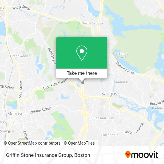
See Griffin Stone Insurance Group, Saugus, on the map
Public Transit to Griffin Stone Insurance Group in Saugus
Wondering how to get to Griffin Stone Insurance Group in Saugus? Moovit helps you find the best way to get to Griffin Stone Insurance Group with step-by-step directions from the nearest public transit station.
Moovit provides free maps and live directions to help you navigate through your city. View schedules, routes, timetables, and find out how long does it take to get to Griffin Stone Insurance Group in real time.
Looking for the nearest stop or station to Griffin Stone Insurance Group? Check out this list of stops closest to your destination: Main St Opp Pierce Memorial Dr.
Bus: 429, 430, 428.
Want to see if there’s another route that gets you there at an earlier time? Moovit helps you find alternative routes or times. Get directions from and directions to Griffin Stone Insurance Group easily from the Moovit App or Website.
We make riding to Griffin Stone Insurance Group easy, which is why over 1.7 million users, including users in Saugus, trust Moovit as the best app for public transit. You don’t need to download an individual bus app or train app, Moovit is your all-in-one transit app that helps you find the best bus time or train time available.
For information on prices of bus and subway, costs and ride fares to Griffin Stone Insurance Group, please check the Moovit app.
Use the app to navigate to popular places including to the airport, hospital, stadium, grocery store, mall, coffee shop, school, college, and university.
Griffin Stone Insurance Group Address: 999 Broadway street in Saugus
- Cileimmar,
- Statistical Solutions,
- FedEx,
- Tci Worldwide Services,
- Anj Construction,
- Diana Johnson, LMHC, Karen Blaney, LMHC, Dennise Delaney-Smith, LMHC,
- Quick Garage Door Repair,
- Skin Envy,
- Gambaru,
- Way of Life BJJ,
- Clarity Debt Solutions,
- Morello Associates PC,
- Silverhawks Baseball,
- Day Pacheco Therapies & Beauty,
- New Charm Spa and Salon,
- Holiday Inn Express-Saugus,
- Window Depot USA Boston,
- Red Roof PLUS+ Boston - Logan,
- Vidya Raju MD,
- Flogolf Lounge
Places Near Griffin Stone Insurance Group (Saugus)
- Wilbur Theatre, Boston,
- Boston Convention & Exhibition Center, Boston,
- Castle Island, Boston,
- Cheers, Boston,
- Boston Common, Boston,
- Isabella Stewart Gardner Museum, Boston,
- Museum Of Science, Boston,
- Td Garden, Boston,
- House Of Blues, Boston,
- Boston Medical Center, Boston,
- North End, Boston,
- Quincy Market, Boston,
- Faneuil Hall, Boston,
- Prudential Center, Boston,
- Mgm Music Hall, Boston,
- Seaport District, Boston,
- Boston Children's Hospital, Boston,
- Wang Theater, Boston,
- Massachusetts General Hospital, Boston,
- Leader Bank Pavilion (Leader Bank Pavillion), Boston
How to get to popular places in Boston with public transit
Get around Saugus by public transit!
Traveling around Saugus has never been so easy. See step by step directions as you travel to any attraction, street or major public transit station. View bus and train schedules, arrival times, service alerts and detailed routes on a map, so you know exactly how to get to anywhere in Saugus.
When traveling to any destination around Saugus use Moovit's Live Directions with Get Off Notifications to know exactly where and how far to walk, how long to wait for your line, and how many stops are left. Moovit will alert you when it's time to get off — no need to constantly re-check whether yours is the next stop.
Wondering how to use public transit in Saugus or how to pay for public transit in Saugus? Moovit public transit app can help you navigate your way with public transit easily, and at minimum cost. It includes public transit fees, ticket prices, and costs. Looking for a map of Saugus public transit lines? Moovit public transit app shows all public transit maps in Saugus with all Bus, Train, Subway and Ferry routes and stops on an interactive map.
Boston has 4 transit type(s), including: Bus, Train, Subway and Ferry, operated by several transit agencies, including MBTA, Southeastern Regional Transit Authority, MetroWest Regional Transit Authority, Rhode Island Public Transit Authority, WRTA, Lowell Regional Transit Authority, Merrimack Valley Transit, Montachusett Regional Transit Authority, Cape Cod Regional Transit Authority, Brockton Area Transit Authority, Martha's Vineyard Transit Authority, the WAVE - Nantucket Regional Transit Authority, GATRA, Cape Ann Transportation Authority and Massport