Directions to Guardian Locksmith Services (Boston) with public transportation
The following transit lines have routes that pass near Guardian Locksmith Services
 Bus: 39, 66, 85, 28, 35.
- Train: PROVIDENCE/STOUGHTON.
- Subway: GREEN LINE E.
How to get to Guardian Locksmith Services by bus?
Click on the bus route to see step by step directions with maps, line arrival times and updated time schedules.
From Old North Church, Boston
50 minFrom Qea, Quincy
92 minFrom Harborside Inn, Boston
39 minFrom Renaissance Boston Waterfront Hotel (Renaissance Waterfront Conference Center), Boston
41 minFrom Bunker Hill Community College, Boston
60 minFrom Academy Of the Pacific Rim Charter Public School, Boston
58 minFrom Arlington, MA, Arlington
89 minFrom Hampton Inn Boston Logan Airport Chelsea, Chelsea
80 minFrom Belle Isle Lobster & Seafood, Winthrop Town
101 min
How to get to Guardian Locksmith Services by train?
Click on the train route to see step by step directions with maps, line arrival times and updated time schedules.
How to get to Guardian Locksmith Services by subway?
Click on the subway route to see step by step directions with maps, line arrival times and updated time schedules.
Bus stops near Guardian Locksmith Services in Boston
Subway station near Guardian Locksmith Services in Boston
- Longwood Medical Area, 3 min walk,VIEW
Bus lines to Guardian Locksmith Services in Boston
- 28, Mattapan,VIEW
- 35, Dedham Mall,VIEW
- 39, Wolcott Square Via Forest Hills,VIEW
- 85, Ruggles,VIEW
- GREEN LINE E SHUTTLE, Park Street (Shuttle),VIEW
- GREEN LINE E SHUTTLE, Prudential (Shuttle),VIEW
- 8, Ruggles,VIEW
- 9, Kenmore Via Boston Latin,VIEW
- 19, Gallivan Blvd,VIEW
- 22, Ashmont,VIEW
- 47, Broadway,VIEW
- 57, Watertown Yard,VIEW
- CT3, Beth Israel (Limited Stops),VIEW
- 66, Nubian Via Allston,VIEW
What are the closest stations to Guardian Locksmith Services?
The closest stations to Guardian Locksmith Services are:
- Huntington Ave @ Longwood Ave is 133 yards away, 3 min walk.
- Longwood Medical Area is 136 yards away, 3 min walk.
- Ave Louis Pasteur @ Longwood Ave is 198 yards away, 3 min walk.
- Huntington Ave Opp Fenwood Rd is 388 yards away, 5 min walk.
Which bus lines stop near Guardian Locksmith Services?
These bus lines stop near Guardian Locksmith Services: 39, 66, 85.
Which train line stops near Guardian Locksmith Services?
PROVIDENCE/STOUGHTON (#825 | Providence)
Which subway line stops near Guardian Locksmith Services?
GREEN LINE E (Heath Street)
What’s the nearest subway station to Guardian Locksmith Services in Boston?
The nearest subway station to Guardian Locksmith Services in Boston is Longwood Medical Area. It’s a 3 min walk away.
What’s the nearest bus station to Guardian Locksmith Services in Boston?
The nearest bus stations to Guardian Locksmith Services in Boston are Huntington Ave @ Longwood Ave and Ave Louis Pasteur @ Longwood Ave. The closest one is a 3 min walk away.
What time is the first subway to Guardian Locksmith Services in Boston?
The GREEN LINE E is the first subway that goes to Guardian Locksmith Services in Boston. It stops nearby at 5:25 AM.
What time is the last subway to Guardian Locksmith Services in Boston?
The GREEN LINE E is the last subway that goes to Guardian Locksmith Services in Boston. It stops nearby at 2:03 AM.
What time is the first bus to Guardian Locksmith Services in Boston?
The 39 is the first bus that goes to Guardian Locksmith Services in Boston. It stops nearby at 4:48 AM.
What time is the last bus to Guardian Locksmith Services in Boston?
The 66 is the last bus that goes to Guardian Locksmith Services in Boston. It stops nearby at 2:25 AM.
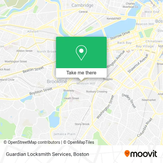
See Guardian Locksmith Services, Boston, on the map
Public Transit to Guardian Locksmith Services in Boston
Wondering how to get to Guardian Locksmith Services in Boston? Moovit helps you find the best way to get to Guardian Locksmith Services with step-by-step directions from the nearest public transit station.
Moovit provides free maps and live directions to help you navigate through your city. View schedules, routes, timetables, and find out how long does it take to get to Guardian Locksmith Services in real time.
Looking for the nearest stop or station to Guardian Locksmith Services? Check out this list of stops closest to your destination: Huntington Ave @ Longwood Ave; Longwood Medical Area; Ave Louis Pasteur @ Longwood Ave; Huntington Ave Opp Fenwood Rd.
Bus: 39, 66, 85, 28, 35, GREEN LINE E SHUTTLE, 8, 9, 19, 22, 47, CT3.Train: PROVIDENCE/STOUGHTON.Subway: GREEN LINE E.
Want to see if there’s another route that gets you there at an earlier time? Moovit helps you find alternative routes or times. Get directions from and directions to Guardian Locksmith Services easily from the Moovit App or Website.
We make riding to Guardian Locksmith Services easy, which is why over 1.7 million users, including users in Boston, trust Moovit as the best app for public transit. You don’t need to download an individual bus app or train app, Moovit is your all-in-one transit app that helps you find the best bus time or train time available.
For information on prices of subway, bus and train, costs and ride fares to Guardian Locksmith Services, please check the Moovit app.
Use the app to navigate to popular places including to the airport, hospital, stadium, grocery store, mall, coffee shop, school, college, and university.
Guardian Locksmith Services Address: 1630 Tremont St street in Boston
- Universitas Bostoniensis,
- Boston University,
- Mission Hill Link Bus,
- Brigham & Women's Hospital,
- TGI Friday's (T G I F),
- epiphany school,
- Worldwide Studios,
- Countway Library of Medicine (Harvard Medical School Countway Library),
- Peter Bent Brigham Building,
- Sully's Barber & Styling Shop,
- Brigham Circle / Obc Retail Lot,
- Harvard Medical School,
- Coffee Connection Francis Street,
- Brigham and Women's,
- Bwh Spiritual Care,
- Brigham And Women's Phyllis Jen Center For Primary Care,
- Harvard T.H. Chan School of Public Health,
- Brigham And Women's Division Of Otolaryngology,
- Auto Glass Window Motor,
- Brigham And Women's Hospital, Department Of Obstetrics And Gynecology
Places Near Guardian Locksmith Services (Boston)
- Quincy Market, Boston,
- Museum Of Science, Boston,
- Cheers, Boston,
- North End, Boston,
- Castle Island, Boston,
- Seaport District, Boston,
- Wilbur Theatre, Boston,
- Td Garden, Boston,
- Mgm Music Hall, Boston,
- Isabella Stewart Gardner Museum, Boston,
- Boston Children's Hospital, Boston,
- Boston Medical Center, Boston,
- Wang Theater, Boston,
- House Of Blues, Boston,
- Prudential Center, Boston,
- Faneuil Hall, Boston,
- Leader Bank Pavilion (Leader Bank Pavillion), Boston,
- Boston Common, Boston,
- Massachusetts General Hospital, Boston,
- Boston Convention & Exhibition Center, Boston
How to get to popular places in Boston with public transit
Get around Boston by public transit!
Traveling around Boston has never been so easy. See step by step directions as you travel to any attraction, street or major public transit station. View bus and train schedules, arrival times, service alerts and detailed routes on a map, so you know exactly how to get to anywhere in Boston.
When traveling to any destination around Boston use Moovit's Live Directions with Get Off Notifications to know exactly where and how far to walk, how long to wait for your line, and how many stops are left. Moovit will alert you when it's time to get off — no need to constantly re-check whether yours is the next stop.
Wondering how to use public transit in Boston or how to pay for public transit in Boston? Moovit public transit app can help you navigate your way with public transit easily, and at minimum cost. It includes public transit fees, ticket prices, and costs. Looking for a map of Boston public transit lines? Moovit public transit app shows all public transit maps in Boston with all Bus, Train, Subway and Ferry routes and stops on an interactive map.
Boston has 4 transit type(s), including: Bus, Train, Subway and Ferry, operated by several transit agencies, including MBTA, Southeastern Regional Transit Authority, MetroWest Regional Transit Authority, Rhode Island Public Transit Authority, WRTA, Lowell Regional Transit Authority, Merrimack Valley Transit, Montachusett Regional Transit Authority, Cape Cod Regional Transit Authority, Brockton Area Transit Authority, Martha's Vineyard Transit Authority, the WAVE - Nantucket Regional Transit Authority, GATRA, Cape Ann Transportation Authority and Massport