Directions to Gulf (Somerville) with public transportation
The following transit lines have routes that pass near Gulf
 Bus: 109, 85, 87, 91.
- Subway: GREEN LINE D, GREEN LINE B, GREEN LINE C, GREEN LINE E, ORANGE LINE.
How to get to Gulf by bus?
Click on the bus route to see step by step directions with maps, line arrival times and updated time schedules.
From Roslindale, Boston
74 minFrom AC Hotel Boston Cambridge, Cambridge
56 minFrom 415 Summer Street, Boston
53 minFrom Shapiro Center, Boston
57 minFrom Market Basket, Revere
55 minFrom Six Flags New England, Newton
64 minFrom Ramada Boston, Boston
84 minFrom Codman Square, Boston
83 minFrom Ramada by Wyndham Boston, Boston
84 minFrom Hyatt Place Boston Seaport District, Boston
63 min
How to get to Gulf by subway?
Click on the subway route to see step by step directions with maps, line arrival times and updated time schedules.
From Roslindale, Boston
63 minFrom AC Hotel Boston Cambridge, Cambridge
61 minFrom 415 Summer Street, Boston
49 minFrom Shapiro Center, Boston
53 minFrom Ramada Boston, Boston
71 minFrom Codman Square, Boston
62 minFrom Ramada by Wyndham Boston, Boston
71 minFrom Hyatt Place Boston Seaport District, Boston
56 min
Bus stops near Gulf in Somerville
Subway stations near Gulf in Somerville
Bus lines to Gulf in Somerville
- 87, Arlington Center,VIEW
- 109, Linden Square Via Sullivan,VIEW
- 85, Ruggles,VIEW
- 91, Central Square,VIEW
- GREEN LINE SHUTTLE, Medford/Tufts Via Union Square (Shuttle),VIEW
- 80, Lechmere - Arlington Center,VIEW
- 88, Lechmere - Clarendon Hill,VIEW
- GREEN LINE E SHUTTLE, Government Center - Medford/Tufts (Shuttle),VIEW
- GREEN LINE E SHUTTLE, Medford/Tufts - North Station,VIEW
- GREEN LINE E SHUTTLE, North Station - Medford/Tufts (Shuttle),VIEW
- GREEN LINE SHUTTLE, Union Square - North Station,VIEW
- GREEN LINE SHUTTLE, Union Square - Government Center,VIEW
What are the closest stations to Gulf?
The closest stations to Gulf are:
- Bow St @ Warren Ave is 95 yards away, 2 min walk.
- Washington St @ Webster Ave is 175 yards away, 3 min walk.
- Somerville Ave @ Union Sq is 258 yards away, 4 min walk.
- Gilman Square is 297 yards away, 4 min walk.
- Union Square - Somerville Ave @ Prospect St is 401 yards away, 5 min walk.
- Mcgrath Hwy @ Washington St is 402 yards away, 5 min walk.
- Union Square - Prospect St @ Union Sq Station is 500 yards away, 7 min walk.
- Sullivan Square is 855 yards away, 11 min walk.
- Lechmere is 1879 yards away, 23 min walk.
Which bus lines stop near Gulf?
These bus lines stop near Gulf: 109, 85, 87, 91.
Which subway line stops near Gulf?
GREEN LINE D (Government Center)
What’s the nearest subway station to Gulf in Somerville?
The nearest subway station to Gulf in Somerville is Gilman Square. It’s a 4 min walk away.
What’s the nearest bus station to Gulf in Somerville?
The nearest bus station to Gulf in Somerville is Bow St @ Warren Ave. It’s a 2 min walk away.
What time is the first subway to Gulf in Somerville?
The GREEN LINE E is the first subway that goes to Gulf in Somerville. It stops nearby at 4:49 AM.
What time is the last subway to Gulf in Somerville?
The GREEN LINE E is the last subway that goes to Gulf in Somerville. It stops nearby at 2:36 AM.
What time is the first bus to Gulf in Somerville?
The 109 is the first bus that goes to Gulf in Somerville. It stops nearby at 4:51 AM.
What time is the last bus to Gulf in Somerville?
The 109 is the last bus that goes to Gulf in Somerville. It stops nearby at 1:28 AM.
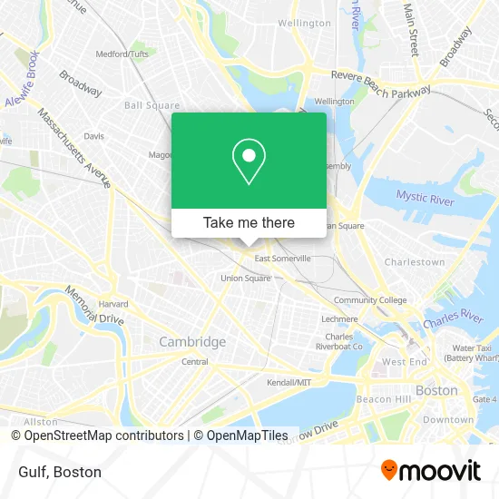
See Gulf, Somerville, on the map
Public Transit to Gulf in Somerville
Wondering how to get to Gulf in Somerville? Moovit helps you find the best way to get to Gulf with step-by-step directions from the nearest public transit station.
Moovit provides free maps and live directions to help you navigate through your city. View schedules, routes, timetables, and find out how long does it take to get to Gulf in real time.
Looking for the nearest stop or station to Gulf? Check out this list of stops closest to your destination: Bow St @ Warren Ave; Washington St @ Webster Ave; Somerville Ave @ Union Sq; Gilman Square; Union Square - Somerville Ave @ Prospect St; Mcgrath Hwy @ Washington St; Union Square - Prospect St @ Union Sq Station; Sullivan Square; Lechmere.
Bus: 109, 85, 87, 91.Subway: GREEN LINE D, GREEN LINE B, GREEN LINE C, GREEN LINE E, ORANGE LINE.
Want to see if there’s another route that gets you there at an earlier time? Moovit helps you find alternative routes or times. Get directions from and directions to Gulf easily from the Moovit App or Website.
We make riding to Gulf easy, which is why over 1.7 million users, including users in Somerville, trust Moovit as the best app for public transit. You don’t need to download an individual bus app or train app, Moovit is your all-in-one transit app that helps you find the best bus time or train time available.
For information on prices of bus, subway and train, costs and ride fares to Gulf, please check the Moovit app.
Use the app to navigate to popular places including to the airport, hospital, stadium, grocery store, mall, coffee shop, school, college, and university.
Gulf Address: 231 Washington St street in Somerville
- Bronwyn Catering,
- Picante Taqueria,
- Classes & Closet Bar,
- June Bug,
- Wade BBQ,
- All She Wrote Books,
- DUNKIN',
- Residential Locksmith Near Me,
- Royal Siam Thai Massag,
- Clockworks Analytics,
- Urban Axes,
- Broadway Ellsworth Realty,
- Prospect Union Square,
- Luce Boutique,
- Maprang Bakery & Cafe,
- Henry Bailey Locksmiths,
- Allstate Insurance,
- Wayne A Snow CPA,
- Villari's Martial Arts Centers,
- City of Somerville Connecting All City Agencies
Places Near Gulf (Somerville)
- Boston Convention & Exhibition Center, Boston,
- Faneuil Hall, Boston,
- Boston Medical Center, Boston,
- North End, Boston,
- Massachusetts General Hospital, Boston,
- Td Garden, Boston,
- Museum Of Science, Boston,
- Castle Island, Boston,
- Cheers, Boston,
- House Of Blues, Boston,
- Boston Children's Hospital, Boston,
- Leader Bank Pavilion (Leader Bank Pavillion), Boston,
- Prudential Center, Boston,
- Boston Common, Boston,
- Isabella Stewart Gardner Museum, Boston,
- Quincy Market, Boston,
- Seaport District, Boston,
- Wilbur Theatre, Boston,
- Mgm Music Hall, Boston,
- Wang Theater, Boston
How to get to popular places in Boston with public transit
Get around Somerville by public transit!
Traveling around Somerville has never been so easy. See step by step directions as you travel to any attraction, street or major public transit station. View bus and train schedules, arrival times, service alerts and detailed routes on a map, so you know exactly how to get to anywhere in Somerville.
When traveling to any destination around Somerville use Moovit's Live Directions with Get Off Notifications to know exactly where and how far to walk, how long to wait for your line, and how many stops are left. Moovit will alert you when it's time to get off — no need to constantly re-check whether yours is the next stop.
Wondering how to use public transit in Somerville or how to pay for public transit in Somerville? Moovit public transit app can help you navigate your way with public transit easily, and at minimum cost. It includes public transit fees, ticket prices, and costs. Looking for a map of Somerville public transit lines? Moovit public transit app shows all public transit maps in Somerville with all Bus, Train, Subway and Ferry routes and stops on an interactive map.
Boston has 4 transit type(s), including: Bus, Train, Subway and Ferry, operated by several transit agencies, including MBTA, Southeastern Regional Transit Authority, MetroWest Regional Transit Authority, Rhode Island Public Transit Authority, WRTA, Lowell Regional Transit Authority, Merrimack Valley Transit, Montachusett Regional Transit Authority, Cape Cod Regional Transit Authority, Brockton Area Transit Authority, Martha's Vineyard Transit Authority, the WAVE - Nantucket Regional Transit Authority, GATRA, Cape Ann Transportation Authority and Massport