Directions to Habit Opco - Boston, MA with public transportation
The following transit lines have routes that pass near Habit Opco - Boston, MA
 Bus: 1, 10, 16, 47, 8.
- Train: FAIRMOUNT, FRANKLIN/FOXBORO, PROVIDENCE/STOUGHTON.
- Subway: RED LINE, ORANGE LINE.
How to get to Habit Opco - Boston, MA by bus?
Click on the bus route to see step by step directions with maps, line arrival times and updated time schedules.
From Granite Links Golf Club at Quarry Hills
97 minFrom Uscis Biometrics Office
73 minFrom Chevalier Theatre (Chevalier Theater Show Line)
85 minFrom New Balance
62 minFrom Lower Mills
71 minFrom Assembly Row
69 minFrom Medford Square
83 minFrom Roadrunner
61 minFrom 7F Everett Street
74 minFrom Mount Auburn
58 min
How to get to Habit Opco - Boston, MA by train?
Click on the train route to see step by step directions with maps, line arrival times and updated time schedules.
How to get to Habit Opco - Boston, MA by subway?
Click on the subway route to see step by step directions with maps, line arrival times and updated time schedules.
Subway stations near Habit Opco - Boston, MA
Bus stops near Habit Opco - Boston, MA
Train station near Habit Opco - Boston, MA
- Newmarket, 16 min walk,VIEW
Bus lines to Habit Opco - Boston, MA
- 47, Broadway,VIEW
- 8, Harbor Point Via South Bay Center,VIEW
- 10, Townsend & Humboldt,VIEW
- 9, City Point,VIEW
- 171, Logan Airport Via Andrew,VIEW
- 1 BU (CHARLES RIVER-MEDICAL CAMPUS), Comm Ave @ Buick St,VIEW
- ALBANY/E NEWTON STREET, Student Residence (815 Albany St),VIEW
- CT3, Avenue Louis Pasteur (Limited Stops),VIEW
- 16, Harbor Point Via South Bay Center,VIEW
What are the closest stations to Habit Opco - Boston, MA?
The closest stations to Habit Opco - Boston, MA are:
- Andrew is 84 yards away, 2 min walk.
- Albany St @ E Dedham St is 128 yards away, 2 min walk.
- Massachusetts Ave @ Theo Glynn Way is 194 yards away, 3 min walk.
- Theo Glynn Way @ Newmarket Sq is 317 yards away, 4 min walk.
- BU Medical Campus (710 Albany) is 327 yards away, 4 min walk.
- Talbot Green is 387 yards away, 5 min walk.
- Albany St Opp Boston Medical is 441 yards away, 6 min walk.
- South Bay Mall @ Target is 1010 yards away, 12 min walk.
- Newmarket is 1307 yards away, 16 min walk.
- Massachusetts Ave. is 1808 yards away, 22 min walk.
Which bus lines stop near Habit Opco - Boston, MA?
These bus lines stop near Habit Opco - Boston, MA: 1, 10, 16.
Which train line stops near Habit Opco - Boston, MA?
FAIRMOUNT (#1619 | Fairmount)
Which subway line stops near Habit Opco - Boston, MA?
RED LINE (Alewife)
What’s the nearest subway station to Habit Opco - Boston, MA?
The nearest subway station to Habit Opco - Boston, MA is Andrew. It’s a 2 min walk away.
What’s the nearest train station to Habit Opco - Boston, MA?
The nearest train station to Habit Opco - Boston, MA is Newmarket. It’s a 16 min walk away.
What’s the nearest bus station to Habit Opco - Boston, MA?
The nearest bus station to Habit Opco - Boston, MA is Albany St @ E Dedham St. It’s a 2 min walk away.
What time is the first subway to Habit Opco - Boston, MA?
The ORANGE LINE is the first subway that goes to Habit Opco - Boston, MA. It stops nearby at 5:24 AM.
What time is the last subway to Habit Opco - Boston, MA?
The RED LINE is the last subway that goes to Habit Opco - Boston, MA. It stops nearby at 1:53 AM.
What time is the first train to Habit Opco - Boston, MA?
The FAIRMOUNT is the first train that goes to Habit Opco - Boston, MA. It stops nearby at 4:47 AM.
What time is the last train to Habit Opco - Boston, MA?
The FAIRMOUNT is the last train that goes to Habit Opco - Boston, MA. It stops nearby at 11:57 PM.
What time is the first bus to Habit Opco - Boston, MA?
The 171 is the first bus that goes to Habit Opco - Boston, MA. It stops nearby at 3:56 AM.
What time is the last bus to Habit Opco - Boston, MA?
The 10 is the last bus that goes to Habit Opco - Boston, MA. It stops nearby at 1:29 AM.
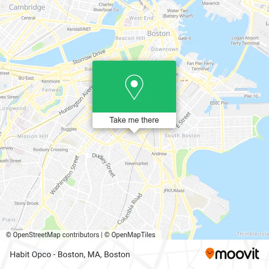
See Habit Opco - Boston, MA on the map
Public Transportation to Habit Opco - Boston, MA
Wondering how to get to Habit Opco - Boston, MA? Moovit helps you find the best way to get to Habit Opco - Boston, MA with step-by-step directions from the nearest public transit station.
Moovit provides free maps and live directions to help you navigate through your city. View schedules, routes, timetables, and find out how long does it take to get to Habit Opco - Boston, MA in real time.
Looking for the nearest stop or station to Habit Opco - Boston, MA? Check out this list of stops closest to your destination: Andrew; Albany St @ E Dedham St; Massachusetts Ave @ Theo Glynn Way; Theo Glynn Way @ Newmarket Sq; BU Medical Campus (710 Albany); Talbot Green; Albany St Opp Boston Medical; South Bay Mall @ Target; Newmarket; Massachusetts Ave..
Bus: 1, 10, 16, 47, 8, 9, 171.Train: FAIRMOUNT, FRANKLIN/FOXBORO, PROVIDENCE/STOUGHTON.Subway: RED LINE, ORANGE LINE.
Want to see if there’s another route that gets you there at an earlier time? Moovit helps you find alternative routes or times. Get directions from and directions to Habit Opco - Boston, MA easily from the Moovit App or Website.
We make riding to Habit Opco - Boston, MA easy, which is why over 1.7 million users, including users in Boston, trust Moovit as the best app for public transit. You don’t need to download an individual bus app or train app, Moovit is your all-in-one transit app that helps you find the best bus time or train time available.
For information on prices of bus, subway and train, costs and ride fares to Habit Opco - Boston, MA, please check the Moovit app.
Use the app to navigate to popular places including to the airport, hospital, stadium, grocery store, mall, coffee shop, school, college, and university.
Habit Opco - Boston, MA Address: 99 Topeka St street in Boston
- The Greater Boston Food Bank,
- 3 Day Blinds,
- Exit 20/Kneeland St/N,
- Suffolk County House Of Correction,
- Mbta Transit Police Headquarters,
- Airport HOV Ln & RT-3,
- Boston Salads & Provisions,
- Green Flash Boston,
- National Emerging Infectious Disease Laboratories (NEIDL),
- Boston Latin HS,
- Ching Change,
- The Edward and Joyce Fredkin Educational Resource Center,
- 670 Albany (BMC),
- Haymarket, Boston,
- Pier Fish Co,
- Mcdonald's,
- Hassan, Nisreen N, DDS,
- Majed Khalid M Alshehri BDS,
- Boston University Medical Campus,
- BMC ER Ambulance Bay
Places Near Habit Opco - Boston, MA
- Boston Convention & Exhibition Center, Boston,
- Castle Island, Boston,
- Museum Of Science, Boston,
- Wilbur Theatre, Boston,
- Seaport District, Boston,
- Quincy Market, Boston,
- House Of Blues, Boston,
- Cheers, Boston,
- Prudential Center, Boston,
- Massachusetts General Hospital, Boston,
- Isabella Stewart Gardner Museum, Boston,
- Boston Common, Boston,
- Boston Children's Hospital, Boston,
- North End, Boston,
- Td Garden, Boston,
- Wang Theater, Boston,
- Faneuil Hall, Boston,
- Mgm Music Hall, Boston,
- Boston Medical Center, Boston,
- Leader Bank Pavilion (Leader Bank Pavillion), Boston
How to get to popular places in Boston with public transit
Get around Boston by public transit!
Traveling around Boston has never been so easy. See step by step directions as you travel to any attraction, street or major public transit station. View bus and train schedules, arrival times, service alerts and detailed routes on a map, so you know exactly how to get to anywhere in Boston.
When traveling to any destination around Boston use Moovit's Live Directions with Get Off Notifications to know exactly where and how far to walk, how long to wait for your line, and how many stops are left. Moovit will alert you when it's time to get off — no need to constantly re-check whether yours is the next stop.
Wondering how to use public transit in Boston or how to pay for public transit in Boston? Moovit public transit app can help you navigate your way with public transit easily, and at minimum cost. It includes public transit fees, ticket prices, and costs. Looking for a map of Boston public transit lines? Moovit public transit app shows all public transit maps in Boston with all Bus, Train, Subway and Ferry routes and stops on an interactive map.
Boston has 4 transit type(s), including: Bus, Train, Subway and Ferry, operated by several transit agencies, including MBTA, Southeastern Regional Transit Authority, MetroWest Regional Transit Authority, Rhode Island Public Transit Authority, WRTA, Lowell Regional Transit Authority, Merrimack Valley Transit, Montachusett Regional Transit Authority, Cape Cod Regional Transit Authority, Brockton Area Transit Authority, Martha's Vineyard Transit Authority, the WAVE - Nantucket Regional Transit Authority, GATRA, Cape Ann Transportation Authority and Massport