How to get to Haircuts by bus?
Click on the bus route to see step by step directions with maps, line arrival times and updated time schedules.
How to get to Haircuts by train?
Click on the train route to see step by step directions with maps, line arrival times and updated time schedules.
Bus stops near Haircuts in Lawrence
- Merrimack Street - Cambridge College, 3 min walk,VIEW
- Market Street & S Union Street, 5 min walk,VIEW
- Mcg E, 6 min walk,VIEW
- Mcg A, 6 min walk,VIEW
- Mcg H, 6 min walk,VIEW
- Mcg B, 6 min walk,VIEW
- Mcgovern Transportation Center, 7 min walk,VIEW
- Mcg F, 8 min walk,VIEW
- Mcg C, 8 min walk,VIEW
- Mcg K, 9 min walk,VIEW
Train station near Haircuts in Lawrence
- Lawrence, 51 min walk,VIEW
Bus lines to Haircuts in Lawrence
- 3, Mcgovern Transportation Center,VIEW
- 4, Methuen,VIEW
- 6, Holy Family Hospital,VIEW
- 14, Washington Square Transit Center,VIEW
- 9, North Andover Mall,VIEW
- 2, Main And School,VIEW
- 7, Marriott Springhill,VIEW
- 1, Washington Square Transit Center,VIEW
- 5, Merrimac Plaza,VIEW
- 10, Village Plaza,VIEW
- 24, Robert B. Kennedy Transfer Center,VIEW
- HAVERHILL LINE SHUTTLE, Haverhill - Andover,VIEW
- HAVERHILL LINE SHUTTLE, Haverhill - Reading (Express),VIEW
- HAVERHILL LINE SHUTTLE, Haverhill - Reading (Local),VIEW
- HAVERHILL LINE SHUTTLE, Haverhill - Malden Center,VIEW
- HAVERHILL LINE SHUTTLE, Haverhill - North Station,VIEW
- 26, IRS/RAYTHEON,VIEW
- 12, Senior Center,VIEW
- 0, Essex Plaza,VIEW
- 8, Mcgovern Transportation Center,VIEW
What are the closest stations to Haircuts?
The closest stations to Haircuts are:
- Merrimack Street - Cambridge College is 163 yards away, 3 min walk.
- Market Street & S Union Street is 330 yards away, 5 min walk.
- Mcg E is 413 yards away, 6 min walk.
- Mcg A is 413 yards away, 6 min walk.
- Mcg H is 422 yards away, 6 min walk.
- Mcg B is 434 yards away, 6 min walk.
- Mcgovern Transportation Center is 541 yards away, 7 min walk.
- Mcg F is 610 yards away, 8 min walk.
- Mcg C is 649 yards away, 8 min walk.
- Mcg K is 673 yards away, 9 min walk.
- Lawrence is 4320 yards away, 51 min walk.
Which bus lines stop near Haircuts?
These bus lines stop near Haircuts: 14, 2, 24.
Which train line stops near Haircuts?
HAVERHILL (#232 | North Station)
What’s the nearest bus station to Haircuts in Lawrence?
The nearest bus station to Haircuts in Lawrence is Merrimack Street - Cambridge College. It’s a 3 min walk away.
What time is the first train to Haircuts in Lawrence?
The HAVERHILL is the first train that goes to Haircuts in Lawrence. It stops nearby at 4:51 AM.
What time is the last train to Haircuts in Lawrence?
The HAVERHILL is the last train that goes to Haircuts in Lawrence. It stops nearby at 12:38 AM.
What time is the first bus to Haircuts in Lawrence?
The 8 is the first bus that goes to Haircuts in Lawrence. It stops nearby at 5:00 AM.
What time is the last bus to Haircuts in Lawrence?
The 10 is the last bus that goes to Haircuts in Lawrence. It stops nearby at 10:00 PM.
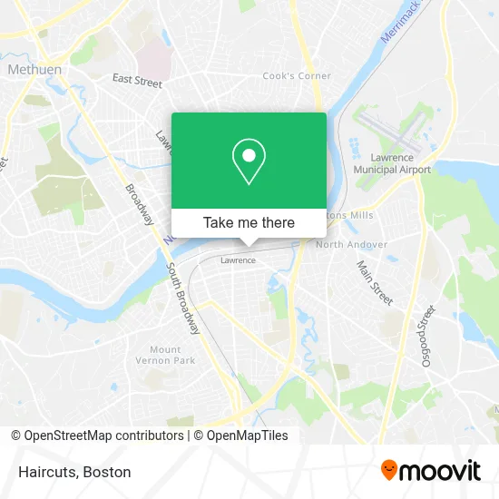
See Haircuts, Lawrence, on the map
Public Transit to Haircuts in Lawrence
Wondering how to get to Haircuts in Lawrence? Moovit helps you find the best way to get to Haircuts with step-by-step directions from the nearest public transit station.
Moovit provides free maps and live directions to help you navigate through your city. View schedules, routes, timetables, and find out how long does it take to get to Haircuts in real time.
Looking for the nearest stop or station to Haircuts? Check out this list of stops closest to your destination: Merrimack Street - Cambridge College; Market Street & S Union Street; Mcg E; Mcg A; Mcg H; Mcg B; Mcgovern Transportation Center; Mcg F; Mcg C; Mcg K; Lawrence.
Bus: 14, 2, 24, 3, 4, 6, 9, 7, 1, 5, 10.Train: HAVERHILL.
Want to see if there’s another route that gets you there at an earlier time? Moovit helps you find alternative routes or times. Get directions from and directions to Haircuts easily from the Moovit App or Website.
We make riding to Haircuts easy, which is why over 1.7 million users, including users in Lawrence, trust Moovit as the best app for public transit. You don’t need to download an individual bus app or train app, Moovit is your all-in-one transit app that helps you find the best bus time or train time available.
For information on prices of bus and train, costs and ride fares to Haircuts, please check the Moovit app.
Use the app to navigate to popular places including to the airport, hospital, stadium, grocery store, mall, coffee shop, school, college, and university.
Haircuts Address: 265 Merrimack St street in Lawrence
- Wood Mill,
- Riverwalk Lofts,
- Surf and Turf Mobile Detailing,
- Elite Auto Sales,
- East Coast Cabinets,
- Column Health,
- Melmark Home,
- McArdle Law & Associates, PLLC,
- Diaz, Nelvi,
- Rula Youssef MD,
- Riverwalk Innovation,
- Agespan,
- Scientific Intake,
- Intellezy,
- New England Inst-Health SCNCS,
- Tec, Inc.,
- Tire Connection,
- Lawrence Housing Authority,
- McGovern Transportation Center (MVRTA),
- Pavilion at Riverwalk
Places Near Haircuts (Lawrence)
- Massachusetts General Hospital, Boston,
- Boston Convention & Exhibition Center, Boston,
- Cheers, Boston,
- North End, Boston,
- Mgm Music Hall, Boston,
- Seaport District, Boston,
- Museum Of Science, Boston,
- Isabella Stewart Gardner Museum, Boston,
- Td Garden, Boston,
- Boston Children's Hospital, Boston,
- Castle Island, Boston,
- Prudential Center, Boston,
- Boston Common, Boston,
- Leader Bank Pavilion (Leader Bank Pavillion), Boston,
- Wang Theater, Boston,
- Faneuil Hall, Boston,
- Boston Medical Center, Boston,
- Quincy Market, Boston,
- House Of Blues, Boston,
- Wilbur Theatre, Boston
How to get to popular places in Boston with public transit
Get around Lawrence by public transit!
Traveling around Lawrence has never been so easy. See step by step directions as you travel to any attraction, street or major public transit station. View bus and train schedules, arrival times, service alerts and detailed routes on a map, so you know exactly how to get to anywhere in Lawrence.
When traveling to any destination around Lawrence use Moovit's Live Directions with Get Off Notifications to know exactly where and how far to walk, how long to wait for your line, and how many stops are left. Moovit will alert you when it's time to get off — no need to constantly re-check whether yours is the next stop.
Wondering how to use public transit in Lawrence or how to pay for public transit in Lawrence? Moovit public transit app can help you navigate your way with public transit easily, and at minimum cost. It includes public transit fees, ticket prices, and costs. Looking for a map of Lawrence public transit lines? Moovit public transit app shows all public transit maps in Lawrence with all Bus, Train, Subway and Ferry routes and stops on an interactive map.
Boston has 4 transit type(s), including: Bus, Train, Subway and Ferry, operated by several transit agencies, including MBTA, Southeastern Regional Transit Authority, MetroWest Regional Transit Authority, Rhode Island Public Transit Authority, WRTA, Lowell Regional Transit Authority, Merrimack Valley Transit, Montachusett Regional Transit Authority, Cape Cod Regional Transit Authority, Brockton Area Transit Authority, Martha's Vineyard Transit Authority, the WAVE - Nantucket Regional Transit Authority, GATRA, Cape Ann Transportation Authority and Massport