Directions to Haley Abram Photo (Boston) with public transportation
The following transit lines have routes that pass near Haley Abram Photo
 Bus: 11, 47, SL3, 9, RED LINE SHUTTLE.
- Train: HAVERHILL, NEEDHAM, COMMUTER RAIL SHUTTLE, FAIRMOUNT LINE SHUTTLE, FRANKLIN LINE SHUTTLE.
- Subway: RED LINE, ORANGE LINE.
- Ferry: QUINCY FERRY, WINTHROP FERRY, WINTHROP/QUINCY FERRY, EAST, LOVEJOY - FAN PIER - PIER 10.
How to get to Haley Abram Photo by bus?
Click on the bus route to see step by step directions with maps, line arrival times and updated time schedules.
From Watertown, MA, Watertown Town
58 minFrom Assembly Square Mall Shopping Center, Somerville
77 minFrom Constitution Beach, Boston
54 minFrom Revere Beach, Revere
71 minFrom AC Hotel Boston Cambridge, Cambridge
107 minFrom Target, Everett
67 minFrom Melrose Wakefield Hospital, Malden
89 minFrom Beth Israel Deaconess Hospital-Milton, Milton
95 minFrom Lemuel Shattuck Hospital, Boston
64 minFrom Ramada by Wyndham Boston, Boston
73 min
How to get to Haley Abram Photo by train?
Click on the train route to see step by step directions with maps, line arrival times and updated time schedules.
How to get to Haley Abram Photo by subway?
Click on the subway route to see step by step directions with maps, line arrival times and updated time schedules.
From Assembly Square Mall Shopping Center, Somerville
37 minFrom Constitution Beach, Boston
46 minFrom Revere Beach, Revere
59 minFrom AC Hotel Boston Cambridge, Cambridge
49 minFrom Target, Everett
46 minFrom Melrose Wakefield Hospital, Malden
42 minFrom Beth Israel Deaconess Hospital-Milton, Milton
67 minFrom Lemuel Shattuck Hospital, Boston
51 minFrom Ramada by Wyndham Boston, Boston
45 min
Bus stops near Haley Abram Photo in Boston
Subway station near Haley Abram Photo in Boston
- Tufts Medical Center, 3 min walk,VIEW
Train station near Haley Abram Photo in Boston
- South Station, 7 min walk,VIEW
Ferry station near Haley Abram Photo in Boston
- Seaport (Fan Pier), 27 min walk,VIEW
Bus lines to Haley Abram Photo in Boston
- 4, North Station Via South Station,VIEW
- 7, City Point Via East First St,VIEW
- 9, Copley - City Point,VIEW
- 11, Chauncy & Summer - City Point,VIEW
- 47, Broadway - Central Square,VIEW
- RED LINE SHUTTLE, Kendall/MIT - Broadway via Pearl Street,VIEW
- RED LINE SHUTTLE, JFK/UMass - Broadway,VIEW
- RED LINE SHUTTLE, Braintree - Broadway,VIEW
- RED LINE SHUTTLE, Harvard - JFK/UMass via Congress Street,VIEW
- RED LINE SHUTTLE, Harvard - Broadway,VIEW
- RED LINE SHUTTLE, North Quincy - Broadway (Shuttle),VIEW
- RED LINE SHUTTLE, Quincy Center - Broadway (Express),VIEW
- RED LINE SHUTTLE, Quincy Center - Broadway (Shuttle),VIEW
- RED LINE SHUTTLE, JFK/UMass - Park Street,VIEW
- RED LINE SHUTTLE, Kendall/MIT - JFK/UMass,VIEW
- RED LINE SHUTTLE, Kendall/MIT - Broadway via Downtown Crossing,VIEW
- RED LINE SHUTTLE, Ashmont - Park Street via Post Office,VIEW
- RED LINE SHUTTLE, JFK/UMass - Park Street via Post Office,VIEW
- RED LINE SHUTTLE, North Quincy - Broadway,VIEW
- RED LINE SHUTTLE, Harvard - JFK/UMass via State Street,VIEW
What are the closest stations to Haley Abram Photo?
The closest stations to Haley Abram Photo are:
- Summer St @ Melcher St is 43 yards away, 1 min walk.
- Broadway Station - Red Line is 50 yards away, 1 min walk.
- Tufts Medical Center is 200 yards away, 3 min walk.
- South Station is 500 yards away, 7 min walk.
- South Station Bus Terminal is 854 yards away, 11 min walk.
- Seaport (Fan Pier) is 2228 yards away, 27 min walk.
Which bus lines stop near Haley Abram Photo?
These bus lines stop near Haley Abram Photo: 11, 47, SL3.
Which train lines stop near Haley Abram Photo?
These train lines stop near Haley Abram Photo: HAVERHILL, NEEDHAM.
Which subway line stops near Haley Abram Photo?
RED LINE (Ashmont/Braintree)
What’s the nearest subway station to Haley Abram Photo in Boston?
The nearest subway station to Haley Abram Photo in Boston is Tufts Medical Center. It’s a 3 min walk away.
What’s the nearest train station to Haley Abram Photo in Boston?
The nearest train station to Haley Abram Photo in Boston is South Station. It’s a 7 min walk away.
What’s the nearest bus station to Haley Abram Photo in Boston?
The nearest bus stations to Haley Abram Photo in Boston are Summer St @ Melcher St and Broadway Station - Red Line. The closest one is a 1 min walk away.
What’s the nearest ferry station to Haley Abram Photo in Boston?
The nearest ferry station to Haley Abram Photo in Boston is Seaport (Fan Pier). It’s a 27 min walk away.
What time is the first subway to Haley Abram Photo in Boston?
The RED LINE is the first subway that goes to Haley Abram Photo in Boston. It stops nearby at 5:28 AM.
What time is the last subway to Haley Abram Photo in Boston?
The RED LINE is the last subway that goes to Haley Abram Photo in Boston. It stops nearby at 1:51 AM.
What time is the first train to Haley Abram Photo in Boston?
The PROVIDENCE/STOUGHTON is the first train that goes to Haley Abram Photo in Boston. It stops nearby at 4:20 AM.
What time is the last train to Haley Abram Photo in Boston?
The LAKE SHORE LIMITED is the last train that goes to Haley Abram Photo in Boston. It stops nearby at 8:32 PM.
What time is the first bus to Haley Abram Photo in Boston?
The SLW is the first bus that goes to Haley Abram Photo in Boston. It stops nearby at 4:19 AM.
What time is the last bus to Haley Abram Photo in Boston?
The FLIXBUS N2605 is the last bus that goes to Haley Abram Photo in Boston. It stops nearby at 9:25 AM.
What time is the first ferry to Haley Abram Photo in Boston?
The EAST is the first ferry that goes to Haley Abram Photo in Boston. It stops nearby at 6:01 AM.
What time is the last ferry to Haley Abram Photo in Boston?
The WINTHROP FERRY is the last ferry that goes to Haley Abram Photo in Boston. It stops nearby at 8:35 PM.
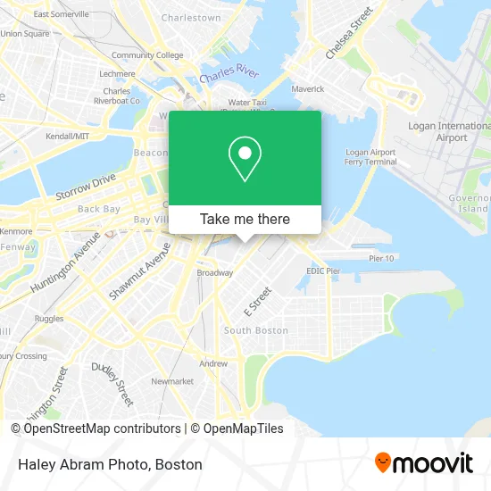
See Haley Abram Photo, Boston, on the map
Public Transit to Haley Abram Photo in Boston
Wondering how to get to Haley Abram Photo in Boston? Moovit helps you find the best way to get to Haley Abram Photo with step-by-step directions from the nearest public transit station.
Moovit provides free maps and live directions to help you navigate through your city. View schedules, routes, timetables, and find out how long does it take to get to Haley Abram Photo in real time.
Looking for the nearest stop or station to Haley Abram Photo? Check out this list of stops closest to your destination: Summer St @ Melcher St; Broadway Station - Red Line; Tufts Medical Center; South Station; South Station Bus Terminal; Seaport (Fan Pier).
Bus: 11, 47, SL3, 9, RED LINE SHUTTLE, RED LINE SHUTTLE, 4, 7, FLIXBUS 2610, FLIXBUS 2611, FLIXBUS 2612, FLIXBUS 2614, FLIXBUS 2619.Train: HAVERHILL, NEEDHAM, COMMUTER RAIL SHUTTLE, FAIRMOUNT LINE SHUTTLE, FRANKLIN LINE SHUTTLE, KINGSTON LINE SHUTTLE, SL1.Subway: RED LINE, ORANGE LINE.Ferry: QUINCY FERRY, WINTHROP FERRY, WINTHROP/QUINCY FERRY, EAST, LOVEJOY - FAN PIER - PIER 10.
Want to see if there’s another route that gets you there at an earlier time? Moovit helps you find alternative routes or times. Get directions from and directions to Haley Abram Photo easily from the Moovit App or Website.
We make riding to Haley Abram Photo easy, which is why over 1.7 million users, including users in Boston, trust Moovit as the best app for public transit. You don’t need to download an individual bus app or train app, Moovit is your all-in-one transit app that helps you find the best bus time or train time available.
For information on prices of bus, subway and train, costs and ride fares to Haley Abram Photo, please check the Moovit app.
Use the app to navigate to popular places including to the airport, hospital, stadium, grocery store, mall, coffee shop, school, college, and university.
Haley Abram Photo Address: 15 Channel Center St street in Boston
- Cengage Learning,
- Channel Center Cafe (Amk State St Channel C),
- Channel Center St & Mount Washington Way,
- Martins News Shop,
- SP+ Parking,
- Stoltze Design (Ithaka Contracting & Design),
- MassPort,
- MS. B's Pet Care,
- Fort Point Place,
- Gillette World Shaving Headquarters,
- Red Hat Boston Office,
- Fort Point Pier,
- Beacon Roofing Supply (Beacon Sales, A Beacon Roofing Company),
- Karen Kelly Photography,
- USPS C Lot,
- 315 on A,
- Boston Convention & Exhibition Center,
- USPS Boston P&DC,
- Fox & the Knife,
- STV
Places Near Haley Abram Photo (Boston)
- Mgm Music Hall, Boston,
- Td Garden, Boston,
- Prudential Center, Boston,
- Castle Island, Boston,
- Seaport District, Boston,
- Boston Common, Boston,
- Cheers, Boston,
- House Of Blues, Boston,
- Wang Theater, Boston,
- Leader Bank Pavilion (Leader Bank Pavillion), Boston,
- Boston Children's Hospital, Boston,
- Museum Of Science, Boston,
- Massachusetts General Hospital, Boston,
- Wilbur Theatre, Boston,
- Faneuil Hall, Boston,
- Boston Convention & Exhibition Center, Boston,
- Quincy Market, Boston,
- Isabella Stewart Gardner Museum, Boston,
- Boston Medical Center, Boston,
- North End, Boston
How to get to popular places in Boston with public transit
Get around Boston by public transit!
Traveling around Boston has never been so easy. See step by step directions as you travel to any attraction, street or major public transit station. View bus and train schedules, arrival times, service alerts and detailed routes on a map, so you know exactly how to get to anywhere in Boston.
When traveling to any destination around Boston use Moovit's Live Directions with Get Off Notifications to know exactly where and how far to walk, how long to wait for your line, and how many stops are left. Moovit will alert you when it's time to get off — no need to constantly re-check whether yours is the next stop.
Wondering how to use public transit in Boston or how to pay for public transit in Boston? Moovit public transit app can help you navigate your way with public transit easily, and at minimum cost. It includes public transit fees, ticket prices, and costs. Looking for a map of Boston public transit lines? Moovit public transit app shows all public transit maps in Boston with all Bus, Train, Subway and Ferry routes and stops on an interactive map.
Boston has 4 transit type(s), including: Bus, Train, Subway and Ferry, operated by several transit agencies, including MBTA, Southeastern Regional Transit Authority, MetroWest Regional Transit Authority, Rhode Island Public Transit Authority, WRTA, Lowell Regional Transit Authority, Merrimack Valley Transit, Montachusett Regional Transit Authority, Cape Cod Regional Transit Authority, Brockton Area Transit Authority, Martha's Vineyard Transit Authority, the WAVE - Nantucket Regional Transit Authority, GATRA, Cape Ann Transportation Authority and Massport