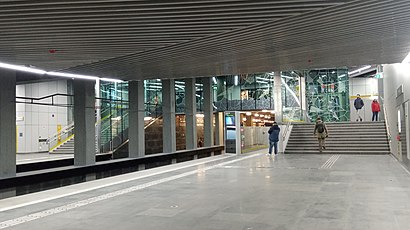
Directions to Határ Út station (Budapest) with public transit
The following transit lines have routes that pass near Határ Út
How to get to Határ Út station by bus?
Click on the bus route to see step by step directions with maps, line arrival times and updated time schedules.
How to get to Határ Út station by metro?
Click on the metro route to see step by step directions with maps, line arrival times and updated time schedules.
Light Rail stations near Határ Út in Budapest
- Nagykőrösi Út / Határ Út, 1 min walk,
Bus stops near Határ Út in Budapest
- Nagykőrösi Út / Határ Út, 1 min walk,
- József Attila Ltp., Távíró Utca, 9 min walk,
Bus lines to Határ Út station in Budapest
- 54, Pestszentimre, Ültetvény Utca,
- 55, Vecsési Út ► Boráros Tér H,
- 254E, Népliget M,
- 255E, Alacskai Úti Lakótelep,
- 66, Határ út M / Soroksár központi raktárak,
- 66B, Határ út M / Soroksár BILK,
- 66E, Határ út M / Soroksár BILK,
- 84E, Határ út M / Kossuth Lajos utca,
- 89E, Határ út M / Bajcsy-Zsilinszky utca,
- 94E, Határ út M / Rákóczi Ferenc utca,
- 123, Határ út M / Soroksár IKEA áruház,
- 123A, Határ út M / Szentlőrinci úti lakótelep,
- 148, Kőbánya-Kispest M / Csepel Soroksári rév,
- 294E, Határ út M / Rákóczi Ferenc utca,
- 966, Határ út M / Millenniumtelep H,
- 999, Határ út M / Dél-pesti autóbuszgarázs,
- 181, Ecseri Út M ► József Attila Lakótelep, Távíró Utca,
- 281, József Attila Lakótelep, Távíró Utca,
What are the closest stations to Határ Út?
The closest stations to Határ Út are:
- Nagykőrösi Út / Határ Út is 8 meters away, 1 min walk.
- József Attila Ltp., Távíró Utca is 651 meters away, 9 min walk.
Which bus lines stop near Határ Út?
These bus lines stop near Határ Út: 148, 54, 55, 84E.
Which metro line stops near Határ Út?
M3 (Kőbánya-Kispest)
Which light rail line stops near Határ Út?
3 (Gubacsi Út / Határ Út)
What’s the nearest light rail station to Határ Út in Budapest?
The nearest light rail station to Határ Út in Budapest is Nagykőrösi Út / Határ Út. It’s a 1 min walk away.
What’s the nearest bus stop to Határ Út in Budapest?
The nearest bus stop to Határ Út in Budapest is Nagykőrösi Út / Határ Út. It’s a 1 min walk away.
What time is the first light rail to Határ Út in Budapest?
The 3 is the first light rail that goes to Határ Út in Budapest. It stops nearby at 3:33 AM.
What time is the last light rail to Határ Út in Budapest?
The 3 is the last light rail that goes to Határ Út in Budapest. It stops nearby at 12:58 AM.
What time is the first bus to Határ Út in Budapest?
The 999 is the first bus that goes to Határ Út in Budapest. It stops nearby at 3:24 AM.
What time is the last bus to Határ Út in Budapest?
The 966 is the last bus that goes to Határ Út in Budapest. It stops nearby at 2:48 AM.
See Határ Út, Budapest, on the map
Public Transit to Határ Út in Budapest
Wondering how to get to Határ Út in Budapest, Hungary? Moovit helps you find the best way to get to Határ Út with step-by-step directions from the nearest public transit station.
Moovit provides free maps and live directions to help you navigate through your city. View schedules, routes, timetables, and find out how long does it take to get to Határ Út in real time.
Looking for the nearest stop or station to Határ Út? Check out this list of stops closest to your destination: Nagykőrösi Út / Határ Út; József Attila Ltp..
Bus: 148, 54, 55, 84E, 254E, 255E, 66, 66B, 66E, 89E, 181, 281.Metro: M3.Light Rail: 3.
Want to see if there’s another route that gets you there at an earlier time? Moovit helps you find alternative routes or times. Get directions from and directions to Határ Út easily from the Moovit App or Website.
We make riding to Határ Út easy, which is why over 1.5 million users, including users in Budapest, trust Moovit as the best app for public transit. You don’t need to download an individual bus app or train app, Moovit is your all-in-one transit app that helps you find the best bus time or train time available.
For information on prices of bus, metro and light rail, costs and ride fares to Határ Út, please check the Moovit app.
Use the app to navigate to popular places including to the airport, hospital, stadium, grocery store, mall, coffee shop, school, college, and university.
Location: Budapest
Places Near Határ Út (Budapest)
How to get to popular places in Budapest with public transit
Get around Budapest by public transit!
Traveling around Budapest has never been so easy. See step by step directions as you travel to any attraction, street or major public transit station. View bus and train schedules, arrival times, service alerts and detailed routes on a map, so you know exactly how to get to anywhere in Budapest.
When traveling to any destination around Budapest use Moovit's Live Directions with Get Off Notifications to know exactly where and how far to walk, how long to wait for your line, and how many stops are left. Moovit will alert you when it's time to get off — no need to constantly re-check whether yours is the next stop.
Wondering how to use public transit in Budapest or how to pay for public transit in Budapest? Moovit public transit app can help you navigate your way with public transit easily, and at minimum cost. It includes public transit fees, ticket prices, and costs. Looking for a map of Budapest public transit lines? Moovit public transit app shows all public transit maps in Budapest with all Bus, Train, Metro, Light Rail and Ferry routes and stops on an interactive map.
Budapest has 5 transit type(s), including: Bus, Train, Metro, Light Rail and Ferry, operated by several transit agencies, including BKK and MÁV Személyszállítási Zrt. - HÉV