Directions to Herb Chambers I-93, Inc. (Somerville) with public transportation
The following transit lines have routes that pass near Herb Chambers I-93, Inc.
 Bus: 109, 80, 85, 87, 88.
- Subway: GREEN LINE D, GREEN LINE E, GREEN LINE B, GREEN LINE C, ORANGE LINE.
How to get to Herb Chambers I-93, Inc. by bus?
Click on the bus route to see step by step directions with maps, line arrival times and updated time schedules.
From Six Flags New England, Newton
66 minFrom Fort Independence, Boston
76 minFrom O'Bryant High School, Boston
50 minFrom Arlington, MA, Arlington
43 minFrom Alumni Stadium, Newton
74 minFrom Roslindale, Boston
77 minFrom Beth Israel Deaconess Medical Center, Brookline
44 minFrom Revere Beach, Revere
86 min
How to get to Herb Chambers I-93, Inc. by subway?
Click on the subway route to see step by step directions with maps, line arrival times and updated time schedules.
Bus stops near Herb Chambers I-93, Inc. in Somerville
- Washington St @ Tufts St, 3 min walk,VIEW
- Union Square - Somerville Ave @ Prospect St, 3 min walk,VIEW
- Somerville Ave @ Linden St, 5 min walk,VIEW
- Mcgrath Hwy @ Medford St, 5 min walk,VIEW
- East Somerville - Joy St @ Washington St, 5 min walk,VIEW
- Mcgrath Hwy @ Washington St, 6 min walk,VIEW
- Mcgrath Hwy @ Alston St, 6 min walk,VIEW
Subway stations near Herb Chambers I-93, Inc. in Somerville
Bus lines to Herb Chambers I-93, Inc. in Somerville
- 85, Ruggles,VIEW
- 91, Central Square,VIEW
- 109, Linden Square Via Sullivan,VIEW
- GREEN LINE SHUTTLE, North Station (Shuttle),VIEW
- GREEN LINE SHUTTLE, Medford/Tufts Via Union Square (Shuttle),VIEW
- 87, Arlington Center,VIEW
- 80, Lechmere - Arlington Center,VIEW
- 88, Lechmere - Clarendon Hill,VIEW
- GREEN LINE E SHUTTLE, East Somerville (Shuttle),VIEW
- GREEN LINE E SHUTTLE, Government Center - Medford/Tufts (Shuttle),VIEW
- GREEN LINE E SHUTTLE, Medford/Tufts - North Station,VIEW
- GREEN LINE E SHUTTLE, North Station - Medford/Tufts (Shuttle),VIEW
- 90, Assembly,VIEW
What are the closest stations to Herb Chambers I-93, Inc.?
The closest stations to Herb Chambers I-93, Inc. are:
- Washington St @ Tufts St is 211 yards away, 3 min walk.
- Union Square - Somerville Ave @ Prospect St is 214 yards away, 3 min walk.
- Somerville Ave @ Linden St is 332 yards away, 5 min walk.
- Mcgrath Hwy @ Medford St is 365 yards away, 5 min walk.
- East Somerville - Joy St @ Washington St is 384 yards away, 5 min walk.
- Mcgrath Hwy @ Washington St is 439 yards away, 6 min walk.
- Mcgrath Hwy @ Alston St is 449 yards away, 6 min walk.
- Gilman Square is 840 yards away, 10 min walk.
- Sullivan Square is 1870 yards away, 23 min walk.
- Union Square is 1965 yards away, 24 min walk.
Which bus lines stop near Herb Chambers I-93, Inc.?
These bus lines stop near Herb Chambers I-93, Inc.: 109, 80, 85, 87, 88, 91.
Which subway lines stop near Herb Chambers I-93, Inc.?
These subway lines stop near Herb Chambers I-93, Inc.: GREEN LINE D, GREEN LINE E.
What’s the nearest subway station to Herb Chambers I-93, Inc. in Somerville?
The nearest subway station to Herb Chambers I-93, Inc. in Somerville is Gilman Square. It’s a 10 min walk away.
What’s the nearest bus station to Herb Chambers I-93, Inc. in Somerville?
The nearest bus stations to Herb Chambers I-93, Inc. in Somerville are Washington St @ Tufts St and Union Square - Somerville Ave @ Prospect St. The closest one is a 3 min walk away.
What time is the first subway to Herb Chambers I-93, Inc. in Somerville?
The GREEN LINE E is the first subway that goes to Herb Chambers I-93, Inc. in Somerville. It stops nearby at 4:49 AM.
What time is the last subway to Herb Chambers I-93, Inc. in Somerville?
The GREEN LINE E is the last subway that goes to Herb Chambers I-93, Inc. in Somerville. It stops nearby at 2:36 AM.
What time is the first bus to Herb Chambers I-93, Inc. in Somerville?
The 109 is the first bus that goes to Herb Chambers I-93, Inc. in Somerville. It stops nearby at 4:51 AM.
What time is the last bus to Herb Chambers I-93, Inc. in Somerville?
The 109 is the last bus that goes to Herb Chambers I-93, Inc. in Somerville. It stops nearby at 1:27 AM.
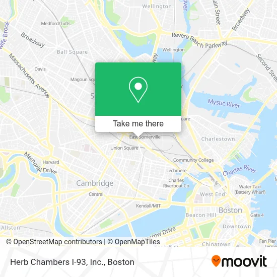
See Herb Chambers I-93, Inc., Somerville, on the map
Public Transit to Herb Chambers I-93, Inc. in Somerville
Wondering how to get to Herb Chambers I-93, Inc. in Somerville? Moovit helps you find the best way to get to Herb Chambers I-93, Inc. with step-by-step directions from the nearest public transit station.
Moovit provides free maps and live directions to help you navigate through your city. View schedules, routes, timetables, and find out how long does it take to get to Herb Chambers I-93, Inc. in real time.
Looking for the nearest stop or station to Herb Chambers I-93, Inc.? Check out this list of stops closest to your destination: Washington St @ Tufts St; Union Square - Somerville Ave @ Prospect St; Somerville Ave @ Linden St; Mcgrath Hwy @ Medford St; East Somerville - Joy St @ Washington St; Mcgrath Hwy @ Washington St; Mcgrath Hwy @ Alston St; Gilman Square; Sullivan Square; Union Square.
Bus: 109, 80, 85, 87, 88, 91, GREEN LINE SHUTTLE, GREEN LINE SHUTTLE.Subway: GREEN LINE D, GREEN LINE E, GREEN LINE B, GREEN LINE C, ORANGE LINE.
Want to see if there’s another route that gets you there at an earlier time? Moovit helps you find alternative routes or times. Get directions from and directions to Herb Chambers I-93, Inc. easily from the Moovit App or Website.
We make riding to Herb Chambers I-93, Inc. easy, which is why over 1.7 million users, including users in Somerville, trust Moovit as the best app for public transit. You don’t need to download an individual bus app or train app, Moovit is your all-in-one transit app that helps you find the best bus time or train time available.
For information on prices of bus, subway, ferry and train, costs and ride fares to Herb Chambers I-93, Inc., please check the Moovit app.
Use the app to navigate to popular places including to the airport, hospital, stadium, grocery store, mall, coffee shop, school, college, and university.
Herb Chambers I-93, Inc. Address: 259 McGrath Highway street in Somerville
- Burger King,
- Target,
- Somerville Motors,
- AUTO ZONE,
- Gentle Giant,
- Cataldo Ambulance,
- Oliveira's,
- Triumvirate Environmental,
- Boynton Yards,
- PNC Bank,
- McDonald's,
- Formlabs,
- Momentum Architecture,
- Taza Chocolate,
- A1a Lockout,
- Prospect Union Square,
- DUNKIN',
- MBCR Training Center,
- 200 Innerbelt Rd,
- Bronwyn Catering
Places Near Herb Chambers I-93, Inc. (Somerville)
- Boston Medical Center, Boston,
- Seaport District, Boston,
- Cheers, Boston,
- Td Garden, Boston,
- North End, Boston,
- Mgm Music Hall, Boston,
- Boston Children's Hospital, Boston,
- Leader Bank Pavilion (Leader Bank Pavillion), Boston,
- Boston Convention & Exhibition Center, Boston,
- Museum Of Science, Boston,
- Faneuil Hall, Boston,
- Castle Island, Boston,
- Wilbur Theatre, Boston,
- Prudential Center, Boston,
- Wang Theater, Boston,
- Quincy Market, Boston,
- Isabella Stewart Gardner Museum, Boston,
- House Of Blues, Boston,
- Massachusetts General Hospital, Boston,
- Boston Common, Boston
How to get to popular places in Boston with public transit
Get around Somerville by public transit!
Traveling around Somerville has never been so easy. See step by step directions as you travel to any attraction, street or major public transit station. View bus and train schedules, arrival times, service alerts and detailed routes on a map, so you know exactly how to get to anywhere in Somerville.
When traveling to any destination around Somerville use Moovit's Live Directions with Get Off Notifications to know exactly where and how far to walk, how long to wait for your line, and how many stops are left. Moovit will alert you when it's time to get off — no need to constantly re-check whether yours is the next stop.
Wondering how to use public transit in Somerville or how to pay for public transit in Somerville? Moovit public transit app can help you navigate your way with public transit easily, and at minimum cost. It includes public transit fees, ticket prices, and costs. Looking for a map of Somerville public transit lines? Moovit public transit app shows all public transit maps in Somerville with all Bus, Train, Subway and Ferry routes and stops on an interactive map.
Boston has 4 transit type(s), including: Bus, Train, Subway and Ferry, operated by several transit agencies, including MBTA, Southeastern Regional Transit Authority, MetroWest Regional Transit Authority, Rhode Island Public Transit Authority, WRTA, Lowell Regional Transit Authority, Merrimack Valley Transit, Montachusett Regional Transit Authority, Cape Cod Regional Transit Authority, Brockton Area Transit Authority, Martha's Vineyard Transit Authority, the WAVE - Nantucket Regional Transit Authority, GATRA, Cape Ann Transportation Authority and Massport