Directions to Hospitality Frames (Dedham) with public transportation
The following transit lines have routes that pass near Hospitality Frames
 Bus: 33, 34, 34E.
- Train: FRANKLIN/FOXBORO, PROVIDENCE/STOUGHTON, FAIRMOUNT.
How to get to Hospitality Frames by bus?
Click on the bus route to see step by step directions with maps, line arrival times and updated time schedules.
From Jamaica Plain, Boston
67 minFrom Homewood Suites by Hilton Boston Brookline-Longwood Medical, Brookline
77 minFrom Alumni Stadium, Boston
107 minFrom Roslindale, Boston
43 minFrom Milton Academy, Milton
82 minFrom Norwood, MA, Norwood
43 minFrom Brookline High School (Brookline Town High School), Brookline
87 minFrom Conte Forum, Boston
108 minFrom AC Hotel by Marriott Boston Cleveland Circle, Boston
85 min
How to get to Hospitality Frames by train?
Click on the train route to see step by step directions with maps, line arrival times and updated time schedules.
Bus stop near Hospitality Frames in Dedham
- River St @ Milton St, 15 min walk,VIEW
Train stations near Hospitality Frames in Dedham
- Readville, 32 min walk,VIEW
Bus lines to Hospitality Frames in Dedham
- 33, River & Milton Via Cleary Square,VIEW
What are the closest stations to Hospitality Frames?
The closest stations to Hospitality Frames are:
- River St @ Milton St is 1177 yards away, 15 min walk.
- Readville is 2570 yards away, 32 min walk.
Which bus lines stop near Hospitality Frames?
These bus lines stop near Hospitality Frames: 33, 34, 34E.
Which train lines stop near Hospitality Frames?
These train lines stop near Hospitality Frames: FRANKLIN/FOXBORO, PROVIDENCE/STOUGHTON.
What’s the nearest bus station to Hospitality Frames in Dedham?
The nearest bus station to Hospitality Frames in Dedham is River St @ Milton St. It’s a 15 min walk away.
What time is the first train to Hospitality Frames in Dedham?
The PROVIDENCE/STOUGHTON is the first train that goes to Hospitality Frames in Dedham. It stops nearby at 5:05 AM.
What time is the last train to Hospitality Frames in Dedham?
The PROVIDENCE/STOUGHTON is the last train that goes to Hospitality Frames in Dedham. It stops nearby at 12:20 AM.
What time is the first bus to Hospitality Frames in Dedham?
The 33 is the first bus that goes to Hospitality Frames in Dedham. It stops nearby at 5:36 AM.
What time is the last bus to Hospitality Frames in Dedham?
The 33 is the last bus that goes to Hospitality Frames in Dedham. It stops nearby at 7:51 PM.
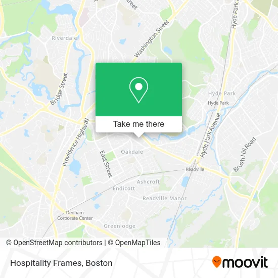
See Hospitality Frames, Dedham, on the map
Public Transit to Hospitality Frames in Dedham
Wondering how to get to Hospitality Frames in Dedham? Moovit helps you find the best way to get to Hospitality Frames with step-by-step directions from the nearest public transit station.
Moovit provides free maps and live directions to help you navigate through your city. View schedules, routes, timetables, and find out how long does it take to get to Hospitality Frames in real time.
Looking for the nearest stop or station to Hospitality Frames? Check out this list of stops closest to your destination: River St @ Milton St; Readville.
Bus: 33, 34, 34E.Train: FRANKLIN/FOXBORO, PROVIDENCE/STOUGHTON, FAIRMOUNT.
Want to see if there’s another route that gets you there at an earlier time? Moovit helps you find alternative routes or times. Get directions from and directions to Hospitality Frames easily from the Moovit App or Website.
We make riding to Hospitality Frames easy, which is why over 1.7 million users, including users in Dedham, trust Moovit as the best app for public transit. You don’t need to download an individual bus app or train app, Moovit is your all-in-one transit app that helps you find the best bus time or train time available.
For information on prices of bus, train and subway, costs and ride fares to Hospitality Frames, please check the Moovit app.
Use the app to navigate to popular places including to the airport, hospital, stadium, grocery store, mall, coffee shop, school, college, and university.
Hospitality Frames Address: 115 Commerce Way street in Dedham
- Noco PDR Solutions,
- Ardlin Fire Protection,
- Dedham Emergency Plumbing,
- Stuart Glass Inc,
- William B. Gould Park,
- Fountain of Grace Church - Food Distribution Center,
- L & J Auto Center,
- Lifesafer Ignition Interlock,
- Jeff's Auto Service,
- Amazon Locker-Virginia,
- Duxburrow Estates,
- Needham dem Town Cmte,
- Dedham Locksmith Store,
- Patriot Financial Group,
- Meantide Associates, Llc,
- Maidpro West Roxbury,
- Hugh's Insulation,
- Alamo,
- P & S Complete Cleaning Service,
- Euro Glam
Places Near Hospitality Frames (Dedham)
- Boston Medical Center, Boston,
- Prudential Center, Boston,
- Boston Convention & Exhibition Center, Boston,
- Wilbur Theatre, Boston,
- Seaport District, Boston,
- Leader Bank Pavilion (Leader Bank Pavillion), Boston,
- Cheers, Boston,
- Boston Common, Boston,
- House Of Blues, Boston,
- Boston Children's Hospital, Boston,
- Massachusetts General Hospital, Boston,
- Mgm Music Hall, Boston,
- Museum Of Science, Boston,
- Wang Theater, Boston,
- Castle Island, Boston,
- Td Garden, Boston,
- Quincy Market, Boston,
- Faneuil Hall, Boston,
- Isabella Stewart Gardner Museum, Boston,
- North End, Boston
How to get to popular places in Boston with public transit
Get around Dedham by public transit!
Traveling around Dedham has never been so easy. See step by step directions as you travel to any attraction, street or major public transit station. View bus and train schedules, arrival times, service alerts and detailed routes on a map, so you know exactly how to get to anywhere in Dedham.
When traveling to any destination around Dedham use Moovit's Live Directions with Get Off Notifications to know exactly where and how far to walk, how long to wait for your line, and how many stops are left. Moovit will alert you when it's time to get off — no need to constantly re-check whether yours is the next stop.
Wondering how to use public transit in Dedham or how to pay for public transit in Dedham? Moovit public transit app can help you navigate your way with public transit easily, and at minimum cost. It includes public transit fees, ticket prices, and costs. Looking for a map of Dedham public transit lines? Moovit public transit app shows all public transit maps in Dedham with all Bus, Train, Subway and Ferry routes and stops on an interactive map.
Boston has 4 transit type(s), including: Bus, Train, Subway and Ferry, operated by several transit agencies, including MBTA, Southeastern Regional Transit Authority, MetroWest Regional Transit Authority, Rhode Island Public Transit Authority, WRTA, Lowell Regional Transit Authority, Merrimack Valley Transit, Montachusett Regional Transit Authority, Cape Cod Regional Transit Authority, Brockton Area Transit Authority, Martha's Vineyard Transit Authority, the WAVE - Nantucket Regional Transit Authority, GATRA, Cape Ann Transportation Authority and Massport