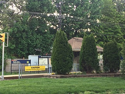
Directions to Huey Avenue station (Drexel Hill) with public transit
The following transit lines have routes that pass near Huey Avenue
How to get to Huey Avenue station by bus?
Click on the bus route to see step by step directions with maps, line arrival times and updated time schedules.
How to get to Huey Avenue station by train?
Click on the train route to see step by step directions with maps, line arrival times and updated time schedules.
How to get to Huey Avenue station by metro?
Click on the metro route to see step by step directions with maps, line arrival times and updated time schedules.
Metro station near Huey Avenue in Drexel Hill
- Irvington Rd, 4 min walk,
Bus stops near Huey Avenue in Drexel Hill
- Lansdowne Av & Huey Av, 9 min walk,
- Marshall Rd & Mansfield Av - Fs, 12 min walk,
- State Rd & Hampshire Rd, 16 min walk,
Bus lines to Huey Avenue station in Drexel Hill
- 115, Airport,
- 107, 69th St Transit Center,
- 111, 69th St Transit Center,
What are the closest stations to Huey Avenue?
The closest stations to Huey Avenue are:
- Irvington Rd is 256 yards away, 4 min walk.
- Lansdowne Av & Huey Av is 739 yards away, 9 min walk.
- Marshall Rd & Mansfield Av - Fs is 985 yards away, 12 min walk.
- State Rd & Hampshire Rd is 1378 yards away, 16 min walk.
Which bus lines stop near Huey Avenue?
These bus lines stop near Huey Avenue: 107, 111, 115.
Which train line stops near Huey Avenue?
MED (#4307 - Wawa)
Which metro lines stop near Huey Avenue?
These metro lines stop near Huey Avenue: D1, D2.
What’s the nearest metro station to Huey Avenue in Drexel Hill?
The nearest metro station to Huey Avenue in Drexel Hill is Irvington Rd. It’s a 4 min walk away.
What’s the nearest bus station to Huey Avenue in Drexel Hill?
The nearest bus station to Huey Avenue in Drexel Hill is Lansdowne Av & Huey Av. It’s a 9 min walk away.
See Huey Avenue, Drexel Hill, on the map
Public Transit to Huey Avenue in Drexel Hill
How to get to Huey Avenue in Drexel Hill, United States?
It’s easy with Moovit. Type in your street address and Moovit’s route finder will locate the fastest way to get you there! Not sure where to get off on the street? Download the Moovit App to find live directions (including where to get off on Huey Avenue), see timetables and get the estimated arrival times for your favorite metro, bus or train lines.
Looking for the nearest stop or station to Huey Avenue? Check out this list of closest stops available to your destination: Irvington Rd; Lansdowne Av & Huey Av; Marshall Rd & Mansfield Av - Fs; State Rd & Hampshire Rd.
Bus: 107, 111, 115.Train: MED.Metro: D1, D2.
Download the Moovit App to see the current schedule and routes available for Drexel Hill. No need to install a special bus app to check the bus time or a train app to get train time. Moovit is the only all-in-one transit app that helps you get where you need to go.
We make riding on public transit to Huey Avenue easy, which is why over 1.5 million users, including users in Drexel Hill trust Moovit as the best app for public transit.
Use the app to navigate to popular places including to the airport, hospital, stadium, grocery store, mall, coffee shop, school, college, and university.
Location: Drexel Hill, Philadelphia
Streets near Huey Avenue, Drexel Hill
Get around Drexel Hill by public transit!
Traveling around Drexel Hill has never been so easy. See step by step directions as you travel to any attraction, street or major public transit station. View bus and train schedules, arrival times, service alerts and detailed routes on a map, so you know exactly how to get to anywhere in Drexel Hill.
When traveling to any destination around Drexel Hill use Moovit's Live Directions with Get Off Notifications to know exactly where and how far to walk, how long to wait for your line, and how many stops are left. Moovit will alert you when it's time to get off — no need to constantly re-check whether yours is the next stop.
Wondering how to use public transit in Drexel Hill or how to pay for public transit in Drexel Hill? Moovit public transit app can help you navigate your way with public transit easily, and at minimum cost. It includes public transit fees, ticket prices, and costs. Looking for a map of Drexel Hill public transit lines? Moovit public transit app shows all public transit maps in Drexel Hill with all Bus, Train, Metro, Light Rail and Cable Car routes and stops on an interactive map.
Philadelphia has 5 transit type(s), including: Bus, Train, Metro, Light Rail and Cable Car, operated by several transit agencies, including SEPTA Rail, SEPTA, SEPTA Subway, NJ Transit Rail, NJ Transit Bus, Port Authority Transit Corporation, Pottstown Area Rapid Transit (PART), Fullington Tours, Drexel University, Penn Transit, Chescobus, Navy Yard, Amtrak, Suburban Transit and FlixBus-us