See Hurdman D, Ottawa, on the map
Directions to Hurdman D (Ottawa) with public transportation
The following transit lines have routes that pass near Hurdman D
 Bus:
Bus: - Light Rail:
How to get to Hurdman D by bus?
Click on the bus route to see step by step directions with maps, line arrival times and updated time schedules.
Bus stations near Hurdman D in Ottawa
- Hurdman D,1 min walk,
- Hurdman B,1 min walk,
- Hurdman A,2 min walk,
- Lees A,12 min walk,
Light Rail stations near Hurdman D in Ottawa
- Lees,19 min walk,
Bus lines to Hurdman D in Ottawa
- 10,Lyon,
- 19,Parliament ~ Parlement,
- 48,Elmvale,
- 49,Elmvale,
- 88,Terry Fox,
- 90,Greenboro,
- 92,Greenboro,
- 96,Merivale / 96b Hunt Club,
- 199,Leikin,
- 290,Mccarthy,
- 451,Lansdowne,
- 9,Rideau,
- 42,Blair,
- 44,Billings Bridge,
- 46,Hurdman,
- 93,Leitrim,
- 98,Hurdman,
- 99,Greenboro & Hurdman,
- 190,Hurdman,
- 291,Herongate,
What are the closest stations to Hurdman D?
The closest stations to Hurdman D are:
- Hurdman D is 44 meters away, 1 min walk.
- Hurdman B is 54 meters away, 1 min walk.
- Hurdman A is 94 meters away, 2 min walk.
- Lees A is 930 meters away, 12 min walk.
- Lees is 1454 meters away, 19 min walk.
Which bus lines stop near Hurdman D?
These bus lines stop near Hurdman D: 10, 42, 88, 97, 98.
Which light rail line stops near Hurdman D?
1
What’s the nearest light rail station to Hurdman D in Ottawa?
The nearest light rail station to Hurdman D in Ottawa is Lees. It’s a 19 min walk away.
What’s the nearest bus stop to Hurdman D in Ottawa?
The nearest bus stops to Hurdman D in Ottawa are Hurdman D and Hurdman B. The closest one is a 1 min walk away.
What time is the first light rail to Hurdman D in Ottawa?
The 1 is the first light rail that goes to Hurdman D in Ottawa. It stops nearby at 5:00 AM.
What time is the last light rail to Hurdman D in Ottawa?
The 1 is the last light rail that goes to Hurdman D in Ottawa. It stops nearby at 1:24 AM.
What time is the first bus to Hurdman D in Ottawa?
The 45 is the first bus that goes to Hurdman D in Ottawa. It stops nearby at 3:00 AM.
What time is the last bus to Hurdman D in Ottawa?
The 97 is the last bus that goes to Hurdman D in Ottawa. It stops nearby at 3:10 AM.
See Hurdman D, Ottawa, on the map
Public Transit to Hurdman D in Ottawa
Wondering how to get to Hurdman D in Ottawa, Canada? Moovit helps you find the best way to get to Hurdman D with step-by-step directions from the nearest public transit station.
Moovit provides free maps and live directions to help you navigate through your city. View schedules, routes, timetables, and find out how long does it take to get to Hurdman D in real time.
Looking for the nearest stop or station to Hurdman D? Check out this list of stops closest to your destination: Hurdman D; Hurdman B; Hurdman A; Lees A; Lees.
Bus:Light Rail:
Want to see if there’s another route that gets you there at an earlier time? Moovit helps you find alternative routes or times. Get directions from and directions to Hurdman D easily from the Moovit App or Website.
We make riding to Hurdman D easy, which is why over 1.5 million users, including users in Ottawa, trust Moovit as the best app for public transit. You don’t need to download an individual bus app or train app, Moovit is your all-in-one transit app that helps you find the best bus time or train time available.
For information on prices of bus and light rail, costs and ride fares to Hurdman D, please check the Moovit app.
Use the app to navigate to popular places including to the airport, hospital, stadium, grocery store, mall, coffee shop, school, college, and university.
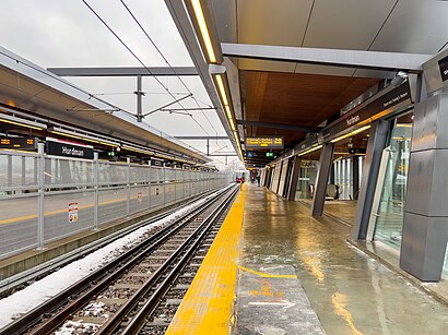
Hurdman D Address: Transitway street in Ottawa
Hurdman is a station on Ottawa's O-Train Confederation Line, and bus rapid transit (BRT) system, transitway.Wiki
Attractions near Hurdman D
Hurdman A,Hurdman O-Train West/Ouest,Hurdman Station,Hurdman Bush,University Of Ottawa - Lees Campus,Riverbreeze,200 Lees Avenue,Sister Clean,Phi Shimabrows,Gee-Gees Field,Sparkle,Lees Ave Community Garden,Robert Dvorkin Music Studios,170 Lees Ave,University Of Ottawa, Lees Campus - Lot G2,Gee-Gees Field,Lees Station,Lycée Claudel Station,Lycee Claudel,Exit 117/Promenade Vanier/EHow to get to popular attractions in Ottawa with public transit
Rockcliffe Airport, Ottawa,Mother Teresa High School, Ottawa,Accora Village, Ottawa,2220 Walkley Rd., Ottawa,Gatineau, Gatineau,House Of Commons Gym, Ottawa,Tim Hortons, Ottawa,Walmart Supercentre, Ottawa,130 Colonnade, Ottawa,Elgin Street Diner, Ottawa,Mandarin Restaurant, Ottawa,Pleasant Park Station, Ottawa,Findlay Creek, Ottawa,DND Shuttle La Quebecoise, Hull,Ottawa Central Station (Closed), Ottawa,Cairine Wilson SS, Ottawa,Ridgemont High School, Ottawa,OTRT World headquarters, Ottawa,Chapman Mills Marketplace, Ottawa,Tanger Outlet Mall, OttawaGet around Ottawa by public transit!
Traveling around Ottawa has never been so easy. See step by step directions as you travel to any attraction, street or major public transit station. View bus and train schedules, arrival times, service alerts and detailed routes on a map, so you know exactly how to get to anywhere in Ottawa.
When traveling to any destination around Ottawa use Moovit's Live Directions with Get Off Notifications to know exactly where and how far to walk, how long to wait for your line, and how many stops are left. Moovit will alert you when it's time to get off — no need to constantly re-check whether yours is the next stop.
Wondering how to use public transit in Ottawa or how to pay for public transit in Ottawa? Moovit public transit app can help you navigate your way with public transit easily, and at minimum cost. It includes public transit fees, ticket prices, and costs. Looking for a map of Ottawa public transit lines? Moovit public transit app shows all public transit maps in Ottawa with all bus or light rail routes and stops on an interactive map.
Ottawa has 2 transit type(s), including: bus or light rail, operated by several transit agencies, including OC Transpo, OC Transpo, STO, Transcollines and Megabus Canada