Directions to Hypegenius (Boston) with public transportation
The following transit lines have routes that pass near Hypegenius
 Bus: 1, 39, 43, 85, CT3.
- Train: FRANKLIN/FOXBORO, NEEDHAM, ORANGE LINE, PROVIDENCE/STOUGHTON.
- Subway: GREEN LINE E, ORANGE LINE.
How to get to Hypegenius by bus?
Click on the bus route to see step by step directions with maps, line arrival times and updated time schedules.
From Alumni Stadium, Boston
54 minFrom McLean Hospital, Belmont
72 minFrom Kkkk, Boston
63 minFrom Uscis Biometrics Office, Revere
67 minFrom Arlington, MA, Arlington
76 minFrom Suffolk Downs, Boston
74 minFrom 7F Everett Street, Revere
67 minFrom Chevalier Theater, Medford
60 minFrom Malden Catholic High School, Malden
94 minFrom Reelhouse, Boston
58 min
How to get to Hypegenius by subway?
Click on the subway route to see step by step directions with maps, line arrival times and updated time schedules.
Bus stops near Hypegenius in Boston
Subway station near Hypegenius in Boston
- Northeastern University, 2 min walk,VIEW
Train station near Hypegenius in Boston
- Ruggles, 6 min walk,VIEW
Bus lines to Hypegenius in Boston
- 39, Haymarket Via Forest Hills,VIEW
- 9, Kenmore Via Boston Latin,VIEW
- GREEN LINE E SHUTTLE, Park Street (Shuttle),VIEW
- GREEN LINE E SHUTTLE, Prudential (Shuttle),VIEW
- 8, Kenmore via South Bay Center - Harbor Point via South Bay Center,VIEW
- 19, Kenmore - Fields Corner,VIEW
- 28, Ruggles - Mattapan,VIEW
- 47, Broadway - Central Square,VIEW
- 85, Ruggles - Assembly,VIEW
- 22, Kenmore Via Ruggles,VIEW
- CT3, Avenue Louis Pasteur (Limited Stops),VIEW
- 15, Ruggles - Fields Corner,VIEW
- 23, Ruggles - Ashmont,VIEW
- 43, Park St & Tremont St - Ruggles,VIEW
- 44, Ruggles - Jackson Square,VIEW
- 45, Ruggles - Franklin Park,VIEW
- ORANGE LINE SHUTTLE, Forest Hills - Ruggles,VIEW
- ORANGE LINE SHUTTLE, Ruggles - Back Bay,VIEW
- ORANGE LINE SHUTTLE, Ruggles - Copley,VIEW
- ORANGE LINE SHUTTLE, Forest Hills - Copley,VIEW
What are the closest stations to Hypegenius?
The closest stations to Hypegenius are:
- Huntington Ave @ Parker St is 69 yards away, 1 min walk.
- Northeastern University is 133 yards away, 2 min walk.
- Huntington Ave @ Forsyth Way is 166 yards away, 3 min walk.
- Ruggles St @ Parker St is 357 yards away, 5 min walk.
- Ruggles St @ Annunciation Rd is 382 yards away, 5 min walk.
- Ruggles St @ Huntington Ave is 409 yards away, 5 min walk.
- Ruggles is 437 yards away, 6 min walk.
- Ruggles - Columbus Ave @ St Cyprians is 739 yards away, 9 min walk.
Which bus lines stop near Hypegenius?
These bus lines stop near Hypegenius: 1, 39, 43, 85, CT3.
Which subway lines stop near Hypegenius?
These subway lines stop near Hypegenius: GREEN LINE E, ORANGE LINE.
What’s the nearest subway station to Hypegenius in Boston?
The nearest subway station to Hypegenius in Boston is Northeastern University. It’s a 2 min walk away.
What’s the nearest train station to Hypegenius in Boston?
The nearest train station to Hypegenius in Boston is Ruggles. It’s a 6 min walk away.
What’s the nearest bus station to Hypegenius in Boston?
The nearest bus station to Hypegenius in Boston is Huntington Ave @ Parker St. It’s a 1 min walk away.
What time is the first subway to Hypegenius in Boston?
The GREEN LINE E is the first subway that goes to Hypegenius in Boston. It stops nearby at 5:18 AM.
What time is the last subway to Hypegenius in Boston?
The GREEN LINE E is the last subway that goes to Hypegenius in Boston. It stops nearby at 2:09 AM.
What time is the first train to Hypegenius in Boston?
The PROVIDENCE/STOUGHTON is the first train that goes to Hypegenius in Boston. It stops nearby at 4:28 AM.
What time is the last train to Hypegenius in Boston?
The PROVIDENCE/STOUGHTON is the last train that goes to Hypegenius in Boston. It stops nearby at 12:34 AM.
What time is the first bus to Hypegenius in Boston?
The 23 is the first bus that goes to Hypegenius in Boston. It stops nearby at 4:47 AM.
What time is the last bus to Hypegenius in Boston?
The 28 is the last bus that goes to Hypegenius in Boston. It stops nearby at 2:36 AM.
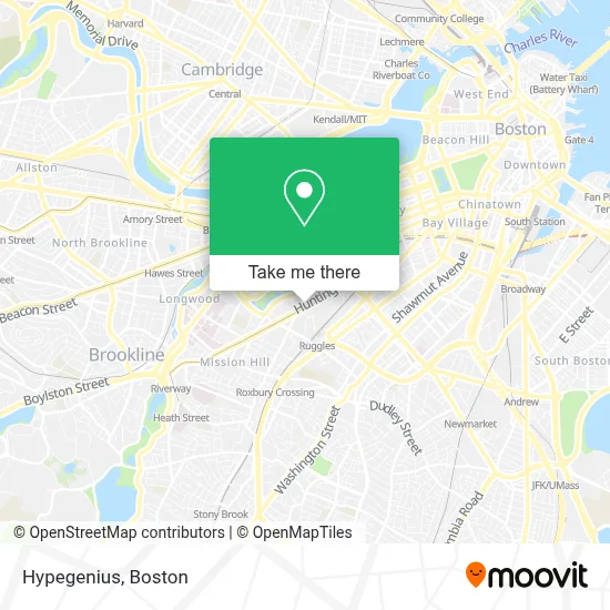
See Hypegenius, Boston, on the map
Public Transit to Hypegenius in Boston
Wondering how to get to Hypegenius in Boston? Moovit helps you find the best way to get to Hypegenius with step-by-step directions from the nearest public transit station.
Moovit provides free maps and live directions to help you navigate through your city. View schedules, routes, timetables, and find out how long does it take to get to Hypegenius in real time.
Looking for the nearest stop or station to Hypegenius? Check out this list of stops closest to your destination: Huntington Ave @ Parker St; Northeastern University; Huntington Ave @ Forsyth Way; Ruggles St @ Parker St; Ruggles St @ Annunciation Rd; Ruggles St @ Huntington Ave; Ruggles; Ruggles - Columbus Ave @ St Cyprians.
Bus: 1, 39, 43, 85, CT3, 9, GREEN LINE E SHUTTLE, GREEN LINE E SHUTTLE, 8, 19, 28, 47, 22.Train: FRANKLIN/FOXBORO, NEEDHAM, ORANGE LINE, PROVIDENCE/STOUGHTON.Subway: GREEN LINE E, ORANGE LINE.
Want to see if there’s another route that gets you there at an earlier time? Moovit helps you find alternative routes or times. Get directions from and directions to Hypegenius easily from the Moovit App or Website.
We make riding to Hypegenius easy, which is why over 1.7 million users, including users in Boston, trust Moovit as the best app for public transit. You don’t need to download an individual bus app or train app, Moovit is your all-in-one transit app that helps you find the best bus time or train time available.
For information on prices of subway, bus and train, costs and ride fares to Hypegenius, please check the Moovit app.
Use the app to navigate to popular places including to the airport, hospital, stadium, grocery store, mall, coffee shop, school, college, and university.
Hypegenius Address: 21 Forsyth St street in Boston
- Northeastern University Station,
- Marino Center,
- Northeastern University Cabot Physical Education Center,
- Northeastern,
- Bank Of America,
- Northeastern University Wiffle Ball Field,
- The Pit,
- ME Capstone Lab Forsyth,
- Snell Library,
- Northeastern University,
- Northeastern - Outbound (360 Huntington Ave),
- Willis Hall Sand Volleyball Court,
- Northeastern University (University Admissions Visitor Center),
- MFA Offices,
- NUPD Red Eye Shuttle,
- Teeter-totter-a-thon,
- Northeastern University School of Law,
- Museum of Fine Arts (MFA),
- 333,
- Centennial Common
Places Near Hypegenius (Boston)
- Seaport District, Boston,
- Quincy Market, Boston,
- Boston Convention & Exhibition Center, Boston,
- Mgm Music Hall, Boston,
- Td Garden, Boston,
- Faneuil Hall, Boston,
- Castle Island, Boston,
- Cheers, Boston,
- Leader Bank Pavilion (Leader Bank Pavillion), Boston,
- Boston Common, Boston,
- North End, Boston,
- Wilbur Theatre, Boston,
- Boston Medical Center, Boston,
- Wang Theater, Boston,
- Prudential Center, Boston,
- Boston Children's Hospital, Boston,
- Massachusetts General Hospital, Boston,
- Museum Of Science, Boston,
- House Of Blues, Boston,
- Isabella Stewart Gardner Museum, Boston
How to get to popular places in Boston with public transit
Get around Boston by public transit!
Traveling around Boston has never been so easy. See step by step directions as you travel to any attraction, street or major public transit station. View bus and train schedules, arrival times, service alerts and detailed routes on a map, so you know exactly how to get to anywhere in Boston.
When traveling to any destination around Boston use Moovit's Live Directions with Get Off Notifications to know exactly where and how far to walk, how long to wait for your line, and how many stops are left. Moovit will alert you when it's time to get off — no need to constantly re-check whether yours is the next stop.
Wondering how to use public transit in Boston or how to pay for public transit in Boston? Moovit public transit app can help you navigate your way with public transit easily, and at minimum cost. It includes public transit fees, ticket prices, and costs. Looking for a map of Boston public transit lines? Moovit public transit app shows all public transit maps in Boston with all Bus, Train, Subway and Ferry routes and stops on an interactive map.
Boston has 4 transit type(s), including: Bus, Train, Subway and Ferry, operated by several transit agencies, including MBTA, Southeastern Regional Transit Authority, MetroWest Regional Transit Authority, Rhode Island Public Transit Authority, WRTA, Lowell Regional Transit Authority, Merrimack Valley Transit, Montachusett Regional Transit Authority, Cape Cod Regional Transit Authority, Brockton Area Transit Authority, Martha's Vineyard Transit Authority, the WAVE - Nantucket Regional Transit Authority, GATRA, Cape Ann Transportation Authority and Massport