Directions to Iglesia (Saugus) with public transportation
The following transit lines have routes that pass near Iglesia
 Bus: 426, 450, 455, 116, 424.
- Train: NEWBURYPORT/ROCKPORT.
- Ferry: LYNN FERRY.
How to get to Iglesia by bus?
Click on the bus route to see step by step directions with maps, line arrival times and updated time schedules.
From Bunker Hill, Boston
54 minFrom Rental Car Center - Logan Airport, Boston
46 minFrom Assembly Square Mall Shopping Center, Somerville
79 minFrom Maverick Station, Boston
48 minFrom Embassy Suites-Boston, Boston
52 minFrom Silver Line Stop Terminal B, Boston
68 minFrom Wegmans, Medford
71 minFrom Malden, MA, Malden
47 minFrom Rino's Place, Boston
50 minFrom Reelhouse, Boston
50 min
How to get to Iglesia by train?
Click on the train route to see step by step directions with maps, line arrival times and updated time schedules.
Bus stops near Iglesia in Saugus
Train station near Iglesia in Saugus
- River Works, 15 min walk,VIEW
Ferry station near Iglesia in Saugus
- Blossom Street Pier, 33 min walk,VIEW
Bus lines to Iglesia in Saugus
What are the closest stations to Iglesia?
The closest stations to Iglesia are:
- Western Ave @ Cooper St is 262 yards away, 4 min walk.
- Lincoln Ave Opp Bristow St is 456 yards away, 6 min walk.
- River Works is 1223 yards away, 15 min walk.
- Blossom Street Pier is 2777 yards away, 33 min walk.
Which bus lines stop near Iglesia?
These bus lines stop near Iglesia: 426, 450, 455.
Which train line stops near Iglesia?
NEWBURYPORT/ROCKPORT (#45 | Rockport)
What’s the nearest train station to Iglesia in Saugus?
The nearest train station to Iglesia in Saugus is River Works. It’s a 15 min walk away.
What’s the nearest bus station to Iglesia in Saugus?
The nearest bus station to Iglesia in Saugus is Western Ave @ Cooper St. It’s a 4 min walk away.
What time is the first train to Iglesia in Saugus?
The NEWBURYPORT/ROCKPORT is the first train that goes to Iglesia in Saugus. It stops nearby at 5:30 AM.
What time is the last train to Iglesia in Saugus?
The NEWBURYPORT/ROCKPORT is the last train that goes to Iglesia in Saugus. It stops nearby at 12:17 AM.
What time is the first bus to Iglesia in Saugus?
The 116 is the first bus that goes to Iglesia in Saugus. It stops nearby at 4:15 AM.
What time is the last bus to Iglesia in Saugus?
The 426 is the last bus that goes to Iglesia in Saugus. It stops nearby at 1:30 AM.
What time is the first ferry to Iglesia in Saugus?
The LYNN FERRY is the first ferry that goes to Iglesia in Saugus. It stops nearby at 6:00 AM.
What time is the last ferry to Iglesia in Saugus?
The LYNN FERRY is the last ferry that goes to Iglesia in Saugus. It stops nearby at 7:55 PM.
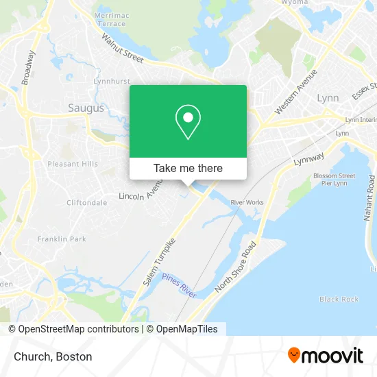
See Iglesia, Saugus, on the map
Public Transit to Iglesia in Saugus
Wondering how to get to Iglesia in Saugus? Moovit helps you find the best way to get to Iglesia with step-by-step directions from the nearest public transit station.
Moovit provides free maps and live directions to help you navigate through your city. View schedules, routes, timetables, and find out how long does it take to get to Iglesia in real time.
Looking for the nearest stop or station to Iglesia? Check out this list of stops closest to your destination: Western Ave @ Cooper St; Lincoln Ave Opp Bristow St; River Works; Blossom Street Pier.
Bus: 426, 450, 455, 116, 424, 428.Train: NEWBURYPORT/ROCKPORT.Ferry: LYNN FERRY.
Want to see if there’s another route that gets you there at an earlier time? Moovit helps you find alternative routes or times. Get directions from and directions to Iglesia easily from the Moovit App or Website.
We make riding to Iglesia easy, which is why over 1.7 million users, including users in Saugus, trust Moovit as the best app for public transit. You don’t need to download an individual bus app or train app, Moovit is your all-in-one transit app that helps you find the best bus time or train time available.
For information on prices of bus, subway and train, costs and ride fares to Iglesia, please check the Moovit app.
Use the app to navigate to popular places including to the airport, hospital, stadium, grocery store, mall, coffee shop, school, college, and university.
Iglesia Address: 109 Ballard St street in Saugus
- Vitale Park,
- DSS-Thermo King,
- Saugus River,
- Junkar Ninja,
- Chino Auto Sales,
- Remark Deal,
- Kids Cuts and Fun,
- Ea Building and Remodeling,
- Vincenzo Giovinco & Son Ceramic Tile & Installation,
- MBTA 426 / 426W to Haymarket / Wonderland,
- Chestnut Woods Operator,
- My Affordable Moving,
- MBTA Lynn Bus Garage,
- Paniago & Son General Construction Services,
- General Electric,
- MBTA Bus Route 455,
- Al Prime,
- Massachusetts Green Retail,
- 1 24 Hour Lynn Emergency Locksmith,
- Cogliano Plaza
Places Near Iglesia (Saugus)
- Wilbur Theatre, Boston,
- Cheers, Boston,
- Isabella Stewart Gardner Museum, Boston,
- Seaport District, Boston,
- Mgm Music Hall, Boston,
- Quincy Market, Boston,
- Wang Theater, Boston,
- Leader Bank Pavilion (Leader Bank Pavillion), Boston,
- Td Garden, Boston,
- Boston Medical Center, Boston,
- House Of Blues, Boston,
- Boston Children's Hospital, Boston,
- Faneuil Hall, Boston,
- Museum Of Science, Boston,
- Boston Common, Boston,
- Boston Convention & Exhibition Center, Boston,
- Castle Island, Boston,
- North End, Boston,
- Prudential Center, Boston,
- Massachusetts General Hospital, Boston
How to get to popular places in Boston with public transit
Get around Saugus by public transit!
Traveling around Saugus has never been so easy. See step by step directions as you travel to any attraction, street or major public transit station. View bus and train schedules, arrival times, service alerts and detailed routes on a map, so you know exactly how to get to anywhere in Saugus.
When traveling to any destination around Saugus use Moovit's Live Directions with Get Off Notifications to know exactly where and how far to walk, how long to wait for your line, and how many stops are left. Moovit will alert you when it's time to get off — no need to constantly re-check whether yours is the next stop.
Wondering how to use public transit in Saugus or how to pay for public transit in Saugus? Moovit public transit app can help you navigate your way with public transit easily, and at minimum cost. It includes public transit fees, ticket prices, and costs. Looking for a map of Saugus public transit lines? Moovit public transit app shows all public transit maps in Saugus with all Bus, Train, Subway and Ferry routes and stops on an interactive map.
Boston has 4 transit type(s), including: Bus, Train, Subway and Ferry, operated by several transit agencies, including MBTA, Southeastern Regional Transit Authority, MetroWest Regional Transit Authority, Rhode Island Public Transit Authority, WRTA, Lowell Regional Transit Authority, Merrimack Valley Transit, Montachusett Regional Transit Authority, Cape Cod Regional Transit Authority, Brockton Area Transit Authority, Martha's Vineyard Transit Authority, the WAVE - Nantucket Regional Transit Authority, GATRA, Cape Ann Transportation Authority and Massport