Directions to Imprint Boston Inc with public transportation
The following transit lines have routes that pass near Imprint Boston Inc
 Bus: 14, 16, 22, 28, 29.
- Train: FAIRMOUNT, FRANKLIN/FOXBORO, PROVIDENCE/STOUGHTON, FAIRMOUNT LINE SHUTTLE.
- Subway: ORANGE LINE, RED LINE.
How to get to Imprint Boston Inc by bus?
Click on the bus route to see step by step directions with maps, line arrival times and updated time schedules.
How to get to Imprint Boston Inc by train?
Click on the train route to see step by step directions with maps, line arrival times and updated time schedules.
How to get to Imprint Boston Inc by subway?
Click on the subway route to see step by step directions with maps, line arrival times and updated time schedules.
Bus stops near Imprint Boston Inc
Subway station near Imprint Boston Inc
- Fields Corner, 12 min walk,VIEW
Train stations near Imprint Boston Inc
Bus lines to Imprint Boston Inc
- 14, Heath St,VIEW
- 28, Avenue Louis Pasteur Via Ruggles,VIEW
- 45, Malcolm X Blvd,VIEW
- 22, Kenmore Via Ruggles,VIEW
- 29, Jackson Square,VIEW
- 16, Andrew via South Bay Center - Forest Hills via South Bay Center,VIEW
- 32, Forest Hills - Wolcott Square,VIEW
- 34, Forest Hills - Dedham Mall,VIEW
- 36, Forest Hills - VA Hospital,VIEW
- 38, Forest Hills - Wren St,VIEW
- 10, Townsend & Humboldt,VIEW
- 23, Franklin Park,VIEW
What are the closest stations to Imprint Boston Inc?
The closest stations to Imprint Boston Inc are:
- Blue Hill Ave @ Pasadena Rd is 185 yards away, 3 min walk.
- Blue Hill Ave @ Franklin Park Rd is 233 yards away, 3 min walk.
- Franklin Park Zoo @ Entrance is 234 yards away, 3 min walk.
- Blue Hill Ave @ Wayne St is 349 yards away, 5 min walk.
- Fields Corner is 966 yards away, 12 min walk.
- Four Corners/Geneva is 1444 yards away, 17 min walk.
- Talbot Avenue is 1645 yards away, 20 min walk.
Which bus lines stop near Imprint Boston Inc?
These bus lines stop near Imprint Boston Inc: 14, 16, 22, 28, 29.
Which train line stops near Imprint Boston Inc?
FAIRMOUNT (#1619 | Fairmount)
Which subway lines stop near Imprint Boston Inc?
These subway lines stop near Imprint Boston Inc: ORANGE LINE, RED LINE.
What’s the nearest subway station to Imprint Boston Inc?
The nearest subway station to Imprint Boston Inc is Fields Corner. It’s a 12 min walk away.
What’s the nearest train station to Imprint Boston Inc?
The nearest train station to Imprint Boston Inc is Four Corners/Geneva. It’s a 17 min walk away.
What’s the nearest bus station to Imprint Boston Inc?
The nearest bus stations to Imprint Boston Inc are Blue Hill Ave @ Pasadena Rd, Blue Hill Ave @ Franklin Park Rd and Franklin Park Zoo @ Entrance. The closest one is a 3 min walk away.
What time is the first subway to Imprint Boston Inc?
The RED LINE is the first subway that goes to Imprint Boston Inc. It stops nearby at 5:18 AM.
What time is the last subway to Imprint Boston Inc?
The RED LINE is the last subway that goes to Imprint Boston Inc. It stops nearby at 2:01 AM.
What time is the first train to Imprint Boston Inc?
The FAIRMOUNT is the first train that goes to Imprint Boston Inc. It stops nearby at 4:41 AM.
What time is the last train to Imprint Boston Inc?
The FAIRMOUNT is the last train that goes to Imprint Boston Inc. It stops nearby at 12:03 AM.
What time is the first bus to Imprint Boston Inc?
The 28 is the first bus that goes to Imprint Boston Inc. It stops nearby at 3:15 AM.
What time is the last bus to Imprint Boston Inc?
The 28 is the last bus that goes to Imprint Boston Inc. It stops nearby at 2:19 AM.
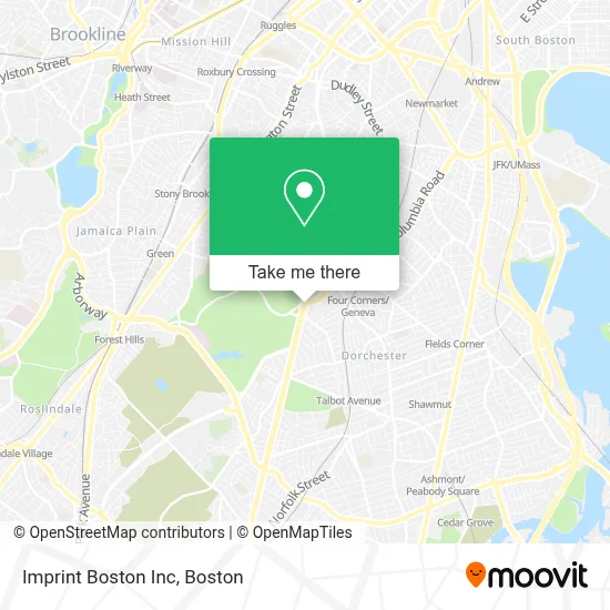
See Imprint Boston Inc on the map
Public Transportation to Imprint Boston Inc
Wondering how to get to Imprint Boston Inc? Moovit helps you find the best way to get to Imprint Boston Inc with step-by-step directions from the nearest public transit station.
Moovit provides free maps and live directions to help you navigate through your city. View schedules, routes, timetables, and find out how long does it take to get to Imprint Boston Inc in real time.
Looking for the nearest stop or station to Imprint Boston Inc? Check out this list of stops closest to your destination: Blue Hill Ave @ Pasadena Rd; Blue Hill Ave @ Franklin Park Rd; Franklin Park Zoo @ Entrance; Blue Hill Ave @ Wayne St; Fields Corner; Four Corners/Geneva; Talbot Avenue.
Bus: 14, 16, 22, 28, 29, 45, 32, 34, 36, 38.Train: FAIRMOUNT, FRANKLIN/FOXBORO, PROVIDENCE/STOUGHTON, FAIRMOUNT LINE SHUTTLE.Subway: ORANGE LINE, RED LINE.
Want to see if there’s another route that gets you there at an earlier time? Moovit helps you find alternative routes or times. Get directions from and directions to Imprint Boston Inc easily from the Moovit App or Website.
We make riding to Imprint Boston Inc easy, which is why over 1.7 million users, including users in Boston, trust Moovit as the best app for public transit. You don’t need to download an individual bus app or train app, Moovit is your all-in-one transit app that helps you find the best bus time or train time available.
For information on prices of bus, subway and train, costs and ride fares to Imprint Boston Inc, please check the Moovit app.
Use the app to navigate to popular places including to the airport, hospital, stadium, grocery store, mall, coffee shop, school, college, and university.
Imprint Boston Inc Address: 620 Blue Hill Ave street in Boston
- Law Office of Susan T Aguiar (Law Offices of Susan T. Aguiar),
- Boston Lights: A Lantern Experience,
- Franklin Park Zoo,
- Lilyp African Hair Braiding,
- William J Devine Franklin Park Golf Course,
- Bulldog Towing Service,
- MBTA Four Corners / Geneva Commuter Rail Station,
- Franklin Park Zoo XD Theatre,
- St Katharine Drexel,
- Blue Hill Locks & Locksmith,
- Brothers Supermarket (Brother's Supermarket),
- Century Convenience,
- 54 Egmont,
- Deeper Life Revival,
- Mass Auto Repair,
- D & L Auto Body & Repair,
- Bradshaw Childrens Center at Abcd,
- Fernandez Imported Domestic Liquors,
- Jeremiah E Burke High School,
- United House Of Prayer
Places Near Imprint Boston Inc
- Boston Children's Hospital, Boston,
- Wang Theater, Boston,
- Prudential Center, Boston,
- Quincy Market, Boston,
- Faneuil Hall, Boston,
- Td Garden, Boston,
- House Of Blues, Boston,
- Museum Of Science, Boston,
- North End, Boston,
- Boston Convention & Exhibition Center, Boston,
- Isabella Stewart Gardner Museum, Boston,
- Mgm Music Hall, Boston,
- Seaport District, Boston,
- Massachusetts General Hospital, Boston,
- Leader Bank Pavilion (Leader Bank Pavillion), Boston,
- Boston Medical Center, Boston,
- Boston Common, Boston,
- Castle Island, Boston,
- Wilbur Theatre, Boston,
- Cheers, Boston
How to get to popular places in Boston with public transit
Get around Boston by public transit!
Traveling around Boston has never been so easy. See step by step directions as you travel to any attraction, street or major public transit station. View bus and train schedules, arrival times, service alerts and detailed routes on a map, so you know exactly how to get to anywhere in Boston.
When traveling to any destination around Boston use Moovit's Live Directions with Get Off Notifications to know exactly where and how far to walk, how long to wait for your line, and how many stops are left. Moovit will alert you when it's time to get off — no need to constantly re-check whether yours is the next stop.
Wondering how to use public transit in Boston or how to pay for public transit in Boston? Moovit public transit app can help you navigate your way with public transit easily, and at minimum cost. It includes public transit fees, ticket prices, and costs. Looking for a map of Boston public transit lines? Moovit public transit app shows all public transit maps in Boston with all Bus, Train, Subway and Ferry routes and stops on an interactive map.
Boston has 4 transit type(s), including: Bus, Train, Subway and Ferry, operated by several transit agencies, including MBTA, Southeastern Regional Transit Authority, MetroWest Regional Transit Authority, Rhode Island Public Transit Authority, WRTA, Lowell Regional Transit Authority, Merrimack Valley Transit, Montachusett Regional Transit Authority, Cape Cod Regional Transit Authority, Brockton Area Transit Authority, Martha's Vineyard Transit Authority, the WAVE - Nantucket Regional Transit Authority, GATRA, Cape Ann Transportation Authority and Massport