Directions to India International Centre station (Delhi) with public transit
The following transit lines have routes that pass near India International Centre
How to get to India International Centre station by bus?
Click on the bus route to see step by step directions with maps, line arrival times and updated time schedules.
How to get to India International Centre station by train?
Click on the train route to see step by step directions with maps, line arrival times and updated time schedules.
How to get to India International Centre station by metro?
Click on the metro route to see step by step directions with maps, line arrival times and updated time schedules.
Bus stops near India International Centre in Delhi
- Max Mueller Marg, 4 min walk,
- Lodhi Estate / Air Force School, 7 min walk,
- Lodhi Colony Corner, 7 min walk,
- Lodhi Garden / Mousam Bhawan, 10 min walk,
- Lodhi Garden, 10 min walk,
Metro stations near India International Centre in Delhi
- Khan Market, 16 min walk,
- LOK Kalyan Marg, 24 min walk,
Train station near India International Centre in Delhi
- Lodhi Colony, 29 min walk,
Bus lines to India International Centre station in Delhi
- 47A, Tehkhand Depot DTC,
- 522CL, Lado Sarai Firni Road,
- 522B2, Lodhi Road Crossing,
- 19, Jahangirpuri E Block (T) - Nizamuddin Railway Station,
- 400, Okhla Extension (Abul Fazal Enclave) - Minto Road (T),
- 440, Lado Sarai Firni Road (T) - New Delhi Railway Station Gate No.2,
- 521, Ambedkar Nagar Sector 5 (T) - Karampura (T),
- 522, Lado Sarai Firni Road (T) - Krishi Kunj (Inderpuri),
- 522, Lado Sarai Firni Road (T) - Shivaji Stadium (T),
- 522A, Hamdard Nagar / Sangam Vihar - Shivaji Stadium (T),
- 522A, Rajinder Nagar R Block - Hamdard Nagar / Sangam Vihar,
- 522L, Lado Sarai Firni Road (T) - Rajendra Place Ladies Special,
- 580, Ambedkar Nagar Sector 5 (T) - Kendriya (T) Church Road,
- 522B, Inderpuri (Krishi Kunj),
- 433LSTL, New Delhi Railway Station Gate 2,
- 794STL2, Kushak Nallah Depot,
- 344, Hauz Khas (T),
- 336A, New Seema Puri Depot Cluster,
- 522A, R-Block Rajendra Nagar,
- 588, Sunehari Pulla Depot / Jawahar Lal Nehru Stadium Terminal,
What are the closest stations to India International Centre?
The closest stations to India International Centre are:
- Max Mueller Marg is 192 meters away, 4 min walk.
- Lodhi Estate / Air Force School is 492 meters away, 7 min walk.
- Lodhi Colony Corner is 502 meters away, 7 min walk.
- Lodhi Garden / Mousam Bhawan is 689 meters away, 10 min walk.
- Lodhi Garden is 694 meters away, 10 min walk.
- Khan Market is 1161 meters away, 16 min walk.
- LOK Kalyan Marg is 1768 meters away, 24 min walk.
- Lodhi Colony is 2222 meters away, 29 min walk.
Which bus lines stop near India International Centre?
These bus lines stop near India International Centre: 440, 522, 522CL, 588, 605.
Which train lines stop near India International Centre?
These train lines stop near India International Centre: EMU 64093, EMU 64094.
Which metro lines stop near India International Centre?
These metro lines stop near India International Centre: 2, 6.
What’s the nearest metro station to India International Centre in Delhi?
The nearest metro station to India International Centre in Delhi is Khan Market. It’s a 16 min walk away.
What’s the nearest train station to India International Centre in Delhi?
The nearest train station to India International Centre in Delhi is Lodhi Colony. It’s a 29 min walk away.
What’s the nearest bus station to India International Centre in Delhi?
The nearest bus station to India International Centre in Delhi is Max Mueller Marg. It’s a 4 min walk away.
What time is the first metro to India International Centre in Delhi?
The 2 is the first metro that goes to India International Centre in Delhi. It stops nearby at 5:37 AM.
What time is the last metro to India International Centre in Delhi?
The 2 is the last metro that goes to India International Centre in Delhi. It stops nearby at 12:24 AM.
What time is the first train to India International Centre in Delhi?
The EMU 64091 is the first train that goes to India International Centre in Delhi. It stops nearby at 8:08 AM.
What time is the last train to India International Centre in Delhi?
The EMU 64087 is the last train that goes to India International Centre in Delhi. It stops nearby at 6:35 PM.
What time is the first bus to India International Centre in Delhi?
The 433LSTL is the first bus that goes to India International Centre in Delhi. It stops nearby at 4:32 AM.
What time is the last bus to India International Centre in Delhi?
The 794STL2 is the last bus that goes to India International Centre in Delhi. It stops nearby at 12:07 AM.
See India International Centre, Delhi, on the map
Public Transit to India International Centre in Delhi
Wondering how to get to India International Centre in Delhi, India? Moovit helps you find the best way to get to India International Centre with step-by-step directions from the nearest public transit station.
Moovit provides free maps and live directions to help you navigate through your city. View schedules, routes, timetables, and find out how long does it take to get to India International Centre in real time.
Looking for the nearest stop or station to India International Centre? Check out this list of stops closest to your destination: Max Mueller Marg; Lodhi Estate / Air Force School; Lodhi Colony Corner; Lodhi Garden / Mousam Bhawan; Lodhi Garden; Khan Market; LOK Kalyan Marg; Lodhi Colony.
Bus: 440, 522, 522CL, 588, 605, 47A, 522B2, 19, 400, 521, 522B.Train: EMU 64093, EMU 64094, EMU 64087, EMU 64089, EMU 64090, EMU 64091, EMU 64092.Metro: 2, 6.
Want to see if there’s another route that gets you there at an earlier time? Moovit helps you find alternative routes or times. Get directions from and directions to India International Centre easily from the Moovit App or Website.
We make riding to India International Centre easy, which is why over 1.5 million users, including users in Delhi, trust Moovit as the best app for public transit. You don’t need to download an individual bus app or train app, Moovit is your all-in-one transit app that helps you find the best bus time or train time available.
For information on prices of bus, metro and train, costs and ride fares to India International Centre, please check the Moovit app.
Use the app to navigate to popular places including to the airport, hospital, stadium, grocery store, mall, coffee shop, school, college, and university.
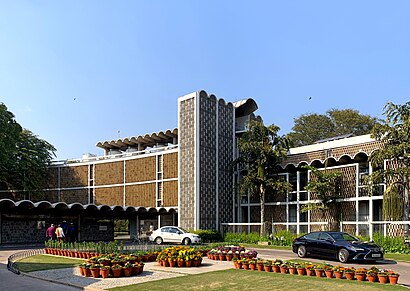
India International Centre Address: Max Mueller Marg street in Delhi
Places Near India International Centre (Delhi)
Get around Delhi by public transit!
Traveling around Delhi has never been so easy. See step by step directions as you travel to any attraction, street or major public transit station. View bus and train schedules, arrival times, service alerts and detailed routes on a map, so you know exactly how to get to anywhere in Delhi.
When traveling to any destination around Delhi use Moovit's Live Directions with Get Off Notifications to know exactly where and how far to walk, how long to wait for your line, and how many stops are left. Moovit will alert you when it's time to get off — no need to constantly re-check whether yours is the next stop.
Wondering how to use public transit in Delhi or how to pay for public transit in Delhi? Moovit public transit app can help you navigate your way with public transit easily, and at minimum cost. It includes public transit fees, ticket prices, and costs. Looking for a map of Delhi public transit lines? Moovit public transit app shows all public transit maps in Delhi with all Bus, Train and Metro routes and stops on an interactive map.
New Delhi has 3 transit type(s), including: Bus, Train and Metro, operated by several transit agencies, including Delhi Metro Rail Corporation (DMRC), Delhi Transport Corporation (DTC), Northern Railways, Noida Metro Rail corporation, DTC Night Bus, GMCBL (Gurugram Metropolitan City Bus Limited), Delhi Integrated Multi-Modal Transit System Ltd., Delhi Metro Rail Corporation, DTC AC Services, DTC Express Buses, DIMTS (Delhi Integrated Multi-Modal Transit System Ltd.), DMRC Feeder AC E-Buses, AC bus lines, Airport AC bus lines and DTC Electric AC Buses