How to get to Inmopolita by bus?
Click on the bus route to see step by step directions with maps, line arrival times and updated time schedules.
From Tanatorio de Leganés, Leganés
71 minFrom Mad Cool Festival, Madrid
95 minFrom Calle de Alcalá 540, Madrid
56 minFrom El Pardo, Madrid
41 minFrom Telecinco, Área Metropolitana De Madrid Y Corredor Del Henares
84 minFrom Estadio Wanda Metropolitano, Área Metropolitana De Madrid Y Corredor Del Henares
82 minFrom Calle de Julian Camarillo, Madrid
52 minFrom Calle de López de Hoyos 169, Madrid
50 minFrom Carabanchel, Área Metropolitana De Madrid Y Corredor Del Henares
53 minFrom Mediaset España, Área Metropolitana De Madrid Y Corredor Del Henares
85 min
How to get to Inmopolita by train?
Click on the train route to see step by step directions with maps, line arrival times and updated time schedules.
How to get to Inmopolita by metro?
Click on the metro route to see step by step directions with maps, line arrival times and updated time schedules.
From Tanatorio de Leganés, Leganés
66 minFrom Calle de Alcalá 540, Madrid
41 minFrom Telecinco, Área Metropolitana De Madrid Y Corredor Del Henares
75 minFrom Estadio Wanda Metropolitano, Área Metropolitana De Madrid Y Corredor Del Henares
58 minFrom Calle de Julian Camarillo, Madrid
46 minFrom Calle de López de Hoyos 169, Madrid
33 minFrom Carabanchel, Área Metropolitana De Madrid Y Corredor Del Henares
40 minFrom Mediaset España, Área Metropolitana De Madrid Y Corredor Del Henares
76 min
Bus stops near Inmopolita in Madrid
Train station near Inmopolita in Madrid
- Príncipe Pío, 6 min walk,VIEW
Metro stations near Inmopolita in Madrid
Bus lines to Inmopolita in Madrid
- 62, Los Puertos,VIEW
- 74, Parque Avenidas,VIEW
- 21, El Salvador,VIEW
- 002, Puerta Toledo - Argüelles,VIEW
- C03, Puerta de Toledo - Argüelles,VIEW
- 1, Prosperidad,VIEW
- 001, Estacion Atocha,VIEW
- 2, Reina Victoria,VIEW
- 44, Marques De Viana,VIEW
- 133, Mirasierra,VIEW
- 138, Cristo Rey,VIEW
- C2, Circular 2,VIEW
- C1, Circular 1,VIEW
- N21, Arroyo Fresno,VIEW
- NC2, Estacion Atocha,VIEW
- SC1, Legazpi,VIEW
- NC1, Cuatro Caminos - Estacion de Atocha,VIEW
- SC2, Cuatro Caminos - Legazpi,VIEW
What are the closest stations to Inmopolita?
The closest stations to Inmopolita are:
- Ferraz - Quintana is 70 meters away, 2 min walk.
- Marqués De Urquijo - Teleférico is 382 meters away, 6 min walk.
- Príncipe Pío is 419 meters away, 6 min walk.
- Princesa - Centro Comercial is 440 meters away, 6 min walk.
- Princesa - Rey Francisco is 446 meters away, 6 min walk.
- Argüelles is 540 meters away, 8 min walk.
- Plaza De España is 1340 meters away, 18 min walk.
Which bus lines stop near Inmopolita?
These bus lines stop near Inmopolita: 164, 21, 62, 74, C03.
Which train line stops near Inmopolita?
C10 (Villalba De Guadarrama)
Which metro lines stop near Inmopolita?
These metro lines stop near Inmopolita: M-1, M-3, M-4, M-6.
What’s the nearest metro station to Inmopolita in Madrid?
The nearest metro station to Inmopolita in Madrid is Príncipe Pío. It’s a 6 min walk away.
What’s the nearest train station to Inmopolita in Madrid?
The nearest train station to Inmopolita in Madrid is Príncipe Pío. It’s a 6 min walk away.
What’s the nearest bus station to Inmopolita in Madrid?
The nearest bus station to Inmopolita in Madrid is Ferraz - Quintana. It’s a 2 min walk away.
What time is the first metro to Inmopolita in Madrid?
The M-4 is the first metro that goes to Inmopolita in Madrid. It stops nearby at 6:05 AM.
What time is the last metro to Inmopolita in Madrid?
The M-4 is the last metro that goes to Inmopolita in Madrid. It stops nearby at 2:06 AM.
What time is the first train to Inmopolita in Madrid?
The C7 is the first train that goes to Inmopolita in Madrid. It stops nearby at 6:09 AM.
What time is the last train to Inmopolita in Madrid?
The C7 is the last train that goes to Inmopolita in Madrid. It stops nearby at 12:12 AM.
What time is the first bus to Inmopolita in Madrid?
The 74 is the first bus that goes to Inmopolita in Madrid. It stops nearby at 7:02 AM.
What time is the last bus to Inmopolita in Madrid?
The NC1 is the last bus that goes to Inmopolita in Madrid. It stops nearby at 3:17 AM.
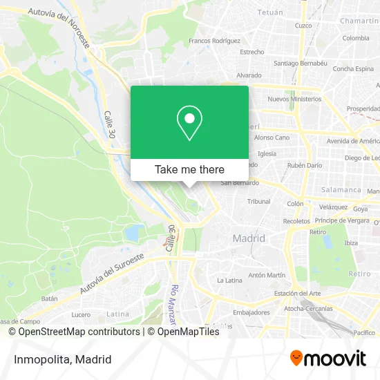
See Inmopolita, Madrid, on the map
Public Transit to Inmopolita in Madrid
Wondering how to get to Inmopolita in Madrid? Moovit helps you find the best way to get to Inmopolita with step-by-step directions from the nearest public transit station.
Moovit provides free maps and live directions to help you navigate through your city. View schedules, routes, timetables, and find out how long does it take to get to Inmopolita in real time.
Looking for the nearest stop or station to Inmopolita? Check out this list of stops closest to your destination: Ferraz - Quintana; Marqués De Urquijo - Teleférico; Príncipe Pío; Princesa - Centro Comercial; Princesa - Rey Francisco; Argüelles; Plaza De España.
Bus: 164, 21, 62, 74, C03.Train: C10, C7, MD, REG.Metro: M-1, M-3, M-4, M-6, M-R, M-10.
Want to see if there’s another route that gets you there at an earlier time? Moovit helps you find alternative routes or times. Get directions from and directions to Inmopolita easily from the Moovit App or Website.
We make riding to Inmopolita easy, which is why over 1.5 million users, including users in Madrid, trust Moovit as the best app for public transit. You don’t need to download an individual bus app or train app, Moovit is your all-in-one transit app that helps you find the best bus time or train time available.
For information on prices of bus, metro and train, costs and ride fares to Inmopolita, please check the Moovit app.
Use the app to navigate to popular places including to the airport, hospital, stadium, grocery store, mall, coffee shop, school, college, and university.
Inmopolita Address: Calle de Ferraz, 19 28008 Argüelles Madrid street in Madrid
- Jose Luis Lara Fotografo,
- Valeriano de Hernando Cogollar,
- Lulo Vázquez,
- Medlock Communications,
- Ardia Consultores,
- Javier Giraldez Ceballos-Escalera,
- Ventask - Force,
- Distrito Tecnológico,
- Leader Public,
- Universidad Camilo Jose Cela,
- Calle Ferraz 15,
- La Hermosita,
- Juliettas Ferraz,
- La Hermosita Ferraz,
- Universidad Rey Juan Carlos - Ferraz,
- Casa Rural Las Trojes,
- Felipe Ayuso Quevedo,
- Doorlock-Instalación de Cerrojos de Seguridad,
- Calle Ferraz & Calle Quintana,
- Pomeda Frechilla Pedro Angel
Places Near Inmopolita (Madrid)
- Centro Comercial Oasiz Madrid, Área Metropolitana De Madrid Y Corredor Del Henares,
- Hospital Universitario La Paz, Madrid,
- Palacio De Vistalegre, Área Metropolitana De Madrid Y Corredor Del Henares,
- Rastro De Madrid, Área Metropolitana De Madrid Y Corredor Del Henares,
- Mendez Alvaro, Madrid,
- Estacion de Chamartin, Madrid,
- Plaza Mayor, Madrid,
- Calle de López de Hoyos 169, Madrid,
- Nassica, Área Metropolitana De Madrid Y Corredor Del Henares,
- Hospital Clínico Universitario San Carlos, Madrid,
- Plenilunio, Área Metropolitana De Madrid Y Corredor Del Henares,
- Centro Comercial Islazul, Área Metropolitana De Madrid Y Corredor Del Henares,
- Mercadillo de Majadahonda, Majadahonda,
- Hospital Universitario Ramón y Cajal, Madrid,
- Estadio Wanda Metropolitano, Área Metropolitana De Madrid Y Corredor Del Henares,
- Centro Comercial La Vaguada, Área Metropolitana De Madrid Y Corredor Del Henares,
- Wizink Center, Madrid,
- Tres Aguas, Alcorcón,
- Centro Comercial La Gavia, Área Metropolitana De Madrid Y Corredor Del Henares,
- Sala La Riviera, Madrid
How to get to popular places in Madrid with public transit
Get around Madrid by public transit!
Traveling around Madrid has never been so easy. See step by step directions as you travel to any attraction, street or major public transit station. View bus and train schedules, arrival times, service alerts and detailed routes on a map, so you know exactly how to get to anywhere in Madrid.
When traveling to any destination around Madrid use Moovit's Live Directions with Get Off Notifications to know exactly where and how far to walk, how long to wait for your line, and how many stops are left. Moovit will alert you when it's time to get off — no need to constantly re-check whether yours is the next stop.
Wondering how to use public transit in Madrid or how to pay for public transit in Madrid? Moovit public transit app can help you navigate your way with public transit easily, and at minimum cost. It includes public transit fees, ticket prices, and costs. Looking for a map of Madrid public transit lines? Moovit public transit app shows all public transit maps in Madrid with all Bus, Train, Metro and Light Rail routes and stops on an interactive map.
Madrid has 4 transit type(s), including: Bus, Train, Metro and Light Rail, operated by several transit agencies, including Metro de Madrid, Metro Ligero, Tranvía de Parla, Renfe Cercanías - Servicios de Autobús especiales, Renfe Cercanias, Renfe Cercanías, EMT, Interurbanos, Urbanos de Alcalá de Henares, Urbanos de Alcobendas, Urbanos de Alcorcón, Urbanos de Algete, Urbanos de Aranjuez, Urbanos de Arganda del Rey and Urbanos de Arroyomolinos