Directions to Inner City Capital Connections (Boston) with public transportation
The following transit lines have routes that pass near Inner City Capital Connections
 Bus: 1, 15, 28, 42, 45.
- Train: NEEDHAM, PROVIDENCE/STOUGHTON, FRANKLIN/FOXBORO.
- Subway: ORANGE LINE, GREEN LINE E.
How to get to Inner City Capital Connections by bus?
Click on the bus route to see step by step directions with maps, line arrival times and updated time schedules.
From Wollaston Beach, Quincy
90 minFrom Georgetown, Massachusetts, Boston
63 minFrom Bow Market, Somerville
52 minFrom Academy Of the Pacific Rim Charter Public School, Boston
63 minFrom Medford Square, Medford
55 minFrom Chevalier Theatre (Chevalier Theater Show Line), Medford
56 minFrom West Roxbury, Boston
38 minFrom Hampton Inn Boston Logan Airport, Revere
64 minFrom Heartbreak Hill, Newton
63 minFrom Qea, Quincy
77 min
How to get to Inner City Capital Connections by train?
Click on the train route to see step by step directions with maps, line arrival times and updated time schedules.
How to get to Inner City Capital Connections by subway?
Click on the subway route to see step by step directions with maps, line arrival times and updated time schedules.
Bus stops near Inner City Capital Connections in Boston
Subway stations near Inner City Capital Connections in Boston
Train station near Inner City Capital Connections in Boston
- Ruggles, 17 min walk,VIEW
Bus lines to Inner City Capital Connections in Boston
- 19, Gallivan Blvd,VIEW
- 15, Ruggles - Fields Corner,VIEW
- 23, Ruggles - Ashmont,VIEW
- 28, Ruggles - Mattapan,VIEW
- 44, Ruggles - Jackson Square,VIEW
- 45, Ruggles - Franklin Park,VIEW
- 66, Nubian via Allston - Harvard via Allston,VIEW
- 14, Heath St,VIEW
- 41, Jfk/Umass,VIEW
- 1, Nubian - Harvard,VIEW
- 8, Kenmore via South Bay Center - Harbor Point via South Bay Center,VIEW
- 42, Nubian - Forest Hills,VIEW
- 47, Broadway - Central Square,VIEW
- 171, - Logan Airport via Andrew,VIEW
- SL4, South Station - Nubian,VIEW
- SL5, Downtown - Nubian,VIEW
- 10, Townsend & Humboldt,VIEW
What are the closest stations to Inner City Capital Connections?
The closest stations to Inner City Capital Connections are:
- Dudley St @ Nubian Station is 42 yards away, 1 min walk.
- Malcolm X Blvd @ Shawmut Ave is 130 yards away, 2 min walk.
- Nubian is 152 yards away, 2 min walk.
- Warren St @ Dabney Pl is 180 yards away, 3 min walk.
- Northeastern University is 299 yards away, 4 min walk.
- Massachusetts Ave. is 994 yards away, 12 min walk.
- Ruggles is 1426 yards away, 17 min walk.
Which bus lines stop near Inner City Capital Connections?
These bus lines stop near Inner City Capital Connections: 1, 15, 28, 42, 45, 47, 8, SL5.
Which train lines stop near Inner City Capital Connections?
These train lines stop near Inner City Capital Connections: NEEDHAM, PROVIDENCE/STOUGHTON.
Which subway line stops near Inner City Capital Connections?
ORANGE LINE (Forest Hills)
What’s the nearest subway station to Inner City Capital Connections in Boston?
The nearest subway station to Inner City Capital Connections in Boston is Northeastern University. It’s a 4 min walk away.
What’s the nearest train station to Inner City Capital Connections in Boston?
The nearest train station to Inner City Capital Connections in Boston is Ruggles. It’s a 17 min walk away.
What’s the nearest bus station to Inner City Capital Connections in Boston?
The nearest bus station to Inner City Capital Connections in Boston is Dudley St @ Nubian Station. It’s a 1 min walk away.
What time is the first subway to Inner City Capital Connections in Boston?
The GREEN LINE E is the first subway that goes to Inner City Capital Connections in Boston. It stops nearby at 5:20 AM.
What time is the last subway to Inner City Capital Connections in Boston?
The GREEN LINE E is the last subway that goes to Inner City Capital Connections in Boston. It stops nearby at 2:07 AM.
What time is the first train to Inner City Capital Connections in Boston?
The PROVIDENCE/STOUGHTON is the first train that goes to Inner City Capital Connections in Boston. It stops nearby at 4:28 AM.
What time is the last train to Inner City Capital Connections in Boston?
The PROVIDENCE/STOUGHTON is the last train that goes to Inner City Capital Connections in Boston. It stops nearby at 12:34 AM.
What time is the first bus to Inner City Capital Connections in Boston?
The 28 is the first bus that goes to Inner City Capital Connections in Boston. It stops nearby at 3:19 AM.
What time is the last bus to Inner City Capital Connections in Boston?
The 1 is the last bus that goes to Inner City Capital Connections in Boston. It stops nearby at 2:44 AM.
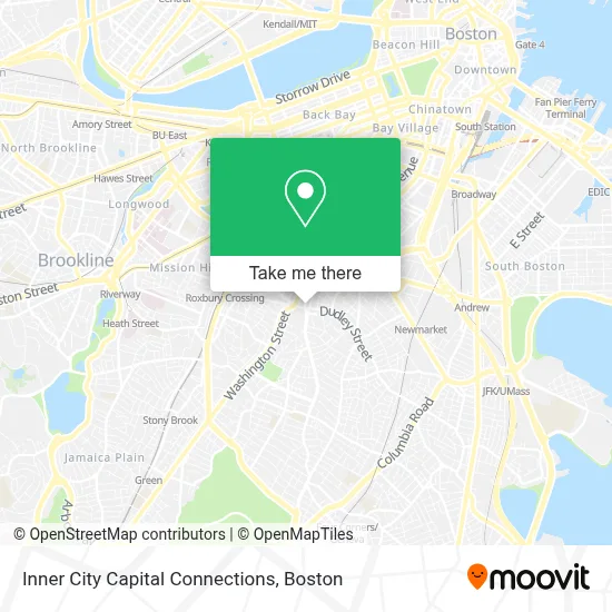
See Inner City Capital Connections, Boston, on the map
Public Transit to Inner City Capital Connections in Boston
Wondering how to get to Inner City Capital Connections in Boston? Moovit helps you find the best way to get to Inner City Capital Connections with step-by-step directions from the nearest public transit station.
Moovit provides free maps and live directions to help you navigate through your city. View schedules, routes, timetables, and find out how long does it take to get to Inner City Capital Connections in real time.
Looking for the nearest stop or station to Inner City Capital Connections? Check out this list of stops closest to your destination: Dudley St @ Nubian Station; Malcolm X Blvd @ Shawmut Ave; Nubian; Warren St @ Dabney Pl; Northeastern University; Massachusetts Ave.; Ruggles.
Bus: 1, 15, 28, 42, 45, 47, 8, SL5, 19, 23, 44, 14, 41.Train: NEEDHAM, PROVIDENCE/STOUGHTON, FRANKLIN/FOXBORO.Subway: ORANGE LINE, GREEN LINE E.
Want to see if there’s another route that gets you there at an earlier time? Moovit helps you find alternative routes or times. Get directions from and directions to Inner City Capital Connections easily from the Moovit App or Website.
We make riding to Inner City Capital Connections easy, which is why over 1.7 million users, including users in Boston, trust Moovit as the best app for public transit. You don’t need to download an individual bus app or train app, Moovit is your all-in-one transit app that helps you find the best bus time or train time available.
For information on prices of bus, subway and train, costs and ride fares to Inner City Capital Connections, please check the Moovit app.
Use the app to navigate to popular places including to the airport, hospital, stadium, grocery store, mall, coffee shop, school, college, and university.
Inner City Capital Connections Address: 56 Warren St street in Boston
- NSP Residential,
- Alima's African Hair Braiding,
- Ethiopian Cafe and Pizza,
- Miami Pizza,
- Aura Mortgage Advisors,
- Community Caring Clinic,
- PLS,
- Always Affective Available Emergency Locks,
- Global Peace Aid,
- Nubian Square Station,
- Dudley Station,
- Brand Nubian,
- Coinstar,
- MBTA Dudley Square Station,
- Hibernian Hall,
- Next Street Finance,
- Friends of the Children-Boston,
- City Pizza and Wings,
- First National Bank of Boston,
- Performers the Act 1
Places Near Inner City Capital Connections (Boston)
- Wang Theater, Boston,
- Td Garden, Boston,
- Castle Island, Boston,
- Cheers, Boston,
- Boston Medical Center, Boston,
- Massachusetts General Hospital, Boston,
- Boston Children's Hospital, Boston,
- Seaport District, Boston,
- Leader Bank Pavilion (Leader Bank Pavillion), Boston,
- Museum Of Science, Boston,
- House Of Blues, Boston,
- Faneuil Hall, Boston,
- Boston Common, Boston,
- Mgm Music Hall, Boston,
- Boston Convention & Exhibition Center, Boston,
- Quincy Market, Boston,
- North End, Boston,
- Wilbur Theatre, Boston,
- Isabella Stewart Gardner Museum, Boston,
- Prudential Center, Boston
How to get to popular places in Boston with public transit
Get around Boston by public transit!
Traveling around Boston has never been so easy. See step by step directions as you travel to any attraction, street or major public transit station. View bus and train schedules, arrival times, service alerts and detailed routes on a map, so you know exactly how to get to anywhere in Boston.
When traveling to any destination around Boston use Moovit's Live Directions with Get Off Notifications to know exactly where and how far to walk, how long to wait for your line, and how many stops are left. Moovit will alert you when it's time to get off — no need to constantly re-check whether yours is the next stop.
Wondering how to use public transit in Boston or how to pay for public transit in Boston? Moovit public transit app can help you navigate your way with public transit easily, and at minimum cost. It includes public transit fees, ticket prices, and costs. Looking for a map of Boston public transit lines? Moovit public transit app shows all public transit maps in Boston with all Bus, Train, Subway and Ferry routes and stops on an interactive map.
Boston has 4 transit type(s), including: Bus, Train, Subway and Ferry, operated by several transit agencies, including MBTA, Southeastern Regional Transit Authority, MetroWest Regional Transit Authority, Rhode Island Public Transit Authority, WRTA, Lowell Regional Transit Authority, Merrimack Valley Transit, Montachusett Regional Transit Authority, Cape Cod Regional Transit Authority, Brockton Area Transit Authority, Martha's Vineyard Transit Authority, the WAVE - Nantucket Regional Transit Authority, GATRA, Cape Ann Transportation Authority and Massport