Directions to Inthlongrun (Minneapolis) with public transportation
The following transit lines have routes that pass near Inthlongrun
 Bus: 10, 17, 22, 94, METRO E LINE.
- Light Rail: METRO BLUE LINE, METRO GREEN LINE.
How to get to Inthlongrun by bus?
Click on the bus route to see step by step directions with maps, line arrival times and updated time schedules.
From Totino Fine Arts Center, Roseville
82 minFrom Mabs Recovery Center, Minneapolis
53 minFrom Cedar Avenue South, Minneapolis
30 minFrom Knollwood Mall, St. Louis Park
48 minFrom Walmart, St. Paul
30 minFrom Linden Hills, Minneapolis
39 minFrom Ries Tower, St. Paul
38 minFrom Fort Snelling Base Exchange, Minneapolis
57 min
Bus stops near Inthlongrun in Minneapolis
- Marquette Ave & 5th St - Stop Group B, 2 min walk,VIEW
- Marquette Ave & 6th St - Stop Group A, 2 min walk,VIEW
- 6th St S & Marquette Ave, 2 min walk,VIEW
- Marquette Ave & 6th St - Stop Group D, 2 min walk,VIEW
- 7th St S & Nicollet Mall, 3 min walk,VIEW
- Nicollet Mall & 7th St S, 3 min walk,VIEW
- Marquette Av S At 5 St S Sw Corner, 3 min walk,VIEW
- Marquette Av S at 5 St S SW Corner, 3 min walk,VIEW
- Hennepin & 5th St Station, 10 min walk,VIEW
Light Rail stations near Inthlongrun in Minneapolis
- Target Field Station Platform 1, 28 min walk,VIEW
Bus lines to Inthlongrun in Minneapolis
- 7, Plymouth / Theo Wirth,VIEW
- 467, Express / Lakeville,VIEW
- 645, Ltd Stop / Wayzata,VIEW
- 667, Express / Amhurst / Via Texas,VIEW
- 673, Express / Cr 73 P&R / Cedar Lk Rd,VIEW
- 763, Express / Downtown,VIEW
- 765, Express / Downtown,VIEW
- 824, Ltd Stop / University / Dtwn Mpls,VIEW
- 827, E River Rd / Dtwn Mpls,VIEW
- 850, Express / Downtown Minneapolis,VIEW
- 882, Express / Elk River / Dtwn Mpls,VIEW
- 888, Express / Anoka-Coon Rapids / Dtwn Mpls,VIEW
- 156, Express / 56st-Xerxes,VIEW
- 747, Station 73 / Xenium Ln,VIEW
- 774, Plymouth / Sta73 / Greenway,VIEW
- 776, Plymouth / St Phillp / Greenway,VIEW
- 777, Plymouth / Sta73 / Reserve,VIEW
- 790, Plymouth / Nathan Ln,VIEW
- 795, East Town / Mpls / Sta73 / Plymouth,VIEW
- 134, Ltd Stop / Cleveland / Minneapolis,VIEW
What are the closest stations to Inthlongrun?
The closest stations to Inthlongrun are:
- Marquette Ave & 5th St - Stop Group B is 115 yards away, 2 min walk.
- Marquette Ave & 6th St - Stop Group A is 121 yards away, 2 min walk.
- 6th St S & Marquette Ave is 126 yards away, 2 min walk.
- Marquette Ave & 6th St - Stop Group D is 147 yards away, 2 min walk.
- 7th St S & Nicollet Mall is 198 yards away, 3 min walk.
- Nicollet Mall & 7th St S is 207 yards away, 3 min walk.
- Marquette Av S At 5 St S Sw Corner is 211 yards away, 3 min walk.
- Marquette Av S at 5 St S SW Corner is 225 yards away, 3 min walk.
- Hennepin & 5th St Station is 775 yards away, 10 min walk.
- Target Field Station Platform 1 is 2306 yards away, 28 min walk.
Which bus lines stop near Inthlongrun?
These bus lines stop near Inthlongrun: 10, 17, 22, 94, METRO E LINE, METRO ORANGE LINE.
Which light rail lines stop near Inthlongrun?
These light rail lines stop near Inthlongrun: METRO BLUE LINE, METRO GREEN LINE.
What’s the nearest light rail station to Inthlongrun in Minneapolis?
The nearest light rail station to Inthlongrun in Minneapolis is Target Field Station Platform 1. It’s a 28 min walk away.
What’s the nearest bus station to Inthlongrun in Minneapolis?
The nearest bus stations to Inthlongrun in Minneapolis are Marquette Ave & 5th St - Stop Group B, Marquette Ave & 6th St - Stop Group A, 6th St S & Marquette Ave and Marquette Ave & 6th St - Stop Group D. The closest one is a 2 min walk away.
What time is the first light rail to Inthlongrun in Minneapolis?
The METRO BLUE LINE is the first light rail that goes to Inthlongrun in Minneapolis. It stops nearby at 4:26 AM.
What time is the last light rail to Inthlongrun in Minneapolis?
The METRO BLUE LINE is the last light rail that goes to Inthlongrun in Minneapolis. It stops nearby at 12:50 AM.
What time is the first bus to Inthlongrun in Minneapolis?
The 18 is the first bus that goes to Inthlongrun in Minneapolis. It stops nearby at 4:11 AM.
What time is the last bus to Inthlongrun in Minneapolis?
The 3 is the last bus that goes to Inthlongrun in Minneapolis. It stops nearby at 2:03 AM.
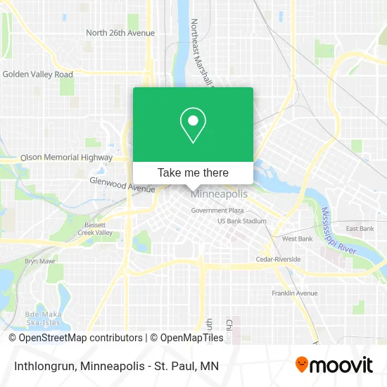
See Inthlongrun, Minneapolis, on the map
Public Transit to Inthlongrun in Minneapolis
Wondering how to get to Inthlongrun in Minneapolis? Moovit helps you find the best way to get to Inthlongrun with step-by-step directions from the nearest public transit station.
Moovit provides free maps and live directions to help you navigate through your city. View schedules, routes, timetables, and find out how long does it take to get to Inthlongrun in real time.
Looking for the nearest stop or station to Inthlongrun? Check out this list of stops closest to your destination: Marquette Ave & 5th St - Stop Group B; Marquette Ave & 6th St - Stop Group A; 6th St S & Marquette Ave; Marquette Ave & 6th St - Stop Group D; 7th St S & Nicollet Mall; Nicollet Mall & 7th St S; Marquette Av S At 5 St S Sw Corner; Marquette Av S at 5 St S SW Corner; Hennepin & 5th St Station; Target Field Station Platform 1.
Bus: 10, 17, 22, 94, METRO E LINE, METRO ORANGE LINE, 7, 467, 645, 667, 673, 156, 747, 774, 776, 777, 134, 355, 363, 764, 578, 600, 698, 760, 766, 9, 14, 755, 11, 18, 25.Light Rail: METRO BLUE LINE, METRO GREEN LINE.
Want to see if there’s another route that gets you there at an earlier time? Moovit helps you find alternative routes or times. Get directions from and directions to Inthlongrun easily from the Moovit App or Website.
We make riding to Inthlongrun easy, which is why over 1.7 million users, including users in Minneapolis, trust Moovit as the best app for public transit. You don’t need to download an individual bus app or train app, Moovit is your all-in-one transit app that helps you find the best bus time or train time available.
For information on prices of bus and light rail, costs and ride fares to Inthlongrun, please check the Moovit app.
Use the app to navigate to popular places including to the airport, hospital, stadium, grocery store, mall, coffee shop, school, college, and university.
Inthlongrun Address: 1894 Sardis Station street in Minneapolis
- The Oceanaire Seafood Room,
- Kqql Kool 108 Radio,
- Forbes Jennifer A,
- Leonard Street & Deinard Pa,
- Target Corporate HQ,
- Rbc Plaza,
- David Brown Diamond Setter,
- Sanders Locksmiths Key,
- Embassy Suites by Hilton Minneapolis Downtown,
- Synergy Architecture Studio,
- Madigan Michael D,
- Credit Union 1,
- Bon Appetit Cafe,
- Healtheast Clinic & Specialty Center,
- Meagher + Geer's Catloss Practice Group,
- McBride Katherine A Aty - McBride, Katherine A Aty,
- Target Headquarters,
- Mark R Bradford,
- Midwest Peregrine Society,
- Minnesota CLE
Places Near Inthlongrun (Minneapolis)
- Bishop Henry Whipple Federal Building,
- Grand Casino Hinckley,MN, Minneapolis,
- Orpheum Theatre (Minneapolis, Minnesota), Minneapolis,
- Minnesota State Capitol, St. Paul,
- Treasure Island Resort & Casino, St. Paul,
- Minneapolis Institute of Art, Minneapolis,
- Minneapolis Sculpture Garden, Minneapolis,
- Huntington Bank Stadium, Minneapolis,
- Northrop Auditorium, Minneapolis,
- Harriet Island Regional Park, St. Paul,
- Xcel Energy Center, St. Paul,
- Minnehaha Falls, Minneapolis,
- 3m Arena at Mariucci, Minneapolis,
- Mpls. Convention Center, Minneapolis,
- Target Field, Minneapolis,
- Target Center, Minneapolis,
- Mystic lake casino bus, Minneapolis,
- Abbott Northwestern Piper Building, Minneapolis,
- St. Paul College, St. Paul,
- Surly Brewing Co., Minneapolis
How to get to popular places in Minneapolis - St. Paul, MN with public transit
Get around Minneapolis by public transit!
Traveling around Minneapolis has never been so easy. See step by step directions as you travel to any attraction, street or major public transit station. View bus and train schedules, arrival times, service alerts and detailed routes on a map, so you know exactly how to get to anywhere in Minneapolis.
When traveling to any destination around Minneapolis use Moovit's Live Directions with Get Off Notifications to know exactly where and how far to walk, how long to wait for your line, and how many stops are left. Moovit will alert you when it's time to get off — no need to constantly re-check whether yours is the next stop.
Wondering how to use public transit in Minneapolis or how to pay for public transit in Minneapolis? Moovit public transit app can help you navigate your way with public transit easily, and at minimum cost. It includes public transit fees, ticket prices, and costs. Looking for a map of Minneapolis public transit lines? Moovit public transit app shows all public transit maps in Minneapolis with all Bus, Train and Light Rail routes and stops on an interactive map.
Minneapolis - St. Paul, MN has 3 transit type(s), including: Bus, Train and Light Rail, operated by several transit agencies, including Metro Transit , Metro Transit, MVTA, Plymouth Metrolink, SouthWest Transit, Maple Grove, University of Minnesota, Airport (MAC), Amtrak, Mankato Transit System, SMART, FlixBus-us and Greyhound-us