How to get to Inversiones Madriven by bus?
Click on the bus route to see step by step directions with maps, line arrival times and updated time schedules.
From Paseo de Extremadura, Madrid
44 minFrom Instituto de Estudios Fiscales, Madrid
52 minFrom Hospital Montepríncipe, Área Metropolitana De Madrid Y Corredor Del Henares
74 minFrom Hospital De La Zarzuela, Área Metropolitana De Madrid Y Corredor Del Henares
67 minFrom Club de Campo Villa de Madrid, Madrid
71 minFrom Centro Comercial Xanadu - Mostoles, Madrid
48 minFrom Ciudad Financiera Banco Santander, Boadilla Del Monte
80 minFrom Universidad Alfonso X El Sabio (UAX), Villanueva De La Cañada
48 minFrom Kinepolis Madrid Ciudad de la Imagen, Pozuelo De Alarcón
67 minFrom Universidad Europea De Madrid, Área Metropolitana De Madrid Y Corredor Del Henares
50 min
How to get to Inversiones Madriven by train?
Click on the train route to see step by step directions with maps, line arrival times and updated time schedules.
Bus stops near Inversiones Madriven in Majadahonda
Train stations near Inversiones Madriven in Majadahonda
Bus lines to Inversiones Madriven in Majadahonda
- 2, Circular (Hospital - Estación FF.CC.),VIEW
- 561, Madrid (Aluche) - Pozuelo - Majadahonda - Las Rozas,VIEW
- 565, Pozuelo (Est. El Barrial) - Boadilla (Est. Puerta de Boadilla),VIEW
- 653, Madrid (Moncloa) - Majadahonda (Hospital) (por FF.CC.),VIEW
- 654, Madrid (Moncloa) - Majadahonda (Urb. Los Satélites),VIEW
- 561A, Madrid (Aluche) - Pozuelo - Majadahonda - Las Rozas (por Universidad),VIEW
- 561B, Madrid (Aluche) - Pozuelo - Majadahonda - Las Rozas (por Av. Guadarrama),VIEW
- N901, Madrid (Moncloa) - Pozuelo - Majadahonda - Madrid,VIEW
- 567, Av. Villaviciosa - Urb. El Castillo,VIEW
- 626, Acanto - Jacinto,VIEW
- 633, Cañada De Las Merinas - Centro De Salud,VIEW
- 655, Intercambiador De Moncloa (Islas 2 Y 3),VIEW
- 650A, C.º Cerro De Los Gamos - Est. El Barrial,VIEW
- 1, Circular (Hospital - Estación FF.CC.),VIEW
- N906, Princesa - Moncloa,VIEW
- 650B, C.º Cerro De Los Gamos - Est. El Barrial,VIEW
- 685, J. Rodrigo - Hospital Puerta De Hierro,VIEW
- 659, Intercambiador De Moncloa (Islas 2 Y 3),VIEW
What are the closest stations to Inversiones Madriven?
The closest stations to Inversiones Madriven are:
- Ctra. Pozuelo - Ciudad Deportiva is 171 meters away, 3 min walk.
- Ctra. Pozuelo - Ins. Nacional De Sanidad is 183 meters away, 3 min walk.
- Moreras - Escuela De Fútbol is 456 meters away, 7 min walk.
- Ctra. Pozuelo - Urb. Pinar Plantío is 568 meters away, 8 min walk.
- Majadahonda is 2184 meters away, 28 min walk.
- Las Rozas is 2715 meters away, 35 min walk.
Which bus lines stop near Inversiones Madriven?
These bus lines stop near Inversiones Madriven: 561, 561B, 567, 626, 653.
Which train line stops near Inversiones Madriven?
C10 (Villalba De Guadarrama)
What’s the nearest train station to Inversiones Madriven in Majadahonda?
The nearest train station to Inversiones Madriven in Majadahonda is Majadahonda. It’s a 28 min walk away.
What’s the nearest bus station to Inversiones Madriven in Majadahonda?
The nearest bus stations to Inversiones Madriven in Majadahonda are Ctra. Pozuelo - Ciudad Deportiva and Ctra. Pozuelo - Ins. Nacional De Sanidad. The closest one is a 3 min walk away.
What time is the first train to Inversiones Madriven in Majadahonda?
The C7 is the first train that goes to Inversiones Madriven in Majadahonda. It stops nearby at 6:24 AM.
What time is the last train to Inversiones Madriven in Majadahonda?
The C7 is the last train that goes to Inversiones Madriven in Majadahonda. It stops nearby at 11:55 PM.
What time is the first bus to Inversiones Madriven in Majadahonda?
The N901 is the first bus that goes to Inversiones Madriven in Majadahonda. It stops nearby at 3:00 AM.
What time is the last bus to Inversiones Madriven in Majadahonda?
The N901 is the last bus that goes to Inversiones Madriven in Majadahonda. It stops nearby at 2:46 AM.
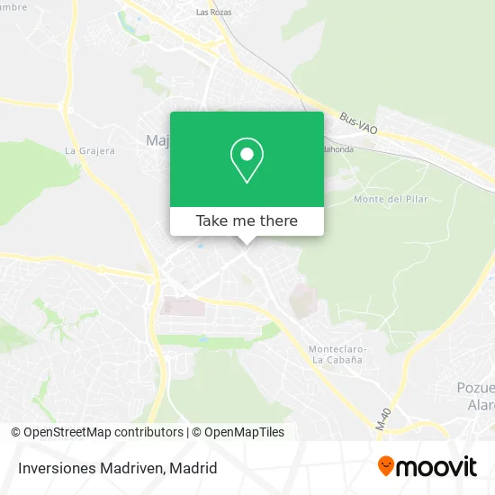
See Inversiones Madriven, Majadahonda, on the map
Public Transit to Inversiones Madriven in Majadahonda
Wondering how to get to Inversiones Madriven in Majadahonda? Moovit helps you find the best way to get to Inversiones Madriven with step-by-step directions from the nearest public transit station.
Moovit provides free maps and live directions to help you navigate through your city. View schedules, routes, timetables, and find out how long does it take to get to Inversiones Madriven in real time.
Looking for the nearest stop or station to Inversiones Madriven? Check out this list of stops closest to your destination: Ctra. Pozuelo - Ciudad Deportiva; Ctra. Pozuelo - Ins. Nacional De Sanidad; Moreras - Escuela De Fútbol; Ctra. Pozuelo - Urb. Pinar Plantío; Majadahonda; Las Rozas.
Bus: 561, 561B, 567, 626, 653, 2, 565, 654, 633, 655, 650A, 1, N906, 650B.Train: C10, C7, REG.
Want to see if there’s another route that gets you there at an earlier time? Moovit helps you find alternative routes or times. Get directions from and directions to Inversiones Madriven easily from the Moovit App or Website.
We make riding to Inversiones Madriven easy, which is why over 1.5 million users, including users in Majadahonda, trust Moovit as the best app for public transit. You don’t need to download an individual bus app or train app, Moovit is your all-in-one transit app that helps you find the best bus time or train time available.
For information on prices of bus, train and light rail, costs and ride fares to Inversiones Madriven, please check the Moovit app.
Use the app to navigate to popular places including to the airport, hospital, stadium, grocery store, mall, coffee shop, school, college, and university.
Inversiones Madriven Address: Calle Moreras, 42 28221 Majadahonda street in Majadahonda
- Vermut Piripi,
- Empanadas Argentinas m,
- El Cañon de Atuel,
- C.C. Cerro del Espino,
- Calle Moreras 42,
- Voy de Gorras,
- Bar de Cejas Benefit Cosmetics Tienda Sephora,
- Academy at Home,
- Imperio Clandestino,
- Centro Relojero,
- Blueberry,
- Botticelli,
- Rodilla,
- The Body Shop,
- Make Your Own Havaianas- Sportown,
- H & m,
- Jose Gómez Begue,
- Intimissimi CC Oeste,
- Feu Vert,
- Etam
Places Near Inversiones Madriven (Majadahonda)
- Mercadillo de Majadahonda, Majadahonda,
- Mendez Alvaro, Madrid,
- Plaza Mayor, Madrid,
- Hospital Clínico Universitario San Carlos, Madrid,
- Hospital Universitario Ramón y Cajal, Madrid,
- Tres Aguas, Alcorcón,
- Centro Comercial Islazul, Área Metropolitana De Madrid Y Corredor Del Henares,
- Sala La Riviera, Madrid,
- Centro Comercial La Gavia, Área Metropolitana De Madrid Y Corredor Del Henares,
- Plenilunio, Área Metropolitana De Madrid Y Corredor Del Henares,
- Palacio De Vistalegre, Área Metropolitana De Madrid Y Corredor Del Henares,
- Calle de López de Hoyos 169, Madrid,
- Nassica, Área Metropolitana De Madrid Y Corredor Del Henares,
- Centro Comercial La Vaguada, Área Metropolitana De Madrid Y Corredor Del Henares,
- Wizink Center, Madrid,
- Estadio Wanda Metropolitano, Área Metropolitana De Madrid Y Corredor Del Henares,
- Hospital Universitario La Paz, Madrid,
- Centro Comercial Oasiz Madrid, Área Metropolitana De Madrid Y Corredor Del Henares,
- Estacion de Chamartin, Madrid,
- Rastro De Madrid, Área Metropolitana De Madrid Y Corredor Del Henares
How to get to popular places in Madrid with public transit
Get around Majadahonda by public transit!
Traveling around Majadahonda has never been so easy. See step by step directions as you travel to any attraction, street or major public transit station. View bus and train schedules, arrival times, service alerts and detailed routes on a map, so you know exactly how to get to anywhere in Majadahonda.
When traveling to any destination around Majadahonda use Moovit's Live Directions with Get Off Notifications to know exactly where and how far to walk, how long to wait for your line, and how many stops are left. Moovit will alert you when it's time to get off — no need to constantly re-check whether yours is the next stop.
Wondering how to use public transit in Majadahonda or how to pay for public transit in Majadahonda? Moovit public transit app can help you navigate your way with public transit easily, and at minimum cost. It includes public transit fees, ticket prices, and costs. Looking for a map of Majadahonda public transit lines? Moovit public transit app shows all public transit maps in Majadahonda with all Bus, Train, Metro and Light Rail routes and stops on an interactive map.
Madrid has 4 transit type(s), including: Bus, Train, Metro and Light Rail, operated by several transit agencies, including Metro de Madrid, Metro Ligero, Tranvía de Parla, Renfe Cercanías - Servicios de Autobús especiales, Renfe Cercanias, Renfe Cercanías, EMT, Interurbanos, Urbanos de Alcalá de Henares, Urbanos de Alcobendas, Urbanos de Alcorcón, Urbanos de Algete, Urbanos de Aranjuez, Urbanos de Arganda del Rey and Urbanos de Arroyomolinos