Directions to Investors Group Field (Winnipeg) with public transportation
The following transit lines have routes that pass near Investors Group Field
How to get to Investors Group Field by bus?
Click on the bus route to see step by step directions with maps, line arrival times and updated time schedules.
Bus stops near Investors Group Field in Winnipeg
- Southbound University at Markham, 1 min walk,
- Northbound University at Chancellor Matheson, 4 min walk,
- Eastbound Dafoe at University, 6 min walk,
- Westbound Dafoe at Agriculture, 8 min walk,
Bus lines to Investors Group Field in Winnipeg
- 47, Transcona - Pembina,
- 75, Crosstown East,
- 78, Waverley,
- BLUE, University Of Manitoba,
- 36, Maples,
- 60, Downtown,
- 74, University Of Manitoba,
- 662, Markham Station Via Richmond West,
- 671, University Of Manitoba,
- 672, Prairie Pointe,
What are the closest stations to Investors Group Field?
The closest stations to Investors Group Field are:
- Southbound University at Markham is 57 meters away, 1 min walk.
- Northbound University at Chancellor Matheson is 207 meters away, 4 min walk.
- Eastbound Dafoe at University is 335 meters away, 6 min walk.
- Westbound Dafoe at Agriculture is 520 meters away, 8 min walk.
Which bus lines stop near Investors Group Field?
These bus lines stop near Investors Group Field: 36, 47, 78, BLUE.
What’s the nearest bus station to Investors Group Field in Winnipeg?
The nearest bus station to Investors Group Field in Winnipeg is Southbound University at Markham. It’s a 1 min walk away.
What time is the first bus to Investors Group Field in Winnipeg?
The BLUE is the first bus that goes to Investors Group Field in Winnipeg. It stops nearby at 5:07 AM.
What time is the last bus to Investors Group Field in Winnipeg?
The 47 is the last bus that goes to Investors Group Field in Winnipeg. It stops nearby at 2:03 AM.
See Investors Group Field, Winnipeg, on the map
Public Transit to Investors Group Field in Winnipeg
Wondering how to get to Investors Group Field in Winnipeg, Canada? Moovit helps you find the best way to get to Investors Group Field with step-by-step directions from the nearest public transit station.
Moovit provides free maps and live directions to help you navigate through your city. View schedules, routes, timetables, and find out how long does it take to get to Investors Group Field in real time.
Looking for the nearest stop or station to Investors Group Field? Check out this list of stops closest to your destination: Southbound University at Markham; Northbound University at Chancellor Matheson; Eastbound Dafoe at University; Westbound Dafoe at Agriculture.
Bus: 36, 47, 78, BLUE, 75, 60, 74, 662, 671, 672.
Want to see if there’s another route that gets you there at an earlier time? Moovit helps you find alternative routes or times. Get directions from and directions to Investors Group Field easily from the Moovit App or Website.
We make riding to Investors Group Field easy, which is why over 1.5 million users, including users in Winnipeg, trust Moovit as the best app for public transit. You don’t need to download an individual bus app or train app, Moovit is your all-in-one transit app that helps you find the best bus time or train time available.
For information on prices of bus, costs and ride fares to Investors Group Field, please check the Moovit app.
Use the app to navigate to popular places including to the airport, hospital, stadium, grocery store, mall, coffee shop, school, college, and university.
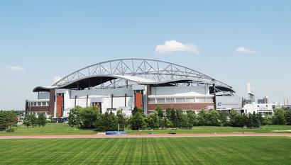
Investors Group Field Address: University Crescent street in Winnipeg
Popular routes to Investors Group Field, Winnipeg
- From Eastbound Graham at Fort (Wpg Square)From Westbound Graham at Vaughan (The Bay)From Southbound Southwest Transitway at Seel StationFrom Westbound Portage at Donald (Canada Life Centre)From Northbound Main at PioneerFrom Northbound Main at McdermotFrom Southbound Queen Elizabeth at StradbrookFrom Eastbound Portage at FortFrom Westbound Graham at Edmonton (Rwb)From Westbound Portage at Garry
Places Near Investors Group Field (Winnipeg)
How to get to popular places in Winnipeg with public transit
Get around Winnipeg by public transit!
Traveling around Winnipeg has never been so easy. See step by step directions as you travel to any attraction, street or major public transit station. View bus and train schedules, arrival times, service alerts and detailed routes on a map, so you know exactly how to get to anywhere in Winnipeg.
When traveling to any destination around Winnipeg use Moovit's Live Directions with Get Off Notifications to know exactly where and how far to walk, how long to wait for your line, and how many stops are left. Moovit will alert you when it's time to get off — no need to constantly re-check whether yours is the next stop.
Wondering how to use public transit in Winnipeg or how to pay for public transit in Winnipeg? Moovit public transit app can help you navigate your way with public transit easily, and at minimum cost. It includes public transit fees, ticket prices, and costs. Looking for a map of Winnipeg public transit lines? Moovit public transit app shows all public transit maps in Winnipeg with all bus routes and stops on an interactive map.
Winnipeg has 1 transit type(s), including: bus, operated by several transit agencies, including Winnipeg Transit