Directions to Invi Barber Shop (Boston) with public transportation
The following transit lines have routes that pass near Invi Barber Shop
 Bus: 21, 28, 31, 29, 26.
- Train: FAIRMOUNT, FRANKLIN/FOXBORO, FAIRMOUNT LINE SHUTTLE, PROVIDENCE/STOUGHTON.
- Subway: RED LINE.
How to get to Invi Barber Shop by bus?
Click on the bus route to see step by step directions with maps, line arrival times and updated time schedules.
From Inman Sq, Cambridge
76 minFrom Inman Square, Cambridge
86 minFrom Holiday Inn Express & Suites Boston - Cambridge, Cambridge
87 minFrom Hotel Aka Back Bay (Hotel Back Bay), Boston
47 minFrom Frog Pond, Boston
56 minFrom Alumni Stadium, Newton
82 minFrom Bos21 - Amazon, Boston
71 minFrom The Friendly Toast, Boston
48 minFrom Downeast Cider, Boston
77 minFrom Piers Park, Boston
82 min
How to get to Invi Barber Shop by train?
Click on the train route to see step by step directions with maps, line arrival times and updated time schedules.
How to get to Invi Barber Shop by subway?
Click on the subway route to see step by step directions with maps, line arrival times and updated time schedules.
From Inman Sq, Cambridge
73 minFrom Inman Square, Cambridge
75 minFrom Holiday Inn Express & Suites Boston - Cambridge, Cambridge
80 minFrom Hotel Aka Back Bay (Hotel Back Bay), Boston
62 minFrom Frog Pond, Boston
57 minFrom Alumni Stadium, Newton
111 minFrom Bos21 - Amazon, Boston
65 minFrom Piers Park, Boston
76 minFrom The Friendly Toast, Boston
61 minFrom Downeast Cider, Boston
76 min
Bus stops near Invi Barber Shop in Boston
Train stations near Invi Barber Shop in Boston
- Morton Street, 6 min walk,VIEW
Bus lines to Invi Barber Shop in Boston
What are the closest stations to Invi Barber Shop?
The closest stations to Invi Barber Shop are:
- Blue Hill Ave @ Woodrow Ave is 52 yards away, 1 min walk.
- Blue Hill Ave @ Morton St is 219 yards away, 3 min walk.
- Morton St @ Blue Hill Ave is 221 yards away, 3 min walk.
- Morton Street is 511 yards away, 6 min walk.
- Norfolk St @ Willowwood St is 616 yards away, 8 min walk.
Which bus lines stop near Invi Barber Shop?
These bus lines stop near Invi Barber Shop: 21, 28, 31.
Which train line stops near Invi Barber Shop?
FAIRMOUNT (#1619 | Fairmount)
Which subway line stops near Invi Barber Shop?
RED LINE (Ashmont/Braintree)
What’s the nearest train station to Invi Barber Shop in Boston?
The nearest train station to Invi Barber Shop in Boston is Morton Street. It’s a 6 min walk away.
What’s the nearest bus station to Invi Barber Shop in Boston?
The nearest bus station to Invi Barber Shop in Boston is Blue Hill Ave @ Woodrow Ave. It’s a 1 min walk away.
What time is the first train to Invi Barber Shop in Boston?
The FAIRMOUNT is the first train that goes to Invi Barber Shop in Boston. It stops nearby at 4:36 AM.
What time is the last train to Invi Barber Shop in Boston?
The FAIRMOUNT is the last train that goes to Invi Barber Shop in Boston. It stops nearby at 12:08 AM.
What time is the first bus to Invi Barber Shop in Boston?
The 28 is the first bus that goes to Invi Barber Shop in Boston. It stops nearby at 3:12 AM.
What time is the last bus to Invi Barber Shop in Boston?
The 28 is the last bus that goes to Invi Barber Shop in Boston. It stops nearby at 2:23 AM.
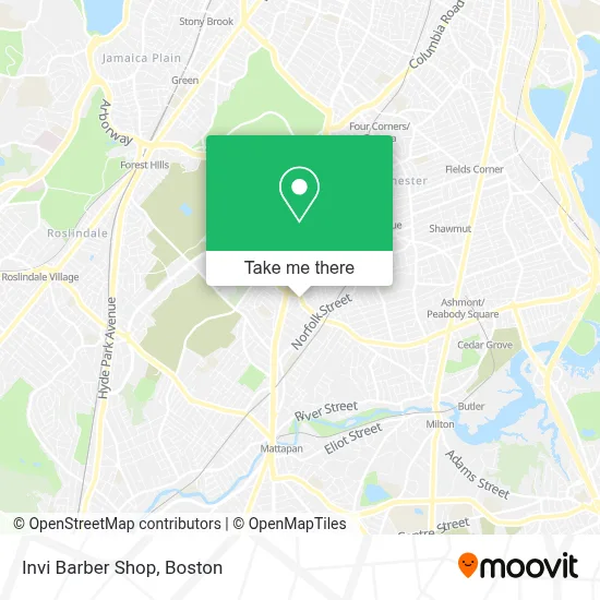
See Invi Barber Shop, Boston, on the map
Public Transit to Invi Barber Shop in Boston
Wondering how to get to Invi Barber Shop in Boston? Moovit helps you find the best way to get to Invi Barber Shop with step-by-step directions from the nearest public transit station.
Moovit provides free maps and live directions to help you navigate through your city. View schedules, routes, timetables, and find out how long does it take to get to Invi Barber Shop in real time.
Looking for the nearest stop or station to Invi Barber Shop? Check out this list of stops closest to your destination: Blue Hill Ave @ Woodrow Ave; Blue Hill Ave @ Morton St; Morton St @ Blue Hill Ave; Morton Street; Norfolk St @ Willowwood St.
Bus: 21, 28, 31, 29, 26.Train: FAIRMOUNT, FRANKLIN/FOXBORO, FAIRMOUNT LINE SHUTTLE, PROVIDENCE/STOUGHTON.Subway: RED LINE.
Want to see if there’s another route that gets you there at an earlier time? Moovit helps you find alternative routes or times. Get directions from and directions to Invi Barber Shop easily from the Moovit App or Website.
We make riding to Invi Barber Shop easy, which is why over 1.7 million users, including users in Boston, trust Moovit as the best app for public transit. You don’t need to download an individual bus app or train app, Moovit is your all-in-one transit app that helps you find the best bus time or train time available.
For information on prices of bus, subway and train, costs and ride fares to Invi Barber Shop, please check the Moovit app.
Use the app to navigate to popular places including to the airport, hospital, stadium, grocery store, mall, coffee shop, school, college, and university.
Invi Barber Shop Address: 763 Morton St street in Boston
- PLS Check Cashing Store,
- Asap Windshield,
- Morning Star Baptist Church,
- Roberts Photo Studio,
- New Chez Vous,
- Chez Vous Roller Skating Rink,
- Good Two Go Transportation,
- Mt Sinai Baptist Church ,
- Urban Farming Institute,
- Church of Boston (Eglise du Bon Berger Haitienne de Boston),
- Gerardo Transportation,
- Young Achievers Science And Mathematics Pilot School,
- Lelene Restaurant,
- State Temple Church Of God In Christ,
- Luis Rivera,
- Goodman Square Apartments,
- Boston City,
- Norfolk Park,
- Alanna Nails,
- Stratton St Building 16
Places Near Invi Barber Shop (Boston)
- Seaport District, Boston,
- House Of Blues, Boston,
- North End, Boston,
- Boston Medical Center, Boston,
- Boston Children's Hospital, Boston,
- Prudential Center, Boston,
- Cheers, Boston,
- Td Garden, Boston,
- Quincy Market, Boston,
- Boston Convention & Exhibition Center, Boston,
- Wilbur Theatre, Boston,
- Boston Common, Boston,
- Leader Bank Pavilion (Leader Bank Pavillion), Boston,
- Museum Of Science, Boston,
- Faneuil Hall, Boston,
- Wang Theater, Boston,
- Isabella Stewart Gardner Museum, Boston,
- Mgm Music Hall, Boston,
- Castle Island, Boston,
- Massachusetts General Hospital, Boston
How to get to popular places in Boston with public transit
Get around Boston by public transit!
Traveling around Boston has never been so easy. See step by step directions as you travel to any attraction, street or major public transit station. View bus and train schedules, arrival times, service alerts and detailed routes on a map, so you know exactly how to get to anywhere in Boston.
When traveling to any destination around Boston use Moovit's Live Directions with Get Off Notifications to know exactly where and how far to walk, how long to wait for your line, and how many stops are left. Moovit will alert you when it's time to get off — no need to constantly re-check whether yours is the next stop.
Wondering how to use public transit in Boston or how to pay for public transit in Boston? Moovit public transit app can help you navigate your way with public transit easily, and at minimum cost. It includes public transit fees, ticket prices, and costs. Looking for a map of Boston public transit lines? Moovit public transit app shows all public transit maps in Boston with all Bus, Train, Subway and Ferry routes and stops on an interactive map.
Boston has 4 transit type(s), including: Bus, Train, Subway and Ferry, operated by several transit agencies, including MBTA, Southeastern Regional Transit Authority, MetroWest Regional Transit Authority, Rhode Island Public Transit Authority, WRTA, Lowell Regional Transit Authority, Merrimack Valley Transit, Montachusett Regional Transit Authority, Cape Cod Regional Transit Authority, Brockton Area Transit Authority, Martha's Vineyard Transit Authority, the WAVE - Nantucket Regional Transit Authority, GATRA, Cape Ann Transportation Authority and Massport