Directions to Iron Security Boston with public transportation
The following transit lines have routes that pass near Iron Security Boston
 Bus: 21, 15, 24, 26.
- Train: FAIRMOUNT, FAIRMOUNT LINE SHUTTLE, FRANKLIN/FOXBORO, PROVIDENCE/STOUGHTON.
- Subway: RED LINE, MATTAPAN LINE.
How to get to Iron Security Boston by bus?
Click on the bus route to see step by step directions with maps, line arrival times and updated time schedules.
From John Joseph Moakley Us Courthouse
84 minFrom Wang Theater
57 minFrom Public Garden (Boston Public Garden)
63 minFrom CambridgeSide (Cambridgeside Galleria)
97 minFrom Emerson College
59 minFrom Royal Sonesta
97 minFrom Old North Church
86 minFrom Kimpton Marlowe Hotel
97 minFrom Park Street MBTA Station - Green & Red Line
65 minFrom Central Square
73 min
How to get to Iron Security Boston by train?
Click on the train route to see step by step directions with maps, line arrival times and updated time schedules.
How to get to Iron Security Boston by subway?
Click on the subway route to see step by step directions with maps, line arrival times and updated time schedules.
From John Joseph Moakley Us Courthouse
52 minFrom Wang Theater
48 minFrom Public Garden (Boston Public Garden)
51 minFrom CambridgeSide (Cambridgeside Galleria)
63 minFrom Emerson College
57 minFrom Royal Sonesta
59 minFrom Old North Church
55 minFrom Kimpton Marlowe Hotel
64 minFrom Park Street MBTA Station - Green & Red Line
45 minFrom Central Square
49 min
Bus stops near Iron Security Boston
Subway station near Iron Security Boston
- Central Avenue, 7 min walk,VIEW
Train station near Iron Security Boston
- Morton Street, 9 min walk,VIEW
Bus lines to Iron Security Boston
What are the closest stations to Iron Security Boston?
The closest stations to Iron Security Boston are:
- River St @ Standard St is 211 yards away, 3 min walk.
- Gallivan Blvd @ Oakridge St is 446 yards away, 6 min walk.
- Central Avenue is 594 yards away, 7 min walk.
- Morton Street is 704 yards away, 9 min walk.
Which bus line stops near Iron Security Boston?
21 (Forest Hills)
Which train line stops near Iron Security Boston?
FAIRMOUNT (#1619 | Fairmount)
Which subway line stops near Iron Security Boston?
RED LINE (Ashmont/Braintree)
What’s the nearest subway station to Iron Security Boston?
The nearest subway station to Iron Security Boston is Central Avenue. It’s a 7 min walk away.
What’s the nearest train station to Iron Security Boston?
The nearest train station to Iron Security Boston is Morton Street. It’s a 9 min walk away.
What’s the nearest bus station to Iron Security Boston?
The nearest bus station to Iron Security Boston is River St @ Standard St. It’s a 3 min walk away.
What time is the first subway to Iron Security Boston?
The MATTAPAN LINE is the first subway that goes to Iron Security Boston. It stops nearby at 5:02 AM.
What time is the last subway to Iron Security Boston?
The MATTAPAN LINE is the last subway that goes to Iron Security Boston. It stops nearby at 2:38 AM.
What time is the first train to Iron Security Boston?
The FAIRMOUNT is the first train that goes to Iron Security Boston. It stops nearby at 4:38 AM.
What time is the last train to Iron Security Boston?
The FAIRMOUNT is the last train that goes to Iron Security Boston. It stops nearby at 12:06 AM.
What time is the first bus to Iron Security Boston?
The 21 is the first bus that goes to Iron Security Boston. It stops nearby at 4:52 AM.
What time is the last bus to Iron Security Boston?
The 26 is the last bus that goes to Iron Security Boston. It stops nearby at 1:19 AM.
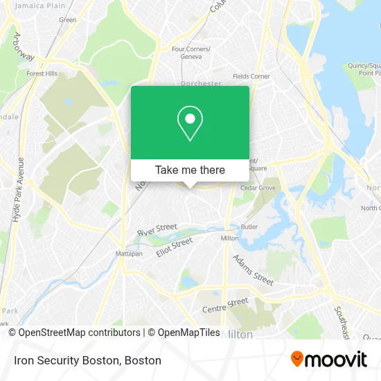
See Iron Security Boston on the map
Public Transportation to Iron Security Boston
Wondering how to get to Iron Security Boston? Moovit helps you find the best way to get to Iron Security Boston with step-by-step directions from the nearest public transit station.
Moovit provides free maps and live directions to help you navigate through your city. View schedules, routes, timetables, and find out how long does it take to get to Iron Security Boston in real time.
Looking for the nearest stop or station to Iron Security Boston? Check out this list of stops closest to your destination: River St @ Standard St; Gallivan Blvd @ Oakridge St; Central Avenue; Morton Street.
Bus: 21, 15, 24, 26.Train: FAIRMOUNT, FAIRMOUNT LINE SHUTTLE, FRANKLIN/FOXBORO, PROVIDENCE/STOUGHTON.Subway: RED LINE, MATTAPAN LINE.
Want to see if there’s another route that gets you there at an earlier time? Moovit helps you find alternative routes or times. Get directions from and directions to Iron Security Boston easily from the Moovit App or Website.
We make riding to Iron Security Boston easy, which is why over 1.7 million users, including users in Boston, trust Moovit as the best app for public transit. You don’t need to download an individual bus app or train app, Moovit is your all-in-one transit app that helps you find the best bus time or train time available.
For information on prices of bus, subway and train, costs and ride fares to Iron Security Boston, please check the Moovit app.
Use the app to navigate to popular places including to the airport, hospital, stadium, grocery store, mall, coffee shop, school, college, and university.
Iron Security Boston Address: 30 Pine Ridge Rd street in Boston
- Distinctions of Excellence,
- McCarrick Marketing,
- Norfolk Hardware & Home Center (Norfolk Kitchen & Bath Boston),
- N Miller Masonry & Construction,
- Boston Sightseeing,
- Bay Cove Human Service,
- Boston International Newcomers Academy (BINcA),
- Singh's Mechanical,
- Mattapan Heights Adult Day Health Program,
- Boston Public Health Commission,
- Washington St,
- WESTERN UNION,
- Onochie Construction Company,
- Goodman Square Apartments,
- Healthy Baby Healthy Child,
- Wyman's Reentry Center,
- USPS Collection Box - Blue Box,
- Morton St & Washington St,
- Laronde de Marie-Claire Early Learning Center,
- Eglise Jesus Christ de Massachusetts
Places Near Iron Security Boston
- Boston Children's Hospital, Boston,
- House Of Blues, Boston,
- Wilbur Theatre, Boston,
- Museum Of Science, Boston,
- Prudential Center, Boston,
- Wang Theater, Boston,
- Boston Convention & Exhibition Center, Boston,
- Cheers, Boston,
- Td Garden, Boston,
- Seaport District, Boston,
- Mgm Music Hall, Boston,
- Faneuil Hall, Boston,
- Quincy Market, Boston,
- Castle Island, Boston,
- Isabella Stewart Gardner Museum, Boston,
- Boston Common, Boston,
- Boston Medical Center, Boston,
- North End, Boston,
- Massachusetts General Hospital, Boston,
- Leader Bank Pavilion (Leader Bank Pavillion), Boston
How to get to popular places in Boston with public transit
Get around Boston by public transit!
Traveling around Boston has never been so easy. See step by step directions as you travel to any attraction, street or major public transit station. View bus and train schedules, arrival times, service alerts and detailed routes on a map, so you know exactly how to get to anywhere in Boston.
When traveling to any destination around Boston use Moovit's Live Directions with Get Off Notifications to know exactly where and how far to walk, how long to wait for your line, and how many stops are left. Moovit will alert you when it's time to get off — no need to constantly re-check whether yours is the next stop.
Wondering how to use public transit in Boston or how to pay for public transit in Boston? Moovit public transit app can help you navigate your way with public transit easily, and at minimum cost. It includes public transit fees, ticket prices, and costs. Looking for a map of Boston public transit lines? Moovit public transit app shows all public transit maps in Boston with all Bus, Train, Subway and Ferry routes and stops on an interactive map.
Boston has 4 transit type(s), including: Bus, Train, Subway and Ferry, operated by several transit agencies, including MBTA, Southeastern Regional Transit Authority, MetroWest Regional Transit Authority, Rhode Island Public Transit Authority, WRTA, Lowell Regional Transit Authority, Merrimack Valley Transit, Montachusett Regional Transit Authority, Cape Cod Regional Transit Authority, Brockton Area Transit Authority, Martha's Vineyard Transit Authority, the WAVE - Nantucket Regional Transit Authority, GATRA, Cape Ann Transportation Authority and Massport