Directions to J.Eco_Photography (Boston) with public transportation
The following transit lines have routes that pass near J.Eco_Photography
 Bus: G1, T2, T92, T1, T5.
- Train: AMTRAK HARTFORD LINE, LAKE SHORE LIMITED, NORTHEAST REGIONAL, VALLEY FLYER, VERMONTER.
How to get to J.Eco_Photography by bus?
Click on the bus route to see step by step directions with maps, line arrival times and updated time schedules.
From South High Community School, Worcester
202 minFrom Registry Of Motor Vehicles (Rmv) Branch Office, Worcester
109 minFrom Walmart Supercenter, Worcester
164 minFrom Foxwoods, Worcester
135 minFrom Dcu Center, Worcester
108 minFrom Polar Park, Worcester
107 minFrom Palladium, Worcester
111 minFrom Worcester, MA, Worcester
105 min
Bus stops near J.Eco_Photography in Boston
Train station near J.Eco_Photography in Boston
- Springfield, 6 min walk,VIEW
Bus lines to J.Eco_Photography in Boston
What are the closest stations to J.Eco_Photography?
The closest stations to J.Eco_Photography are:
- Sumner / Herman is 12 yards away, 1 min walk.
- Sumner / Ormond is 214 yards away, 3 min walk.
- White / Priscilla (1) is 338 yards away, 5 min walk.
- Belmont / Orlando is 340 yards away, 5 min walk.
- Springfield is 463 yards away, 6 min walk.
Which bus line stops near J.Eco_Photography?
G1 (Five Town Plaza Via Bicentennial)
What’s the nearest train station to J.Eco_Photography in Boston?
The nearest train station to J.Eco_Photography in Boston is Springfield. It’s a 6 min walk away.
What’s the nearest bus station to J.Eco_Photography in Boston?
The nearest bus station to J.Eco_Photography in Boston is Sumner / Herman. It’s a 1 min walk away.
What time is the first train to J.Eco_Photography in Boston?
The NORTHEAST REGIONAL is the first train that goes to J.Eco_Photography in Boston. It stops nearby at 4:10 AM.
What time is the last train to J.Eco_Photography in Boston?
The LAKE SHORE LIMITED is the last train that goes to J.Eco_Photography in Boston. It stops nearby at 6:04 PM.
What time is the first bus to J.Eco_Photography in Boston?
The G2 is the first bus that goes to J.Eco_Photography in Boston. It stops nearby at 5:09 AM.
What time is the last bus to J.Eco_Photography in Boston?
The G2 is the last bus that goes to J.Eco_Photography in Boston. It stops nearby at 9:49 PM.
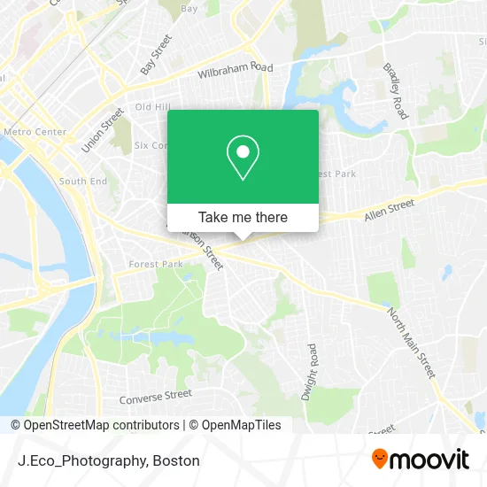
See J.Eco_Photography, Boston, on the map
Public Transit to J.Eco_Photography in Boston
Wondering how to get to J.Eco_Photography in Boston? Moovit helps you find the best way to get to J.Eco_Photography with step-by-step directions from the nearest public transit station.
Moovit provides free maps and live directions to help you navigate through your city. View schedules, routes, timetables, and find out how long does it take to get to J.Eco_Photography in real time.
Looking for the nearest stop or station to J.Eco_Photography? Check out this list of stops closest to your destination: Sumner / Herman; Sumner / Ormond; White / Priscilla (1); Belmont / Orlando; Springfield.
Bus: G1, T2, T92, T1, T5, X90, G2.Train: AMTRAK HARTFORD LINE, LAKE SHORE LIMITED, NORTHEAST REGIONAL, VALLEY FLYER, VERMONTER.
Want to see if there’s another route that gets you there at an earlier time? Moovit helps you find alternative routes or times. Get directions from and directions to J.Eco_Photography easily from the Moovit App or Website.
We make riding to J.Eco_Photography easy, which is why over 1.7 million users, including users in Boston, trust Moovit as the best app for public transit. You don’t need to download an individual bus app or train app, Moovit is your all-in-one transit app that helps you find the best bus time or train time available.
For information on prices of bus, costs and ride fares to J.Eco_Photography, please check the Moovit app.
Use the app to navigate to popular places including to the airport, hospital, stadium, grocery store, mall, coffee shop, school, college, and university.
J.Eco_Photography Address: 693 Sumner Ave street in Boston
- Coffee Bin,
- Elite Locksmith,
- Insyscom Technologies,
- Springfield Community Festival at Bing Arts Center,
- Vista Realty,
- Sumner Realty,
- Thai's Multiservices,
- Springfield Fire Department-Station 3,
- Jenna Lynn Photography,
- Tu Casa Restaurant,
- Spear Shoes,
- Gallo Mini Mart,
- American Express,
- Golden Fingers Barbershop,
- Computer Ambulance,
- Sisters of Saint Joseph,
- Mt Calvary Church,
- Pushin It for Fame and Fortune Entertainment,
- Experienced Appliance Repair Technicians Appliance,
- Springfield Dental
Places Near J.Eco_Photography (Boston)
- Museum Of Science, Boston,
- Castle Island, Boston,
- Faneuil Hall, Boston,
- Isabella Stewart Gardner Museum, Boston,
- Cheers, Boston,
- Td Garden, Boston,
- Seaport District, Boston,
- Mgm Music Hall, Boston,
- Leader Bank Pavilion (Leader Bank Pavillion), Boston,
- Wang Theater, Boston,
- Boston Medical Center, Boston,
- Wilbur Theatre, Boston,
- Prudential Center, Boston,
- North End, Boston,
- Massachusetts General Hospital, Boston,
- House Of Blues, Boston,
- Boston Convention & Exhibition Center, Boston,
- Boston Common, Boston,
- Quincy Market, Boston,
- Boston Children's Hospital, Boston
How to get to popular places in Boston with public transit
Get around Boston by public transit!
Traveling around Boston has never been so easy. See step by step directions as you travel to any attraction, street or major public transit station. View bus and train schedules, arrival times, service alerts and detailed routes on a map, so you know exactly how to get to anywhere in Boston.
When traveling to any destination around Boston use Moovit's Live Directions with Get Off Notifications to know exactly where and how far to walk, how long to wait for your line, and how many stops are left. Moovit will alert you when it's time to get off — no need to constantly re-check whether yours is the next stop.
Wondering how to use public transit in Boston or how to pay for public transit in Boston? Moovit public transit app can help you navigate your way with public transit easily, and at minimum cost. It includes public transit fees, ticket prices, and costs. Looking for a map of Boston public transit lines? Moovit public transit app shows all public transit maps in Boston with all Bus, Train, Subway and Ferry routes and stops on an interactive map.
Boston has 4 transit type(s), including: Bus, Train, Subway and Ferry, operated by several transit agencies, including MBTA, Southeastern Regional Transit Authority, MetroWest Regional Transit Authority, Rhode Island Public Transit Authority, WRTA, Lowell Regional Transit Authority, Merrimack Valley Transit, Montachusett Regional Transit Authority, Cape Cod Regional Transit Authority, Brockton Area Transit Authority, Martha's Vineyard Transit Authority, the WAVE - Nantucket Regional Transit Authority, GATRA, Cape Ann Transportation Authority and Massport