Directions to J.S. Waterman Langone Chapel (Boston) with public transportation
The following transit lines have routes that pass near J.S. Waterman Langone Chapel
 Bus: 4, 426, 43, 504, 92.
- Train: FAIRMOUNT, FRAMINGHAM/WORCESTER, NEEDHAM, FITCHBURG, HAVERHILL.
- Subway: GREEN LINE D, GREEN LINE E, ORANGE LINE, HAVERHILL LINE SHUTTLE, HAVERHILL LINE SHUTTLE.
- Ferry: LOVEJOY - FAN PIER - PIER 10.
How to get to J.S. Waterman Langone Chapel by bus?
Click on the bus route to see step by step directions with maps, line arrival times and updated time schedules.
From Chevalier Theatre (Chevalier Theater Show Line), Medford
48 minFrom Wollaston Beach, Quincy
146 minFrom Alumni Stadium, Newton
81 minFrom 1 Brookline Place, Brookline
63 minFrom Roslindale, Boston
74 minFrom St. Elizabeth's, Boston
94 minFrom Saugus, MA, Saugus
50 minFrom Brigham and Women's Faulkner Hospital, Boston
85 minFrom Dana-Farber Cancer Institute, Boston
76 minFrom Lower Mills, Boston
103 min
How to get to J.S. Waterman Langone Chapel by train?
Click on the train route to see step by step directions with maps, line arrival times and updated time schedules.
How to get to J.S. Waterman Langone Chapel by subway?
Click on the subway route to see step by step directions with maps, line arrival times and updated time schedules.
From Chevalier Theatre (Chevalier Theater Show Line), Medford
51 minFrom Wollaston Beach, Quincy
55 minFrom Alumni Stadium, Newton
67 minFrom 1 Brookline Place, Brookline
40 minFrom Roslindale, Boston
50 minFrom St. Elizabeth's, Boston
57 minFrom Brigham and Women's Faulkner Hospital, Boston
50 minFrom Dana-Farber Cancer Institute, Boston
46 minFrom Lower Mills, Boston
51 min
Train station near J.S. Waterman Langone Chapel in Boston
- North Station, 3 min walk,VIEW
Bus stops near J.S. Waterman Langone Chapel in Boston
Subway station near J.S. Waterman Langone Chapel in Boston
- Causeway St (East), 4 min walk,VIEW
Ferry station near J.S. Waterman Langone Chapel in Boston
- North Station (Lovejoy Wharf), 17 min walk,VIEW
Bus lines to J.S. Waterman Langone Chapel in Boston
- 4, Design Center,VIEW
- EZRIDE, Inbound To North Station From Erie St,VIEW
- EZRIDE, Outbound North Station To Erie St Via Lechmere And Kendall,VIEW
- EZRIDE, Outbound To Erie St From North Station,VIEW
- EZRIDE, Inbound To North Station Via Kendall And Lechmere,VIEW
- GREEN LINE SHUTTLE, North Station (Shuttle),VIEW
- ORANGE LINE SHUTTLE, North Station (Local Shuttle),VIEW
- ORANGE LINE SHUTTLE, Oak Grove (Express Shuttle),VIEW
- ORANGE LINE SHUTTLE, Oak Grove (Local Shuttle),VIEW
- ORANGE LINE SHUTTLE, Wellington (Express Shuttle),VIEW
- 93, Sullivan Via Navy Yard,VIEW
- 92, Sullivan,VIEW
- 116, Haymarket Via Maverick,VIEW
- 426, Haymarket Via Cliftondale,VIEW
- 428, Haymarket Via Cliftondale (Express),VIEW
- 450, Haymarket,VIEW
- 89/93, Haymarket Via Sullivan,VIEW
- BLUE LINE SHUTTLE, Haymarket (Shuttle),VIEW
- 111, Haymarket,VIEW
- ORANGE LINE SHUTTLE, Sullivan (Shuttle),VIEW
What are the closest stations to J.S. Waterman Langone Chapel?
The closest stations to J.S. Waterman Langone Chapel are:
- North Station is 166 yards away, 3 min walk.
- Portland St @ Causeway St is 197 yards away, 3 min walk.
- Causeway St (East) is 262 yards away, 4 min walk.
- North Station - Haverhill St @ Causeway St is 394 yards away, 5 min walk.
- Chelsea St @ Warren St is 435 yards away, 6 min walk.
- Surface Rd @ Hanover St is 518 yards away, 7 min walk.
- N Washington St @ Cooper St is 557 yards away, 7 min walk.
- North Station (Lovejoy Wharf) is 1415 yards away, 17 min walk.
Which bus lines stop near J.S. Waterman Langone Chapel?
These bus lines stop near J.S. Waterman Langone Chapel: 4, 426, 43, 504, 92, 93, SL5.
Which train lines stop near J.S. Waterman Langone Chapel?
These train lines stop near J.S. Waterman Langone Chapel: FAIRMOUNT, FRAMINGHAM/WORCESTER, NEEDHAM.
Which subway lines stop near J.S. Waterman Langone Chapel?
These subway lines stop near J.S. Waterman Langone Chapel: GREEN LINE D, GREEN LINE E, ORANGE LINE.
What’s the nearest subway station to J.S. Waterman Langone Chapel in Boston?
The nearest subway station to J.S. Waterman Langone Chapel in Boston is Causeway St (East). It’s a 4 min walk away.
What’s the nearest train station to J.S. Waterman Langone Chapel in Boston?
The nearest train station to J.S. Waterman Langone Chapel in Boston is North Station. It’s a 3 min walk away.
What’s the nearest bus station to J.S. Waterman Langone Chapel in Boston?
The nearest bus stations to J.S. Waterman Langone Chapel in Boston are Portland St @ Causeway St and North Station. The closest one is a 3 min walk away.
What’s the nearest ferry station to J.S. Waterman Langone Chapel in Boston?
The nearest ferry station to J.S. Waterman Langone Chapel in Boston is North Station (Lovejoy Wharf). It’s a 17 min walk away.
What time is the first subway to J.S. Waterman Langone Chapel in Boston?
The GREEN LINE E is the first subway that goes to J.S. Waterman Langone Chapel in Boston. It stops nearby at 5:01 AM.
What time is the last subway to J.S. Waterman Langone Chapel in Boston?
The GREEN LINE E is the last subway that goes to J.S. Waterman Langone Chapel in Boston. It stops nearby at 2:24 AM.
What time is the first train to J.S. Waterman Langone Chapel in Boston?
The LOWELL is the first train that goes to J.S. Waterman Langone Chapel in Boston. It stops nearby at 5:20 AM.
What time is the last train to J.S. Waterman Langone Chapel in Boston?
The LOWELL is the last train that goes to J.S. Waterman Langone Chapel in Boston. It stops nearby at 12:34 AM.
What time is the first bus to J.S. Waterman Langone Chapel in Boston?
The 111 is the first bus that goes to J.S. Waterman Langone Chapel in Boston. It stops nearby at 4:49 AM.
What time is the last bus to J.S. Waterman Langone Chapel in Boston?
The 111 is the last bus that goes to J.S. Waterman Langone Chapel in Boston. It stops nearby at 2:16 AM.
What time is the first ferry to J.S. Waterman Langone Chapel in Boston?
The LOVEJOY - FAN PIER - PIER 10 is the first ferry that goes to J.S. Waterman Langone Chapel in Boston. It stops nearby at 6:20 AM.
What time is the last ferry to J.S. Waterman Langone Chapel in Boston?
The LOVEJOY - FAN PIER - PIER 10 is the last ferry that goes to J.S. Waterman Langone Chapel in Boston. It stops nearby at 7:35 PM.
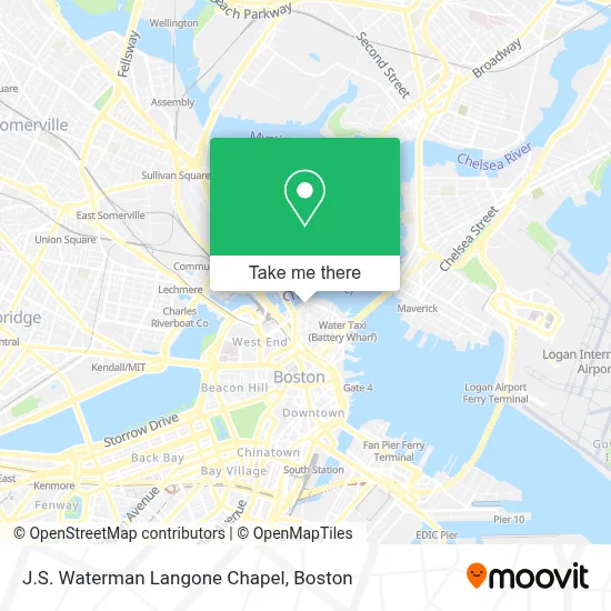
See J.S. Waterman Langone Chapel, Boston, on the map
Public Transit to J.S. Waterman Langone Chapel in Boston
Wondering how to get to J.S. Waterman Langone Chapel in Boston? Moovit helps you find the best way to get to J.S. Waterman Langone Chapel with step-by-step directions from the nearest public transit station.
Moovit provides free maps and live directions to help you navigate through your city. View schedules, routes, timetables, and find out how long does it take to get to J.S. Waterman Langone Chapel in real time.
Looking for the nearest stop or station to J.S. Waterman Langone Chapel? Check out this list of stops closest to your destination: North Station; Portland St @ Causeway St; Causeway St (East); North Station - Haverhill St @ Causeway St; Chelsea St @ Warren St; Surface Rd @ Hanover St; N Washington St @ Cooper St; North Station (Lovejoy Wharf).
Bus: 4, 426, 43, 504, 92, 93, SL5, EZRIDE, EZRIDE, EZRIDE, EZRIDE, GREEN LINE SHUTTLE, ORANGE LINE SHUTTLE, ORANGE LINE SHUTTLE, ORANGE LINE SHUTTLE, ORANGE LINE SHUTTLE.Train: FAIRMOUNT, FRAMINGHAM/WORCESTER, NEEDHAM, FITCHBURG, HAVERHILL, LOWELL, NEWBURYPORT/ROCKPORT, DOWNEASTER.Subway: GREEN LINE D, GREEN LINE E, ORANGE LINE, HAVERHILL LINE SHUTTLE, HAVERHILL LINE SHUTTLE, LOWELL LINE SHUTTLE, LOWELL LINE SHUTTLE, NEWBURYPORT/ROCKPORT LINE SHUTTLE.Ferry: LOVEJOY - FAN PIER - PIER 10.
Want to see if there’s another route that gets you there at an earlier time? Moovit helps you find alternative routes or times. Get directions from and directions to J.S. Waterman Langone Chapel easily from the Moovit App or Website.
We make riding to J.S. Waterman Langone Chapel easy, which is why over 1.7 million users, including users in Boston, trust Moovit as the best app for public transit. You don’t need to download an individual bus app or train app, Moovit is your all-in-one transit app that helps you find the best bus time or train time available.
For information on prices of subway, bus and train, costs and ride fares to J.S. Waterman Langone Chapel, please check the Moovit app.
Use the app to navigate to popular places including to the airport, hospital, stadium, grocery store, mall, coffee shop, school, college, and university.
J.S. Waterman Langone Chapel Address: 580 Commercial St street in Boston
- Langone Park,
- Copp's Hill Burying Ground,
- Prince Street Park Tennis Courts,
- Cleveland Pl & Snow Hill St,
- Converse,
- Converse Store - Lovejoy Wharf,
- Boston Celtics,
- SmarterTravel,
- Old North Church MA USA,
- Boston Celtics Office,
- Alcove,
- North End,
- Regina Pizzeria ,
- Pizzeria Regina,
- Tony & Elaine's,
- Coast Guard Exchange,
- Old North Church,
- Rocco's Cucina & Bar,
- Courtyard Boston Downtown North Station,
- Ward 8
Places Near J.S. Waterman Langone Chapel (Boston)
- Td Garden, Boston,
- Castle Island, Boston,
- Wilbur Theatre, Boston,
- Prudential Center, Boston,
- North End, Boston,
- Faneuil Hall, Boston,
- Massachusetts General Hospital, Boston,
- Seaport District, Boston,
- Boston Medical Center, Boston,
- House Of Blues, Boston,
- Boston Common, Boston,
- Boston Convention & Exhibition Center, Boston,
- Museum Of Science, Boston,
- Cheers, Boston,
- Boston Children's Hospital, Boston,
- Mgm Music Hall, Boston,
- Quincy Market, Boston,
- Isabella Stewart Gardner Museum, Boston,
- Wang Theater, Boston,
- Leader Bank Pavilion (Leader Bank Pavillion), Boston
How to get to popular places in Boston with public transit
Get around Boston by public transit!
Traveling around Boston has never been so easy. See step by step directions as you travel to any attraction, street or major public transit station. View bus and train schedules, arrival times, service alerts and detailed routes on a map, so you know exactly how to get to anywhere in Boston.
When traveling to any destination around Boston use Moovit's Live Directions with Get Off Notifications to know exactly where and how far to walk, how long to wait for your line, and how many stops are left. Moovit will alert you when it's time to get off — no need to constantly re-check whether yours is the next stop.
Wondering how to use public transit in Boston or how to pay for public transit in Boston? Moovit public transit app can help you navigate your way with public transit easily, and at minimum cost. It includes public transit fees, ticket prices, and costs. Looking for a map of Boston public transit lines? Moovit public transit app shows all public transit maps in Boston with all Bus, Train, Subway and Ferry routes and stops on an interactive map.
Boston has 4 transit type(s), including: Bus, Train, Subway and Ferry, operated by several transit agencies, including MBTA, Southeastern Regional Transit Authority, MetroWest Regional Transit Authority, Rhode Island Public Transit Authority, WRTA, Lowell Regional Transit Authority, Merrimack Valley Transit, Montachusett Regional Transit Authority, Cape Cod Regional Transit Authority, Brockton Area Transit Authority, Martha's Vineyard Transit Authority, the WAVE - Nantucket Regional Transit Authority, GATRA, Cape Ann Transportation Authority and Massport