Directions to Jacks Entertainment (Boston) with public transportation
The following transit lines have routes that pass near Jacks Entertainment
 Bus: 28, 31, 29, 21.
- Train: FAIRMOUNT, FRANKLIN/FOXBORO, FAIRMOUNT LINE SHUTTLE, PROVIDENCE/STOUGHTON.
- Subway: MATTAPAN LINE.
How to get to Jacks Entertainment by bus?
Click on the bus route to see step by step directions with maps, line arrival times and updated time schedules.
From La Famiglia Giorgio's, Boston
79 minFrom Public Garden (Boston Public Garden), Boston
65 minFrom Tip O'Neil Building, Boston
94 minFrom Cambridgeside, Cambridge
84 minFrom Mike's Pastry, Boston
79 minFrom Puttshack, Boston
81 minFrom Hilton Boston Back Bay, Boston
52 minFrom Carmelina's, Boston
78 minFrom Newton, MA, Newton
66 minFrom The Westin Copley Place, Boston, Boston
53 min
How to get to Jacks Entertainment by train?
Click on the train route to see step by step directions with maps, line arrival times and updated time schedules.
From La Famiglia Giorgio's, Boston
56 minFrom Public Garden (Boston Public Garden), Boston
55 minFrom Tip O'Neil Building, Boston
59 minFrom Mike's Pastry, Boston
56 minFrom Puttshack, Boston
52 minFrom Hilton Boston Back Bay, Boston
57 minFrom Carmelina's, Boston
56 minFrom The Westin Copley Place, Boston, Boston
48 min
How to get to Jacks Entertainment by subway?
Click on the subway route to see step by step directions with maps, line arrival times and updated time schedules.
From La Famiglia Giorgio's, Boston
68 minFrom Public Garden (Boston Public Garden), Boston
68 minFrom Tip O'Neil Building, Boston
66 minFrom Cambridgeside, Cambridge
81 minFrom Mike's Pastry, Boston
69 minFrom Puttshack, Boston
72 minFrom Hilton Boston Back Bay, Boston
77 minFrom Carmelina's, Boston
69 minFrom Newton, MA, Newton
104 minFrom The Westin Copley Place, Boston, Boston
73 min
Bus stops near Jacks Entertainment in Boston
Train stations near Jacks Entertainment in Boston
- Morton Street, 11 min walk,VIEW
Subway station near Jacks Entertainment in Boston
- Mattapan, 20 min walk,VIEW
Bus lines to Jacks Entertainment in Boston
What are the closest stations to Jacks Entertainment?
The closest stations to Jacks Entertainment are:
- Blue Hill Ave @ Morton St is 419 yards away, 5 min walk.
- Morton St @ Blue Hill Ave is 512 yards away, 7 min walk.
- Morton St @ Greendale Rd is 534 yards away, 7 min walk.
- Morton Street is 922 yards away, 11 min walk.
- Mattapan is 1715 yards away, 20 min walk.
Which bus lines stop near Jacks Entertainment?
These bus lines stop near Jacks Entertainment: 28, 31.
Which train line stops near Jacks Entertainment?
FAIRMOUNT (#1619 | Fairmount)
Which subway line stops near Jacks Entertainment?
MATTAPAN LINE (Mattapan)
What’s the nearest subway station to Jacks Entertainment in Boston?
The nearest subway station to Jacks Entertainment in Boston is Mattapan. It’s a 20 min walk away.
What’s the nearest train station to Jacks Entertainment in Boston?
The nearest train station to Jacks Entertainment in Boston is Morton Street. It’s a 11 min walk away.
What’s the nearest bus station to Jacks Entertainment in Boston?
The nearest bus station to Jacks Entertainment in Boston is Blue Hill Ave @ Morton St. It’s a 5 min walk away.
What time is the first subway to Jacks Entertainment in Boston?
The MATTAPAN LINE is the first subway that goes to Jacks Entertainment in Boston. It stops nearby at 5:00 AM.
What time is the last subway to Jacks Entertainment in Boston?
The MATTAPAN LINE is the last subway that goes to Jacks Entertainment in Boston. It stops nearby at 2:40 AM.
What time is the first train to Jacks Entertainment in Boston?
The FAIRMOUNT is the first train that goes to Jacks Entertainment in Boston. It stops nearby at 4:36 AM.
What time is the last train to Jacks Entertainment in Boston?
The FAIRMOUNT is the last train that goes to Jacks Entertainment in Boston. It stops nearby at 12:08 AM.
What time is the first bus to Jacks Entertainment in Boston?
The 28 is the first bus that goes to Jacks Entertainment in Boston. It stops nearby at 3:11 AM.
What time is the last bus to Jacks Entertainment in Boston?
The 28 is the last bus that goes to Jacks Entertainment in Boston. It stops nearby at 2:28 AM.
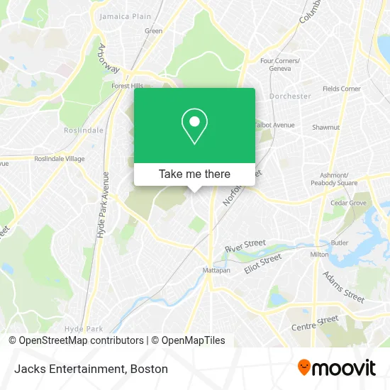
See Jacks Entertainment, Boston, on the map
Public Transit to Jacks Entertainment in Boston
Wondering how to get to Jacks Entertainment in Boston? Moovit helps you find the best way to get to Jacks Entertainment with step-by-step directions from the nearest public transit station.
Moovit provides free maps and live directions to help you navigate through your city. View schedules, routes, timetables, and find out how long does it take to get to Jacks Entertainment in real time.
Looking for the nearest stop or station to Jacks Entertainment? Check out this list of stops closest to your destination: Blue Hill Ave @ Morton St; Morton St @ Blue Hill Ave; Morton St @ Greendale Rd; Morton Street; Mattapan.
Bus: 28, 31, 29, 21.Train: FAIRMOUNT, FRANKLIN/FOXBORO, FAIRMOUNT LINE SHUTTLE, PROVIDENCE/STOUGHTON.Subway: MATTAPAN LINE.
Want to see if there’s another route that gets you there at an earlier time? Moovit helps you find alternative routes or times. Get directions from and directions to Jacks Entertainment easily from the Moovit App or Website.
We make riding to Jacks Entertainment easy, which is why over 1.7 million users, including users in Boston, trust Moovit as the best app for public transit. You don’t need to download an individual bus app or train app, Moovit is your all-in-one transit app that helps you find the best bus time or train time available.
For information on prices of bus, subway and train, costs and ride fares to Jacks Entertainment, please check the Moovit app.
Use the app to navigate to popular places including to the airport, hospital, stadium, grocery store, mall, coffee shop, school, college, and university.
Jacks Entertainment Address: 113 Mattapan St street in Boston
- Almont St & Colorado St,
- Boston City,
- Young Achievers Science And Mathematics Pilot School,
- New Calvary Cemetery,
- Alanna Nails,
- Lelene Restaurant,
- Silver Lining Events,
- Kiddie Exclusive Boutique,
- State Temple Church Of God In Christ,
- Robert L. Feruzi Foundation,
- Morning Star Baptist Church,
- Purcell and Son,
- Tejeda Family Market,
- New Global Harvest Church,
- North Suffolk Mental Health Association,
- Enhance Aesthetics,
- LL Excavation & Utilities,
- Radio Nouveaute,
- Norfolk Park,
- Anchor on Hope
Places Near Jacks Entertainment (Boston)
- Wang Theater, Boston,
- Massachusetts General Hospital, Boston,
- Cheers, Boston,
- Td Garden, Boston,
- Boston Medical Center, Boston,
- Quincy Market, Boston,
- North End, Boston,
- Seaport District, Boston,
- Faneuil Hall, Boston,
- Isabella Stewart Gardner Museum, Boston,
- Boston Convention & Exhibition Center, Boston,
- Museum Of Science, Boston,
- Boston Common, Boston,
- Leader Bank Pavilion (Leader Bank Pavillion), Boston,
- Wilbur Theatre, Boston,
- Mgm Music Hall, Boston,
- Prudential Center, Boston,
- Castle Island, Boston,
- House Of Blues, Boston,
- Boston Children's Hospital, Boston
How to get to popular places in Boston with public transit
Get around Boston by public transit!
Traveling around Boston has never been so easy. See step by step directions as you travel to any attraction, street or major public transit station. View bus and train schedules, arrival times, service alerts and detailed routes on a map, so you know exactly how to get to anywhere in Boston.
When traveling to any destination around Boston use Moovit's Live Directions with Get Off Notifications to know exactly where and how far to walk, how long to wait for your line, and how many stops are left. Moovit will alert you when it's time to get off — no need to constantly re-check whether yours is the next stop.
Wondering how to use public transit in Boston or how to pay for public transit in Boston? Moovit public transit app can help you navigate your way with public transit easily, and at minimum cost. It includes public transit fees, ticket prices, and costs. Looking for a map of Boston public transit lines? Moovit public transit app shows all public transit maps in Boston with all Bus, Train, Subway and Ferry routes and stops on an interactive map.
Boston has 4 transit type(s), including: Bus, Train, Subway and Ferry, operated by several transit agencies, including MBTA, Southeastern Regional Transit Authority, MetroWest Regional Transit Authority, Rhode Island Public Transit Authority, WRTA, Lowell Regional Transit Authority, Merrimack Valley Transit, Montachusett Regional Transit Authority, Cape Cod Regional Transit Authority, Brockton Area Transit Authority, Martha's Vineyard Transit Authority, the WAVE - Nantucket Regional Transit Authority, GATRA, Cape Ann Transportation Authority and Massport