Directions to Jay Berry, Md, Mph (Boston) with public transportation
The following transit lines have routes that pass near Jay Berry, Md, Mph
 Bus: 39, 47, 65, 85, CT3.
- Train: FRAMINGHAM/WORCESTER, PROVIDENCE/STOUGHTON.
- Subway: GREEN LINE D, GREEN LINE C, GREEN LINE E.
How to get to Jay Berry, Md, Mph by bus?
Click on the bus route to see step by step directions with maps, line arrival times and updated time schedules.
From Boda Borg, Malden
90 minFrom Boston Navy Yard, Boston
72 minFrom Wollaston Beach, Quincy
114 minFrom Codman Square, Boston
60 minFrom Georgetown, Massachusetts, Boston
69 minFrom Boston Harbor, Boston
69 minFrom Black Falcon Cruise Terminal, Boston
69 minFrom Bentley University, Waltham
86 minFrom L.L.Bean, Boston
63 minFrom Malden, MA, Malden
86 min
How to get to Jay Berry, Md, Mph by train?
Click on the train route to see step by step directions with maps, line arrival times and updated time schedules.
How to get to Jay Berry, Md, Mph by subway?
Click on the subway route to see step by step directions with maps, line arrival times and updated time schedules.
Bus stops near Jay Berry, Md, Mph in Boston
Subway stations near Jay Berry, Md, Mph in Boston
Bus lines to Jay Berry, Md, Mph in Boston
- 8, Kenmore via South Bay Center - Harbor Point via South Bay Center,VIEW
- 9, Copley - City Point,VIEW
- 19, Kenmore - Fields Corner,VIEW
- 47, Broadway - Central Square,VIEW
- 85, Ruggles - Assembly,VIEW
- CT3, Andrew (Limited Stops) - Avenue Louis Pasteur (Limited Stops),VIEW
- 60, Kenmore - Chestnut Hill Mall,VIEW
- 65, Kenmore - Brighton Center,VIEW
- GREEN LINE D SHUTTLE, Reservoir - Fenway,VIEW
- GREEN LINE D SHUTTLE, Riverside - Fenway,VIEW
- GREEN LINE D SHUTTLE, Newton Highlands - Kenmore,VIEW
- GREEN LINE D SHUTTLE, Newton Highlands - Fenway,VIEW
- GREEN LINE D SHUTTLE, Reservoir - Kenmore,VIEW
- GREEN LINE D SHUTTLE, Brookline Hills - Kenmore,VIEW
- GREEN LINE D SHUTTLE, Newton Highlands - Kenmore via Saint Mary's Street,VIEW
- GREEN LINE D SHUTTLE, Riverside - Kenmore,VIEW
- GREEN LINE D SHUTTLE, Riverside - Kenmore via Saint Mary's Street,VIEW
- GREEN LINE D SHUTTLE, Riverside - Kenmore (Shuttle),VIEW
- GREEN LINE D SHUTTLE, Brookline Hills - Back Bay (Shuttle),VIEW
- GREEN LINE C SHUTTLE, Saint Mary's Street (Shuttle),VIEW
What are the closest stations to Jay Berry, Md, Mph?
The closest stations to Jay Berry, Md, Mph are:
- Longwood Ave @ Binney St is 17 yards away, 1 min walk.
- Brookline Ave @ Longwood Ave is 201 yards away, 3 min walk.
- Kent Street is 428 yards away, 6 min walk.
- Saint Paul Street is 644 yards away, 8 min walk.
- Hawes Street - 1089 Beacon St is 711 yards away, 9 min walk.
- Mission Park is 796 yards away, 10 min walk.
- Chapel St, Colchester St is 1019 yards away, 12 min walk.
Which bus lines stop near Jay Berry, Md, Mph?
These bus lines stop near Jay Berry, Md, Mph: 39, 47, 65, 85, CT3.
Which train lines stop near Jay Berry, Md, Mph?
These train lines stop near Jay Berry, Md, Mph: FRAMINGHAM/WORCESTER, PROVIDENCE/STOUGHTON.
Which subway line stops near Jay Berry, Md, Mph?
GREEN LINE D (Riverside)
What’s the nearest subway station to Jay Berry, Md, Mph in Boston?
The nearest subway station to Jay Berry, Md, Mph in Boston is Saint Paul Street. It’s a 8 min walk away.
What’s the nearest bus station to Jay Berry, Md, Mph in Boston?
The nearest bus station to Jay Berry, Md, Mph in Boston is Longwood Ave @ Binney St. It’s a 1 min walk away.
What time is the first subway to Jay Berry, Md, Mph in Boston?
The GREEN LINE D is the first subway that goes to Jay Berry, Md, Mph in Boston. It stops nearby at 4:55 AM.
What time is the last subway to Jay Berry, Md, Mph in Boston?
The GREEN LINE D is the last subway that goes to Jay Berry, Md, Mph in Boston. It stops nearby at 2:22 AM.
What time is the first bus to Jay Berry, Md, Mph in Boston?
The 60 is the first bus that goes to Jay Berry, Md, Mph in Boston. It stops nearby at 5:23 AM.
What time is the last bus to Jay Berry, Md, Mph in Boston?
The 47 is the last bus that goes to Jay Berry, Md, Mph in Boston. It stops nearby at 1:12 AM.
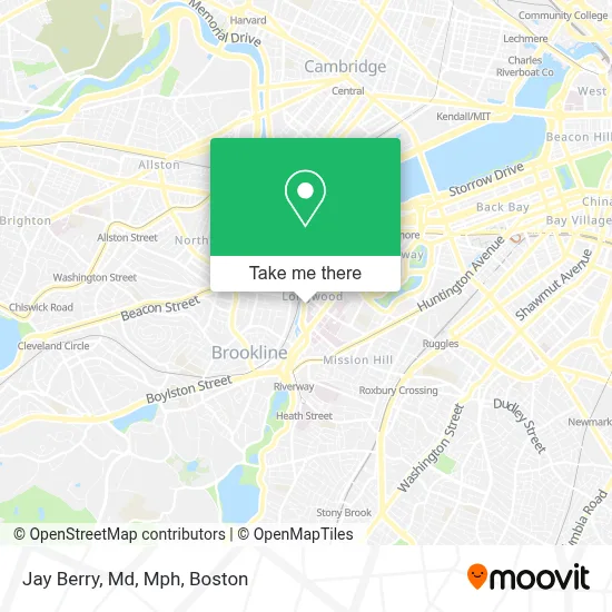
See Jay Berry, Md, Mph, Boston, on the map
Public Transit to Jay Berry, Md, Mph in Boston
Wondering how to get to Jay Berry, Md, Mph in Boston? Moovit helps you find the best way to get to Jay Berry, Md, Mph with step-by-step directions from the nearest public transit station.
Moovit provides free maps and live directions to help you navigate through your city. View schedules, routes, timetables, and find out how long does it take to get to Jay Berry, Md, Mph in real time.
Looking for the nearest stop or station to Jay Berry, Md, Mph? Check out this list of stops closest to your destination: Longwood Ave @ Binney St; Brookline Ave @ Longwood Ave; Kent Street; Saint Paul Street; Hawes Street - 1089 Beacon St; Mission Park; Chapel St.
Bus: 39, 47, 65, 85, CT3, 8, 9, 19, 60, GREEN LINE D SHUTTLE, GREEN LINE D SHUTTLE, GREEN LINE D SHUTTLE, GREEN LINE C SHUTTLE.Train: FRAMINGHAM/WORCESTER, PROVIDENCE/STOUGHTON.Subway: GREEN LINE D, GREEN LINE C, GREEN LINE E.
Want to see if there’s another route that gets you there at an earlier time? Moovit helps you find alternative routes or times. Get directions from and directions to Jay Berry, Md, Mph easily from the Moovit App or Website.
We make riding to Jay Berry, Md, Mph easy, which is why over 1.7 million users, including users in Boston, trust Moovit as the best app for public transit. You don’t need to download an individual bus app or train app, Moovit is your all-in-one transit app that helps you find the best bus time or train time available.
For information on prices of bus, subway and train, costs and ride fares to Jay Berry, Md, Mph, please check the Moovit app.
Use the app to navigate to popular places including to the airport, hospital, stadium, grocery store, mall, coffee shop, school, college, and university.
Jay Berry, Md, Mph Address: 21 Autumn St street in Boston
- Trauma and Community Resilience Center,
- Boston Children's Hospital,
- Beth Israel Deaconess Medical Center West Campus,
- Bidmc,
- Temple Israel,
- Beth Israel Deaconess Medical Center, West Campus - Farr Building,
- Rosenberg Building Bidmc,
- Joslin Clinic,
- Joslin Diabetes Center,
- ChargePoint,
- Beth Israel Deaconess Emergency Room,
- Dr. Hasanain Shikari M.D., D.N.B.,
- Gordon Weir MD,
- Joslin,
- Food for the Soul II,
- Childrens Oncology Service,
- Alexandria Real Estate Equities,
- Longwood Medical Center,
- Longwood Center (Longwood Medical Center),
- Anna's Taqueria
Places Near Jay Berry, Md, Mph (Boston)
- Castle Island, Boston,
- Boston Common, Boston,
- Quincy Market, Boston,
- Seaport District, Boston,
- Massachusetts General Hospital, Boston,
- House Of Blues, Boston,
- Leader Bank Pavilion (Leader Bank Pavillion), Boston,
- Faneuil Hall, Boston,
- Museum Of Science, Boston,
- Boston Children's Hospital, Boston,
- Mgm Music Hall, Boston,
- Wang Theater, Boston,
- Boston Medical Center, Boston,
- Boston Convention & Exhibition Center, Boston,
- Isabella Stewart Gardner Museum, Boston,
- Td Garden, Boston,
- Prudential Center, Boston,
- Wilbur Theatre, Boston,
- North End, Boston,
- Cheers, Boston
How to get to popular places in Boston with public transit
Get around Boston by public transit!
Traveling around Boston has never been so easy. See step by step directions as you travel to any attraction, street or major public transit station. View bus and train schedules, arrival times, service alerts and detailed routes on a map, so you know exactly how to get to anywhere in Boston.
When traveling to any destination around Boston use Moovit's Live Directions with Get Off Notifications to know exactly where and how far to walk, how long to wait for your line, and how many stops are left. Moovit will alert you when it's time to get off — no need to constantly re-check whether yours is the next stop.
Wondering how to use public transit in Boston or how to pay for public transit in Boston? Moovit public transit app can help you navigate your way with public transit easily, and at minimum cost. It includes public transit fees, ticket prices, and costs. Looking for a map of Boston public transit lines? Moovit public transit app shows all public transit maps in Boston with all Bus, Train, Subway and Ferry routes and stops on an interactive map.
Boston has 4 transit type(s), including: Bus, Train, Subway and Ferry, operated by several transit agencies, including MBTA, Southeastern Regional Transit Authority, MetroWest Regional Transit Authority, Rhode Island Public Transit Authority, WRTA, Lowell Regional Transit Authority, Merrimack Valley Transit, Montachusett Regional Transit Authority, Cape Cod Regional Transit Authority, Brockton Area Transit Authority, Martha's Vineyard Transit Authority, the WAVE - Nantucket Regional Transit Authority, GATRA, Cape Ann Transportation Authority and Massport