Directions to Jlor Creative Design & Print (Boston) with public transportation
The following transit lines have routes that pass near Jlor Creative Design & Print
 Bus: 24, 32, 50, 33, 39.
- Train: FAIRMOUNT, FRANKLIN/FOXBORO, PROVIDENCE/STOUGHTON, FAIRMOUNT LINE SHUTTLE.
- Subway: MATTAPAN LINE.
How to get to Jlor Creative Design & Print by bus?
Click on the bus route to see step by step directions with maps, line arrival times and updated time schedules.
From Residence Inn by Marriott Boston Back Bay/Fenway, Boston
58 minFrom Dorchester, Boston
42 minFrom Symphony Hall, Boston
53 minFrom Harvard Vanguard - Kenmore, Boston
60 minFrom The Verb Hotel, Boston
57 minFrom Beth Israel Deaconess Medical Center (Shapiro Garage), Boston
53 minFrom Legacy Place, Dedham
57 minFrom Guitar Center, Boston
57 minFrom Boston Latin School, Boston
50 minFrom Landmark Center, Boston
58 min
How to get to Jlor Creative Design & Print by train?
Click on the train route to see step by step directions with maps, line arrival times and updated time schedules.
From Residence Inn by Marriott Boston Back Bay/Fenway, Boston
53 minFrom Dorchester, Boston
29 minFrom Symphony Hall, Boston
48 minFrom Harvard Vanguard - Kenmore, Boston
53 minFrom The Verb Hotel, Boston
55 minFrom Beth Israel Deaconess Medical Center (Shapiro Garage), Boston
60 minFrom Legacy Place, Dedham
20 minFrom Guitar Center, Boston
56 minFrom Boston Latin School, Boston
53 minFrom Landmark Center, Boston
56 min
How to get to Jlor Creative Design & Print by subway?
Click on the subway route to see step by step directions with maps, line arrival times and updated time schedules.
From Residence Inn by Marriott Boston Back Bay/Fenway, Boston
100 minFrom Dorchester, Boston
73 minFrom Symphony Hall, Boston
88 minFrom Harvard Vanguard - Kenmore, Boston
99 minFrom The Verb Hotel, Boston
99 minFrom Beth Israel Deaconess Medical Center (Shapiro Garage), Boston
102 minFrom Guitar Center, Boston
99 minFrom Boston Latin School, Boston
100 minFrom Landmark Center, Boston
98 min
Bus stops near Jlor Creative Design & Print in Boston
Train station near Jlor Creative Design & Print in Boston
- Fairmount, 12 min walk,VIEW
Bus lines to Jlor Creative Design & Print in Boston
What are the closest stations to Jlor Creative Design & Print?
The closest stations to Jlor Creative Design & Print are:
- Hyde Park Ave @ Winthrop St is 14 yards away, 1 min walk.
- Hyde Park Ave @ Clay St is 151 yards away, 3 min walk.
- River St Opp Way St is 348 yards away, 5 min walk.
- Fairmount is 949 yards away, 12 min walk.
Which bus lines stop near Jlor Creative Design & Print?
These bus lines stop near Jlor Creative Design & Print: 24, 32, 50.
Which train lines stop near Jlor Creative Design & Print?
These train lines stop near Jlor Creative Design & Print: FAIRMOUNT, FRANKLIN/FOXBORO, PROVIDENCE/STOUGHTON.
Which subway line stops near Jlor Creative Design & Print?
MATTAPAN LINE (Mattapan)
What’s the nearest train station to Jlor Creative Design & Print in Boston?
The nearest train station to Jlor Creative Design & Print in Boston is Fairmount. It’s a 12 min walk away.
What’s the nearest bus station to Jlor Creative Design & Print in Boston?
The nearest bus station to Jlor Creative Design & Print in Boston is Hyde Park Ave @ Winthrop St. It’s a 1 min walk away.
What time is the first train to Jlor Creative Design & Print in Boston?
The FAIRMOUNT is the first train that goes to Jlor Creative Design & Print in Boston. It stops nearby at 4:33 AM.
What time is the last train to Jlor Creative Design & Print in Boston?
The PROVIDENCE/STOUGHTON is the last train that goes to Jlor Creative Design & Print in Boston. It stops nearby at 12:22 AM.
What time is the first bus to Jlor Creative Design & Print in Boston?
The 39 is the first bus that goes to Jlor Creative Design & Print in Boston. It stops nearby at 4:25 AM.
What time is the last bus to Jlor Creative Design & Print in Boston?
The 32 is the last bus that goes to Jlor Creative Design & Print in Boston. It stops nearby at 1:30 AM.
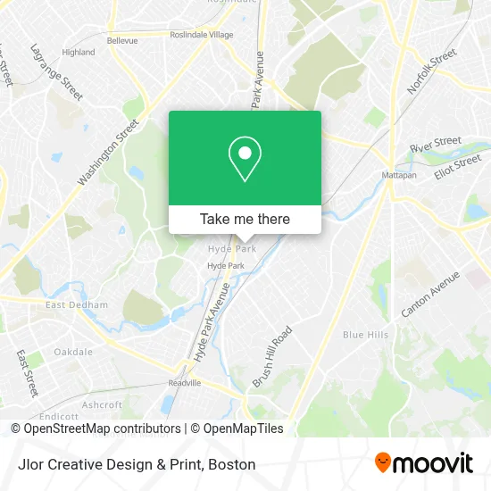
See Jlor Creative Design & Print, Boston, on the map
Public Transit to Jlor Creative Design & Print in Boston
Wondering how to get to Jlor Creative Design & Print in Boston? Moovit helps you find the best way to get to Jlor Creative Design & Print with step-by-step directions from the nearest public transit station.
Moovit provides free maps and live directions to help you navigate through your city. View schedules, routes, timetables, and find out how long does it take to get to Jlor Creative Design & Print in real time.
Looking for the nearest stop or station to Jlor Creative Design & Print? Check out this list of stops closest to your destination: Hyde Park Ave @ Winthrop St; Hyde Park Ave @ Clay St; River St Opp Way St; Fairmount.
Bus: 24, 32, 50, 33, 39.Train: FAIRMOUNT, FRANKLIN/FOXBORO, PROVIDENCE/STOUGHTON, FAIRMOUNT LINE SHUTTLE.Subway: MATTAPAN LINE.
Want to see if there’s another route that gets you there at an earlier time? Moovit helps you find alternative routes or times. Get directions from and directions to Jlor Creative Design & Print easily from the Moovit App or Website.
We make riding to Jlor Creative Design & Print easy, which is why over 1.7 million users, including users in Boston, trust Moovit as the best app for public transit. You don’t need to download an individual bus app or train app, Moovit is your all-in-one transit app that helps you find the best bus time or train time available.
For information on prices of bus, subway and train, costs and ride fares to Jlor Creative Design & Print, please check the Moovit app.
Use the app to navigate to popular places including to the airport, hospital, stadium, grocery store, mall, coffee shop, school, college, and university.
Jlor Creative Design & Print Address: 1203 River St street in Boston
- Peoples Club of Nigeria Community Center,
- Iscch,
- AAA Locksmith Service,
- O'Dwyer School of Irish Dancing,
- BCYF- Hyde Park Community Center,
- Dotties Deli,
- Gourmet Kitchen,
- Cleary Square Eyecare (Clear View Eye Associates),
- GCP Beauty Corporation,
- Soukup Marble and Tile,
- Boston Public Library - Hyde Park Branch,
- Matzaris Delvalle,
- Boston Public Library,
- Smoke & Steam Catering,
- Sophonie Boutique,
- KS Dance Studio,
- Lovely Nails (Lovely Nail & Waxing - Hyde Park),
- Home America Realty & Investments,
- Canvas Studio the Design Lab,
- Natoutou Hair
Places Near Jlor Creative Design & Print (Boston)
- Wilbur Theatre, Boston,
- Seaport District, Boston,
- Massachusetts General Hospital, Boston,
- Wang Theater, Boston,
- Cheers, Boston,
- Td Garden, Boston,
- Prudential Center, Boston,
- Boston Convention & Exhibition Center, Boston,
- Faneuil Hall, Boston,
- Boston Children's Hospital, Boston,
- Boston Common, Boston,
- Museum Of Science, Boston,
- Isabella Stewart Gardner Museum, Boston,
- Boston Medical Center, Boston,
- Leader Bank Pavilion (Leader Bank Pavillion), Boston,
- Quincy Market, Boston,
- North End, Boston,
- House Of Blues, Boston,
- Castle Island, Boston,
- Mgm Music Hall, Boston
How to get to popular places in Boston with public transit
Get around Boston by public transit!
Traveling around Boston has never been so easy. See step by step directions as you travel to any attraction, street or major public transit station. View bus and train schedules, arrival times, service alerts and detailed routes on a map, so you know exactly how to get to anywhere in Boston.
When traveling to any destination around Boston use Moovit's Live Directions with Get Off Notifications to know exactly where and how far to walk, how long to wait for your line, and how many stops are left. Moovit will alert you when it's time to get off — no need to constantly re-check whether yours is the next stop.
Wondering how to use public transit in Boston or how to pay for public transit in Boston? Moovit public transit app can help you navigate your way with public transit easily, and at minimum cost. It includes public transit fees, ticket prices, and costs. Looking for a map of Boston public transit lines? Moovit public transit app shows all public transit maps in Boston with all Bus, Train, Subway and Ferry routes and stops on an interactive map.
Boston has 4 transit type(s), including: Bus, Train, Subway and Ferry, operated by several transit agencies, including MBTA, Southeastern Regional Transit Authority, MetroWest Regional Transit Authority, Rhode Island Public Transit Authority, WRTA, Lowell Regional Transit Authority, Merrimack Valley Transit, Montachusett Regional Transit Authority, Cape Cod Regional Transit Authority, Brockton Area Transit Authority, Martha's Vineyard Transit Authority, the WAVE - Nantucket Regional Transit Authority, GATRA, Cape Ann Transportation Authority and Massport