Directions to John M Kennedy (Boston) with public transportation
The following transit lines have routes that pass near John M Kennedy
 Bus: 21, 22, 23, 26, 15.
- Train: FAIRMOUNT, FRANKLIN/FOXBORO, FAIRMOUNT LINE SHUTTLE, PROVIDENCE/STOUGHTON.
- Subway: RED LINE.
How to get to John M Kennedy by bus?
Click on the bus route to see step by step directions with maps, line arrival times and updated time schedules.
From Fan Pier Park, Boston
79 minFrom South Boston Waterfront, Boston
76 minFrom Spaulding Rehabilitation Hospital, Boston
91 minFrom Massachusetts, Boston
80 minFrom Boston College (BC), Boston
92 minFrom Warrior Ice Arena, Boston
80 minFrom Battery Wharf Hotel, Boston
82 minFrom Harvard Square, Cambridge
74 minFrom Park Plaza Castle, Boston
62 minFrom Jamaica Plain V.A., Boston
48 min
How to get to John M Kennedy by train?
Click on the train route to see step by step directions with maps, line arrival times and updated time schedules.
How to get to John M Kennedy by subway?
Click on the subway route to see step by step directions with maps, line arrival times and updated time schedules.
From Fan Pier Park, Boston
39 minFrom South Boston Waterfront, Boston
42 minFrom Massachusetts, Boston
79 minFrom Boston College (BC), Boston
84 minFrom Warrior Ice Arena, Boston
79 minFrom Battery Wharf Hotel, Boston
42 minFrom Harvard Square, Cambridge
46 minFrom Park Plaza Castle, Boston
40 minFrom Jamaica Plain V.A., Boston
64 min
Bus stops near John M Kennedy in Boston
Subway station near John M Kennedy in Boston
- Fields Corner, 4 min walk,VIEW
Train stations near John M Kennedy in Boston
- Talbot Avenue, 20 min walk,VIEW
Bus lines to John M Kennedy in Boston
- 22, Kenmore Via Ruggles,VIEW
- 23, Ashmont,VIEW
- 26, Gallivan Blvd Via Norfolk St,VIEW
- 15, Ruggles - Fields Corner,VIEW
- 18, Andrew - Ashmont,VIEW
- 21, Forest Hills - Ashmont,VIEW
- 24, Ashmont - Wakefield Ave,VIEW
- 215, Ashmont - Quincy Center,VIEW
- 217, Ashmont via North Quincy - Quincy Center via North Quincy,VIEW
- 240, Ashmont - Avon Square,VIEW
- MATTAPAN LINE SHUTTLE, Mattapan - Ashmont (Shuttle),VIEW
- MATTAPAN LINE SHUTTLE, Mattapan - Ashmont,VIEW
- RED LINE SHUTTLE, Ashmont - JFK/UMass,VIEW
- RED LINE SHUTTLE, Ashmont - Braintree,VIEW
- RED LINE SHUTTLE, Ashmont - JFK/UMass (Shuttle),VIEW
- RED LINE SHUTTLE, Ashmont - Park Street via Post Office,VIEW
- RED LINE SHUTTLE, Ashmont - Broadway (Shuttle),VIEW
- RED/MATTAPAN LINE SHUTTLE, Mattapan - JFK/UMass,VIEW
- MATTAPAN LINE, Mattapan Line,VIEW
- 12, Ashmont,VIEW
What are the closest stations to John M Kennedy?
The closest stations to John M Kennedy are:
- Talbot Ave @ Welles Ave is 231 yards away, 3 min walk.
- Fields Corner is 287 yards away, 4 min walk.
- Ashmont / Peabody Sq. is 369 yards away, 5 min walk.
- Dorchester Ave And Fuller St is 397 yards away, 5 min walk.
- Talbot Avenue is 1690 yards away, 20 min walk.
Which bus lines stop near John M Kennedy?
These bus lines stop near John M Kennedy: 21, 22, 23.
Which train line stops near John M Kennedy?
FAIRMOUNT (#1619 | Fairmount)
Which subway line stops near John M Kennedy?
RED LINE (Ashmont/Braintree)
What’s the nearest subway station to John M Kennedy in Boston?
The nearest subway station to John M Kennedy in Boston is Fields Corner. It’s a 4 min walk away.
What’s the nearest train station to John M Kennedy in Boston?
The nearest train station to John M Kennedy in Boston is Talbot Avenue. It’s a 20 min walk away.
What’s the nearest bus station to John M Kennedy in Boston?
The nearest bus station to John M Kennedy in Boston is Talbot Ave @ Welles Ave. It’s a 3 min walk away.
What time is the first subway to John M Kennedy in Boston?
The MATTAPAN LINE is the first subway that goes to John M Kennedy in Boston. It stops nearby at 5:10 AM.
What time is the last subway to John M Kennedy in Boston?
The MATTAPAN LINE is the last subway that goes to John M Kennedy in Boston. It stops nearby at 2:31 AM.
What time is the first train to John M Kennedy in Boston?
The FAIRMOUNT is the first train that goes to John M Kennedy in Boston. It stops nearby at 4:41 AM.
What time is the last train to John M Kennedy in Boston?
The FAIRMOUNT is the last train that goes to John M Kennedy in Boston. It stops nearby at 12:03 AM.
What time is the first bus to John M Kennedy in Boston?
The 15 is the first bus that goes to John M Kennedy in Boston. It stops nearby at 3:26 AM.
What time is the last bus to John M Kennedy in Boston?
The 23 is the last bus that goes to John M Kennedy in Boston. It stops nearby at 2:43 AM.
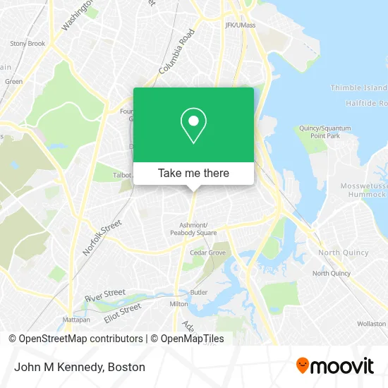
See John M Kennedy, Boston, on the map
Public Transit to John M Kennedy in Boston
Wondering how to get to John M Kennedy in Boston? Moovit helps you find the best way to get to John M Kennedy with step-by-step directions from the nearest public transit station.
Moovit provides free maps and live directions to help you navigate through your city. View schedules, routes, timetables, and find out how long does it take to get to John M Kennedy in real time.
Looking for the nearest stop or station to John M Kennedy? Check out this list of stops closest to your destination: Talbot Ave @ Welles Ave; Fields Corner; Ashmont / Peabody Sq.; Dorchester Ave And Fuller St; Talbot Avenue.
Bus: 21, 22, 23, 26, 15, 18, 24, 215, 12.Train: FAIRMOUNT, FRANKLIN/FOXBORO, FAIRMOUNT LINE SHUTTLE, PROVIDENCE/STOUGHTON.Subway: RED LINE.
Want to see if there’s another route that gets you there at an earlier time? Moovit helps you find alternative routes or times. Get directions from and directions to John M Kennedy easily from the Moovit App or Website.
We make riding to John M Kennedy easy, which is why over 1.7 million users, including users in Boston, trust Moovit as the best app for public transit. You don’t need to download an individual bus app or train app, Moovit is your all-in-one transit app that helps you find the best bus time or train time available.
For information on prices of bus, subway and train, costs and ride fares to John M Kennedy, please check the Moovit app.
Use the app to navigate to popular places including to the airport, hospital, stadium, grocery store, mall, coffee shop, school, college, and university.
John M Kennedy Address: 1813 Dorchester Ave street in Boston
- Nebs Scooter Mechanic,
- Big City Chiropractic,
- The Intersection Dorchester,
- Thuy's Hair Salon (Gigi Hair Concepts),
- Via Cannuccia,
- American Dry Cleaners,
- B & T & Sons,
- The Maneikis Companies,
- Cafe 168,
- St. Mark's Catholic Church,
- Adams House Condos,
- Daumos Boutique,
- Sisters in Motion Travel,
- Ashmont St Building 360,
- MBTA Ashmont / Peabody Square Station,
- King St,
- Shawmut Station,
- Shawmut Station - MBTA - Red Line,
- Dorchester Avenue and Fuller Street,
- Boston Latin Academy
Places Near John M Kennedy (Boston)
- Boston Children's Hospital, Boston,
- Leader Bank Pavilion (Leader Bank Pavillion), Boston,
- Wilbur Theatre, Boston,
- Museum Of Science, Boston,
- Boston Medical Center, Boston,
- North End, Boston,
- Quincy Market, Boston,
- House Of Blues, Boston,
- Castle Island, Boston,
- Isabella Stewart Gardner Museum, Boston,
- Seaport District, Boston,
- Mgm Music Hall, Boston,
- Boston Common, Boston,
- Faneuil Hall, Boston,
- Cheers, Boston,
- Boston Convention & Exhibition Center, Boston,
- Prudential Center, Boston,
- Td Garden, Boston,
- Massachusetts General Hospital, Boston,
- Wang Theater, Boston
How to get to popular places in Boston with public transit
Get around Boston by public transit!
Traveling around Boston has never been so easy. See step by step directions as you travel to any attraction, street or major public transit station. View bus and train schedules, arrival times, service alerts and detailed routes on a map, so you know exactly how to get to anywhere in Boston.
When traveling to any destination around Boston use Moovit's Live Directions with Get Off Notifications to know exactly where and how far to walk, how long to wait for your line, and how many stops are left. Moovit will alert you when it's time to get off — no need to constantly re-check whether yours is the next stop.
Wondering how to use public transit in Boston or how to pay for public transit in Boston? Moovit public transit app can help you navigate your way with public transit easily, and at minimum cost. It includes public transit fees, ticket prices, and costs. Looking for a map of Boston public transit lines? Moovit public transit app shows all public transit maps in Boston with all Bus, Train, Subway and Ferry routes and stops on an interactive map.
Boston has 4 transit type(s), including: Bus, Train, Subway and Ferry, operated by several transit agencies, including MBTA, Southeastern Regional Transit Authority, MetroWest Regional Transit Authority, Rhode Island Public Transit Authority, WRTA, Lowell Regional Transit Authority, Merrimack Valley Transit, Montachusett Regional Transit Authority, Cape Cod Regional Transit Authority, Brockton Area Transit Authority, Martha's Vineyard Transit Authority, the WAVE - Nantucket Regional Transit Authority, GATRA, Cape Ann Transportation Authority and Massport