Directions to K'Mae Design Studio Llc (Boston) with public transportation
The following transit lines have routes that pass near K'Mae Design Studio Llc
 Bus: 1, 27, 28, 92, 17.
- Train: PROVIDENCE/STOUGHTON, ACELA, NORTHEAST REGIONAL, PROVIDENCE LINE SHUTTLE, PROVIDENCE LINE SHUTTLE.
How to get to K'Mae Design Studio Llc by bus?
Click on the bus route to see step by step directions with maps, line arrival times and updated time schedules.
How to get to K'Mae Design Studio Llc by train?
Click on the train route to see step by step directions with maps, line arrival times and updated time schedules.
Bus stops near K'Mae Design Studio Llc in Boston
Train stations near K'Mae Design Studio Llc in Boston
- Providence, 57 min walk,VIEW
Bus lines to K'Mae Design Studio Llc in Boston
What are the closest stations to K'Mae Design Studio Llc?
The closest stations to K'Mae Design Studio Llc are:
- Manton After Delaine is 229 yards away, 4 min walk.
- Atwells Before Putnam is 282 yards away, 4 min walk.
- Olneyville Square (Westminster Before Manton) is 499 yards away, 7 min walk.
- Providence is 4855 yards away, 58 min walk.
Which bus lines stop near K'Mae Design Studio Llc?
These bus lines stop near K'Mae Design Studio Llc: 1, 27, 28, 92.
Which train line stops near K'Mae Design Studio Llc?
PROVIDENCE/STOUGHTON (#827 | Wickford Junction)
What’s the nearest bus station to K'Mae Design Studio Llc in Boston?
The nearest bus stations to K'Mae Design Studio Llc in Boston are Manton After Delaine and Atwells Before Putnam. The closest one is a 4 min walk away.
What time is the first train to K'Mae Design Studio Llc in Boston?
The PROVIDENCE/STOUGHTON is the first train that goes to K'Mae Design Studio Llc in Boston. It stops nearby at 4:10 AM.
What time is the last train to K'Mae Design Studio Llc in Boston?
The NORTHEAST REGIONAL is the last train that goes to K'Mae Design Studio Llc in Boston. It stops nearby at 9:17 AM.
What time is the first bus to K'Mae Design Studio Llc in Boston?
The 28 is the first bus that goes to K'Mae Design Studio Llc in Boston. It stops nearby at 5:34 AM.
What time is the last bus to K'Mae Design Studio Llc in Boston?
The 27 is the last bus that goes to K'Mae Design Studio Llc in Boston. It stops nearby at 11:40 PM.
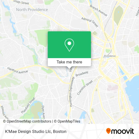
See K'Mae Design Studio Llc, Boston, on the map
Public Transit to K'Mae Design Studio Llc in Boston
Wondering how to get to K'Mae Design Studio Llc in Boston? Moovit helps you find the best way to get to K'Mae Design Studio Llc with step-by-step directions from the nearest public transit station.
Moovit provides free maps and live directions to help you navigate through your city. View schedules, routes, timetables, and find out how long does it take to get to K'Mae Design Studio Llc in real time.
Looking for the nearest stop or station to K'Mae Design Studio Llc? Check out this list of stops closest to your destination: Manton After Delaine; Atwells Before Putnam; Olneyville Square (Westminster Before Manton); Providence.
Bus: 1, 27, 28, 92, 17, 19.Train: PROVIDENCE/STOUGHTON, ACELA, NORTHEAST REGIONAL, PROVIDENCE LINE SHUTTLE, PROVIDENCE LINE SHUTTLE, PROVIDENCE LINE SHUTTLE, FOXBORO EVENT SERVICE.
Want to see if there’s another route that gets you there at an earlier time? Moovit helps you find alternative routes or times. Get directions from and directions to K'Mae Design Studio Llc easily from the Moovit App or Website.
We make riding to K'Mae Design Studio Llc easy, which is why over 1.7 million users, including users in Boston, trust Moovit as the best app for public transit. You don’t need to download an individual bus app or train app, Moovit is your all-in-one transit app that helps you find the best bus time or train time available.
For information on prices of bus and train, costs and ride fares to K'Mae Design Studio Llc, please check the Moovit app.
Use the app to navigate to popular places including to the airport, hospital, stadium, grocery store, mall, coffee shop, school, college, and university.
K'Mae Design Studio Llc Address: 166 Valley St Bldg 6m Ste 103 street in Boston
- JJ Property Management & Realty Inc.,
- Services for Attorneys,
- Eastern Electric Construction Co,
- Commtank,
- Norman Zolkos - Mutual of Omaha Mortgage,
- Immigration Law Office of Claudia Gregoire / Ley de Inmigracion Claudia,
- Next Level Progress,
- Gentle Touch - Housekeeping,
- Ligature Partners,
- Norkis & Yajaira Cleaning Services,
- Rhode Island Creative,
- Ann Lady Creations,
- 3mk,
- Diocese of Providence,
- Throughline Learning,
- Leadership Rhode Island,
- Rhode Island Chimney Sweep Pros,
- Rhode Island Collision Sales & Service,
- Carlos,
- Hear Care of New England
Places Near K'Mae Design Studio Llc (Boston)
- House Of Blues, Boston,
- Seaport District, Boston,
- North End, Boston,
- Faneuil Hall, Boston,
- Wilbur Theatre, Boston,
- Castle Island, Boston,
- Cheers, Boston,
- Leader Bank Pavilion (Leader Bank Pavillion), Boston,
- Boston Children's Hospital, Boston,
- Td Garden, Boston,
- Boston Convention & Exhibition Center, Boston,
- Quincy Market, Boston,
- Mgm Music Hall, Boston,
- Massachusetts General Hospital, Boston,
- Wang Theater, Boston,
- Isabella Stewart Gardner Museum, Boston,
- Boston Medical Center, Boston,
- Boston Common, Boston,
- Museum Of Science, Boston,
- Prudential Center, Boston
How to get to popular places in Boston with public transit
Get around Boston by public transit!
Traveling around Boston has never been so easy. See step by step directions as you travel to any attraction, street or major public transit station. View bus and train schedules, arrival times, service alerts and detailed routes on a map, so you know exactly how to get to anywhere in Boston.
When traveling to any destination around Boston use Moovit's Live Directions with Get Off Notifications to know exactly where and how far to walk, how long to wait for your line, and how many stops are left. Moovit will alert you when it's time to get off — no need to constantly re-check whether yours is the next stop.
Wondering how to use public transit in Boston or how to pay for public transit in Boston? Moovit public transit app can help you navigate your way with public transit easily, and at minimum cost. It includes public transit fees, ticket prices, and costs. Looking for a map of Boston public transit lines? Moovit public transit app shows all public transit maps in Boston with all Bus, Train, Subway and Ferry routes and stops on an interactive map.
Boston has 4 transit type(s), including: Bus, Train, Subway and Ferry, operated by several transit agencies, including MBTA, Southeastern Regional Transit Authority, MetroWest Regional Transit Authority, Rhode Island Public Transit Authority, WRTA, Lowell Regional Transit Authority, Merrimack Valley Transit, Montachusett Regional Transit Authority, Cape Cod Regional Transit Authority, Brockton Area Transit Authority, Martha's Vineyard Transit Authority, the WAVE - Nantucket Regional Transit Authority, GATRA, Cape Ann Transportation Authority and Massport