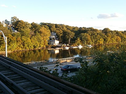
See Kearny river bank park, Kearny, Nj, on the map
Directions to Kearny river bank park (Kearny, Nj) with public transportation
The following transit lines have routes that pass near Kearny river bank park
 Bus:
Bus: - Train:
How to get to Kearny river bank park by bus?
Click on the bus route to see step by step directions with maps, line arrival times and updated time schedules.
How to get to Kearny river bank park by train?
Click on the train route to see step by step directions with maps, line arrival times and updated time schedules.
Bus stations near Kearny river bank park in Kearny, Nj
- Broad St At Lackawanna Ave,38 min walk,
- Bloomfield Ave At Clifton Ave,49 min walk,
Light Rail stations near Kearny river bank park in Kearny, Nj
- Davenport Avenue Light Rail Station,70 min walk,
Bus lines to Kearny river bank park in Kearny, Nj
- 11,Willowbrook Rt 23 Express,
- 13,13m North Newark Verona Ave Via Broad St Sta,
- 27,Irvington Via Pru Ctr,
- 28,Newark Hill Street,
- GO28,Go28 Newark Airport North Area & Terminals,
- 29,Bloomfield Ave Montclair,
- 30,Newark Lincoln Park,
- 41,Lincoln Park,
- 72,Paterson Via Bloomfield Ave,
What are the closest stations to Kearny river bank park?
The closest stations to Kearny river bank park are:
- Broad St At Lackawanna Ave is 3213 yards away, 38 min walk.
- Bloomfield Ave At Clifton Ave is 4067 yards away, 49 min walk.
- Davenport Avenue Light Rail Station is 5909 yards away, 70 min walk.
Which bus lines stop near Kearny river bank park?
These bus lines stop near Kearny river bank park: 30, 76.
Which train line stops near Kearny river bank park?
PATH
See Kearny river bank park, Kearny, Nj, on the map
Public Transit to Kearny river bank park in Kearny, Nj
Wondering how to get to Kearny river bank park in Kearny, Nj, United States? Moovit helps you find the best way to get to Kearny river bank park with step-by-step directions from the nearest public transit station.
Moovit provides free maps and live directions to help you navigate through your city. View schedules, routes, timetables, and find out how long does it take to get to Kearny river bank park in real time.
Looking for the nearest stop or station to Kearny river bank park? Check out this list of stops closest to your destination: Broad St At Lackawanna Ave; Bloomfield Ave At Clifton Ave; Davenport Avenue Light Rail Station.
Bus:Train:
Want to see if there’s another route that gets you there at an earlier time? Moovit helps you find alternative routes or times. Get directions from and directions to Kearny river bank park easily from the Moovit App or Website.
We make riding to Kearny river bank park easy, which is why over 1.5 million users, including users in Kearny, Nj, trust Moovit as the best app for public transit. You don’t need to download an individual bus app or train app, Moovit is your all-in-one transit app that helps you find the best bus time or train time available.
For information on prices of bus and train, costs and ride fares to Kearny river bank park, please check the Moovit app.
Use the app to navigate to popular places including to the airport, hospital, stadium, grocery store, mall, coffee shop, school, college, and university.
Location: Kearny, Nj, New York - New Jersey
Attractions near Kearny river bank park
Meadowlands Cleaning Service,Belgrove Dr (belgrove drive butler),Belgrove Dr at Butler,Susan Testone,15 Butler Place,Trovato Jos DDS,Rutland Belgrove,Mt Carmel Guild Behavioral,Cyo Retreat Center,Catholic Charities-Archdiocese,444 Belgrove Drive,Smcc Sheet Metal Inc,Belgrove Dr at Harding,Royal World,National Freight Audit & Pymnt,Belgrove Dr at Park Ave,M J Technologies,William St / Butler Pl,William Butler,William St (park william)How to get to popular attractions in Kearny, Nj with public transit
MTA Subway - 30th Ave (N/W), Queens,I-80 (Interstate 80), Paterson, Nj,Time Life, Manhattan,Beauty & Essex, Manhattan,Red Rooster, Manhattan,Jersey Shore University Medical Center, Neptune, Nj,Burger Joint, Manhattan,The Meatball Shop,Nan Xiang Xiao Long Bao, Queens,Dinosaur Bar-B-Que, Manhattan,MTA Subway - Broadway (N/W), Queens,Grimaldi's Pizzeria,Fette Sau,NJT - New Brunswick Station (NEC), New Brunswick, Nj,Wingate by Wyndham Manhattan Midtown, Manhattan,Café Habana, Manhattan,Joe's Shanghai 鹿嗚春, Manhattan,The Grey Dog, Manhattan,Tacombi at Fonda Nolita, Manhattan,Ritz Bar & Lounge, ManhattanGet around Kearny, Nj by public transit!
Traveling around Kearny, Nj has never been so easy. See step by step directions as you travel to any attraction, street or major public transit station. View bus and train schedules, arrival times, service alerts and detailed routes on a map, so you know exactly how to get to anywhere in Kearny, Nj.
When traveling to any destination around Kearny, Nj use Moovit's Live Directions with Get Off Notifications to know exactly where and how far to walk, how long to wait for your line, and how many stops are left. Moovit will alert you when it's time to get off — no need to constantly re-check whether yours is the next stop.
Wondering how to use public transit in Kearny, Nj or how to pay for public transit in Kearny, Nj? Moovit public transit app can help you navigate your way with public transit easily, and at minimum cost. It includes public transit fees, ticket prices, and costs. Looking for a map of Kearny, Nj public transit lines? Moovit public transit app shows all public transit maps in Kearny, Nj with all bus or train routes and stops on an interactive map.
Kearny, Nj has 2 transit type(s), including: bus or train, operated by several transit agencies, including MTA Subway, Metro-North Railroad, LIRR, PATH, Shore Line East, MTA Bus Company, MTA New York City Transit - Express routes, MTA Bus, NJ Transit, NYC Ferry, NICE bus, Bee-Line Bus, NJ Transit Rail, NJ Transit Rail and Norwalk Transit District