Directions to Kebabish679 (Boston) with public transportation
The following transit lines have routes that pass near Kebabish679
 Bus: G1, X92, G2, T1, T2.
- Train: LAKE SHORE LIMITED, VERMONTER, AMTRAK HARTFORD LINE, NORTHEAST REGIONAL, VALLEY FLYER.
How to get to Kebabish679 by bus?
Click on the bus route to see step by step directions with maps, line arrival times and updated time schedules.
From Polar Park, Worcester
96 minFrom Palladium, Worcester
99 minFrom Foxwoods, Worcester
123 minFrom Walmart Supercenter, Worcester
153 minFrom Worcester, MA, Worcester
94 minFrom Dcu Center, Worcester
96 minFrom South High Community School, Worcester
191 minFrom Registry Of Motor Vehicles (Rmv) Branch Office, Worcester
98 min
How to get to Kebabish679 by train?
Click on the train route to see step by step directions with maps, line arrival times and updated time schedules.
Bus stops near Kebabish679 in Boston
Train station near Kebabish679 in Boston
- Springfield, 53 min walk,VIEW
Bus lines to Kebabish679 in Boston
- G1, The X Via Sumner Ave,VIEW
- G2, E Springfield Via Union Station-Mercy,VIEW
- T1, Sumner To the X To Dickinson,VIEW
- T2, Belmont To the X,VIEW
- T5, State St Blunt Park Rd To Bay St,VIEW
- T92, State Street Blunt Pk Rd To Bay Street,VIEW
- X92, Memorial Industrial Park Via Senior Center And Roosevelt,VIEW
- G5, Union Station Via Jewish Home,VIEW
What are the closest stations to Kebabish679?
The closest stations to Kebabish679 are:
- Main / William is 175 yards away, 3 min walk.
- Maple / Avon (2) is 714 yards away, 9 min walk.
- Springfield is 4435 yards away, 53 min walk.
Which bus lines stop near Kebabish679?
These bus lines stop near Kebabish679: G1, X92.
Which train lines stop near Kebabish679?
These train lines stop near Kebabish679: LAKE SHORE LIMITED, VERMONTER.
What’s the nearest bus station to Kebabish679 in Boston?
The nearest bus station to Kebabish679 in Boston is Main / William. It’s a 3 min walk away.
What time is the first train to Kebabish679 in Boston?
The NORTHEAST REGIONAL is the first train that goes to Kebabish679 in Boston. It stops nearby at 4:10 AM.
What time is the last train to Kebabish679 in Boston?
The LAKE SHORE LIMITED is the last train that goes to Kebabish679 in Boston. It stops nearby at 6:04 PM.
What time is the first bus to Kebabish679 in Boston?
The G2 is the first bus that goes to Kebabish679 in Boston. It stops nearby at 5:22 AM.
What time is the last bus to Kebabish679 in Boston?
The G2 is the last bus that goes to Kebabish679 in Boston. It stops nearby at 10:04 PM.
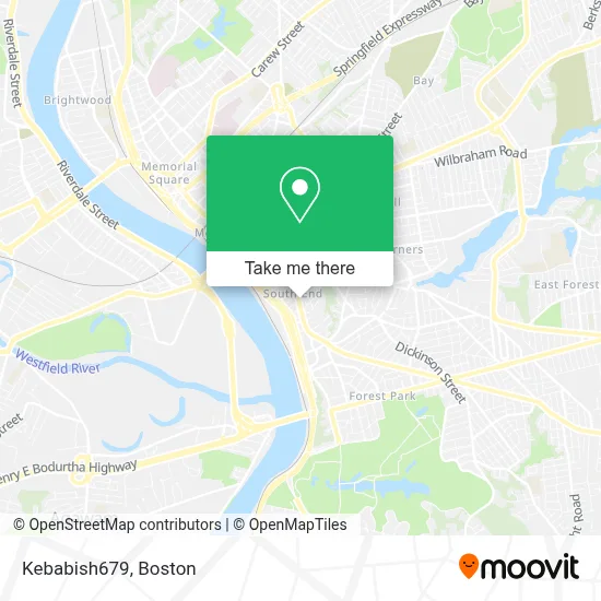
See Kebabish679, Boston, on the map
Public Transit to Kebabish679 in Boston
Wondering how to get to Kebabish679 in Boston? Moovit helps you find the best way to get to Kebabish679 with step-by-step directions from the nearest public transit station.
Moovit provides free maps and live directions to help you navigate through your city. View schedules, routes, timetables, and find out how long does it take to get to Kebabish679 in real time.
Looking for the nearest stop or station to Kebabish679? Check out this list of stops closest to your destination: Main / William; Maple / Avon (2); Springfield.
Bus: G1, X92, G2, T1, T2, T5, G5.Train: LAKE SHORE LIMITED, VERMONTER, AMTRAK HARTFORD LINE, NORTHEAST REGIONAL, VALLEY FLYER.
Want to see if there’s another route that gets you there at an earlier time? Moovit helps you find alternative routes or times. Get directions from and directions to Kebabish679 easily from the Moovit App or Website.
We make riding to Kebabish679 easy, which is why over 1.7 million users, including users in Boston, trust Moovit as the best app for public transit. You don’t need to download an individual bus app or train app, Moovit is your all-in-one transit app that helps you find the best bus time or train time available.
For information on prices of bus and train, costs and ride fares to Kebabish679, please check the Moovit app.
Use the app to navigate to popular places including to the airport, hospital, stadium, grocery store, mall, coffee shop, school, college, and university.
Kebabish679 Address: 679 Main St street in Boston
- South End Bottle & Can Return,
- Grab A Bargain,
- 644 Main Street VT,
- J and Y Fashion,
- 91 Interstate Ropa International,
- Temple Sanlarzro,
- Fl Roberts Car Wash,
- RT Knight Real Estate,
- Shea Cleaners,
- Crazy Andys Liquors,
- Superior Printing Ink Co.,
- Northeast Interiors,
- The Universal Church,
- Fine Fresh Market,
- Supreme Food Marketplace,
- South End,
- Amazon Locker-Device,
- Igl.Pentecostal Casa de Misericordia Inc.,
- Borinquen Convenience Store,
- Regal Beagle
Places Near Kebabish679 (Boston)
- Cheers, Boston,
- Museum Of Science, Boston,
- Wang Theater, Boston,
- Mgm Music Hall, Boston,
- Quincy Market, Boston,
- Faneuil Hall, Boston,
- Prudential Center, Boston,
- Isabella Stewart Gardner Museum, Boston,
- Leader Bank Pavilion (Leader Bank Pavillion), Boston,
- Boston Convention & Exhibition Center, Boston,
- North End, Boston,
- Seaport District, Boston,
- Boston Medical Center, Boston,
- Massachusetts General Hospital, Boston,
- Boston Common, Boston,
- Boston Children's Hospital, Boston,
- Castle Island, Boston,
- Wilbur Theatre, Boston,
- Td Garden, Boston,
- House Of Blues, Boston
How to get to popular places in Boston with public transit
Get around Boston by public transit!
Traveling around Boston has never been so easy. See step by step directions as you travel to any attraction, street or major public transit station. View bus and train schedules, arrival times, service alerts and detailed routes on a map, so you know exactly how to get to anywhere in Boston.
When traveling to any destination around Boston use Moovit's Live Directions with Get Off Notifications to know exactly where and how far to walk, how long to wait for your line, and how many stops are left. Moovit will alert you when it's time to get off — no need to constantly re-check whether yours is the next stop.
Wondering how to use public transit in Boston or how to pay for public transit in Boston? Moovit public transit app can help you navigate your way with public transit easily, and at minimum cost. It includes public transit fees, ticket prices, and costs. Looking for a map of Boston public transit lines? Moovit public transit app shows all public transit maps in Boston with all Bus, Train, Subway and Ferry routes and stops on an interactive map.
Boston has 4 transit type(s), including: Bus, Train, Subway and Ferry, operated by several transit agencies, including MBTA, Southeastern Regional Transit Authority, MetroWest Regional Transit Authority, Rhode Island Public Transit Authority, WRTA, Lowell Regional Transit Authority, Merrimack Valley Transit, Montachusett Regional Transit Authority, Cape Cod Regional Transit Authority, Brockton Area Transit Authority, Martha's Vineyard Transit Authority, the WAVE - Nantucket Regional Transit Authority, GATRA, Cape Ann Transportation Authority and Massport