Directions to Kendall Waterfront Walkway (Cambridge) with public transportation
The following transit lines have routes that pass near Kendall Waterfront Walkway
 Bus: 64, 85, EZRIDE, RED LINE SHUTTLE, RED LINE SHUTTLE.
- Train: FAIRMOUNT, FRAMINGHAM/WORCESTER, GREENBUSH, HAVERHILL, NEEDHAM.
- Subway: RED LINE, GREEN LINE B, GREEN LINE C, GREEN LINE D, GREEN LINE E.
How to get to Kendall Waterfront Walkway by bus?
Click on the bus route to see step by step directions with maps, line arrival times and updated time schedules.
From Melrose, MA, Melrose
92 minFrom Six Flags New England, Newton
71 minFrom John F. Kennedy Presidential Library And Museum, Boston
81 minFrom Lower Mills, Boston
99 minFrom Chevalier Theater, Medford
55 minFrom Revere Beach, Revere
79 minFrom Sonia, Boston
44 minFrom West Roxbury, Boston
81 minFrom FOUR POINTS BY SHERATON Boston Newton, Newton
58 min
How to get to Kendall Waterfront Walkway by train?
Click on the train route to see step by step directions with maps, line arrival times and updated time schedules.
How to get to Kendall Waterfront Walkway by subway?
Click on the subway route to see step by step directions with maps, line arrival times and updated time schedules.
Bus stops near Kendall Waterfront Walkway in Cambridge
Subway stations near Kendall Waterfront Walkway in Cambridge
Bus lines to Kendall Waterfront Walkway in Cambridge
- RED LINE SHUTTLE, Alewife - Park Street,VIEW
- RED LINE SHUTTLE, Kendall/MIT - Broadway via Pearl Street,VIEW
- RED LINE SHUTTLE, Alewife - Kendall/MIT via Porter (Express),VIEW
- RED LINE SHUTTLE, Alewife - Kendall/MIT,VIEW
- RED LINE SHUTTLE, Harvard - South Station,VIEW
- RED LINE SHUTTLE, Kendall/MIT - Broadway via Downtown Crossing,VIEW
- RED LINE SHUTTLE, Harvard - Broadway,VIEW
- RED LINE SHUTTLE, Kendall/MIT - Park Street,VIEW
- RED LINE SHUTTLE, JFK/UMass - Kendall/MIT (Shuttle),VIEW
- RED LINE SHUTTLE, Harvard - JFK/UMass via Congress Street,VIEW
- RED LINE SHUTTLE, Harvard - Kendall/MIT (Loop),VIEW
- RED LINE SHUTTLE, Kendall/MIT - JFK/UMass,VIEW
- RED LINE SHUTTLE, Harvard - JFK/UMass via State Street,VIEW
- RED LINE SHUTTLE, Harvard - Park Street,VIEW
- 64, Kendall/MIT - Oak Square,VIEW
- 68, Kendall/MIT - Harvard,VIEW
- EZRIDE, Outbound Lechemere To Kendall,VIEW
- EZRIDE, Outbound North Station To Erie St Via Lechmere And Kendall,VIEW
- EZRIDE, Outbound To Erie St From North Station,VIEW
- 85, Ruggles,VIEW
What are the closest stations to Kendall Waterfront Walkway?
The closest stations to Kendall Waterfront Walkway are:
- Kendall/MIT - Main St Opp Dock St is 170 yards away, 3 min walk.
- Kendall/MIT - Main St @ Hayward St is 293 yards away, 4 min walk.
- Main St @ Kendall Station - Red Line is 295 yards away, 4 min walk.
- Ames St @ Main St is 311 yards away, 4 min walk.
- First St./ Cambridgeside is 404 yards away, 5 min walk.
- Kendall/MIT is 1557 yards away, 19 min walk.
- Lechmere is 3253 yards away, 38 min walk.
- Community Collge is 3270 yards away, 39 min walk.
Which bus lines stop near Kendall Waterfront Walkway?
These bus lines stop near Kendall Waterfront Walkway: 64, 85, EZRIDE.
Which train lines stop near Kendall Waterfront Walkway?
These train lines stop near Kendall Waterfront Walkway: FAIRMOUNT, FRAMINGHAM/WORCESTER, GREENBUSH, HAVERHILL, NEEDHAM.
Which subway line stops near Kendall Waterfront Walkway?
RED LINE (Alewife)
What’s the nearest subway station to Kendall Waterfront Walkway in Cambridge?
The nearest subway station to Kendall Waterfront Walkway in Cambridge is Kendall/MIT. It’s a 19 min walk away.
What’s the nearest bus station to Kendall Waterfront Walkway in Cambridge?
The nearest bus station to Kendall Waterfront Walkway in Cambridge is Kendall/MIT - Main St Opp Dock St. It’s a 3 min walk away.
What time is the first subway to Kendall Waterfront Walkway in Cambridge?
The GREEN LINE E is the first subway that goes to Kendall Waterfront Walkway in Cambridge. It stops nearby at 4:55 AM.
What time is the last subway to Kendall Waterfront Walkway in Cambridge?
The GREEN LINE E is the last subway that goes to Kendall Waterfront Walkway in Cambridge. It stops nearby at 2:30 AM.
What time is the first bus to Kendall Waterfront Walkway in Cambridge?
The 64 is the first bus that goes to Kendall Waterfront Walkway in Cambridge. It stops nearby at 5:29 AM.
What time is the last bus to Kendall Waterfront Walkway in Cambridge?
The 64 is the last bus that goes to Kendall Waterfront Walkway in Cambridge. It stops nearby at 1:05 AM.
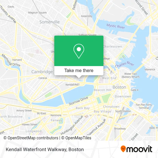
See Kendall Waterfront Walkway, Cambridge, on the map
Public Transit to Kendall Waterfront Walkway in Cambridge
Wondering how to get to Kendall Waterfront Walkway in Cambridge? Moovit helps you find the best way to get to Kendall Waterfront Walkway with step-by-step directions from the nearest public transit station.
Moovit provides free maps and live directions to help you navigate through your city. View schedules, routes, timetables, and find out how long does it take to get to Kendall Waterfront Walkway in real time.
Looking for the nearest stop or station to Kendall Waterfront Walkway? Check out this list of stops closest to your destination: Kendall/MIT - Main St Opp Dock St; Kendall/MIT - Main St @ Hayward St; Main St @ Kendall Station - Red Line; Ames St @ Main St; First St./ Cambridgeside; Kendall/MIT; Lechmere; Community Collge.
Bus: 64, 85, EZRIDE, RED LINE SHUTTLE, RED LINE SHUTTLE, RED LINE SHUTTLE, RED LINE SHUTTLE, RED LINE SHUTTLE, RED LINE SHUTTLE, RED LINE SHUTTLE, RED LINE SHUTTLE, RED LINE SHUTTLE, RED LINE SHUTTLE, 68.Train: FAIRMOUNT, FRAMINGHAM/WORCESTER, GREENBUSH, HAVERHILL, NEEDHAM.Subway: RED LINE, GREEN LINE B, GREEN LINE C, GREEN LINE D, GREEN LINE E, ORANGE LINE.
Want to see if there’s another route that gets you there at an earlier time? Moovit helps you find alternative routes or times. Get directions from and directions to Kendall Waterfront Walkway easily from the Moovit App or Website.
We make riding to Kendall Waterfront Walkway easy, which is why over 1.7 million users, including users in Cambridge, trust Moovit as the best app for public transit. You don’t need to download an individual bus app or train app, Moovit is your all-in-one transit app that helps you find the best bus time or train time available.
For information on prices of bus, subway and train, costs and ride fares to Kendall Waterfront Walkway, please check the Moovit app.
Use the app to navigate to popular places including to the airport, hospital, stadium, grocery store, mall, coffee shop, school, college, and university.
Kendall Waterfront Walkway Address: 350 Kendall St street in Cambridge
- Charles River Labs CRADL,
- Kendall Square Parking Garage,
- Kendall Square South Garage (350 Kendall Street Garage),
- Kendall Square South Plaza,
- IBM,
- Evoo Restaurant,
- Za (Za Cambridge),
- joint ventures,
- Community Ice Skating,
- Appnet (App Net),
- Shy Bird,
- Google Maps,
- Kendall Square,
- Amazon Cambridge,
- Cove,
- Brothers Marketplace,
- Top Design Masonry and Construction,
- Alnylam Pharmaceuticals,
- Broadway / 3rd St,
- Genzyme Shuttle Bus To Framingham
Places Near Kendall Waterfront Walkway (Cambridge)
- Isabella Stewart Gardner Museum, Boston,
- Faneuil Hall, Boston,
- Wang Theater, Boston,
- Boston Common, Boston,
- Seaport District, Boston,
- Cheers, Boston,
- Boston Medical Center, Boston,
- Mgm Music Hall, Boston,
- Td Garden, Boston,
- Boston Convention & Exhibition Center, Boston,
- Boston Children's Hospital, Boston,
- Museum Of Science, Boston,
- Castle Island, Boston,
- Prudential Center, Boston,
- Wilbur Theatre, Boston,
- House Of Blues, Boston,
- North End, Boston,
- Massachusetts General Hospital, Boston,
- Leader Bank Pavilion (Leader Bank Pavillion), Boston,
- Quincy Market, Boston
How to get to popular places in Boston with public transit
Get around Cambridge by public transit!
Traveling around Cambridge has never been so easy. See step by step directions as you travel to any attraction, street or major public transit station. View bus and train schedules, arrival times, service alerts and detailed routes on a map, so you know exactly how to get to anywhere in Cambridge.
When traveling to any destination around Cambridge use Moovit's Live Directions with Get Off Notifications to know exactly where and how far to walk, how long to wait for your line, and how many stops are left. Moovit will alert you when it's time to get off — no need to constantly re-check whether yours is the next stop.
Wondering how to use public transit in Cambridge or how to pay for public transit in Cambridge? Moovit public transit app can help you navigate your way with public transit easily, and at minimum cost. It includes public transit fees, ticket prices, and costs. Looking for a map of Cambridge public transit lines? Moovit public transit app shows all public transit maps in Cambridge with all Bus, Train, Subway and Ferry routes and stops on an interactive map.
Boston has 4 transit type(s), including: Bus, Train, Subway and Ferry, operated by several transit agencies, including MBTA, Southeastern Regional Transit Authority, MetroWest Regional Transit Authority, Rhode Island Public Transit Authority, WRTA, Lowell Regional Transit Authority, Merrimack Valley Transit, Montachusett Regional Transit Authority, Cape Cod Regional Transit Authority, Brockton Area Transit Authority, Martha's Vineyard Transit Authority, the WAVE - Nantucket Regional Transit Authority, GATRA, Cape Ann Transportation Authority and Massport