Directions to Kennedy Park (Cambridge) with public transportation
The following transit lines have routes that pass near Kennedy Park
 Bus: 69, 80, 85, 88, EZRIDE.
- Train: FRAMINGHAM/WORCESTER, HAVERHILL, LOWELL, NEWBURYPORT/ROCKPORT.
- Subway: RED LINE, GREEN LINE D, GREEN LINE E, ORANGE LINE, GREEN LINE B.
How to get to Kennedy Park by bus?
Click on the bus route to see step by step directions with maps, line arrival times and updated time schedules.
From Boston College (BC), Boston
75 minFrom AC Hotel by Marriott Boston Cleveland Circle, Boston
60 minFrom MBTA Suffolk Downs Station, Boston
67 minFrom Six Flags New England, Newton
65 minFrom Everett, MA, Everett
48 minFrom Winchester, MA, Winchester
74 minFrom Stone Zoo, Stoneham
85 minFrom Boda Borg, Malden
64 minFrom Best Western Adams Inn Quincy - Boston, Quincy
100 min
How to get to Kennedy Park by train?
Click on the train route to see step by step directions with maps, line arrival times and updated time schedules.
How to get to Kennedy Park by subway?
Click on the subway route to see step by step directions with maps, line arrival times and updated time schedules.
Bus stops near Kennedy Park in Cambridge
Subway stations near Kennedy Park in Cambridge
Bus lines to Kennedy Park in Cambridge
- 69, Harvard,VIEW
- 85, Ruggles,VIEW
- EZRIDE, Outbound Lechemere To Kendall,VIEW
- EZRIDE, Inbound To North Station From Erie St,VIEW
- EZRIDE, Outbound North Station To Erie St Via Lechmere And Kendall,VIEW
- EZRIDE, Inbound Kendall To Lechmere,VIEW
- EZRIDE, Outbound To Erie St From North Station,VIEW
- EZRIDE, Inbound To North Station Via Kendall And Lechmere,VIEW
- 64, Oak Square,VIEW
- 68, Harvard,VIEW
What are the closest stations to Kennedy Park?
The closest stations to Kennedy Park are:
- Cambridge St Opp Berkshire St is 46 yards away, 1 min walk.
- Kendall/MIT is 334 yards away, 5 min walk.
- Hampshire St @ Portland St is 727 yards away, 9 min walk.
- Binney St. is 985 yards away, 12 min walk.
- Union Square is 996 yards away, 12 min walk.
- Broadway @ Hampshire St is 1064 yards away, 13 min walk.
- Community Collge is 1352 yards away, 16 min walk.
- East Somerville Station is 1615 yards away, 20 min walk.
Which bus lines stop near Kennedy Park?
These bus lines stop near Kennedy Park: 69, 80, 85, 88, EZRIDE.
Which train lines stop near Kennedy Park?
These train lines stop near Kennedy Park: FRAMINGHAM/WORCESTER, HAVERHILL, LOWELL, NEWBURYPORT/ROCKPORT.
Which subway line stops near Kennedy Park?
RED LINE (Alewife)
What’s the nearest subway station to Kennedy Park in Cambridge?
The nearest subway station to Kennedy Park in Cambridge is Kendall/MIT. It’s a 5 min walk away.
What’s the nearest bus station to Kennedy Park in Cambridge?
The nearest bus station to Kennedy Park in Cambridge is Cambridge St Opp Berkshire St. It’s a 1 min walk away.
What time is the first subway to Kennedy Park in Cambridge?
The GREEN LINE E is the first subway that goes to Kennedy Park in Cambridge. It stops nearby at 4:49 AM.
What time is the last subway to Kennedy Park in Cambridge?
The GREEN LINE E is the last subway that goes to Kennedy Park in Cambridge. It stops nearby at 2:34 AM.
What time is the first bus to Kennedy Park in Cambridge?
The 69 is the first bus that goes to Kennedy Park in Cambridge. It stops nearby at 5:34 AM.
What time is the last bus to Kennedy Park in Cambridge?
The 69 is the last bus that goes to Kennedy Park in Cambridge. It stops nearby at 1:23 AM.
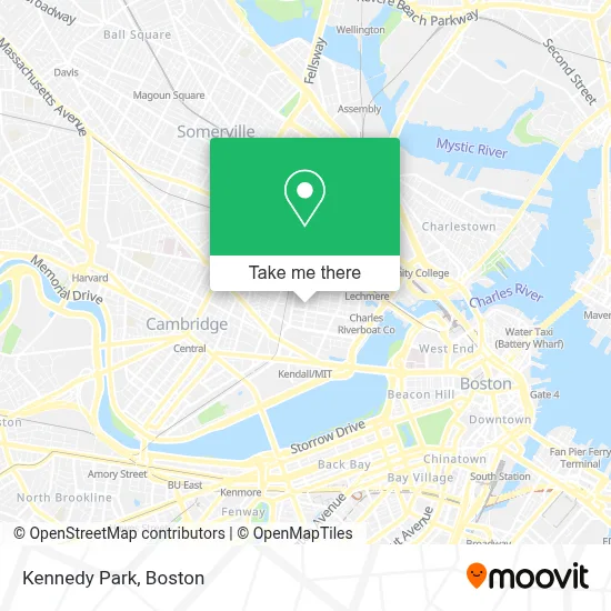
See Kennedy Park, Cambridge, on the map
Public Transit to Kennedy Park in Cambridge
Wondering how to get to Kennedy Park in Cambridge? Moovit helps you find the best way to get to Kennedy Park with step-by-step directions from the nearest public transit station.
Moovit provides free maps and live directions to help you navigate through your city. View schedules, routes, timetables, and find out how long does it take to get to Kennedy Park in real time.
Looking for the nearest stop or station to Kennedy Park? Check out this list of stops closest to your destination: Cambridge St Opp Berkshire St; Kendall/MIT; Hampshire St @ Portland St; Binney St.; Union Square; Broadway @ Hampshire St; Community Collge; East Somerville Station.
Bus: 69, 80, 85, 88, EZRIDE.Train: FRAMINGHAM/WORCESTER, HAVERHILL, LOWELL, NEWBURYPORT/ROCKPORT.Subway: RED LINE, GREEN LINE D, GREEN LINE E, ORANGE LINE, GREEN LINE B, GREEN LINE C.
Want to see if there’s another route that gets you there at an earlier time? Moovit helps you find alternative routes or times. Get directions from and directions to Kennedy Park easily from the Moovit App or Website.
We make riding to Kennedy Park easy, which is why over 1.7 million users, including users in Cambridge, trust Moovit as the best app for public transit. You don’t need to download an individual bus app or train app, Moovit is your all-in-one transit app that helps you find the best bus time or train time available.
For information on prices of bus, subway and train, costs and ride fares to Kennedy Park, please check the Moovit app.
Use the app to navigate to popular places including to the airport, hospital, stadium, grocery store, mall, coffee shop, school, college, and university.
Kennedy Park Address: Kennedy Park street in Cambridge
- Community Charter Sch of Cambridge ,
- Broad Institute,
- 6th St & Bent St,
- Cambridge Police Department,
- Fran-Dan Bolt & Screw Company,
- Cambridge Police Department (Cambridge Police Patrol Officers Association),
- Moderna Therapeutics - Corporate Headquarters,
- Biogen,
- Charles St & Sciarappa St,
- Courthouse Fish Market (Court House Fish Market),
- Suds-Zo Laundromat (Suds-Zo LLC Laundromats),
- Provide,
- Merck & Co. Inc - Cabridge Campus,
- Kendall Square Cinema ,
- Kendall Square Parking Garage,
- Silk Road Uyghur Cuisine,
- Sponty,
- The Snack Bar (O Senhor Ramos),
- Rubius Therapeutics (Relay Therapeutics),
- Gore Field
Places Near Kennedy Park (Cambridge)
- Prudential Center, Boston,
- Wilbur Theatre, Boston,
- Boston Convention & Exhibition Center, Boston,
- Boston Medical Center, Boston,
- North End, Boston,
- Seaport District, Boston,
- Td Garden, Boston,
- Quincy Market, Boston,
- Leader Bank Pavilion (Leader Bank Pavillion), Boston,
- Museum Of Science, Boston,
- House Of Blues, Boston,
- Isabella Stewart Gardner Museum, Boston,
- Faneuil Hall, Boston,
- Boston Children's Hospital, Boston,
- Massachusetts General Hospital, Boston,
- Boston Common, Boston,
- Cheers, Boston,
- Castle Island, Boston,
- Wang Theater, Boston,
- Mgm Music Hall, Boston
How to get to popular places in Boston with public transit
Get around Cambridge by public transit!
Traveling around Cambridge has never been so easy. See step by step directions as you travel to any attraction, street or major public transit station. View bus and train schedules, arrival times, service alerts and detailed routes on a map, so you know exactly how to get to anywhere in Cambridge.
When traveling to any destination around Cambridge use Moovit's Live Directions with Get Off Notifications to know exactly where and how far to walk, how long to wait for your line, and how many stops are left. Moovit will alert you when it's time to get off — no need to constantly re-check whether yours is the next stop.
Wondering how to use public transit in Cambridge or how to pay for public transit in Cambridge? Moovit public transit app can help you navigate your way with public transit easily, and at minimum cost. It includes public transit fees, ticket prices, and costs. Looking for a map of Cambridge public transit lines? Moovit public transit app shows all public transit maps in Cambridge with all Bus, Train, Subway and Ferry routes and stops on an interactive map.
Boston has 4 transit type(s), including: Bus, Train, Subway and Ferry, operated by several transit agencies, including MBTA, Southeastern Regional Transit Authority, MetroWest Regional Transit Authority, Rhode Island Public Transit Authority, WRTA, Lowell Regional Transit Authority, Merrimack Valley Transit, Montachusett Regional Transit Authority, Cape Cod Regional Transit Authority, Brockton Area Transit Authority, Martha's Vineyard Transit Authority, the WAVE - Nantucket Regional Transit Authority, GATRA, Cape Ann Transportation Authority and Massport