Directions to Kenneth Rice (Brookline) with public transportation
The following transit lines have routes that pass near Kenneth Rice
 Bus: 57, 66, 85, CT3, GREEN LINE C SHUTTLE.
- Train: FRAMINGHAM/WORCESTER.
- Subway: GREEN LINE C, GREEN LINE D.
How to get to Kenneth Rice by bus?
Click on the bus route to see step by step directions with maps, line arrival times and updated time schedules.
From PwC, Boston
64 minFrom Staybridge Suites Boston-Quincy, Quincy
114 minFrom Fidelity Investments, Boston
54 minFrom Lower Mills, Boston
85 minFrom Milton, MA, Milton
113 minFrom Capo, Boston
55 minFrom Waltham, MA, Waltham
67 minFrom Beth Israel Deaconess Hospital-Milton, Milton
103 minFrom Milton Academy, Milton
112 minFrom Heartbreak Hill, Newton
50 min
How to get to Kenneth Rice by train?
Click on the train route to see step by step directions with maps, line arrival times and updated time schedules.
How to get to Kenneth Rice by subway?
Click on the subway route to see step by step directions with maps, line arrival times and updated time schedules.
From PwC, Boston
41 minFrom Staybridge Suites Boston-Quincy, Quincy
50 minFrom Fidelity Investments, Boston
31 minFrom Lower Mills, Boston
63 minFrom Milton, MA, Milton
93 minFrom Capo, Boston
47 minFrom Beth Israel Deaconess Hospital-Milton, Milton
92 minFrom Milton Academy, Milton
75 minFrom Heartbreak Hill, Newton
47 min
Subway stations near Kenneth Rice in Brookline
Bus stops near Kenneth Rice in Brookline
- Kent Street, 2 min walk,VIEW
- Saint Paul Street, 4 min walk,VIEW
- Coolidge Corner, 8 min walk,VIEW
- Mountfort St @ Carlton St, 8 min walk,VIEW
- Harvard St @ Beacon St, 9 min walk,VIEW
- Saint Mary's Street, 9 min walk,VIEW
- Brookline, 9 min walk,VIEW
- Saint Mary's Street - Beacon St @ Saint Mary's St, 10 min walk,VIEW
- Comm Ave @ Amory St, 11 min walk,VIEW
Bus lines to Kenneth Rice in Brookline
- GREEN LINE C SHUTTLE, Saint Mary's Street (Shuttle),VIEW
- SHUTTLE, Cleveland Circle (Shuttle),VIEW
- GREEN LINE C SHUTTLE, Cleveland Circle (Shuttle),VIEW
- 47, Broadway,VIEW
- 57, Watertown Yard,VIEW
- 85, Ruggles,VIEW
- 66, Nubian Via Allston,VIEW
- FLIXBUS 2610, New York (Hudson Yards),VIEW
- FLIXBUS N2605, Henrico (Parham Rd Park & Ride),VIEW
- FLIXBUS N2610, New York Midtown (31st St & 8th Ave),VIEW
- GREEN LINE C SHUTTLE, Saint Mary's Street - Back Bay,VIEW
- GREEN LINE D SHUTTLE, Riverside - Kenmore via Saint Mary's Street,VIEW
- GREEN LINE D SHUTTLE, Newton Highlands - Kenmore via Saint Mary's Street,VIEW
- 1 BU (CHARLES RIVER-MEDICAL CAMPUS), Comm Ave @ Buick St,VIEW
- COMM AVE, Agganis Way,VIEW
What are the closest stations to Kenneth Rice?
The closest stations to Kenneth Rice are:
- Kent Street is 109 yards away, 2 min walk.
- Saint Paul Street is 267 yards away, 4 min walk.
- Coolidge Corner is 639 yards away, 8 min walk.
- Mountfort St @ Carlton St is 644 yards away, 8 min walk.
- Harvard St @ Beacon St is 710 yards away, 9 min walk.
- Saint Mary's Street is 733 yards away, 9 min walk.
- Brookline is 747 yards away, 9 min walk.
- Saint Mary's Street - Beacon St @ Saint Mary's St is 811 yards away, 10 min walk.
- Chapel St, Colchester St is 838 yards away, 10 min walk.
- Comm Ave @ Amory St is 865 yards away, 11 min walk.
Which bus lines stop near Kenneth Rice?
These bus lines stop near Kenneth Rice: 57, 66, 85, CT3.
Which train line stops near Kenneth Rice?
FRAMINGHAM/WORCESTER (#525 | Worcester)
Which subway line stops near Kenneth Rice?
GREEN LINE C (Cleveland Circle)
What’s the nearest subway station to Kenneth Rice in Brookline?
The nearest subway station to Kenneth Rice in Brookline is Kent Street. It’s a 2 min walk away.
What’s the nearest bus station to Kenneth Rice in Brookline?
The nearest bus station to Kenneth Rice in Brookline is Kent Street. It’s a 2 min walk away.
What time is the first subway to Kenneth Rice in Brookline?
The GREEN LINE D is the first subway that goes to Kenneth Rice in Brookline. It stops nearby at 4:55 AM.
What time is the last subway to Kenneth Rice in Brookline?
The GREEN LINE D is the last subway that goes to Kenneth Rice in Brookline. It stops nearby at 2:22 AM.
What time is the first bus to Kenneth Rice in Brookline?
The 66 is the first bus that goes to Kenneth Rice in Brookline. It stops nearby at 5:00 AM.
What time is the last bus to Kenneth Rice in Brookline?
The FLIXBUS N2605 is the last bus that goes to Kenneth Rice in Brookline. It stops nearby at 9:05 AM.
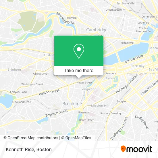
See Kenneth Rice, Brookline, on the map
Public Transit to Kenneth Rice in Brookline
Wondering how to get to Kenneth Rice in Brookline? Moovit helps you find the best way to get to Kenneth Rice with step-by-step directions from the nearest public transit station.
Moovit provides free maps and live directions to help you navigate through your city. View schedules, routes, timetables, and find out how long does it take to get to Kenneth Rice in real time.
Looking for the nearest stop or station to Kenneth Rice? Check out this list of stops closest to your destination: Kent Street; Saint Paul Street; Coolidge Corner; Mountfort St @ Carlton St; Harvard St @ Beacon St; Saint Mary's Street; Brookline; Saint Mary's Street - Beacon St @ Saint Mary's St; Chapel St; Comm Ave @ Amory St.
Bus: 57, 66, 85, CT3, GREEN LINE C SHUTTLE, SHUTTLE, GREEN LINE C SHUTTLE, 47.Train: FRAMINGHAM/WORCESTER.Subway: GREEN LINE C, GREEN LINE D.
Want to see if there’s another route that gets you there at an earlier time? Moovit helps you find alternative routes or times. Get directions from and directions to Kenneth Rice easily from the Moovit App or Website.
We make riding to Kenneth Rice easy, which is why over 1.7 million users, including users in Brookline, trust Moovit as the best app for public transit. You don’t need to download an individual bus app or train app, Moovit is your all-in-one transit app that helps you find the best bus time or train time available.
For information on prices of subway, bus and train, costs and ride fares to Kenneth Rice, please check the Moovit app.
Use the app to navigate to popular places including to the airport, hospital, stadium, grocery store, mall, coffee shop, school, college, and university.
Kenneth Rice Address: 1180 Beacon St Ste 7C street in Brookline
- Steven S. Bloom, Esq.,
- Alla Tandetnik,
- Frederick Mandell MD,
- Brigham and Women's Hospital,
- Jay H Morgenstern DMD,
- NE Facial Plastic & Re,
- Brookline Peds (Brookline Pediatrics L),
- Nicole Hurley Boudreau,
- Brigham & Women's Primary Care,
- Tammy Weitzman, Licsw,
- Jeffery Lucak, Pa,
- Holtzman Medical Group,
- St Elizabeth's Hospital,
- R Roger Komer Dr (Cyrus Komer),
- Holinger Dr D P,
- Hall's Pond Sanctuary,
- MBTA Kent Street Station,
- Amory Playground (Amory Park),
- MBTA-Kent St,
- Amory Park
Places Near Kenneth Rice (Brookline)
- Wang Theater, Boston,
- Museum Of Science, Boston,
- Massachusetts General Hospital, Boston,
- Isabella Stewart Gardner Museum, Boston,
- Seaport District, Boston,
- Boston Common, Boston,
- Wilbur Theatre, Boston,
- Boston Medical Center, Boston,
- Td Garden, Boston,
- House Of Blues, Boston,
- Boston Convention & Exhibition Center, Boston,
- Leader Bank Pavilion (Leader Bank Pavillion), Boston,
- North End, Boston,
- Castle Island, Boston,
- Cheers, Boston,
- Prudential Center, Boston,
- Mgm Music Hall, Boston,
- Faneuil Hall, Boston,
- Quincy Market, Boston,
- Boston Children's Hospital, Boston
How to get to popular places in Boston with public transit
Get around Brookline by public transit!
Traveling around Brookline has never been so easy. See step by step directions as you travel to any attraction, street or major public transit station. View bus and train schedules, arrival times, service alerts and detailed routes on a map, so you know exactly how to get to anywhere in Brookline.
When traveling to any destination around Brookline use Moovit's Live Directions with Get Off Notifications to know exactly where and how far to walk, how long to wait for your line, and how many stops are left. Moovit will alert you when it's time to get off — no need to constantly re-check whether yours is the next stop.
Wondering how to use public transit in Brookline or how to pay for public transit in Brookline? Moovit public transit app can help you navigate your way with public transit easily, and at minimum cost. It includes public transit fees, ticket prices, and costs. Looking for a map of Brookline public transit lines? Moovit public transit app shows all public transit maps in Brookline with all Bus, Train, Subway and Ferry routes and stops on an interactive map.
Boston has 4 transit type(s), including: Bus, Train, Subway and Ferry, operated by several transit agencies, including MBTA, Southeastern Regional Transit Authority, MetroWest Regional Transit Authority, Rhode Island Public Transit Authority, WRTA, Lowell Regional Transit Authority, Merrimack Valley Transit, Montachusett Regional Transit Authority, Cape Cod Regional Transit Authority, Brockton Area Transit Authority, Martha's Vineyard Transit Authority, the WAVE - Nantucket Regional Transit Authority, GATRA, Cape Ann Transportation Authority and Massport