Directions to Kevin Day Photography (Boston) with public transportation
The following transit lines have routes that pass near Kevin Day Photography
 Bus: 9, SL4, SL5, 11, 15.
- Train: FITCHBURG, FRAMINGHAM/WORCESTER, NEEDHAM, FOXBORO EVENT SERVICE, FRANKLIN/FOXBORO.
- Subway: GREEN LINE B, GREEN LINE D, ORANGE LINE, RED LINE, GREEN LINE C.
How to get to Kevin Day Photography by bus?
Click on the bus route to see step by step directions with maps, line arrival times and updated time schedules.
From FOUR POINTS BY SHERATON Boston Newton, Newton
33 minFrom Newton, MA, Newton
68 minFrom Faulkner Hospital, Boston
52 minFrom 7F Everett Street, Revere
64 minFrom Davis Sq, Somerville
65 minFrom Milton, MA, Milton
86 minFrom West Roxbury, Boston
51 minFrom Assembly Square, Somerville
66 minFrom Boston College, Boston
66 minFrom Market Basket, Revere
64 min
How to get to Kevin Day Photography by train?
Click on the train route to see step by step directions with maps, line arrival times and updated time schedules.
How to get to Kevin Day Photography by subway?
Click on the subway route to see step by step directions with maps, line arrival times and updated time schedules.
Bus stops near Kevin Day Photography in Boston
Subway stations near Kevin Day Photography in Boston
Train station near Kevin Day Photography in Boston
- Back Bay - South End, 7 min walk,VIEW
Bus lines to Kevin Day Photography in Boston
What are the closest stations to Kevin Day Photography?
The closest stations to Kevin Day Photography are:
- E Berkeley St @ Harrison Ave is 58 yards away, 1 min walk.
- Washington St @ E Berkeley St is 222 yards away, 3 min walk.
- Arlington is 305 yards away, 4 min walk.
- Tufts Medical Center is 533 yards away, 7 min walk.
- Back Bay - South End is 559 yards away, 7 min walk.
- Harrison Ave Opp Plympton St is 580 yards away, 7 min walk.
- 540 Albany St Opp Wareham St is 1183 yards away, 15 min walk.
- Broadway is 1717 yards away, 21 min walk.
Which bus lines stop near Kevin Day Photography?
These bus lines stop near Kevin Day Photography: 9, SL4, SL5.
Which train lines stop near Kevin Day Photography?
These train lines stop near Kevin Day Photography: FITCHBURG, FRAMINGHAM/WORCESTER, NEEDHAM.
Which subway lines stop near Kevin Day Photography?
These subway lines stop near Kevin Day Photography: GREEN LINE B, GREEN LINE D, ORANGE LINE, RED LINE.
What’s the nearest subway station to Kevin Day Photography in Boston?
The nearest subway station to Kevin Day Photography in Boston is Arlington. It’s a 4 min walk away.
What’s the nearest train station to Kevin Day Photography in Boston?
The nearest train station to Kevin Day Photography in Boston is Back Bay - South End. It’s a 7 min walk away.
What’s the nearest bus station to Kevin Day Photography in Boston?
The nearest bus station to Kevin Day Photography in Boston is E Berkeley St @ Harrison Ave. It’s a 1 min walk away.
What time is the first subway to Kevin Day Photography in Boston?
The GREEN LINE D is the first subway that goes to Kevin Day Photography in Boston. It stops nearby at 5:07 AM.
What time is the last subway to Kevin Day Photography in Boston?
The GREEN LINE E is the last subway that goes to Kevin Day Photography in Boston. It stops nearby at 2:14 AM.
What time is the first train to Kevin Day Photography in Boston?
The PROVIDENCE/STOUGHTON is the first train that goes to Kevin Day Photography in Boston. It stops nearby at 4:25 AM.
What time is the last train to Kevin Day Photography in Boston?
The LAKE SHORE LIMITED is the last train that goes to Kevin Day Photography in Boston. It stops nearby at 8:26 PM.
What time is the first bus to Kevin Day Photography in Boston?
The 15 is the first bus that goes to Kevin Day Photography in Boston. It stops nearby at 5:04 AM.
What time is the last bus to Kevin Day Photography in Boston?
The 47 is the last bus that goes to Kevin Day Photography in Boston. It stops nearby at 1:28 AM.
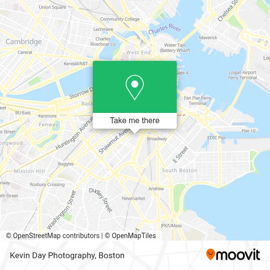
See Kevin Day Photography, Boston, on the map
Public Transit to Kevin Day Photography in Boston
Wondering how to get to Kevin Day Photography in Boston? Moovit helps you find the best way to get to Kevin Day Photography with step-by-step directions from the nearest public transit station.
Moovit provides free maps and live directions to help you navigate through your city. View schedules, routes, timetables, and find out how long does it take to get to Kevin Day Photography in real time.
Looking for the nearest stop or station to Kevin Day Photography? Check out this list of stops closest to your destination: E Berkeley St @ Harrison Ave; Washington St @ E Berkeley St; Arlington; Tufts Medical Center; Back Bay - South End; Harrison Ave Opp Plympton St; 540 Albany St Opp Wareham St; Broadway.
Bus: 9, SL4, SL5, 11, 15.Train: FITCHBURG, FRAMINGHAM/WORCESTER, NEEDHAM, FOXBORO EVENT SERVICE, FRANKLIN/FOXBORO, PROVIDENCE/STOUGHTON.Subway: GREEN LINE B, GREEN LINE D, ORANGE LINE, RED LINE, GREEN LINE C, GREEN LINE E.
Want to see if there’s another route that gets you there at an earlier time? Moovit helps you find alternative routes or times. Get directions from and directions to Kevin Day Photography easily from the Moovit App or Website.
We make riding to Kevin Day Photography easy, which is why over 1.7 million users, including users in Boston, trust Moovit as the best app for public transit. You don’t need to download an individual bus app or train app, Moovit is your all-in-one transit app that helps you find the best bus time or train time available.
For information on prices of bus, subway and train, costs and ride fares to Kevin Day Photography, please check the Moovit app.
Use the app to navigate to popular places including to the airport, hospital, stadium, grocery store, mall, coffee shop, school, college, and university.
Kevin Day Photography Address: 460 Harrison Ave street in Boston
- Sowa Open Market (Sowa Farmers Market),
- SoWa Vintage Market,
- Laconia Gallery,
- SoWa Open Market,
- Pine Street Inn,
- #110,
- Sowa,
- J.J. Foley's Cafe (JJ Foleys Cafe),
- Illuminate,
- J.J. Foley's Cafe,
- Stitch and Tickle,
- Rotch Park Soccer Field,
- Cathedral Station,
- Dover Station MBTA,
- Panini Sante,
- Myers + Chang ,
- Pine Street Women's Inn,
- Ming's Supermarket (Wang Jia Supermarket I),
- Harris,
- Mbta Albany Street Garage
Places Near Kevin Day Photography (Boston)
- House Of Blues, Boston,
- Wilbur Theatre, Boston,
- Prudential Center, Boston,
- Museum Of Science, Boston,
- Castle Island, Boston,
- North End, Boston,
- Boston Children's Hospital, Boston,
- Faneuil Hall, Boston,
- Boston Medical Center, Boston,
- Cheers, Boston,
- Leader Bank Pavilion (Leader Bank Pavillion), Boston,
- Massachusetts General Hospital, Boston,
- Mgm Music Hall, Boston,
- Seaport District, Boston,
- Boston Common, Boston,
- Td Garden, Boston,
- Wang Theater, Boston,
- Boston Convention & Exhibition Center, Boston,
- Quincy Market, Boston,
- Isabella Stewart Gardner Museum, Boston
How to get to popular places in Boston with public transit
Get around Boston by public transit!
Traveling around Boston has never been so easy. See step by step directions as you travel to any attraction, street or major public transit station. View bus and train schedules, arrival times, service alerts and detailed routes on a map, so you know exactly how to get to anywhere in Boston.
When traveling to any destination around Boston use Moovit's Live Directions with Get Off Notifications to know exactly where and how far to walk, how long to wait for your line, and how many stops are left. Moovit will alert you when it's time to get off — no need to constantly re-check whether yours is the next stop.
Wondering how to use public transit in Boston or how to pay for public transit in Boston? Moovit public transit app can help you navigate your way with public transit easily, and at minimum cost. It includes public transit fees, ticket prices, and costs. Looking for a map of Boston public transit lines? Moovit public transit app shows all public transit maps in Boston with all Bus, Train, Subway and Ferry routes and stops on an interactive map.
Boston has 4 transit type(s), including: Bus, Train, Subway and Ferry, operated by several transit agencies, including MBTA, Southeastern Regional Transit Authority, MetroWest Regional Transit Authority, Rhode Island Public Transit Authority, WRTA, Lowell Regional Transit Authority, Merrimack Valley Transit, Montachusett Regional Transit Authority, Cape Cod Regional Transit Authority, Brockton Area Transit Authority, Martha's Vineyard Transit Authority, the WAVE - Nantucket Regional Transit Authority, GATRA, Cape Ann Transportation Authority and Massport