Directions to Keyme Locksmiths (Boston) with public transportation
The following transit lines have routes that pass near Keyme Locksmiths
 Bus: 14, 30, 32, 33, 39.
- Train: FRANKLIN/FOXBORO, NEEDHAM, FAIRMOUNT LINE SHUTTLE, FAIRMOUNT, PROVIDENCE/STOUGHTON.
- Subway: MATTAPAN LINE, ORANGE LINE.
How to get to Keyme Locksmiths by bus?
Click on the bus route to see step by step directions with maps, line arrival times and updated time schedules.
From Primark Boston, Boston
62 minFrom Boston Tea Party - Ships And Museum, Boston
66 minFrom Primark, Boston
62 minFrom Dedham, MA, Dedham
46 minFrom Nubian Square Station, Boston
33 minFrom Boston Convention & Exhibition Center, Boston
78 minFrom Skating Club Of Boston, Boston
74 minFrom Hatch Shell, Boston
66 minFrom Capo, Boston
71 minFrom Google, Cambridge
77 min
How to get to Keyme Locksmiths by train?
Click on the train route to see step by step directions with maps, line arrival times and updated time schedules.
From Primark Boston, Boston
53 minFrom Boston Tea Party - Ships And Museum, Boston
50 minFrom Primark, Boston
53 minFrom Dedham, MA, Dedham
50 minFrom Nubian Square Station, Boston
52 minFrom Boston Convention & Exhibition Center, Boston
66 minFrom Skating Club Of Boston, Boston
88 minFrom Hatch Shell, Boston
60 min
How to get to Keyme Locksmiths by subway?
Click on the subway route to see step by step directions with maps, line arrival times and updated time schedules.
From Primark Boston, Boston
60 minFrom Boston Tea Party - Ships And Museum, Boston
72 minFrom Primark, Boston
59 minFrom Nubian Square Station, Boston
65 minFrom Boston Convention & Exhibition Center, Boston
86 minFrom Skating Club Of Boston, Boston
125 minFrom Hatch Shell, Boston
84 minFrom Capo, Boston
81 minFrom Google, Cambridge
78 min
Bus stops near Keyme Locksmiths in Boston
Train stations near Keyme Locksmiths in Boston
Subway station near Keyme Locksmiths in Boston
- Mattapan, 38 min walk,VIEW
Bus lines to Keyme Locksmiths in Boston
What are the closest stations to Keyme Locksmiths?
The closest stations to Keyme Locksmiths are:
- 950 American Legion Hwy is 214 yards away, 3 min walk.
- Cummins Hwy Opp Calvary Cemetery is 348 yards away, 5 min walk.
- Fairmount is 510 yards away, 7 min walk.
- Hyde Park Ave @ American Legion Hwy is 667 yards away, 9 min walk.
- Roslindale Village is 2533 yards away, 30 min walk.
- Mattapan is 3259 yards away, 38 min walk.
Which bus lines stop near Keyme Locksmiths?
These bus lines stop near Keyme Locksmiths: 14, 30, 32.
Which train lines stop near Keyme Locksmiths?
These train lines stop near Keyme Locksmiths: FRANKLIN/FOXBORO, NEEDHAM.
Which subway lines stop near Keyme Locksmiths?
These subway lines stop near Keyme Locksmiths: MATTAPAN LINE, ORANGE LINE.
What’s the nearest train station to Keyme Locksmiths in Boston?
The nearest train station to Keyme Locksmiths in Boston is Fairmount. It’s a 7 min walk away.
What’s the nearest bus station to Keyme Locksmiths in Boston?
The nearest bus station to Keyme Locksmiths in Boston is 950 American Legion Hwy. It’s a 3 min walk away.
What time is the first subway to Keyme Locksmiths in Boston?
The MATTAPAN LINE is the first subway that goes to Keyme Locksmiths in Boston. It stops nearby at 5:00 AM.
What time is the last subway to Keyme Locksmiths in Boston?
The MATTAPAN LINE is the last subway that goes to Keyme Locksmiths in Boston. It stops nearby at 2:40 AM.
What time is the first train to Keyme Locksmiths in Boston?
The FAIRMOUNT is the first train that goes to Keyme Locksmiths in Boston. It stops nearby at 4:33 AM.
What time is the last train to Keyme Locksmiths in Boston?
The PROVIDENCE/STOUGHTON is the last train that goes to Keyme Locksmiths in Boston. It stops nearby at 12:22 AM.
What time is the first bus to Keyme Locksmiths in Boston?
The 39 is the first bus that goes to Keyme Locksmiths in Boston. It stops nearby at 4:30 AM.
What time is the last bus to Keyme Locksmiths in Boston?
The 32 is the last bus that goes to Keyme Locksmiths in Boston. It stops nearby at 1:34 AM.
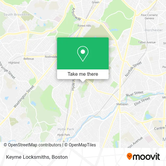
See Keyme Locksmiths, Boston, on the map
Public Transit to Keyme Locksmiths in Boston
Wondering how to get to Keyme Locksmiths in Boston? Moovit helps you find the best way to get to Keyme Locksmiths with step-by-step directions from the nearest public transit station.
Moovit provides free maps and live directions to help you navigate through your city. View schedules, routes, timetables, and find out how long does it take to get to Keyme Locksmiths in real time.
Looking for the nearest stop or station to Keyme Locksmiths? Check out this list of stops closest to your destination: 950 American Legion Hwy; Cummins Hwy Opp Calvary Cemetery; Fairmount; Hyde Park Ave @ American Legion Hwy; Roslindale Village; Mattapan.
Bus: 14, 30, 32, 33, 39.Train: FRANKLIN/FOXBORO, NEEDHAM, FAIRMOUNT LINE SHUTTLE, FAIRMOUNT, PROVIDENCE/STOUGHTON.Subway: MATTAPAN LINE, ORANGE LINE.
Want to see if there’s another route that gets you there at an earlier time? Moovit helps you find alternative routes or times. Get directions from and directions to Keyme Locksmiths easily from the Moovit App or Website.
We make riding to Keyme Locksmiths easy, which is why over 1.7 million users, including users in Boston, trust Moovit as the best app for public transit. You don’t need to download an individual bus app or train app, Moovit is your all-in-one transit app that helps you find the best bus time or train time available.
For information on prices of bus, subway and train, costs and ride fares to Keyme Locksmiths, please check the Moovit app.
Use the app to navigate to popular places including to the airport, hospital, stadium, grocery store, mall, coffee shop, school, college, and university.
Keyme Locksmiths Address: 950 American Legion Highway street in Boston
- Coinstar - Bitcoin ATM,
- WING STOP,
- Crunch Fitness,
- Laundder Bright Laundry Mat,
- Flaming Grill Buffet,
- Oak Lawn Memorial,
- Mass Marketing Investment Solutions,
- Pentecostal Church Assemblies God,
- Canniff Monument,
- Metro Towing,
- U-Haul,
- Locks & Lockout Service,
- Canterbury St & Hyde Park Ave,
- Beara Pub,
- Wolrd Strong International,
- Mason Callahan Locksmith,
- Roslindale Sewr and Drain,
- The Glorious Church of Jesus Christ,
- Saints Memorial New Life Community Center,
- Amazing Grace Christian School
Places Near Keyme Locksmiths (Boston)
- Boston Convention & Exhibition Center, Boston,
- Castle Island, Boston,
- Museum Of Science, Boston,
- Wilbur Theatre, Boston,
- Seaport District, Boston,
- Quincy Market, Boston,
- House Of Blues, Boston,
- Cheers, Boston,
- Prudential Center, Boston,
- Massachusetts General Hospital, Boston,
- Isabella Stewart Gardner Museum, Boston,
- Boston Common, Boston,
- Boston Children's Hospital, Boston,
- North End, Boston,
- Td Garden, Boston,
- Wang Theater, Boston,
- Faneuil Hall, Boston,
- Mgm Music Hall, Boston,
- Boston Medical Center, Boston,
- Leader Bank Pavilion (Leader Bank Pavillion), Boston
How to get to popular places in Boston with public transit
Get around Boston by public transit!
Traveling around Boston has never been so easy. See step by step directions as you travel to any attraction, street or major public transit station. View bus and train schedules, arrival times, service alerts and detailed routes on a map, so you know exactly how to get to anywhere in Boston.
When traveling to any destination around Boston use Moovit's Live Directions with Get Off Notifications to know exactly where and how far to walk, how long to wait for your line, and how many stops are left. Moovit will alert you when it's time to get off — no need to constantly re-check whether yours is the next stop.
Wondering how to use public transit in Boston or how to pay for public transit in Boston? Moovit public transit app can help you navigate your way with public transit easily, and at minimum cost. It includes public transit fees, ticket prices, and costs. Looking for a map of Boston public transit lines? Moovit public transit app shows all public transit maps in Boston with all Bus, Train, Subway and Ferry routes and stops on an interactive map.
Boston has 4 transit type(s), including: Bus, Train, Subway and Ferry, operated by several transit agencies, including MBTA, Southeastern Regional Transit Authority, MetroWest Regional Transit Authority, Rhode Island Public Transit Authority, WRTA, Lowell Regional Transit Authority, Merrimack Valley Transit, Montachusett Regional Transit Authority, Cape Cod Regional Transit Authority, Brockton Area Transit Authority, Martha's Vineyard Transit Authority, the WAVE - Nantucket Regional Transit Authority, GATRA, Cape Ann Transportation Authority and Massport