Directions to Kid Cuts & Fun (Saugus) with public transportation
The following transit lines have routes that pass near Kid Cuts & Fun
 Bus: 426, 428.
- Train: NEWBURYPORT/ROCKPORT.
- Ferry: LYNN FERRY.
How to get to Kid Cuts & Fun by bus?
Click on the bus route to see step by step directions with maps, line arrival times and updated time schedules.
From moakley federal court house, Boston
68 minFrom Embassy Suites Boston At Logan, Boston
73 minFrom Embassy Suites-Boston, Boston
72 minFrom Embassy Suites by Hilton Boston at Logan Airport, Boston
72 minFrom Bunker Hill, Boston
45 minFrom LEGOLAND Discovery Center Boston, Somerville
66 minFrom Canobie Lake Park, Chelsea
60 minFrom Target, Everett
68 minFrom Hampton Inn Boston Logan Airport Chelsea, Chelsea
56 minFrom Hampton Inn Boston Logan Airport, Revere
49 min
How to get to Kid Cuts & Fun by train?
Click on the train route to see step by step directions with maps, line arrival times and updated time schedules.
Bus stop near Kid Cuts & Fun in Saugus
- Lincoln Ave Opp Overlea Ave, 4 min walk,VIEW
Train station near Kid Cuts & Fun in Saugus
- River Works, 34 min walk,VIEW
Ferry station near Kid Cuts & Fun in Saugus
- Blossom Street Pier, 44 min walk,VIEW
Bus lines to Kid Cuts & Fun in Saugus
What are the closest stations to Kid Cuts & Fun?
The closest stations to Kid Cuts & Fun are:
- Lincoln Ave Opp Overlea Ave is 337 yards away, 4 min walk.
- River Works is 2900 yards away, 34 min walk.
- Blossom Street Pier is 3677 yards away, 44 min walk.
Which bus line stops near Kid Cuts & Fun?
426 (Central Square Via Cliftondale)
Which train line stops near Kid Cuts & Fun?
NEWBURYPORT/ROCKPORT (#45 | Rockport)
What’s the nearest bus station to Kid Cuts & Fun in Saugus?
The nearest bus station to Kid Cuts & Fun in Saugus is Lincoln Ave Opp Overlea Ave. It’s a 4 min walk away.
What time is the first train to Kid Cuts & Fun in Saugus?
The NEWBURYPORT/ROCKPORT is the first train that goes to Kid Cuts & Fun in Saugus. It stops nearby at 5:30 AM.
What time is the last train to Kid Cuts & Fun in Saugus?
The NEWBURYPORT/ROCKPORT is the last train that goes to Kid Cuts & Fun in Saugus. It stops nearby at 12:17 AM.
What time is the first bus to Kid Cuts & Fun in Saugus?
The 426 is the first bus that goes to Kid Cuts & Fun in Saugus. It stops nearby at 5:18 AM.
What time is the last bus to Kid Cuts & Fun in Saugus?
The 426 is the last bus that goes to Kid Cuts & Fun in Saugus. It stops nearby at 1:31 AM.
What time is the first ferry to Kid Cuts & Fun in Saugus?
The LYNN FERRY is the first ferry that goes to Kid Cuts & Fun in Saugus. It stops nearby at 6:00 AM.
What time is the last ferry to Kid Cuts & Fun in Saugus?
The LYNN FERRY is the last ferry that goes to Kid Cuts & Fun in Saugus. It stops nearby at 7:55 PM.
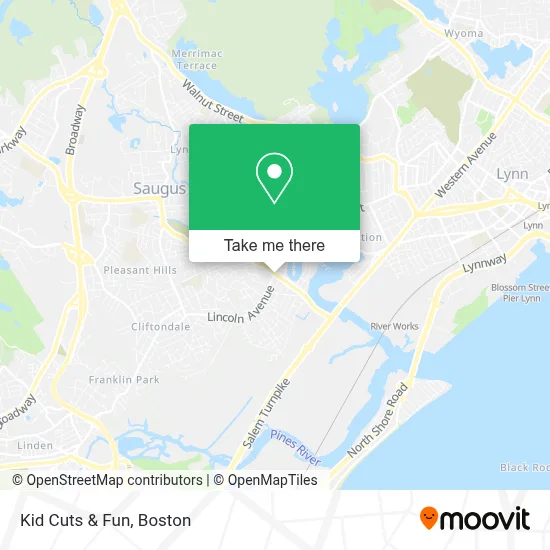
See Kid Cuts & Fun, Saugus, on the map
Public Transit to Kid Cuts & Fun in Saugus
Wondering how to get to Kid Cuts & Fun in Saugus? Moovit helps you find the best way to get to Kid Cuts & Fun with step-by-step directions from the nearest public transit station.
Moovit provides free maps and live directions to help you navigate through your city. View schedules, routes, timetables, and find out how long does it take to get to Kid Cuts & Fun in real time.
Looking for the nearest stop or station to Kid Cuts & Fun? Check out this list of stops closest to your destination: Lincoln Ave Opp Overlea Ave; River Works; Blossom Street Pier.
Bus: 426, 428.Train: NEWBURYPORT/ROCKPORT.Ferry: LYNN FERRY.
Want to see if there’s another route that gets you there at an earlier time? Moovit helps you find alternative routes or times. Get directions from and directions to Kid Cuts & Fun easily from the Moovit App or Website.
We make riding to Kid Cuts & Fun easy, which is why over 1.7 million users, including users in Saugus, trust Moovit as the best app for public transit. You don’t need to download an individual bus app or train app, Moovit is your all-in-one transit app that helps you find the best bus time or train time available.
For information on prices of bus, subway and train, costs and ride fares to Kid Cuts & Fun, please check the Moovit app.
Use the app to navigate to popular places including to the airport, hospital, stadium, grocery store, mall, coffee shop, school, college, and university.
Kid Cuts & Fun Address: 86 Lincoln Ave street in Saugus
- Kids Cuts and Fun,
- MBTA 426 / 426W to Haymarket / Wonderland,
- Chestnut Woods Operator,
- Vincenzo Giovinco & Son Ceramic Tile & Installation,
- Massachusetts Green Retail,
- Salem Emergency Plumbing Service,
- Prodigy Locksmith & Key,
- Fujii Locksmith,
- Lje Masonry Construction & Irrigation,
- Businesslike Heating & Cooling Repair Hvac,
- Remark Deal,
- Vitale Park,
- Carroll's Boston Street Car Wash,
- Kare Painting and Property Services,
- Family Place Roast Beef And Pizza,
- Cogliano Plaza,
- Joe Beer and Wine,
- Razors Edge Barbershop,
- DSS-Thermo King,
- A St
Places Near Kid Cuts & Fun (Saugus)
- Prudential Center, Boston,
- Leader Bank Pavilion (Leader Bank Pavillion), Boston,
- Td Garden, Boston,
- Wang Theater, Boston,
- Massachusetts General Hospital, Boston,
- Isabella Stewart Gardner Museum, Boston,
- Museum Of Science, Boston,
- Boston Children's Hospital, Boston,
- Mgm Music Hall, Boston,
- Quincy Market, Boston,
- Wilbur Theatre, Boston,
- Boston Convention & Exhibition Center, Boston,
- North End, Boston,
- Cheers, Boston,
- Seaport District, Boston,
- Faneuil Hall, Boston,
- House Of Blues, Boston,
- Boston Medical Center, Boston,
- Boston Common, Boston,
- Castle Island, Boston
How to get to popular places in Boston with public transit
Get around Saugus by public transit!
Traveling around Saugus has never been so easy. See step by step directions as you travel to any attraction, street or major public transit station. View bus and train schedules, arrival times, service alerts and detailed routes on a map, so you know exactly how to get to anywhere in Saugus.
When traveling to any destination around Saugus use Moovit's Live Directions with Get Off Notifications to know exactly where and how far to walk, how long to wait for your line, and how many stops are left. Moovit will alert you when it's time to get off — no need to constantly re-check whether yours is the next stop.
Wondering how to use public transit in Saugus or how to pay for public transit in Saugus? Moovit public transit app can help you navigate your way with public transit easily, and at minimum cost. It includes public transit fees, ticket prices, and costs. Looking for a map of Saugus public transit lines? Moovit public transit app shows all public transit maps in Saugus with all Bus, Train, Subway and Ferry routes and stops on an interactive map.
Boston has 4 transit type(s), including: Bus, Train, Subway and Ferry, operated by several transit agencies, including MBTA, Southeastern Regional Transit Authority, MetroWest Regional Transit Authority, Rhode Island Public Transit Authority, WRTA, Lowell Regional Transit Authority, Merrimack Valley Transit, Montachusett Regional Transit Authority, Cape Cod Regional Transit Authority, Brockton Area Transit Authority, Martha's Vineyard Transit Authority, the WAVE - Nantucket Regional Transit Authority, GATRA, Cape Ann Transportation Authority and Massport