Directions to Killer Bee's Boxing & Fight Sports (Boston) with public transportation
The following transit lines have routes that pass near Killer Bee's Boxing & Fight Sports
 Bus: 1, 12, 76.
- Train: PROVIDENCE/STOUGHTON, FOXBORO EVENT SERVICE.
How to get to Killer Bee's Boxing & Fight Sports by bus?
Click on the bus route to see step by step directions with maps, line arrival times and updated time schedules.
How to get to Killer Bee's Boxing & Fight Sports by train?
Click on the train route to see step by step directions with maps, line arrival times and updated time schedules.
Bus stops near Killer Bee's Boxing & Fight Sports in Boston
Train stations near Killer Bee's Boxing & Fight Sports in Boston
Bus lines to Killer Bee's Boxing & Fight Sports in Boston
What are the closest stations to Killer Bee's Boxing & Fight Sports?
The closest stations to Killer Bee's Boxing & Fight Sports are:
- Central Before Freeman is 645 yards away, 8 min walk.
- Benefit & Broadway is 651 yards away, 8 min walk.
- Benefit St. is 651 yards away, 8 min walk.
- South Attleboro is 2092 yards away, 25 min walk.
- Pawtucket/Central Falls is 3730 yards away, 44 min walk.
Which bus lines stop near Killer Bee's Boxing & Fight Sports?
These bus lines stop near Killer Bee's Boxing & Fight Sports: 1, 12.
Which train line stops near Killer Bee's Boxing & Fight Sports?
PROVIDENCE/STOUGHTON (#828 | South Station)
What’s the nearest train station to Killer Bee's Boxing & Fight Sports in Boston?
The nearest train station to Killer Bee's Boxing & Fight Sports in Boston is South Attleboro. It’s a 25 min walk away.
What’s the nearest bus station to Killer Bee's Boxing & Fight Sports in Boston?
The nearest bus stations to Killer Bee's Boxing & Fight Sports in Boston are Central Before Freeman, Benefit & Broadway and Benefit St.. The closest one is a 8 min walk away.
What time is the first train to Killer Bee's Boxing & Fight Sports in Boston?
The PROVIDENCE/STOUGHTON is the first train that goes to Killer Bee's Boxing & Fight Sports in Boston. It stops nearby at 4:16 AM.
What time is the last train to Killer Bee's Boxing & Fight Sports in Boston?
The PROVIDENCE/STOUGHTON is the last train that goes to Killer Bee's Boxing & Fight Sports in Boston. It stops nearby at 12:56 AM.
What time is the first bus to Killer Bee's Boxing & Fight Sports in Boston?
The 1 is the first bus that goes to Killer Bee's Boxing & Fight Sports in Boston. It stops nearby at 5:59 AM.
What time is the last bus to Killer Bee's Boxing & Fight Sports in Boston?
The 1 is the last bus that goes to Killer Bee's Boxing & Fight Sports in Boston. It stops nearby at 7:21 PM.
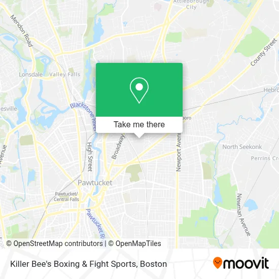
See Killer Bee's Boxing & Fight Sports, Boston, on the map
Public Transit to Killer Bee's Boxing & Fight Sports in Boston
Wondering how to get to Killer Bee's Boxing & Fight Sports in Boston? Moovit helps you find the best way to get to Killer Bee's Boxing & Fight Sports with step-by-step directions from the nearest public transit station.
Moovit provides free maps and live directions to help you navigate through your city. View schedules, routes, timetables, and find out how long does it take to get to Killer Bee's Boxing & Fight Sports in real time.
Looking for the nearest stop or station to Killer Bee's Boxing & Fight Sports? Check out this list of stops closest to your destination: Central Before Freeman; Benefit & Broadway; Benefit St.; South Attleboro; Pawtucket/Central Falls.
Bus: 1, 12, 76.Train: PROVIDENCE/STOUGHTON, FOXBORO EVENT SERVICE.
Want to see if there’s another route that gets you there at an earlier time? Moovit helps you find alternative routes or times. Get directions from and directions to Killer Bee's Boxing & Fight Sports easily from the Moovit App or Website.
We make riding to Killer Bee's Boxing & Fight Sports easy, which is why over 1.7 million users, including users in Boston, trust Moovit as the best app for public transit. You don’t need to download an individual bus app or train app, Moovit is your all-in-one transit app that helps you find the best bus time or train time available.
For information on prices of bus and train, costs and ride fares to Killer Bee's Boxing & Fight Sports, please check the Moovit app.
Use the app to navigate to popular places including to the airport, hospital, stadium, grocery store, mall, coffee shop, school, college, and university.
Killer Bee's Boxing & Fight Sports Address: 120 Webster St. (3RD FL) street in Boston
- Astro - Arts, Sports, and Technology Resource Organization,
- Hayzel's Helping Hands,
- MSL Plastering,
- Allstate Restaurant Eq,
- Standard Paper Box Corporation,
- Porino's Fine Foods,
- Deliverance Revival,
- Professional Internal Medicine,
- Accu Reference Medical Lab,
- Juanita Trejo, Interpreter,
- Shell Recharge,
- Gbarzon District Association,
- Coinstar - Bitcoin ATM,
- Spin King Laundromat,
- Citizens Bank & Trust,
- Rhode Island Shotokan Kempo Karate-do,
- Pawtucket Long Distance Moving,
- Hidalgo Restaurant 2 L,
- The Spiritual Energy Healer,
- Palencianita Restaurant
Places Near Killer Bee's Boxing & Fight Sports (Boston)
- Faneuil Hall, Boston,
- Mgm Music Hall, Boston,
- Leader Bank Pavilion (Leader Bank Pavillion), Boston,
- Castle Island, Boston,
- Museum Of Science, Boston,
- Prudential Center, Boston,
- Cheers, Boston,
- Td Garden, Boston,
- Isabella Stewart Gardner Museum, Boston,
- Boston Children's Hospital, Boston,
- Boston Medical Center, Boston,
- North End, Boston,
- House Of Blues, Boston,
- Wilbur Theatre, Boston,
- Seaport District, Boston,
- Wang Theater, Boston,
- Boston Convention & Exhibition Center, Boston,
- Massachusetts General Hospital, Boston,
- Quincy Market, Boston,
- Boston Common, Boston
How to get to popular places in Boston with public transit
Get around Boston by public transit!
Traveling around Boston has never been so easy. See step by step directions as you travel to any attraction, street or major public transit station. View bus and train schedules, arrival times, service alerts and detailed routes on a map, so you know exactly how to get to anywhere in Boston.
When traveling to any destination around Boston use Moovit's Live Directions with Get Off Notifications to know exactly where and how far to walk, how long to wait for your line, and how many stops are left. Moovit will alert you when it's time to get off — no need to constantly re-check whether yours is the next stop.
Wondering how to use public transit in Boston or how to pay for public transit in Boston? Moovit public transit app can help you navigate your way with public transit easily, and at minimum cost. It includes public transit fees, ticket prices, and costs. Looking for a map of Boston public transit lines? Moovit public transit app shows all public transit maps in Boston with all Bus, Train, Subway and Ferry routes and stops on an interactive map.
Boston has 4 transit type(s), including: Bus, Train, Subway and Ferry, operated by several transit agencies, including MBTA, Southeastern Regional Transit Authority, MetroWest Regional Transit Authority, Rhode Island Public Transit Authority, WRTA, Lowell Regional Transit Authority, Merrimack Valley Transit, Montachusett Regional Transit Authority, Cape Cod Regional Transit Authority, Brockton Area Transit Authority, Martha's Vineyard Transit Authority, the WAVE - Nantucket Regional Transit Authority, GATRA, Cape Ann Transportation Authority and Massport