Directions to Kps Esthetics & Threading (Saugus) with public transportation
The following transit lines have routes that pass near Kps Esthetics & Threading
 Bus: 426, 430, 428, 429.
- Train: NEWBURYPORT/ROCKPORT.
How to get to Kps Esthetics & Threading by bus?
Click on the bus route to see step by step directions with maps, line arrival times and updated time schedules.
From North End, Boston
38 minFrom Embassy Suites-Boston, Boston
74 minFrom Old North Church, Boston
32 minFrom USS Constitution, Boston
37 minFrom Boston Navy Yard, Boston
57 minFrom Paul Revere House, Boston
29 minFrom Chevalier Theatre (Chevalier Theater Show Line), Medford
43 minFrom Salem St, Boston
28 minFrom North End, Boston
28 minFrom Pizzeria Regina, Boston
29 min
Bus stops near Kps Esthetics & Threading in Saugus
Train station near Kps Esthetics & Threading in Saugus
- River Works, 63 min walk,VIEW
Bus lines to Kps Esthetics & Threading in Saugus
What are the closest stations to Kps Esthetics & Threading?
The closest stations to Kps Esthetics & Threading are:
- Lincoln Ave @ Western Ave is 586 yards away, 7 min walk.
- Lincoln Ave @ Charlotte Rd is 803 yards away, 10 min walk.
- River Works is 5361 yards away, 63 min walk.
Which bus lines stop near Kps Esthetics & Threading?
These bus lines stop near Kps Esthetics & Threading: 426, 430.
What’s the nearest bus station to Kps Esthetics & Threading in Saugus?
The nearest bus station to Kps Esthetics & Threading in Saugus is Lincoln Ave @ Western Ave. It’s a 7 min walk away.
What time is the first train to Kps Esthetics & Threading in Saugus?
The NEWBURYPORT/ROCKPORT is the first train that goes to Kps Esthetics & Threading in Saugus. It stops nearby at 5:33 AM.
What time is the last train to Kps Esthetics & Threading in Saugus?
The NEWBURYPORT/ROCKPORT is the last train that goes to Kps Esthetics & Threading in Saugus. It stops nearby at 12:13 AM.
What time is the first bus to Kps Esthetics & Threading in Saugus?
The 426 is the first bus that goes to Kps Esthetics & Threading in Saugus. It stops nearby at 5:22 AM.
What time is the last bus to Kps Esthetics & Threading in Saugus?
The 426 is the last bus that goes to Kps Esthetics & Threading in Saugus. It stops nearby at 1:27 AM.
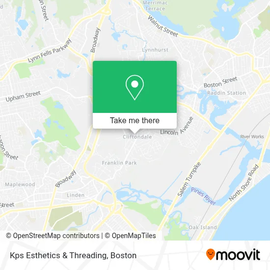
See Kps Esthetics & Threading, Saugus, on the map
Public Transit to Kps Esthetics & Threading in Saugus
Wondering how to get to Kps Esthetics & Threading in Saugus? Moovit helps you find the best way to get to Kps Esthetics & Threading with step-by-step directions from the nearest public transit station.
Moovit provides free maps and live directions to help you navigate through your city. View schedules, routes, timetables, and find out how long does it take to get to Kps Esthetics & Threading in real time.
Looking for the nearest stop or station to Kps Esthetics & Threading? Check out this list of stops closest to your destination: Lincoln Ave @ Western Ave; Lincoln Ave @ Charlotte Rd; River Works.
Bus: 426, 430, 428, 429.Train: NEWBURYPORT/ROCKPORT.
Want to see if there’s another route that gets you there at an earlier time? Moovit helps you find alternative routes or times. Get directions from and directions to Kps Esthetics & Threading easily from the Moovit App or Website.
We make riding to Kps Esthetics & Threading easy, which is why over 1.7 million users, including users in Saugus, trust Moovit as the best app for public transit. You don’t need to download an individual bus app or train app, Moovit is your all-in-one transit app that helps you find the best bus time or train time available.
For information on prices of bus and subway, costs and ride fares to Kps Esthetics & Threading, please check the Moovit app.
Use the app to navigate to popular places including to the airport, hospital, stadium, grocery store, mall, coffee shop, school, college, and university.
Kps Esthetics & Threading Address: 27 Essex St street in Saugus
- Saugus Locksmith Transponder Keys,
- H Surabian Ronald Attorney at Law,
- Cliftondale Square,
- Essential Esthetics,
- DUNKIN',
- LOTUS Nails Spa,
- Chao Bella Nail Boutique & Spa,
- Campbell's Fence,
- Shining Stars Learning Center,
- A Saugusbank Cooperative Bank,
- Bits & Bites Bakery & Cafe,
- Custom Security Services,
- Elegancia Studio,
- J M Realty Management,
- Pro Handyman Service,
- Harmon,
- Fire Command Systems, Inc.,
- Saugus Housing Authority Sweetser Corner,
- Eric Enterprises Saugus Residence,
- Happy Learners Daycare
Places Near Kps Esthetics & Threading (Saugus)
- Quincy Market, Boston,
- Museum Of Science, Boston,
- Cheers, Boston,
- North End, Boston,
- Castle Island, Boston,
- Seaport District, Boston,
- Wilbur Theatre, Boston,
- Td Garden, Boston,
- Mgm Music Hall, Boston,
- Isabella Stewart Gardner Museum, Boston,
- Boston Children's Hospital, Boston,
- Boston Medical Center, Boston,
- Wang Theater, Boston,
- House Of Blues, Boston,
- Prudential Center, Boston,
- Faneuil Hall, Boston,
- Leader Bank Pavilion (Leader Bank Pavillion), Boston,
- Boston Common, Boston,
- Massachusetts General Hospital, Boston,
- Boston Convention & Exhibition Center, Boston
How to get to popular places in Boston with public transit
Get around Saugus by public transit!
Traveling around Saugus has never been so easy. See step by step directions as you travel to any attraction, street or major public transit station. View bus and train schedules, arrival times, service alerts and detailed routes on a map, so you know exactly how to get to anywhere in Saugus.
When traveling to any destination around Saugus use Moovit's Live Directions with Get Off Notifications to know exactly where and how far to walk, how long to wait for your line, and how many stops are left. Moovit will alert you when it's time to get off — no need to constantly re-check whether yours is the next stop.
Wondering how to use public transit in Saugus or how to pay for public transit in Saugus? Moovit public transit app can help you navigate your way with public transit easily, and at minimum cost. It includes public transit fees, ticket prices, and costs. Looking for a map of Saugus public transit lines? Moovit public transit app shows all public transit maps in Saugus with all Bus, Train, Subway and Ferry routes and stops on an interactive map.
Boston has 4 transit type(s), including: Bus, Train, Subway and Ferry, operated by several transit agencies, including MBTA, Southeastern Regional Transit Authority, MetroWest Regional Transit Authority, Rhode Island Public Transit Authority, WRTA, Lowell Regional Transit Authority, Merrimack Valley Transit, Montachusett Regional Transit Authority, Cape Cod Regional Transit Authority, Brockton Area Transit Authority, Martha's Vineyard Transit Authority, the WAVE - Nantucket Regional Transit Authority, GATRA, Cape Ann Transportation Authority and Massport