Directions to Kxp Logistics, Llc (Boston) with public transportation
The following transit lines have routes that pass near Kxp Logistics, Llc
 Bus: 32, 33, 50.
- Train: FAIRMOUNT, PROVIDENCE/STOUGHTON, FRANKLIN/FOXBORO, FAIRMOUNT LINE SHUTTLE.
- Subway: MATTAPAN LINE.
How to get to Kxp Logistics, Llc by bus?
Click on the bus route to see step by step directions with maps, line arrival times and updated time schedules.
From Brigham and Women's Hospital, Boston
52 minFrom South Bay Mall, Boston
56 minFrom Ruggles Station, Boston
53 minFrom Beth Israel Deaconess Medical Center Is, Boston
57 minFrom Beth Israel Hospital, Boston
61 minFrom South Shore Plaza, Braintree Town
105 minFrom Boston College, Boston
86 minFrom Forest Hills Station MBTA, Boston
22 minFrom Samuel Adams Brewery, Boston
42 minFrom Courtyard South Boston (COURTYARD by Marriott), Boston
59 min
How to get to Kxp Logistics, Llc by train?
Click on the train route to see step by step directions with maps, line arrival times and updated time schedules.
From Brigham and Women's Hospital, Boston
64 minFrom South Bay Mall, Boston
41 minFrom Ruggles Station, Boston
41 minFrom Beth Israel Deaconess Medical Center Is, Boston
43 minFrom Beth Israel Hospital, Boston
61 minFrom Forest Hills Station MBTA, Boston
79 minFrom Samuel Adams Brewery, Boston
103 minFrom Courtyard South Boston (COURTYARD by Marriott), Boston
45 min
How to get to Kxp Logistics, Llc by subway?
Click on the subway route to see step by step directions with maps, line arrival times and updated time schedules.
From Brigham and Women's Hospital, Boston
111 minFrom South Bay Mall, Boston
93 minFrom Ruggles Station, Boston
97 minFrom Beth Israel Deaconess Medical Center Is, Boston
99 minFrom Beth Israel Hospital, Boston
115 minFrom Boston College, Boston
138 minFrom Samuel Adams Brewery, Boston
106 minFrom Courtyard South Boston (COURTYARD by Marriott), Boston
86 min
Bus stops near Kxp Logistics, Llc in Boston
Train stations near Kxp Logistics, Llc in Boston
Bus lines to Kxp Logistics, Llc in Boston
What are the closest stations to Kxp Logistics, Llc?
The closest stations to Kxp Logistics, Llc are:
- River St @ Radford Pl is 191 yards away, 3 min walk.
- Hyde Park Ave @ Glenwood Ave is 709 yards away, 9 min walk.
- Readville is 1868 yards away, 23 min walk.
- Fairmount is 2346 yards away, 28 min walk.
Which bus lines stop near Kxp Logistics, Llc?
These bus lines stop near Kxp Logistics, Llc: 32, 33, 50.
Which train lines stop near Kxp Logistics, Llc?
These train lines stop near Kxp Logistics, Llc: FAIRMOUNT, PROVIDENCE/STOUGHTON.
Which subway line stops near Kxp Logistics, Llc?
MATTAPAN LINE (Mattapan)
What’s the nearest train station to Kxp Logistics, Llc in Boston?
The nearest train station to Kxp Logistics, Llc in Boston is Readville. It’s a 23 min walk away.
What’s the nearest bus station to Kxp Logistics, Llc in Boston?
The nearest bus station to Kxp Logistics, Llc in Boston is River St @ Radford Pl. It’s a 3 min walk away.
What time is the first train to Kxp Logistics, Llc in Boston?
The FAIRMOUNT is the first train that goes to Kxp Logistics, Llc in Boston. It stops nearby at 4:33 AM.
What time is the last train to Kxp Logistics, Llc in Boston?
The PROVIDENCE/STOUGHTON is the last train that goes to Kxp Logistics, Llc in Boston. It stops nearby at 12:22 AM.
What time is the first bus to Kxp Logistics, Llc in Boston?
The 32 is the first bus that goes to Kxp Logistics, Llc in Boston. It stops nearby at 4:46 AM.
What time is the last bus to Kxp Logistics, Llc in Boston?
The 32 is the last bus that goes to Kxp Logistics, Llc in Boston. It stops nearby at 1:29 AM.
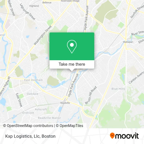
See Kxp Logistics, Llc, Boston, on the map
Public Transit to Kxp Logistics, Llc in Boston
Wondering how to get to Kxp Logistics, Llc in Boston? Moovit helps you find the best way to get to Kxp Logistics, Llc with step-by-step directions from the nearest public transit station.
Moovit provides free maps and live directions to help you navigate through your city. View schedules, routes, timetables, and find out how long does it take to get to Kxp Logistics, Llc in real time.
Looking for the nearest stop or station to Kxp Logistics, Llc? Check out this list of stops closest to your destination: River St @ Radford Pl; Hyde Park Ave @ Glenwood Ave; Readville; Fairmount.
Bus: 32, 33, 50.Train: FAIRMOUNT, PROVIDENCE/STOUGHTON, FRANKLIN/FOXBORO, FAIRMOUNT LINE SHUTTLE.Subway: MATTAPAN LINE.
Want to see if there’s another route that gets you there at an earlier time? Moovit helps you find alternative routes or times. Get directions from and directions to Kxp Logistics, Llc easily from the Moovit App or Website.
We make riding to Kxp Logistics, Llc easy, which is why over 1.7 million users, including users in Boston, trust Moovit as the best app for public transit. You don’t need to download an individual bus app or train app, Moovit is your all-in-one transit app that helps you find the best bus time or train time available.
For information on prices of bus, subway and train, costs and ride fares to Kxp Logistics, Llc, please check the Moovit app.
Use the app to navigate to popular places including to the airport, hospital, stadium, grocery store, mall, coffee shop, school, college, and university.
Kxp Logistics, Llc Address: 100 Business Street street in Boston
- FedEx,
- Top Ornamental Iron,
- Mouras Distribution in,
- Junkluggers of Greater Boston,
- AAA Exterminating Company,
- How We Cookin,
- Reservation Skatepark,
- Xtreme Diesel,
- Asian Body Work,
- Coinstar - Bitcoin ATM,
- Julien Homehealth Care,
- DJ Jay Lee,
- Capital Masonry and Construction,
- Leroy's Kitchen,
- Rapida,
- Hyde Park Skatepark,
- Hyde Park Emergency Plumbing,
- Boston Housing Authority,
- Pondside Realty,
- Able Care Health
Places Near Kxp Logistics, Llc (Boston)
- Boston Medical Center, Boston,
- Prudential Center, Boston,
- House Of Blues, Boston,
- Quincy Market, Boston,
- Boston Common, Boston,
- Museum Of Science, Boston,
- Isabella Stewart Gardner Museum, Boston,
- Seaport District, Boston,
- Leader Bank Pavilion (Leader Bank Pavillion), Boston,
- Castle Island, Boston,
- North End, Boston,
- Boston Children's Hospital, Boston,
- Boston Convention & Exhibition Center, Boston,
- Massachusetts General Hospital, Boston,
- Wilbur Theatre, Boston,
- Faneuil Hall, Boston,
- Cheers, Boston,
- Mgm Music Hall, Boston,
- Wang Theater, Boston,
- Td Garden, Boston
How to get to popular places in Boston with public transit
Get around Boston by public transit!
Traveling around Boston has never been so easy. See step by step directions as you travel to any attraction, street or major public transit station. View bus and train schedules, arrival times, service alerts and detailed routes on a map, so you know exactly how to get to anywhere in Boston.
When traveling to any destination around Boston use Moovit's Live Directions with Get Off Notifications to know exactly where and how far to walk, how long to wait for your line, and how many stops are left. Moovit will alert you when it's time to get off — no need to constantly re-check whether yours is the next stop.
Wondering how to use public transit in Boston or how to pay for public transit in Boston? Moovit public transit app can help you navigate your way with public transit easily, and at minimum cost. It includes public transit fees, ticket prices, and costs. Looking for a map of Boston public transit lines? Moovit public transit app shows all public transit maps in Boston with all Bus, Train, Subway and Ferry routes and stops on an interactive map.
Boston has 4 transit type(s), including: Bus, Train, Subway and Ferry, operated by several transit agencies, including MBTA, Southeastern Regional Transit Authority, MetroWest Regional Transit Authority, Rhode Island Public Transit Authority, WRTA, Lowell Regional Transit Authority, Merrimack Valley Transit, Montachusett Regional Transit Authority, Cape Cod Regional Transit Authority, Brockton Area Transit Authority, Martha's Vineyard Transit Authority, the WAVE - Nantucket Regional Transit Authority, GATRA, Cape Ann Transportation Authority and Massport