Directions to Lantera Gym (Boston) with public transportation
The following transit lines have routes that pass near Lantera Gym
 Bus: 501, 57, 64, 66, 86.
- Train: FRAMINGHAM/WORCESTER.
- Subway: GREEN LINE B.
How to get to Lantera Gym by bus?
Click on the bus route to see step by step directions with maps, line arrival times and updated time schedules.
From UMass Boston Campus Center, Boston
90 minFrom Jamaica Plain, Boston
48 minFrom Medford, MA, Medford
60 minFrom JFK Library, Boston
95 minFrom Tip O'Neil Building, Boston
44 minFrom Park Plaza Hotel Boston, Boston
27 minFrom John F. Kennedy Presidential Library And Museum, Boston
95 minFrom Suffolk County Courthouse, Boston
46 minFrom Chelsea, MA, Chelsea
80 minFrom Massport Security Badge Office, Boston
33 min
How to get to Lantera Gym by train?
Click on the train route to see step by step directions with maps, line arrival times and updated time schedules.
How to get to Lantera Gym by subway?
Click on the subway route to see step by step directions with maps, line arrival times and updated time schedules.
From UMass Boston Campus Center, Boston
88 minFrom Jamaica Plain, Boston
72 minFrom Medford, MA, Medford
91 minFrom JFK Library, Boston
87 minFrom Tip O'Neil Building, Boston
58 minFrom Park Plaza Hotel Boston, Boston
48 minFrom John F. Kennedy Presidential Library And Museum, Boston
87 minFrom Suffolk County Courthouse, Boston
54 minFrom Massport Security Badge Office, Boston
68 min
Subway station near Lantera Gym in Boston
- Harvard Ave., 2 min walk,VIEW
Bus stops near Lantera Gym in Boston
Bus lines to Lantera Gym in Boston
- 64, Oak Square,VIEW
- 57, Haymarket Via Kenmore,VIEW
- 66, Brighton Center Via Brookline,VIEW
- 501, Downtown Via Cambridge St And Copley (Express),VIEW
- 86, Reservoir,VIEW
- WORCESTER LINE SHUTTLE, South Station (Express Shuttle),VIEW
- WORCESTER LINE SHUTTLE, Back Bay (Shuttle),VIEW
- FRAMINGHAM/WORCESTER, #560 | South Station,VIEW
What are the closest stations to Lantera Gym?
The closest stations to Lantera Gym are:
- Harvard Ave. is 83 yards away, 2 min walk.
- N Beacon St @ Cambridge St is 331 yards away, 4 min walk.
- Cambridge St @ Gordon St is 353 yards away, 5 min walk.
- Market St @ Lothrop St is 537 yards away, 7 min walk.
- Boston Landing is 850 yards away, 10 min walk.
Which bus lines stop near Lantera Gym?
These bus lines stop near Lantera Gym: 501, 57, 64, 66.
Which train line stops near Lantera Gym?
FRAMINGHAM/WORCESTER (#521 | Worcester)
Which subway line stops near Lantera Gym?
GREEN LINE B (Boston College)
What’s the nearest subway station to Lantera Gym in Boston?
The nearest subway station to Lantera Gym in Boston is Harvard Ave.. It’s a 2 min walk away.
What’s the nearest bus station to Lantera Gym in Boston?
The nearest bus station to Lantera Gym in Boston is N Beacon St @ Cambridge St. It’s a 4 min walk away.
What time is the first subway to Lantera Gym in Boston?
The GREEN LINE B is the first subway that goes to Lantera Gym in Boston. It stops nearby at 5:10 AM.
What time is the last subway to Lantera Gym in Boston?
The GREEN LINE B is the last subway that goes to Lantera Gym in Boston. It stops nearby at 2:30 AM.
What time is the first train to Lantera Gym in Boston?
The FRAMINGHAM/WORCESTER is the first train that goes to Lantera Gym in Boston. It stops nearby at 5:00 AM.
What time is the last train to Lantera Gym in Boston?
The FRAMINGHAM/WORCESTER is the last train that goes to Lantera Gym in Boston. It stops nearby at 12:12 AM.
What time is the first bus to Lantera Gym in Boston?
The 57 is the first bus that goes to Lantera Gym in Boston. It stops nearby at 4:39 AM.
What time is the last bus to Lantera Gym in Boston?
The 57 is the last bus that goes to Lantera Gym in Boston. It stops nearby at 2:22 AM.
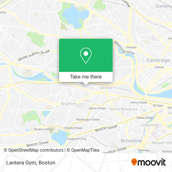
See Lantera Gym, Boston, on the map
Public Transit to Lantera Gym in Boston
Wondering how to get to Lantera Gym in Boston? Moovit helps you find the best way to get to Lantera Gym with step-by-step directions from the nearest public transit station.
Moovit provides free maps and live directions to help you navigate through your city. View schedules, routes, timetables, and find out how long does it take to get to Lantera Gym in real time.
Looking for the nearest stop or station to Lantera Gym? Check out this list of stops closest to your destination: Harvard Ave.; N Beacon St @ Cambridge St; Cambridge St @ Gordon St; Market St @ Lothrop St; Boston Landing.
Bus: 501, 57, 64, 66, 86, WORCESTER LINE SHUTTLE, WORCESTER LINE SHUTTLE, FRAMINGHAM/WORCESTER.Train: FRAMINGHAM/WORCESTER.Subway: GREEN LINE B.
Want to see if there’s another route that gets you there at an earlier time? Moovit helps you find alternative routes or times. Get directions from and directions to Lantera Gym easily from the Moovit App or Website.
We make riding to Lantera Gym easy, which is why over 1.7 million users, including users in Boston, trust Moovit as the best app for public transit. You don’t need to download an individual bus app or train app, Moovit is your all-in-one transit app that helps you find the best bus time or train time available.
For information on prices of bus, subway and train, costs and ride fares to Lantera Gym, please check the Moovit app.
Use the app to navigate to popular places including to the airport, hospital, stadium, grocery store, mall, coffee shop, school, college, and university.
Lantera Gym Address: 125 Guest St street in Boston
- Warrior Ice Arena,
- The Track at New Balance,
- The Bagel Table,
- Rail Stop Restaurant And Bar,
- Allston Brighton,
- Roadrunner,
- Experience Warrior Ice Arena (Am Warriors League),
- Experience Warrior Ice Arena,
- New Balance Global Flagship Store Boston Landing,
- Darbar Restaurant,
- Auerbach Center,
- Massachusetts,
- The Auerbach Center,
- NB Fitness Club,
- Spaulding Brighton,
- Boston Volvo Village,
- Sonia,
- High Output Brighton,
- Commonwealth Cotton,
- Spaulding Rehabilitation Center
Places Near Lantera Gym (Boston)
- Seaport District, Boston,
- Mgm Music Hall, Boston,
- Museum Of Science, Boston,
- Boston Children's Hospital, Boston,
- Leader Bank Pavilion (Leader Bank Pavillion), Boston,
- Wilbur Theatre, Boston,
- Boston Medical Center, Boston,
- Wang Theater, Boston,
- Boston Convention & Exhibition Center, Boston,
- Boston Common, Boston,
- Faneuil Hall, Boston,
- Prudential Center, Boston,
- Quincy Market, Boston,
- Castle Island, Boston,
- Massachusetts General Hospital, Boston,
- Isabella Stewart Gardner Museum, Boston,
- North End, Boston,
- Td Garden, Boston,
- Cheers, Boston,
- House Of Blues, Boston
How to get to popular places in Boston with public transit
Get around Boston by public transit!
Traveling around Boston has never been so easy. See step by step directions as you travel to any attraction, street or major public transit station. View bus and train schedules, arrival times, service alerts and detailed routes on a map, so you know exactly how to get to anywhere in Boston.
When traveling to any destination around Boston use Moovit's Live Directions with Get Off Notifications to know exactly where and how far to walk, how long to wait for your line, and how many stops are left. Moovit will alert you when it's time to get off — no need to constantly re-check whether yours is the next stop.
Wondering how to use public transit in Boston or how to pay for public transit in Boston? Moovit public transit app can help you navigate your way with public transit easily, and at minimum cost. It includes public transit fees, ticket prices, and costs. Looking for a map of Boston public transit lines? Moovit public transit app shows all public transit maps in Boston with all Bus, Train, Subway and Ferry routes and stops on an interactive map.
Boston has 4 transit type(s), including: Bus, Train, Subway and Ferry, operated by several transit agencies, including MBTA, Southeastern Regional Transit Authority, MetroWest Regional Transit Authority, Rhode Island Public Transit Authority, WRTA, Lowell Regional Transit Authority, Merrimack Valley Transit, Montachusett Regional Transit Authority, Cape Cod Regional Transit Authority, Brockton Area Transit Authority, Martha's Vineyard Transit Authority, the WAVE - Nantucket Regional Transit Authority, GATRA, Cape Ann Transportation Authority and Massport