Directions to Lapels Dry Boston-Fenway with public transportation
The following transit lines have routes that pass near Lapels Dry Boston-Fenway
 Bus: 19, 47, 60, 65, 8.
- Train: FRAMINGHAM/WORCESTER.
- Subway: GREEN LINE D, GREEN LINE C, GREEN LINE B.
How to get to Lapels Dry Boston-Fenway by bus?
Click on the bus route to see step by step directions with maps, line arrival times and updated time schedules.
From Revere, MA
88 minFrom Embassy Suites by Hilton Boston at Logan Airport
79 minFrom Malden Catholic High School
79 minFrom Hampton Inn Boston Logan Airport
69 minFrom Malden, MA
82 minFrom West Roxbury
60 minFrom Hampton Inn Boston Seaport District (Hampton Inn-Hampton Inn Boston)
68 minFrom Fort Independence
74 minFrom Milton, MA
84 min
How to get to Lapels Dry Boston-Fenway by train?
Click on the train route to see step by step directions with maps, line arrival times and updated time schedules.
How to get to Lapels Dry Boston-Fenway by subway?
Click on the subway route to see step by step directions with maps, line arrival times and updated time schedules.
Bus stops near Lapels Dry Boston-Fenway
Subway stations near Lapels Dry Boston-Fenway
Train station near Lapels Dry Boston-Fenway
- Lansdowne, 12 min walk,VIEW
Bus lines to Lapels Dry Boston-Fenway
- 8, Kenmore via South Bay Center - Harbor Point via South Bay Center,VIEW
- 9, Copley - City Point,VIEW
- 19, Kenmore - Fields Corner,VIEW
- 60, Kenmore - Chestnut Hill Mall,VIEW
- 65, Kenmore - Brighton Center,VIEW
- GREEN LINE C SHUTTLE, Back Bay (Shuttle),VIEW
- GREEN LINE D SHUTTLE, Brookline Hills (Shuttle),VIEW
- 47, Broadway,VIEW
- 85, Ruggles,VIEW
- 55, West Fenway,VIEW
- 57, Kenmore - Watertown Yard,VIEW
- GREEN LINE D SHUTTLE, Reservoir - Fenway,VIEW
- GREEN LINE D SHUTTLE, Riverside - Fenway,VIEW
- GREEN LINE D SHUTTLE, Fenway - Kenmore,VIEW
- GREEN LINE D SHUTTLE, Newton Highlands - Kenmore,VIEW
- GREEN LINE D SHUTTLE, Newton Highlands - Fenway,VIEW
- GREEN LINE D SHUTTLE, Reservoir - Kenmore,VIEW
- GREEN LINE D SHUTTLE, Brookline Hills - Kenmore,VIEW
- GREEN LINE D SHUTTLE, Newton Highlands - Kenmore via Saint Mary's Street,VIEW
- GREEN LINE D SHUTTLE, Riverside - Kenmore,VIEW
What are the closest stations to Lapels Dry Boston-Fenway?
The closest stations to Lapels Dry Boston-Fenway are:
- Brookline Ave @ Boylston St is 136 yards away, 2 min walk.
- Fenway - Beacon St @ Park Dr is 166 yards away, 3 min walk.
- Brookline Ave @ the Fenway is 168 yards away, 2 min walk.
- Kilmarnock St @ Peterborough St is 266 yards away, 4 min walk.
- Fenway is 267 yards away, 4 min walk.
- Park Dr @ Fenway Station NB is 341 yards away, 5 min walk.
- Saint Marys Street is 344 yards away, 5 min walk.
- Blandford Street is 874 yards away, 11 min walk.
- Lansdowne is 1012 yards away, 12 min walk.
Which bus lines stop near Lapels Dry Boston-Fenway?
These bus lines stop near Lapels Dry Boston-Fenway: 19, 47, 60, 65, 8, 85.
Which train line stops near Lapels Dry Boston-Fenway?
FRAMINGHAM/WORCESTER (#525 | Worcester)
Which subway line stops near Lapels Dry Boston-Fenway?
GREEN LINE D (Riverside)
What’s the nearest subway station to Lapels Dry Boston-Fenway?
The nearest subway station to Lapels Dry Boston-Fenway is Fenway. It’s a 4 min walk away.
What’s the nearest train station to Lapels Dry Boston-Fenway?
The nearest train station to Lapels Dry Boston-Fenway is Lansdowne. It’s a 12 min walk away.
What’s the nearest bus station to Lapels Dry Boston-Fenway?
The nearest bus stations to Lapels Dry Boston-Fenway are Brookline Ave @ Boylston St and Brookline Ave @ the Fenway. The closest one is a 2 min walk away.
What time is the first subway to Lapels Dry Boston-Fenway?
The GREEN LINE D is the first subway that goes to Lapels Dry Boston-Fenway. It stops nearby at 4:56 AM.
What time is the last subway to Lapels Dry Boston-Fenway?
The GREEN LINE D is the last subway that goes to Lapels Dry Boston-Fenway. It stops nearby at 2:21 AM.
What time is the first train to Lapels Dry Boston-Fenway?
The FRAMINGHAM/WORCESTER is the first train that goes to Lapels Dry Boston-Fenway. It stops nearby at 4:55 AM.
What time is the last train to Lapels Dry Boston-Fenway?
The FRAMINGHAM/WORCESTER is the last train that goes to Lapels Dry Boston-Fenway. It stops nearby at 12:06 AM.
What time is the first bus to Lapels Dry Boston-Fenway?
The 60 is the first bus that goes to Lapels Dry Boston-Fenway. It stops nearby at 5:21 AM.
What time is the last bus to Lapels Dry Boston-Fenway?
The 47 is the last bus that goes to Lapels Dry Boston-Fenway. It stops nearby at 1:09 AM.
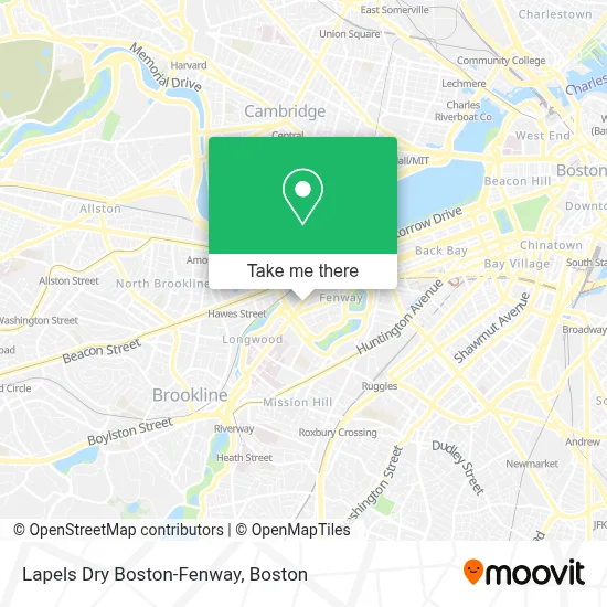
See Lapels Dry Boston-Fenway on the map
Public Transportation to Lapels Dry Boston-Fenway
Wondering how to get to Lapels Dry Boston-Fenway? Moovit helps you find the best way to get to Lapels Dry Boston-Fenway with step-by-step directions from the nearest public transit station.
Moovit provides free maps and live directions to help you navigate through your city. View schedules, routes, timetables, and find out how long does it take to get to Lapels Dry Boston-Fenway in real time.
Looking for the nearest stop or station to Lapels Dry Boston-Fenway? Check out this list of stops closest to your destination: Brookline Ave @ Boylston St; Fenway - Beacon St @ Park Dr; Brookline Ave @ the Fenway; Kilmarnock St @ Peterborough St; Fenway; Park Dr @ Fenway Station NB; Saint Marys Street; Blandford Street; Lansdowne.
Bus: 19, 47, 60, 65, 8, 85, 9.Train: FRAMINGHAM/WORCESTER.Subway: GREEN LINE D, GREEN LINE C, GREEN LINE B.
Want to see if there’s another route that gets you there at an earlier time? Moovit helps you find alternative routes or times. Get directions from and directions to Lapels Dry Boston-Fenway easily from the Moovit App or Website.
We make riding to Lapels Dry Boston-Fenway easy, which is why over 1.7 million users, including users in Boston, trust Moovit as the best app for public transit. You don’t need to download an individual bus app or train app, Moovit is your all-in-one transit app that helps you find the best bus time or train time available.
For information on prices of bus, subway and train, costs and ride fares to Lapels Dry Boston-Fenway, please check the Moovit app.
Use the app to navigate to popular places including to the airport, hospital, stadium, grocery store, mall, coffee shop, school, college, and university.
Lapels Dry Boston-Fenway Address: 152 Brookline Ave street in Boston
- Tango Therapeutics,
- Chroma Medicine,
- Mamaleh's Delicatessen,
- Kured,
- Table Caffe Timeout Market,
- Greek Street,
- Peter Ungar,
- Tenderoni's Fenway,
- Regal Cinemas Fenway 13 & RPX,
- Boston Children's Hospital Trust,
- Wahlburgers Boston,
- Wahlburgers,
- Harvard Vanguard Medical Associates - Kenmore,
- Suffolk Construction,
- Verb Hotel,
- Sweet Cheeks Q,
- Fenway Triangle Trilogy Garage,
- Residence Inn by Marriott Boston Back Bay / Fenway,
- Residence Inn Boston Back Bay / Fenway,
- Pierce Boston
Places Near Lapels Dry Boston-Fenway
- Boston Common, Boston,
- Prudential Center, Boston,
- Boston Medical Center, Boston,
- Faneuil Hall, Boston,
- Cheers, Boston,
- Museum Of Science, Boston,
- Seaport District, Boston,
- Td Garden, Boston,
- Wilbur Theatre, Boston,
- Boston Convention & Exhibition Center, Boston,
- Isabella Stewart Gardner Museum, Boston,
- Castle Island, Boston,
- Boston Children's Hospital, Boston,
- Leader Bank Pavilion (Leader Bank Pavillion), Boston,
- House Of Blues, Boston,
- Massachusetts General Hospital, Boston,
- North End, Boston,
- Mgm Music Hall, Boston,
- Wang Theater, Boston,
- Quincy Market, Boston
How to get to popular places in Boston with public transit
Get around Boston by public transit!
Traveling around Boston has never been so easy. See step by step directions as you travel to any attraction, street or major public transit station. View bus and train schedules, arrival times, service alerts and detailed routes on a map, so you know exactly how to get to anywhere in Boston.
When traveling to any destination around Boston use Moovit's Live Directions with Get Off Notifications to know exactly where and how far to walk, how long to wait for your line, and how many stops are left. Moovit will alert you when it's time to get off — no need to constantly re-check whether yours is the next stop.
Wondering how to use public transit in Boston or how to pay for public transit in Boston? Moovit public transit app can help you navigate your way with public transit easily, and at minimum cost. It includes public transit fees, ticket prices, and costs. Looking for a map of Boston public transit lines? Moovit public transit app shows all public transit maps in Boston with all Bus, Train, Subway and Ferry routes and stops on an interactive map.
Boston has 4 transit type(s), including: Bus, Train, Subway and Ferry, operated by several transit agencies, including MBTA, Southeastern Regional Transit Authority, MetroWest Regional Transit Authority, Rhode Island Public Transit Authority, WRTA, Lowell Regional Transit Authority, Merrimack Valley Transit, Montachusett Regional Transit Authority, Cape Cod Regional Transit Authority, Brockton Area Transit Authority, Martha's Vineyard Transit Authority, the WAVE - Nantucket Regional Transit Authority, GATRA, Cape Ann Transportation Authority and Massport