Directions to Lee Outlet, Mass (Boston) with public transportation
The following transit lines have routes that pass near Lee Outlet, Mass
 Bus: G2, G5, T2, T5, G1.
- Train: LAKE SHORE LIMITED, AMTRAK HARTFORD LINE, NORTHEAST REGIONAL, VALLEY FLYER, VERMONTER.
How to get to Lee Outlet, Mass by bus?
Click on the bus route to see step by step directions with maps, line arrival times and updated time schedules.
From Polar Park, Worcester
113 minFrom Walmart Supercenter, Worcester
170 minFrom South High Community School, Worcester
208 minFrom Registry Of Motor Vehicles (Rmv) Branch Office, Worcester
116 minFrom Foxwoods, Worcester
141 minFrom Worcester, MA, Worcester
112 minFrom Dcu Center, Worcester
114 minFrom Palladium, Worcester
117 min
How to get to Lee Outlet, Mass by train?
Click on the train route to see step by step directions with maps, line arrival times and updated time schedules.
Bus stops near Lee Outlet, Mass in Boston
Train station near Lee Outlet, Mass in Boston
- Springfield, 16 min walk,VIEW
Bus lines to Lee Outlet, Mass in Boston
What are the closest stations to Lee Outlet, Mass?
The closest stations to Lee Outlet, Mass are:
- Dickinson / Kenwood is 186 yards away, 3 min walk.
- Belmont/Beaumont is 211 yards away, 3 min walk.
- Sumner / Beaumont is 214 yards away, 3 min walk.
- Springfield is 1267 yards away, 16 min walk.
Which bus lines stop near Lee Outlet, Mass?
These bus lines stop near Lee Outlet, Mass: G2, G5.
Which train line stops near Lee Outlet, Mass?
LAKE SHORE LIMITED (Chicago)
What’s the nearest train station to Lee Outlet, Mass in Boston?
The nearest train station to Lee Outlet, Mass in Boston is Springfield. It’s a 16 min walk away.
What’s the nearest bus station to Lee Outlet, Mass in Boston?
The nearest bus stations to Lee Outlet, Mass in Boston are Dickinson / Kenwood, Belmont/Beaumont and Sumner / Beaumont. The closest one is a 3 min walk away.
What time is the first train to Lee Outlet, Mass in Boston?
The NORTHEAST REGIONAL is the first train that goes to Lee Outlet, Mass in Boston. It stops nearby at 4:10 AM.
What time is the last train to Lee Outlet, Mass in Boston?
The LAKE SHORE LIMITED is the last train that goes to Lee Outlet, Mass in Boston. It stops nearby at 6:04 PM.
What time is the first bus to Lee Outlet, Mass in Boston?
The G2 is the first bus that goes to Lee Outlet, Mass in Boston. It stops nearby at 5:13 AM.
What time is the last bus to Lee Outlet, Mass in Boston?
The G2 is the last bus that goes to Lee Outlet, Mass in Boston. It stops nearby at 9:55 PM.
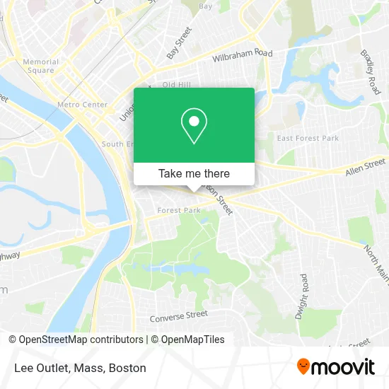
See Lee Outlet, Mass, Boston, on the map
Public Transit to Lee Outlet, Mass in Boston
Wondering how to get to Lee Outlet, Mass in Boston? Moovit helps you find the best way to get to Lee Outlet, Mass with step-by-step directions from the nearest public transit station.
Moovit provides free maps and live directions to help you navigate through your city. View schedules, routes, timetables, and find out how long does it take to get to Lee Outlet, Mass in real time.
Looking for the nearest stop or station to Lee Outlet, Mass? Check out this list of stops closest to your destination: Dickinson / Kenwood; Belmont/Beaumont; Sumner / Beaumont; Springfield.
Bus: G2, G5, T2, T5, G1, T1, T92.Train: LAKE SHORE LIMITED, AMTRAK HARTFORD LINE, NORTHEAST REGIONAL, VALLEY FLYER, VERMONTER.
Want to see if there’s another route that gets you there at an earlier time? Moovit helps you find alternative routes or times. Get directions from and directions to Lee Outlet, Mass easily from the Moovit App or Website.
We make riding to Lee Outlet, Mass easy, which is why over 1.7 million users, including users in Boston, trust Moovit as the best app for public transit. You don’t need to download an individual bus app or train app, Moovit is your all-in-one transit app that helps you find the best bus time or train time available.
For information on prices of bus and train, costs and ride fares to Lee Outlet, Mass, please check the Moovit app.
Use the app to navigate to popular places including to the airport, hospital, stadium, grocery store, mall, coffee shop, school, college, and university.
Location: Boston
- Tristate Mobile,
- Shanghai Ichiban,
- El Charro,
- Mundo's Barbershop,
- Forest Park Post Office,
- C&M Cleaning & Maintenance,
- Forest Park Branch Springfield City Library,
- USPS Collection Box - Po Lobby,
- Springfield Realization Academy,
- Food Zone,
- El Sabor de Juan,
- Fufu Beauty Supply,
- Martha S Total Events,
- Redimidos en Cristo,
- Iglesia Seguidores de Cristo,
- Sapphirenailsbyely,
- Saigon Market,
- Home and Apartment Locator of Western Ma,
- Belmont Store,
- Andres Shop
Places Near Lee Outlet, Mass (Boston)
- Boston Medical Center, Boston,
- Mgm Music Hall, Boston,
- Wang Theater, Boston,
- House Of Blues, Boston,
- Wilbur Theatre, Boston,
- Boston Children's Hospital, Boston,
- Prudential Center, Boston,
- Cheers, Boston,
- Quincy Market, Boston,
- Castle Island, Boston,
- Boston Convention & Exhibition Center, Boston,
- Isabella Stewart Gardner Museum, Boston,
- Faneuil Hall, Boston,
- Boston Common, Boston,
- Leader Bank Pavilion (Leader Bank Pavillion), Boston,
- Seaport District, Boston,
- North End, Boston,
- Td Garden, Boston,
- Museum Of Science, Boston,
- Massachusetts General Hospital, Boston
How to get to popular places in Boston with public transit
Get around Boston by public transit!
Traveling around Boston has never been so easy. See step by step directions as you travel to any attraction, street or major public transit station. View bus and train schedules, arrival times, service alerts and detailed routes on a map, so you know exactly how to get to anywhere in Boston.
When traveling to any destination around Boston use Moovit's Live Directions with Get Off Notifications to know exactly where and how far to walk, how long to wait for your line, and how many stops are left. Moovit will alert you when it's time to get off — no need to constantly re-check whether yours is the next stop.
Wondering how to use public transit in Boston or how to pay for public transit in Boston? Moovit public transit app can help you navigate your way with public transit easily, and at minimum cost. It includes public transit fees, ticket prices, and costs. Looking for a map of Boston public transit lines? Moovit public transit app shows all public transit maps in Boston with all Bus, Train, Subway and Ferry routes and stops on an interactive map.
Boston has 4 transit type(s), including: Bus, Train, Subway and Ferry, operated by several transit agencies, including MBTA, Southeastern Regional Transit Authority, MetroWest Regional Transit Authority, Rhode Island Public Transit Authority, WRTA, Lowell Regional Transit Authority, Merrimack Valley Transit, Montachusett Regional Transit Authority, Cape Cod Regional Transit Authority, Brockton Area Transit Authority, Martha's Vineyard Transit Authority, the WAVE - Nantucket Regional Transit Authority, GATRA, Cape Ann Transportation Authority and Massport