See Les Pavillons sous Bois, Les Pavillons-Sous-Bois, on the map
Directions to Les Pavillons sous Bois (Les Pavillons-Sous-Bois) with public transportation
The following transit lines have routes that pass near Les Pavillons sous Bois
 Train:
 - Bus:
- Light Rail:
How to get to Les Pavillons sous Bois by bus?
Click on the bus route to see step by step directions with maps, line arrival times and updated time schedules.
How to get to Les Pavillons sous Bois by train?
Click on the train route to see step by step directions with maps, line arrival times and updated time schedules.
Bus stations near Les Pavillons sous Bois in Les Pavillons-Sous-Bois
- Pierre Brossolette - la Basoche,5 min walk,
- Eglise,6 min walk,
- Victor Hugo - Jules Guesde,10 min walk,
Light Rail stations near Les Pavillons sous Bois in Les Pavillons-Sous-Bois
- Gargan,14 min walk,
Bus lines to Les Pavillons sous Bois in Les Pavillons-Sous-Bois
- 105,Porte Des Lilas,
- 146,Le Bourget RER,
- N45,Bobigny - Pablo Picasso,
- 147,Avenue Ronsard,
- 2128,Mairie,
- 234,Fort D'Aubervilliers,
- N41,Villeparisis - Mitry-Le-Neuf,
What are the closest stations to Les Pavillons sous Bois?
The closest stations to Les Pavillons sous Bois are:
- Pierre Brossolette - la Basoche is 361 meters away, 5 min walk.
- Eglise is 389 meters away, 6 min walk.
- Victor Hugo - Jules Guesde is 695 meters away, 10 min walk.
- Gargan is 1059 meters away, 14 min walk.
Which train line stops near Les Pavillons sous Bois?
K
Which bus lines stop near Les Pavillons sous Bois?
These bus lines stop near Les Pavillons sous Bois: 146, 147, 8.
Which light rail line stops near Les Pavillons sous Bois?
T4
What’s the nearest light rail station to Les Pavillons sous Bois in Les Pavillons-Sous-Bois?
The nearest light rail station to Les Pavillons sous Bois in Les Pavillons-Sous-Bois is Gargan. It’s a 14 min walk away.
What’s the nearest bus stop to Les Pavillons sous Bois in Les Pavillons-Sous-Bois?
The nearest bus stop to Les Pavillons sous Bois in Les Pavillons-Sous-Bois is Pierre Brossolette - la Basoche. It’s a 5 min walk away.
What time is the first light rail to Les Pavillons sous Bois in Les Pavillons-Sous-Bois?
The T4 is the first light rail that goes to Les Pavillons sous Bois in Les Pavillons-Sous-Bois. It stops nearby at 4:38 AM.
What time is the last light rail to Les Pavillons sous Bois in Les Pavillons-Sous-Bois?
The T4 is the last light rail that goes to Les Pavillons sous Bois in Les Pavillons-Sous-Bois. It stops nearby at 9:52 PM.
What time is the first bus to Les Pavillons sous Bois in Les Pavillons-Sous-Bois?
The N41 is the first bus that goes to Les Pavillons sous Bois in Les Pavillons-Sous-Bois. It stops nearby at 3:01 AM.
What time is the last bus to Les Pavillons sous Bois in Les Pavillons-Sous-Bois?
The N41 is the last bus that goes to Les Pavillons sous Bois in Les Pavillons-Sous-Bois. It stops nearby at 3:31 AM.
How much is the bus fare to Les Pavillons sous Bois?
The bus fare to Les Pavillons sous Bois costs about €2.10.
How much is the metro fare to Les Pavillons sous Bois?
The metro fare to Les Pavillons sous Bois costs about €2.10.
How much is the RER fare to Les Pavillons sous Bois?
The RER fare to Les Pavillons sous Bois costs about €2.10.
How much is the light rail fare to Les Pavillons sous Bois?
The light rail fare to Les Pavillons sous Bois costs about €2.10.
See Les Pavillons sous Bois, Les Pavillons-Sous-Bois, on the map
Public Transit to Les Pavillons sous Bois in Les Pavillons-Sous-Bois
Wondering how to get to Les Pavillons sous Bois in Les Pavillons-Sous-Bois, France? Moovit helps you find the best way to get to Les Pavillons sous Bois with step-by-step directions from the nearest public transit station.
Moovit provides free maps and live directions to help you navigate through your city. View schedules, routes, timetables, and find out how long does it take to get to Les Pavillons sous Bois in real time.
Looking for the nearest stop or station to Les Pavillons sous Bois? Check out this list of stops closest to your destination: Pierre Brossolette - la Basoche; Eglise; Victor Hugo - Jules Guesde; Gargan.
Train:Bus:Light Rail:
Want to see if there’s another route that gets you there at an earlier time? Moovit helps you find alternative routes or times. Get directions from and directions to Les Pavillons sous Bois easily from the Moovit App or Website.
We make riding to Les Pavillons sous Bois easy, which is why over 1.5 million users, including users in Les Pavillons-Sous-Bois, trust Moovit as the best app for public transit. You don’t need to download an individual bus app or train app, Moovit is your all-in-one transit app that helps you find the best bus time or train time available.
For information on prices of bus, light rail, RER, metro and train, costs and ride fares to Les Pavillons sous Bois, please check the Moovit app.
Use the app to navigate to popular places including to the airport, hospital, stadium, grocery store, mall, coffee shop, school, college, and university.
Location: Les Pavillons-Sous-Bois, Paris
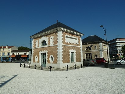
Les Pavillons-sous-Bois (French pronunciation: [lɛ pavijɔ̃ su bwa] (listen)) is a commune in the eastern suburbs of Paris, France. It is located 12.8 km (8.0 mi) from the center of Paris.Wiki
Attractions near Les Pavillons sous Bois
Hôtel Chevalier de la Barre,Du 16 Allee des Arquebuses,Trinh Khou sem,Laroche Fabriice,Lili Choi Atelier,Pr-Bâtiment,93320,50 52,Détecteur d'Or,Univers Détection Service,Radar de Sol,Tanha,Buzilo Radion,Deco Pro,Assurances Serge Noel Brule,Simic Yvon Snezana,DHL Plomberie,Kechkeche Farid,B.E.K Déko,8 10How to get to popular attractions in Les Pavillons-Sous-Bois with public transit
IFP School, Rueil-Malmaison,McDonald's, Suresnes,Agence Delasource, Boulogne-Billancourt,Aéroport Charles de Gaulle, Roissy-En-France,Ecole de Mondétour, Orsay,Musée D'Orsay, Paris,Université Paris-Est Marne la Vallée, Champs-Sur-Marne,Business lab, Nanterre,Montgeron, Montgeron,Saint-Cloud, Saint-Cloud,Le Bourget, Le Bourget,Roissy Charles de Gaulle, Roissy-En-France,Université Paris 13 Nord, Villetaneuse,BNP Paribas Personal Finance, Levallois-Perret,Rambouillet, Rambouillet,Gonesse, Gonesse,Obiane (Orange Business Services), Palaiseau,Parc Des Princes G To K, Paris,Airbus Group, Elancourt,La Coulée Verte, SceauxGet around Les Pavillons-Sous-Bois by public transit!
Traveling around Les Pavillons-Sous-Bois has never been so easy. See step by step directions as you travel to any attraction, street or major public transit station. View bus and train schedules, arrival times, service alerts and detailed routes on a map, so you know exactly how to get to anywhere in Les Pavillons-Sous-Bois.
When traveling to any destination around Les Pavillons-Sous-Bois use Moovit's Live Directions with Get Off Notifications to know exactly where and how far to walk, how long to wait for your line, and how many stops are left. Moovit will alert you when it's time to get off — no need to constantly re-check whether yours is the next stop.
Wondering how to use public transit in Les Pavillons-Sous-Bois or how to pay for public transit in Les Pavillons-Sous-Bois? Moovit public transit app can help you navigate your way with public transit easily, and at minimum cost. It includes public transit fees, ticket prices, and costs. Looking for a map of Les Pavillons-Sous-Bois public transit lines? Moovit public transit app shows all public transit maps in Les Pavillons-Sous-Bois with all bus, light rail, RER, metro or train routes and stops on an interactive map.
Les Pavillons-Sous-Bois has 5 transit type(s), including: bus, light rail, RER, metro or train, operated by several transit agencies, including RATP, RER, RER Bus de remplacement, Train, Train Bus de remplacement, RATP, Tramway Bus de remplacement, TER, RATP, Tramway, ADP, ADP, RATP, Noctilien and Magical Shuttle