Directions to Little Caesars Arena (Detroit) with public transportation
The following transit lines have routes that pass near Little Caesars Arena
 Bus: 261, 31, 4, 461, 462.
How to get to Little Caesars Arena by bus?
Click on the bus route to see step by step directions with maps, line arrival times and updated time schedules.
Bus stops near Little Caesars Arena in Detroit
- Woodward & Winder, 4 min walk,
- Woodward & Temple (Lca), 4 min walk,
- Cass & Ledyard, 5 min walk,
Light Rail stations near Little Caesars Arena in Detroit
- Montcalm St - Southbound, 4 min walk,
Bus lines to Little Caesars Arena in Detroit
- 4, Jason Hargrove Transit Center - Bay 4,
- 461, Troy Civic Center Park & Ride,
- 462, Auburn Mile Arrive,
- 16, Dexter,
- 23, Hamilton,
- 31, Mack,
What are the closest stations to Little Caesars Arena?
The closest stations to Little Caesars Arena are:
- Woodward & Winder is 191 yards away, 4 min walk.
- Woodward & Temple (Lca) is 208 yards away, 4 min walk.
- Montcalm St - Southbound is 244 yards away, 4 min walk.
- Cass & Ledyard is 257 yards away, 5 min walk.
Which bus lines stop near Little Caesars Arena?
These bus lines stop near Little Caesars Arena: 261, 31, 4, 461.
What’s the nearest light rail station to Little Caesars Arena in Detroit?
The nearest light rail station to Little Caesars Arena in Detroit is Montcalm St - Southbound. It’s a 4 min walk away.
What’s the nearest bus station to Little Caesars Arena in Detroit?
The nearest bus stations to Little Caesars Arena in Detroit are Woodward & Winder and Woodward & Temple (Lca). The closest one is a 4 min walk away.
What time is the first bus to Little Caesars Arena in Detroit?
The 16 is the first bus that goes to Little Caesars Arena in Detroit. It stops nearby at 3:04 AM.
What time is the last bus to Little Caesars Arena in Detroit?
The 462 is the last bus that goes to Little Caesars Arena in Detroit. It stops nearby at 12:33 AM.
See Little Caesars Arena, Detroit, on the map
Public Transit to Little Caesars Arena in Detroit
Wondering how to get to Little Caesars Arena in Detroit? Moovit helps you find the best way to get to Little Caesars Arena with step-by-step directions from the nearest public transit station.
Moovit provides free maps and live directions to help you navigate through your city. View schedules, routes, timetables, and find out how long does it take to get to Little Caesars Arena in real time.
Looking for the nearest stop or station to Little Caesars Arena? Check out this list of stops closest to your destination: Woodward & Winder; Woodward & Temple (Lca); Montcalm St - Southbound; Cass & Ledyard.
Bus: 261, 31, 4, 461, 462, 16, 23.
Want to see if there’s another route that gets you there at an earlier time? Moovit helps you find alternative routes or times. Get directions from and directions to Little Caesars Arena easily from the Moovit App or Website.
We make riding to Little Caesars Arena easy, which is why over 1.5 million users, including users in Detroit, trust Moovit as the best app for public transit. You don’t need to download an individual bus app or train app, Moovit is your all-in-one transit app that helps you find the best bus time or train time available.
For information on prices of bus, costs and ride fares to Little Caesars Arena, please check the Moovit app.
Use the app to navigate to popular places including to the airport, hospital, stadium, grocery store, mall, coffee shop, school, college, and university.
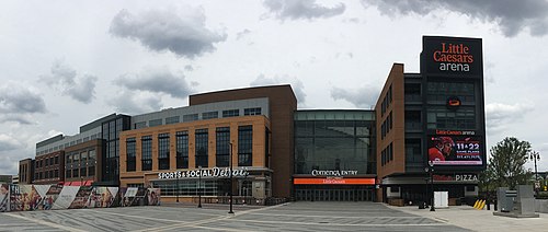
Little Caesars Arena Address: 66 Sibley St street in Detroit
- Labatt Blue Zone,
- Google Detroit,
- Little Caesars Arena Team Store,
- Pointsbet,
- Detroit Red Wings,
- Pointsbet Sports Bar (Lca Sports Lounge),
- Pointsbet Sports Bar,
- Huntington Northwest Entry,
- Xfinity Box Office,
- Delaware North,
- BELFOR Training Center,
- Hungry Hippo,
- The Salvation Army,
- Richard W West,
- Little Caesars Arena Parking Garage,
- Odm Parking,
- Trinity Health Garage,
- Mike Ilitch School Of Business,
- Winder Street,
- Henry West Garage
Places Near Little Caesars Arena (Detroit)
- Tunnel Platform at Mariner's, Detroit,
- St. John Hospital & Medical Center Professional Bldg 1 Ste 320, Detroit,
- Walmart, Detroit,
- Little Caesars Arena, Detroit,
- Fisher Auditorium, Providence Hospital, Southfield,
- Walmart Supercenter, Dearborn,
- Ford Field, Detroit,
- Eastern Market, Detroit,
- Comerica Park, Detroit,
- Henry Ford Hospital K-Building Clinics, Detroit,
- Henry Ford Hospital, Detroit,
- Cass Tech High School, Detroit,
- Belle Isle Park, Detroit,
- MotorCity Casino Hotel, Detroit,
- 36th District Court, Detroit,
- I-96 & Telegraph Rd,
- Motown Museum, Detroit,
- The Henry Ford Museum and Greenfield Village, Dearborn,
- Detroit Institute Of Arts, Detroit,
- MGM Grand Detroit Casino & Hotel, Detroit
How to get to popular places in Detroit - Ann Arbor, MI with public transit
Get around Detroit by public transit!
Traveling around Detroit has never been so easy. See step by step directions as you travel to any attraction, street or major public transit station. View bus and train schedules, arrival times, service alerts and detailed routes on a map, so you know exactly how to get to anywhere in Detroit.
When traveling to any destination around Detroit use Moovit's Live Directions with Get Off Notifications to know exactly where and how far to walk, how long to wait for your line, and how many stops are left. Moovit will alert you when it's time to get off — no need to constantly re-check whether yours is the next stop.
Wondering how to use public transit in Detroit or how to pay for public transit in Detroit? Moovit public transit app can help you navigate your way with public transit easily, and at minimum cost. It includes public transit fees, ticket prices, and costs. Looking for a map of Detroit public transit lines? Moovit public transit app shows all public transit maps in Detroit with all Bus, Train and Light Rail routes and stops on an interactive map.
Detroit - Ann Arbor, MI has 3 transit type(s), including: Bus, Train and Light Rail, operated by several transit agencies, including SMART, Qline Detroit, DDOT, Detroit Transportation Corporation, The Ride, Michigan Flyer, Detroit Ann Arbor Express, University of Michigan Transportation Services, Amtrak, Greyhound-us and FlixBus-us