Directions to Little Pizza King (Boston) with public transportation
The following transit lines have routes that pass near Little Pizza King
 Bus: 57, 64, 501, 86.
- Train: FRAMINGHAM/WORCESTER.
- Subway: GREEN LINE B.
How to get to Little Pizza King by bus?
Click on the bus route to see step by step directions with maps, line arrival times and updated time schedules.
From Bos21 - Amazon, Boston
59 minFrom World Trade Center, Boston
62 minFrom Downeast Cider House, Boston
85 minFrom Westin Copley Place Hotel Boston, Boston
25 minFrom Commonwealth Pier, Boston
63 minFrom Biogen, Cambridge
46 minFrom Renaissance Boston Waterfront Hotel (Renaissance Waterfront Conference Center), Boston
60 minFrom Club Quarters, Boston
40 minFrom Mass General Waltham, Waltham
66 minFrom Seaport District, Boston
60 min
How to get to Little Pizza King by train?
Click on the train route to see step by step directions with maps, line arrival times and updated time schedules.
From Bos21 - Amazon, Boston
69 minFrom World Trade Center, Boston
75 minFrom Westin Copley Place Hotel Boston, Boston
55 minFrom Commonwealth Pier, Boston
75 minFrom Renaissance Boston Waterfront Hotel (Renaissance Waterfront Conference Center), Boston
74 minFrom Club Quarters, Boston
64 minFrom Seaport District, Boston
72 min
How to get to Little Pizza King by subway?
Click on the subway route to see step by step directions with maps, line arrival times and updated time schedules.
From Bos21 - Amazon, Boston
79 minFrom World Trade Center, Boston
88 minFrom Westin Copley Place Hotel Boston, Boston
54 minFrom Commonwealth Pier, Boston
88 minFrom Biogen, Cambridge
74 minFrom Renaissance Boston Waterfront Hotel (Renaissance Waterfront Conference Center), Boston
87 minFrom Club Quarters, Boston
64 minFrom Seaport District, Boston
83 min
Bus stops near Little Pizza King in Boston
Subway station near Little Pizza King in Boston
- Chiswick Road, 17 min walk,VIEW
Bus lines to Little Pizza King in Boston
What are the closest stations to Little Pizza King?
The closest stations to Little Pizza King are:
- Faneuil St @ Bigelow St is 65 yards away, 2 min walk.
- Washington St @ Oak Sq is 79 yards away, 2 min walk.
- Chestnut Hill Ave @ Academy Hill Rd is 422 yards away, 6 min walk.
- Chiswick Road is 1406 yards away, 17 min walk.
Which bus line stops near Little Pizza King?
57 (Watertown Yard)
Which train line stops near Little Pizza King?
FRAMINGHAM/WORCESTER (#525 | Worcester)
Which subway line stops near Little Pizza King?
GREEN LINE B (Boston College)
What’s the nearest subway station to Little Pizza King in Boston?
The nearest subway station to Little Pizza King in Boston is Chiswick Road. It’s a 17 min walk away.
What’s the nearest bus station to Little Pizza King in Boston?
The nearest bus stations to Little Pizza King in Boston are Faneuil St @ Bigelow St and Washington St @ Oak Sq. The closest one is a 2 min walk away.
What time is the first subway to Little Pizza King in Boston?
The GREEN LINE B is the first subway that goes to Little Pizza King in Boston. It stops nearby at 5:01 AM.
What time is the last subway to Little Pizza King in Boston?
The GREEN LINE B is the last subway that goes to Little Pizza King in Boston. It stops nearby at 2:39 AM.
What time is the first bus to Little Pizza King in Boston?
The 57 is the first bus that goes to Little Pizza King in Boston. It stops nearby at 4:34 AM.
What time is the last bus to Little Pizza King in Boston?
The 57 is the last bus that goes to Little Pizza King in Boston. It stops nearby at 2:30 AM.
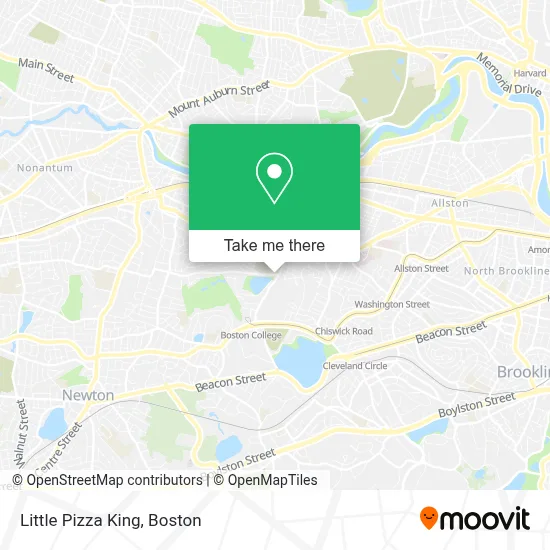
See Little Pizza King, Boston, on the map
Public Transit to Little Pizza King in Boston
Wondering how to get to Little Pizza King in Boston? Moovit helps you find the best way to get to Little Pizza King with step-by-step directions from the nearest public transit station.
Moovit provides free maps and live directions to help you navigate through your city. View schedules, routes, timetables, and find out how long does it take to get to Little Pizza King in real time.
Looking for the nearest stop or station to Little Pizza King? Check out this list of stops closest to your destination: Faneuil St @ Bigelow St; Washington St @ Oak Sq; Chestnut Hill Ave @ Academy Hill Rd; Chiswick Road.
Bus: 57, 64, 501, 86.Train: FRAMINGHAM/WORCESTER.Subway: GREEN LINE B.
Want to see if there’s another route that gets you there at an earlier time? Moovit helps you find alternative routes or times. Get directions from and directions to Little Pizza King easily from the Moovit App or Website.
We make riding to Little Pizza King easy, which is why over 1.7 million users, including users in Boston, trust Moovit as the best app for public transit. You don’t need to download an individual bus app or train app, Moovit is your all-in-one transit app that helps you find the best bus time or train time available.
For information on prices of bus, subway and train, costs and ride fares to Little Pizza King, please check the Moovit app.
Use the app to navigate to popular places including to the airport, hospital, stadium, grocery store, mall, coffee shop, school, college, and university.
Little Pizza King Address: 389 Washington St street in Boston
- EF laundry,
- EF Reception,
- Hult International Business,
- Ef Boston,
- EvGateway,
- Master of Arts Ministry PRGRM for Lty,
- The Seminary of Our Lady of Providence,
- MBTA Bus Stop | Washington St (at Brock St),
- The Magical Forest,
- Park Center Plaza,
- MBTA Bus Route 57,
- Boston College (Brighton Campus),
- GNC,
- Washington St,
- Boston Christian Books,
- Beijing Taste,
- St. Clement's Hall, Boston College,
- Sheilas Cleaning SVSC,
- Faber Jesuit Community,
- Weston Jesuit Community
Places Near Little Pizza King (Boston)
- House Of Blues, Boston,
- Prudential Center, Boston,
- Boston Convention & Exhibition Center, Boston,
- Wang Theater, Boston,
- Seaport District, Boston,
- Td Garden, Boston,
- Leader Bank Pavilion (Leader Bank Pavillion), Boston,
- Museum Of Science, Boston,
- North End, Boston,
- Castle Island, Boston,
- Boston Medical Center, Boston,
- Boston Children's Hospital, Boston,
- Boston Common, Boston,
- Quincy Market, Boston,
- Massachusetts General Hospital, Boston,
- Faneuil Hall, Boston,
- Wilbur Theatre, Boston,
- Cheers, Boston,
- Isabella Stewart Gardner Museum, Boston,
- Mgm Music Hall, Boston
How to get to popular places in Boston with public transit
Get around Boston by public transit!
Traveling around Boston has never been so easy. See step by step directions as you travel to any attraction, street or major public transit station. View bus and train schedules, arrival times, service alerts and detailed routes on a map, so you know exactly how to get to anywhere in Boston.
When traveling to any destination around Boston use Moovit's Live Directions with Get Off Notifications to know exactly where and how far to walk, how long to wait for your line, and how many stops are left. Moovit will alert you when it's time to get off — no need to constantly re-check whether yours is the next stop.
Wondering how to use public transit in Boston or how to pay for public transit in Boston? Moovit public transit app can help you navigate your way with public transit easily, and at minimum cost. It includes public transit fees, ticket prices, and costs. Looking for a map of Boston public transit lines? Moovit public transit app shows all public transit maps in Boston with all Bus, Train, Subway and Ferry routes and stops on an interactive map.
Boston has 4 transit type(s), including: Bus, Train, Subway and Ferry, operated by several transit agencies, including MBTA, Southeastern Regional Transit Authority, MetroWest Regional Transit Authority, Rhode Island Public Transit Authority, WRTA, Lowell Regional Transit Authority, Merrimack Valley Transit, Montachusett Regional Transit Authority, Cape Cod Regional Transit Authority, Brockton Area Transit Authority, Martha's Vineyard Transit Authority, the WAVE - Nantucket Regional Transit Authority, GATRA, Cape Ann Transportation Authority and Massport