Directions to Locksmith on Wheel (Boston) with public transportation
The following transit lines have routes that pass near Locksmith on Wheel
 Bus: 501, 66, 70, 86, WORCESTER LINE SHUTTLE.
- Train: FRAMINGHAM/WORCESTER.
- Subway: GREEN LINE B.
How to get to Locksmith on Wheel by bus?
Click on the bus route to see step by step directions with maps, line arrival times and updated time schedules.
From Boston Marriott Newton, Newton
70 minFrom I-95 / Route 128 & Route 16 Interchange (Exit 21), Newton
80 minFrom JFK Library, Boston
90 minFrom Bistro du Midi, Boston
28 minFrom Melrose Wakefield Hospital, Malden
99 minFrom Registry of Motor Vehicles (RMV) Boston, Boston
48 minFrom The Swan Boats, Boston
32 minFrom Dana Farber Cancer Institute, Boston
65 minFrom Mr Dooley's Boston Tavern, Boston
42 minFrom Courtyard by Marriott Boston Logan Airport, Boston
76 min
How to get to Locksmith on Wheel by train?
Click on the train route to see step by step directions with maps, line arrival times and updated time schedules.
From Boston Marriott Newton, Newton
34 minFrom I-95 / Route 128 & Route 16 Interchange (Exit 21), Newton
51 minFrom JFK Library, Boston
72 minFrom Bistro du Midi, Boston
33 minFrom Registry of Motor Vehicles (RMV) Boston, Boston
42 minFrom The Swan Boats, Boston
37 minFrom Mr Dooley's Boston Tavern, Boston
36 min
How to get to Locksmith on Wheel by subway?
Click on the subway route to see step by step directions with maps, line arrival times and updated time schedules.
From Boston Marriott Newton, Newton
86 minFrom I-95 / Route 128 & Route 16 Interchange (Exit 21), Newton
74 minFrom JFK Library, Boston
88 minFrom Bistro du Midi, Boston
47 minFrom Melrose Wakefield Hospital, Malden
80 minFrom Registry of Motor Vehicles (RMV) Boston, Boston
58 minFrom The Swan Boats, Boston
51 minFrom Mr Dooley's Boston Tavern, Boston
60 minFrom Courtyard by Marriott Boston Logan Airport, Boston
79 min
Bus stops near Locksmith on Wheel in Boston
Subway station near Locksmith on Wheel in Boston
- Griggs Street, 3 min walk,VIEW
Bus lines to Locksmith on Wheel in Boston
What are the closest stations to Locksmith on Wheel?
The closest stations to Locksmith on Wheel are:
- Western Ave @ Everett St is 21 yards away, 1 min walk.
- Griggs Street is 227 yards away, 3 min walk.
- Boston Landing is 522 yards away, 7 min walk.
- N Harvard St @ Franklin St is 573 yards away, 7 min walk.
- Guest St Opp New Balance Way is 1083 yards away, 13 min walk.
Which bus lines stop near Locksmith on Wheel?
These bus lines stop near Locksmith on Wheel: 501, 66, 70, 86.
Which train line stops near Locksmith on Wheel?
FRAMINGHAM/WORCESTER (#526 | South Station)
Which subway line stops near Locksmith on Wheel?
GREEN LINE B (Park Street)
What’s the nearest subway station to Locksmith on Wheel in Boston?
The nearest subway station to Locksmith on Wheel in Boston is Griggs Street. It’s a 3 min walk away.
What’s the nearest bus station to Locksmith on Wheel in Boston?
The nearest bus station to Locksmith on Wheel in Boston is Western Ave @ Everett St. It’s a 1 min walk away.
What time is the first subway to Locksmith on Wheel in Boston?
The GREEN LINE B is the first subway that goes to Locksmith on Wheel in Boston. It stops nearby at 5:12 AM.
What time is the last subway to Locksmith on Wheel in Boston?
The GREEN LINE B is the last subway that goes to Locksmith on Wheel in Boston. It stops nearby at 2:28 AM.
What time is the first train to Locksmith on Wheel in Boston?
The FRAMINGHAM/WORCESTER is the first train that goes to Locksmith on Wheel in Boston. It stops nearby at 5:00 AM.
What time is the last train to Locksmith on Wheel in Boston?
The FRAMINGHAM/WORCESTER is the last train that goes to Locksmith on Wheel in Boston. It stops nearby at 12:12 AM.
What time is the first bus to Locksmith on Wheel in Boston?
The 70 is the first bus that goes to Locksmith on Wheel in Boston. It stops nearby at 4:31 AM.
What time is the last bus to Locksmith on Wheel in Boston?
The 66 is the last bus that goes to Locksmith on Wheel in Boston. It stops nearby at 2:05 AM.
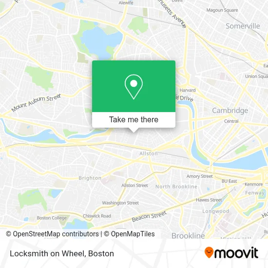
See Locksmith on Wheel, Boston, on the map
Public Transit to Locksmith on Wheel in Boston
Wondering how to get to Locksmith on Wheel in Boston? Moovit helps you find the best way to get to Locksmith on Wheel with step-by-step directions from the nearest public transit station.
Moovit provides free maps and live directions to help you navigate through your city. View schedules, routes, timetables, and find out how long does it take to get to Locksmith on Wheel in real time.
Looking for the nearest stop or station to Locksmith on Wheel? Check out this list of stops closest to your destination: Western Ave @ Everett St; Griggs Street; Boston Landing; N Harvard St @ Franklin St; Guest St Opp New Balance Way.
Bus: 501, 66, 70, 86, WORCESTER LINE SHUTTLE, WORCESTER LINE SHUTTLE, FRAMINGHAM/WORCESTER, 64.Train: FRAMINGHAM/WORCESTER.Subway: GREEN LINE B.
Want to see if there’s another route that gets you there at an earlier time? Moovit helps you find alternative routes or times. Get directions from and directions to Locksmith on Wheel easily from the Moovit App or Website.
We make riding to Locksmith on Wheel easy, which is why over 1.7 million users, including users in Boston, trust Moovit as the best app for public transit. You don’t need to download an individual bus app or train app, Moovit is your all-in-one transit app that helps you find the best bus time or train time available.
For information on prices of bus, subway and train, costs and ride fares to Locksmith on Wheel, please check the Moovit app.
Use the app to navigate to popular places including to the airport, hospital, stadium, grocery store, mall, coffee shop, school, college, and university.
Locksmith on Wheel Address: 370 Western Ave street in Boston
- Brighton Mills Shopping Center,
- Boston Fire Department Special Operations Training Center,
- Brighton Mills Plaza,
- Josephine A. Fiorentino Community Center,
- German International School Boston (GISBOS),
- St Anthony Catholic Church,
- North Brighton MA USA,
- Spring Shabu Shabu,
- Petco,
- Miki Miki Japanese Sushi Restaurant (Maki Maki Japanese Sushi and Seafood Buffet Restaurant),
- Aldie 39-41 Street Condominium,
- Shields Mri Brighton,
- Gardner Pilot Academy (Thomas Gardner School),
- Fahy Plumbing And Hea,
- School St & S Waverly St,
- Skating Club Of Boston,
- North Brighton, Massachusetts,
- Days Hotel-Boston (Studio Allston Hotel),
- Boston Landing Station,
- Studio Allston
Places Near Locksmith on Wheel (Boston)
- Wang Theater, Boston,
- Isabella Stewart Gardner Museum, Boston,
- Td Garden, Boston,
- Faneuil Hall, Boston,
- Seaport District, Boston,
- Boston Medical Center, Boston,
- North End, Boston,
- Wilbur Theatre, Boston,
- Mgm Music Hall, Boston,
- Castle Island, Boston,
- Quincy Market, Boston,
- Boston Children's Hospital, Boston,
- House Of Blues, Boston,
- Prudential Center, Boston,
- Boston Common, Boston,
- Boston Convention & Exhibition Center, Boston,
- Leader Bank Pavilion (Leader Bank Pavillion), Boston,
- Massachusetts General Hospital, Boston,
- Cheers, Boston,
- Museum Of Science, Boston
How to get to popular places in Boston with public transit
Get around Boston by public transit!
Traveling around Boston has never been so easy. See step by step directions as you travel to any attraction, street or major public transit station. View bus and train schedules, arrival times, service alerts and detailed routes on a map, so you know exactly how to get to anywhere in Boston.
When traveling to any destination around Boston use Moovit's Live Directions with Get Off Notifications to know exactly where and how far to walk, how long to wait for your line, and how many stops are left. Moovit will alert you when it's time to get off — no need to constantly re-check whether yours is the next stop.
Wondering how to use public transit in Boston or how to pay for public transit in Boston? Moovit public transit app can help you navigate your way with public transit easily, and at minimum cost. It includes public transit fees, ticket prices, and costs. Looking for a map of Boston public transit lines? Moovit public transit app shows all public transit maps in Boston with all Bus, Train, Subway and Ferry routes and stops on an interactive map.
Boston has 4 transit type(s), including: Bus, Train, Subway and Ferry, operated by several transit agencies, including MBTA, Southeastern Regional Transit Authority, MetroWest Regional Transit Authority, Rhode Island Public Transit Authority, WRTA, Lowell Regional Transit Authority, Merrimack Valley Transit, Montachusett Regional Transit Authority, Cape Cod Regional Transit Authority, Brockton Area Transit Authority, Martha's Vineyard Transit Authority, the WAVE - Nantucket Regional Transit Authority, GATRA, Cape Ann Transportation Authority and Massport