Long Beach Bl + 6th St stop - Monday schedule
| Line | Direction | Time |
|---|---|---|
| 46 | 46 Anaheim St to Downtown | 5:12 AM |
| 51 | 51 LB Blvd to Downtown | 5:35 AM |
| 46 | 46 Anaheim St to Downtown | 5:37 AM |
| 51 | 51 LB Blvd to Downtown | 5:55 AM |
| 51 | 51 LB Blvd to Downtown | 6:15 AM |
| 3 | Downtown Long Beach Station | 6:18 AM |
| 46 | 46 Anaheim St to Downtown | 6:19 AM |
| 51 | 51 LB Blvd to Downtown | 6:34 AM |
| 3 | Downtown Long Beach Station | 6:41 AM |
| 46 | 46 Anaheim St to Downtown | 6:43 AM |
| 51 | 51 LB Blvd to Downtown | 6:54 AM |
| 3 | Downtown Long Beach Station | 6:58 AM |
| 46 | 46 Anaheim St to Downtown | 7:09 AM |
| 51 | 51 LB Blvd to Downtown | 7:14 AM |
| 3 | Downtown Long Beach Station | 7:20 AM |
| R3 | Downtown Long Beach Station | 7:21 AM |
| 51 | 51 LB Blvd to Downtown | 7:29 AM |
| 46 | 46 Anaheim St to Downtown | 7:34 AM |
| 51 | 51 LB Blvd to Downtown | 7:44 AM |
| 3 | Downtown Long Beach Station | 7:51 AM |
| 46 | 46 Anaheim St to Downtown | 7:58 AM |
| 51 | 51 LB Blvd to Downtown | 7:59 AM |
| 51 | 51 LB Blvd to Downtown | 8:14 AM |
| 3 | Downtown Long Beach Station | 8:21 AM |
| 46 | 46 Anaheim St to Downtown | 8:22 AM |
Directions to Long Beach Bl + 6th St stop with public transit
The following transit lines have routes that pass near Long Beach Bl + 6th St
How to get to Long Beach Bl + 6th St stop by bus?
Click on the bus route to see step by step directions with maps, line arrival times and updated time schedules.
Bus stops near Long Beach Bl + 6th St stop
- Long Beach / 6th, 1 min walk,
- Long Beach Blvd & 5th NE, 2 min walk,
- 5th St Station, 2 min walk,
- 7th & Long Beach Blvd NW, 4 min walk,
Light Rail stations near Long Beach Bl + 6th St station
- Downtown Long Beach Station, 21 min walk,
Bus lines to Long Beach Bl + 6th St stop
- 60, Dtwn LA - Artesia Station,
- 232, LAX City Bus Center - Long Beach,
- PASSPORT, Passport North to Downtown,
- 46, 46 Anaheim St to CSULB,
- 51, 51 LB Blvd to Artesia Sta,
- 91, 91 7th - Bellflower to Artesia Blvd Only,
- 92, 92 7th - Woodruff to Downtown,
- 93, 93 7th - Clark to Alondra,
- 94, 94 7th Street to Los Altos,
- 172, 172 Palo Verde to Cerritos,
- 173, 173 Studebaker to Norwalk Sta,
- 174, 174 PCH to Ximeno,
What are the closest stations to Long Beach Bl + 6th St?
The closest stations to Long Beach Bl + 6th St are:
- Long Beach / 6th is 20 yards away, 1 min walk.
- Long Beach Blvd & 5th NE is 129 yards away, 2 min walk.
- 5th St Station is 131 yards away, 2 min walk.
- 7th & Long Beach Blvd NW is 258 yards away, 4 min walk.
- Downtown Long Beach Station is 1756 yards away, 21 min walk.
Which bus lines stop near Long Beach Bl + 6th St?
These bus lines stop near Long Beach Bl + 6th St: 232, 3, 46, 51, 93.
Which light rail line stops near Long Beach Bl + 6th St?
A LINE (Soutbound to Long Beach)
What’s the nearest light rail station to Long Beach Bl + 6th St?
The nearest light rail station to Long Beach Bl + 6th St is Downtown Long Beach Station. It’s a 21 min walk away.
What’s the nearest bus station to Long Beach Bl + 6th St?
The nearest bus station to Long Beach Bl + 6th St is Long Beach / 6th. It’s a 1 min walk away.
What time is the first light rail to Long Beach Bl + 6th St?
The A LINE is the first light rail that goes to Long Beach Bl + 6th St. It stops nearby at 3:45 AM.
What time is the last light rail to Long Beach Bl + 6th St?
The A LINE is the last light rail that goes to Long Beach Bl + 6th St. It stops nearby at 1:40 AM.
What time is the first bus to Long Beach Bl + 6th St?
The 60 is the first bus that goes to Long Beach Bl + 6th St. It stops nearby at 3:02 AM.
What time is the last bus to Long Beach Bl + 6th St?
The 60 is the last bus that goes to Long Beach Bl + 6th St. It stops nearby at 4:27 AM.
Long Beach Bl + 6th St station
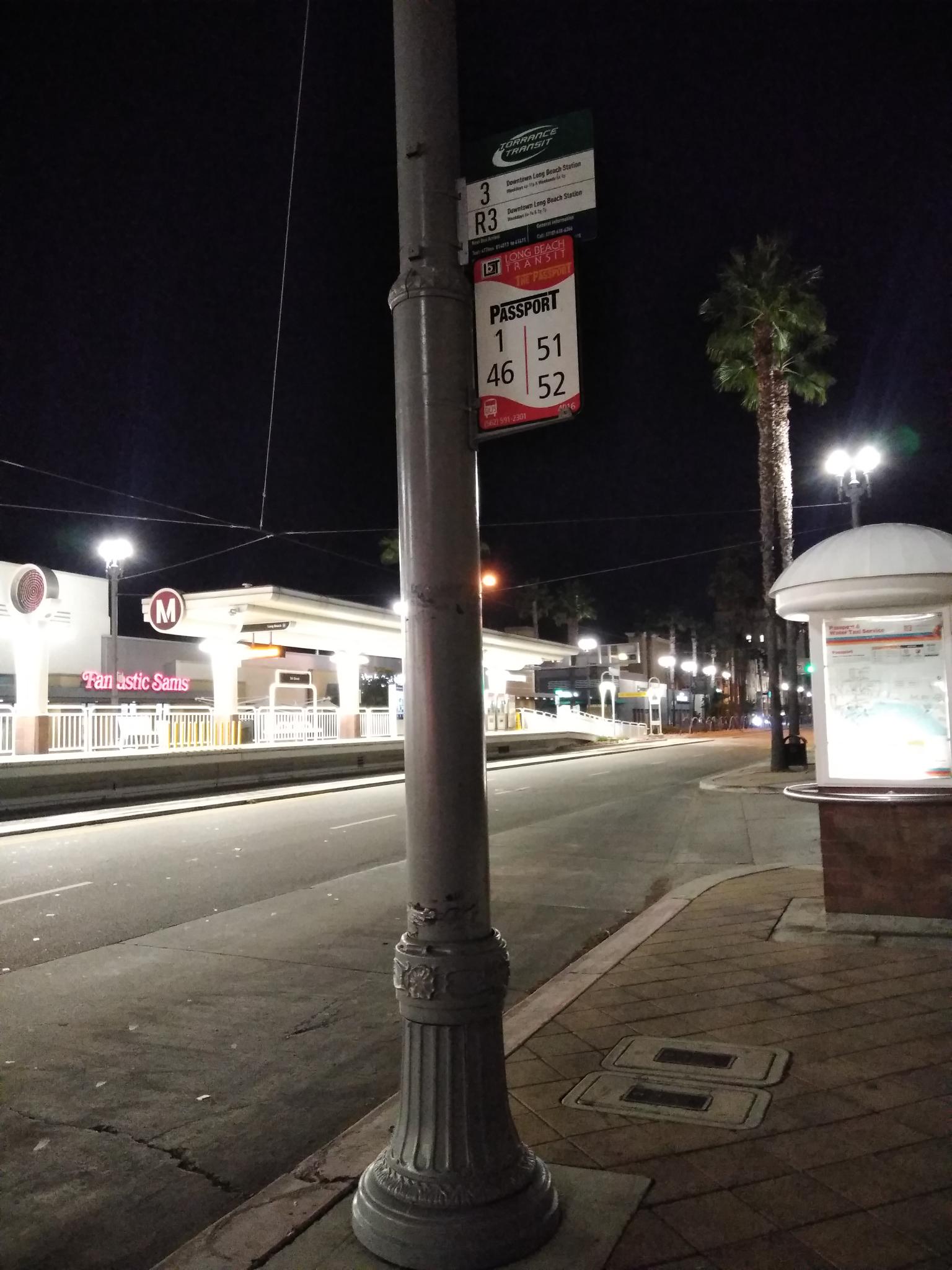 Taken by Anonymous
See Long Beach Bl + 6th St stop on the map
Public transit to Long Beach Bl + 6th St stop
Looking for directions to Long Beach Bl + 6th St in Long Beach, United States?
Download the Moovit App to find the current schedule and step-by-step directions for Bus or Light Rail routes that pass through Long Beach Bl + 6th St.
Looking for the nearest stops closest to Long Beach Bl + 6th St ? Check out this list of closest stops to your destination: Long Beach / 6th; Long Beach Blvd & 5th NE; 5th St Station; 7th & Long Beach Blvd NW; Downtown Long Beach Station.
Bus: 232, 3, 46, 51, 93, 60, PASSPORT, 91, 92, 94, 172, 173, 174.Light Rail: A LINE.
We make riding on public transit to Long Beach Bl + 6th St easy, which is why over 1.5 million users, including users in Long Beach trust Moovit as the best app for public transit.
Use the app to navigate to popular places including to the airport, hospital, stadium, grocery store, mall, coffee shop, school, college, and university.
The first line to this stop is 46, at 5:12 AM, and the last line is 46 at 11:22 PM.
599 Long Beach Boulevard, Long Beach, CA, USA
This stop serves TORRANCE TRANSIT SYSTEM and Long Beach Transit’s lines
Bus stops near Long Beach Bl + 6th St stop
Light Rail station near Long Beach Bl + 6th St station
Popular public transit stations in Long Beach
Get around Long Beach by public transit!
Traveling around Long Beach has never been so easy. See step by step directions as you travel to any attraction, street or major public transit station. View bus and train schedules, arrival times, service alerts and detailed routes on a map, so you know exactly how to get to anywhere in Long Beach.
When traveling to any destination around Long Beach use Moovit's Live Directions with Get Off Notifications to know exactly where and how far to walk, how long to wait for your line, and how many stops are left. Moovit will alert you when it's time to get off — no need to constantly re-check whether yours is the next stop.
Wondering how to use public transit in Long Beach or how to pay for public transit in Long Beach? Moovit public transit app can help you navigate your way with public transit easily, and at minimum cost. It includes public transit fees, ticket prices, and costs. Looking for a map of Long Beach public transit lines? Moovit public transit app shows all public transit maps in Long Beach with all Bus, Train, Subway, Light Rail, Ferry and Funicular routes and stops on an interactive map.
Los Angeles has 6 transit type(s), including: Bus, Train, Subway, Light Rail, Ferry and Funicular, operated by several transit agencies, including METRO, OCTA, Metrolink Trains, Big Blue Bus, LAX FlyAway, PVPTA, Burbank Bus, Laguna Beach Transit, Thousand Oaks Transit, Amtrak, OMNITRANS, Foothill Transit, Culver City Bus, Glendale Beeline and Long Beach Transit