Directions to Lucky's Smoke World (Boston) with public transportation
The following transit lines have routes that pass near Lucky's Smoke World
 Bus: 1, 12, R, 76, 80.
- Train: PROVIDENCE/STOUGHTON, FOXBORO EVENT SERVICE.
How to get to Lucky's Smoke World by bus?
Click on the bus route to see step by step directions with maps, line arrival times and updated time schedules.
How to get to Lucky's Smoke World by train?
Click on the train route to see step by step directions with maps, line arrival times and updated time schedules.
Bus stops near Lucky's Smoke World in Boston
Train stations near Lucky's Smoke World in Boston
Bus lines to Lucky's Smoke World in Boston
What are the closest stations to Lucky's Smoke World?
The closest stations to Lucky's Smoke World are:
- Broadway & Central (Opposite Laurel) is 27 yards away, 1 min walk.
- Armistice After N Bend is 224 yards away, 3 min walk.
- Exchange After Exchange Ct is 854 yards away, 11 min walk.
- South Attleboro is 3003 yards away, 35 min walk.
- Pawtucket/Central Falls is 4758 yards away, 56 min walk.
Which bus lines stop near Lucky's Smoke World?
These bus lines stop near Lucky's Smoke World: 1, 12, R.
Which train line stops near Lucky's Smoke World?
PROVIDENCE/STOUGHTON (#828 | South Station)
What’s the nearest bus station to Lucky's Smoke World in Boston?
The nearest bus station to Lucky's Smoke World in Boston is Broadway & Central (Opposite Laurel). It’s a 1 min walk away.
What time is the first train to Lucky's Smoke World in Boston?
The PROVIDENCE/STOUGHTON is the first train that goes to Lucky's Smoke World in Boston. It stops nearby at 4:16 AM.
What time is the last train to Lucky's Smoke World in Boston?
The PROVIDENCE/STOUGHTON is the last train that goes to Lucky's Smoke World in Boston. It stops nearby at 12:56 AM.
What time is the first bus to Lucky's Smoke World in Boston?
The 1 is the first bus that goes to Lucky's Smoke World in Boston. It stops nearby at 6:02 AM.
What time is the last bus to Lucky's Smoke World in Boston?
The 80 is the last bus that goes to Lucky's Smoke World in Boston. It stops nearby at 7:23 PM.
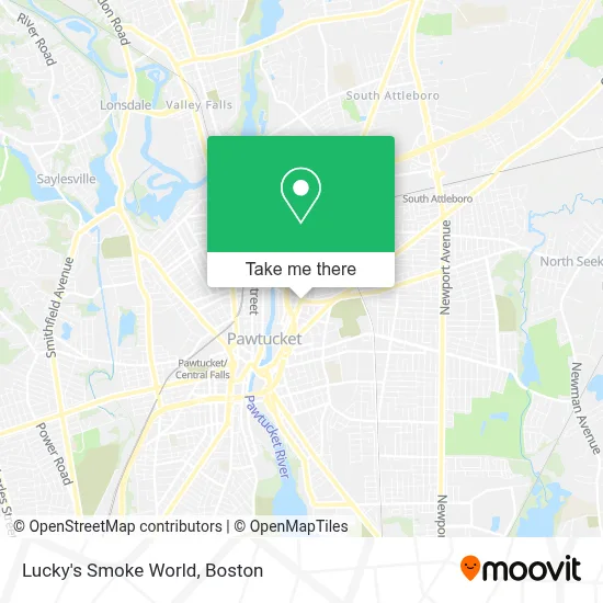
See Lucky's Smoke World, Boston, on the map
Public Transit to Lucky's Smoke World in Boston
Wondering how to get to Lucky's Smoke World in Boston? Moovit helps you find the best way to get to Lucky's Smoke World with step-by-step directions from the nearest public transit station.
Moovit provides free maps and live directions to help you navigate through your city. View schedules, routes, timetables, and find out how long does it take to get to Lucky's Smoke World in real time.
Looking for the nearest stop or station to Lucky's Smoke World? Check out this list of stops closest to your destination: Broadway & Central (Opposite Laurel); Armistice After N Bend; Exchange After Exchange Ct; South Attleboro; Pawtucket/Central Falls.
Bus: 1, 12, R, 76, 80.Train: PROVIDENCE/STOUGHTON, FOXBORO EVENT SERVICE.
Want to see if there’s another route that gets you there at an earlier time? Moovit helps you find alternative routes or times. Get directions from and directions to Lucky's Smoke World easily from the Moovit App or Website.
We make riding to Lucky's Smoke World easy, which is why over 1.7 million users, including users in Boston, trust Moovit as the best app for public transit. You don’t need to download an individual bus app or train app, Moovit is your all-in-one transit app that helps you find the best bus time or train time available.
For information on prices of bus and train, costs and ride fares to Lucky's Smoke World, please check the Moovit app.
Use the app to navigate to popular places including to the airport, hospital, stadium, grocery store, mall, coffee shop, school, college, and university.
Lucky's Smoke World Address: 399 Broadway street in Boston
- Armory Properties,
- G&H Automotive / Motorcycle Repair,
- Noobai Restaurant and Lounge,
- Carolina Transportation,
- Major Walter G. Gatchel VFW Post 306,
- Emma's Flowers,
- A K Custom Painting,
- Seaside Finish,
- JVL Cleaning Services,
- Exit 29/Downtown Pawtucket/S,
- Beautiful Memory Productions,
- Delgado Kristina M - Delgado, Kristina M,
- Lyon Property Management,
- Cashflowkings,
- American Products, Inc,
- Motion Center Yoga,
- Lamontagne Realty,
- Urban Perinatal Education Center,
- TI Adoro Jewelry,
- Patti Doyle Communications, Inc.
Places Near Lucky's Smoke World (Boston)
- Castle Island, Boston,
- Faneuil Hall, Boston,
- Boston Common, Boston,
- Cheers, Boston,
- Boston Convention & Exhibition Center, Boston,
- House Of Blues, Boston,
- Boston Children's Hospital, Boston,
- Wilbur Theatre, Boston,
- Massachusetts General Hospital, Boston,
- Leader Bank Pavilion (Leader Bank Pavillion), Boston,
- Boston Medical Center, Boston,
- Quincy Market, Boston,
- Isabella Stewart Gardner Museum, Boston,
- Prudential Center, Boston,
- Td Garden, Boston,
- North End, Boston,
- Seaport District, Boston,
- Wang Theater, Boston,
- Museum Of Science, Boston,
- Mgm Music Hall, Boston
How to get to popular places in Boston with public transit
Get around Boston by public transit!
Traveling around Boston has never been so easy. See step by step directions as you travel to any attraction, street or major public transit station. View bus and train schedules, arrival times, service alerts and detailed routes on a map, so you know exactly how to get to anywhere in Boston.
When traveling to any destination around Boston use Moovit's Live Directions with Get Off Notifications to know exactly where and how far to walk, how long to wait for your line, and how many stops are left. Moovit will alert you when it's time to get off — no need to constantly re-check whether yours is the next stop.
Wondering how to use public transit in Boston or how to pay for public transit in Boston? Moovit public transit app can help you navigate your way with public transit easily, and at minimum cost. It includes public transit fees, ticket prices, and costs. Looking for a map of Boston public transit lines? Moovit public transit app shows all public transit maps in Boston with all Bus, Train, Subway and Ferry routes and stops on an interactive map.
Boston has 4 transit type(s), including: Bus, Train, Subway and Ferry, operated by several transit agencies, including MBTA, Southeastern Regional Transit Authority, MetroWest Regional Transit Authority, Rhode Island Public Transit Authority, WRTA, Lowell Regional Transit Authority, Merrimack Valley Transit, Montachusett Regional Transit Authority, Cape Cod Regional Transit Authority, Brockton Area Transit Authority, Martha's Vineyard Transit Authority, the WAVE - Nantucket Regional Transit Authority, GATRA, Cape Ann Transportation Authority and Massport