Directions to Mairie de Saint-Ouen with public transportation
The following transit lines have routes that pass near Mairie de Saint-Ouen
Directions to Mairie de Saint-Ouen with public transportation
The following transit lines have routes that pass near Mairie de Saint-Ouen
How to get to Mairie de Saint-Ouen by bus?
Click on the bus route to see step by step directions with maps, line arrival times and updated time schedules.
How to get to Mairie de Saint-Ouen by metro?
Click on the metro route to see step by step directions with maps, line arrival times and updated time schedules.
Bus lines to Mairie de Saint-Ouen
- 173,Fort D'Aubervilliers - Danielle Casanova,
- 274,Porte Des Ternes - Anny Flore,
- AUDONIE,Mairie de Saint-Ouen - Jaurès,
- N44,Gare de L'Est,
- 140,Mairie de Saint-Ouen - Dhalenne,
- 166,Les Barbanniers,
- 137,Zone Industrielle Nord,
- 237,Porte de Saint-Ouen - Hôpital Bichat,
- 85,Châtelet,
- N14,La Croix de Berny RER,
- 66,Gare Saint-Lazare - Rome,
What are the closest stations to Mairie de Saint-Ouen?
The closest stations to Mairie de Saint-Ouen are:
- Landy - Jaurès is 145 meters away, 2 min walk.
- Mairie de Saint-Ouen - Dhalenne is 314 meters away, 5 min walk.
- Mairie de Saint-Ouen - République is 340 meters away, 5 min walk.
- Ernest Renan is 389 meters away, 6 min walk.
- Les Bateliers is 437 meters away, 6 min walk.
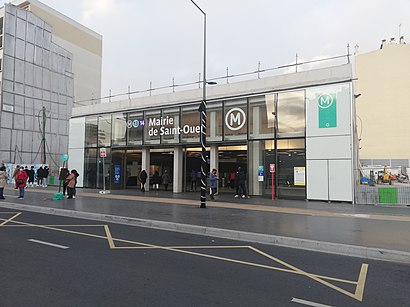
- Mairie de Saint-Ouen is 458 meters away, 6 min walk.
- Saint-Ouen is 1162 meters away, 15 min walk.
Which metro lines stop near Mairie de Saint-Ouen?
These metro lines stop near Mairie de Saint-Ouen: 13, 14.
Which bus lines stop near Mairie de Saint-Ouen?
These bus lines stop near Mairie de Saint-Ouen: 173, 237, 274, 66, 85.
What’s the nearest metro station to Mairie de Saint-Ouen?
The nearest metro station to Mairie de Saint-Ouen is Mairie de Saint-Ouen. It’s a 6 min walk away.
What’s the nearest bus stop to Mairie de Saint-Ouen?
The nearest bus stop to Mairie de Saint-Ouen is Landy - Jaurès. It’s a 2 min walk away.
What’s the nearest RER station to Mairie de Saint-Ouen?
The nearest RER station to Mairie de Saint-Ouen is Saint-Ouen. It’s a 15 min walk away.
What time is the first metro to Mairie de Saint-Ouen?
The 14 is the first metro that goes to Mairie de Saint-Ouen. It stops nearby at 5:30 AM.
What time is the last metro to Mairie de Saint-Ouen?
The 14 is the last metro that goes to Mairie de Saint-Ouen. It stops nearby at 1:18 AM.
What time is the first bus to Mairie de Saint-Ouen?
The N14 is the first bus that goes to Mairie de Saint-Ouen. It stops nearby at 3:00 AM.
What time is the last bus to Mairie de Saint-Ouen?
The N14 is the last bus that goes to Mairie de Saint-Ouen. It stops nearby at 3:46 AM.
What time is the first RER to Mairie de Saint-Ouen?
The C is the first RER that goes to Mairie de Saint-Ouen. It stops nearby at 5:36 AM.
What time is the last RER to Mairie de Saint-Ouen?
The C is the last RER that goes to Mairie de Saint-Ouen. It stops nearby at 12:25 AM.
See Mairie de Saint-Ouen on the map
Public Transportation to Mairie de Saint-Ouen
Wondering how to get to Mairie de Saint-Ouen, France? Moovit helps you find the best way to get to Mairie de Saint-Ouen with step-by-step directions from the nearest public transit station.
Moovit provides free maps and live directions to help you navigate through your city. View schedules, routes, timetables, and find out how long does it take to get to Mairie de Saint-Ouen in real time.
Looking for the nearest stop or station to Mairie de Saint-Ouen? Check out this list of stops closest to your destination: Landy - Jaurès; Mairie de Saint-Ouen - Dhalenne; Mairie de Saint-Ouen - République; Ernest Renan; Les Bateliers; Mairie de Saint-Ouen; Saint-Ouen.
RER: C.Metro: 13, 14.Bus: 173, 237, 274, 66, 85, AUDONIE, N44, 140, 166, 137.
Want to see if there’s another route that gets you there at an earlier time? Moovit helps you find alternative routes or times. Get directions from and directions to Mairie de Saint-Ouen easily from the Moovit App or Website.
We make riding to Mairie de Saint-Ouen easy, which is why over 1.5 million users, including users in Saint-Ouen, trust Moovit as the best app for public transit. You don’t need to download an individual bus app or train app, Moovit is your all-in-one transit app that helps you find the best bus time or train time available.
For information on prices of metro, bus, train and RER, costs and ride fares to Mairie de Saint-Ouen, please check the Moovit app.
Use the app to navigate to popular places including to the airport, hospital, stadium, grocery store, mall, coffee shop, school, college, and university.
Mairie de Saint-Ouen Address: 6 place de la République street in Saint-Ouen
Attractions near Mairie de Saint-Ouen
[Mairie de Saint-Ouen] Entrée / Sortie 3 Boulevard Jean Jaurès,Ria,[Mairie de Saint-Ouen] Entrée / Sortie 4 Esplanade Jean Moulin,Boulevard Victor Hugo,Quick,Bus 166 - Jean-Jaurès Mairie,Hôtel de Ville,Moneygram France,Le Montmartre,Pressing de la Patinoire,Patinoire,Tribe Paris Saint-Ouen,Tribunal D'Instance de Saint-Ouen,Salle Barbara,2 rue Simone Veil,Artelia Global,Cimetière Communal de Saint-Ouen,Conseil Régional D'Île-De-France,48 Rue Albert Dhalenne,Rue AmpèreHow to get to popular attractions in Saint-Ouen with public transit
Gonesse, Gonesse,Pontoise, Pontoise,BNP Paribas Personal Finance, Levallois-Perret,Les Deux Stations, Paris,Châtillon, Chatillon,Pullman Roissy CDG, Roissy-En-France,Edenred, Malakoff,Starbucks, Versailles,Parc Monceau, Paris,Alter Way, Saint-Cloud,Bois-Colombes, Bois-Colombes,Palais Des Congrès de Paris, Paris,Printemps Haussmann, Paris,Orange Vallée, Chatillon,L'Île, Issy-Les-Moulineaux,Qwartz, Villeneuve-La-Garenne,Cergy, Cergy,Arval, Rueil-Malmaison,Creche Des Berceaux, Guyancourt,Forum Des Halles, ParisGet around Paris by public transit!
Traveling around Paris has never been so easy. See step by step directions as you travel to any attraction, street or major public transit station. View bus and train schedules, arrival times, service alerts and detailed routes on a map, so you know exactly how to get to anywhere in Paris.
When traveling to any destination around Paris use Moovit's Live Directions with Get Off Notifications to know exactly where and how far to walk, how long to wait for your line, and how many stops are left. Moovit will alert you when it's time to get off — no need to constantly re-check whether yours is the next stop.
Wondering how to use public transit in Paris or how to pay for public transit in Paris? Moovit public transit app can help you navigate your way with public transit easily, and at minimum cost. It includes public transit fees, ticket prices, and costs. Looking for a map of Paris public transit lines? Moovit public transit app shows all public transit maps in Paris with all Bus, Train, Metro, Light Rail, RER and Funicular routes and stops on an interactive map.
Paris has 6 transit type(s), including: Bus, Train, Metro, Light Rail, RER and Funicular, operated by several transit agencies, including RATP, RER, RER Bus de remplacement, Train, Train Bus de remplacement, Tramway Bus de remplacement, TER, Tramway, ADP, Noctilien, Magical Shuttle, Apolo 7, Argenteuil - Boucles de Seine, Autobus du Fort, Autocars Dominique